מדריך צלילה אזורי זה נועד לספק את המוסמכים שכבר צוללן עם מידע שיעזור לתכנן צלילות במי חצי האי קייפ ומפרץ השווא, בין אם כתושב מקומי או כמבקר. המידע נמסר ללא משוא פנים, ואינו מובטח מדויק או מלא. השתמש בו על אחריותך בלבד. הרחב או תקן אותו כשתוכל.
האזור המתואר נמצא בטווח יום טיול בכביש מכל חלק גדול יותר קייפטאון, בתוך ה הכף המערבי פרובינציה של דרום אפריקה וכולל למעלה מ -280 אתרי צלילה עם שמות שנבחרו עבורם, וזה הרבה לכל יעד בודד.
מידע מפורט על אתרי צלילה בודדים ניתן בתת-מאמרים המקושרים מה- אתרי צלילה סָעִיף. המידע בתיאורי האתר נע בין שטחי למפורט ביותר, תלוי במה שידוע על האתר. יכול להיות שיש מפה. התרשימים האמבטיים של SURGMAP מתעדכנים ככל שנאספים נתוני סקר חדשים וממופים על ידי שחיית קווי המתאר שגוררים מצוף GPS. הם מדויקים באופן סביר - בתוך כמה מטרים בדרך כלל - ואמינים למה שמוצג, אך לעתים רחוקות הם שלמים. בהחלט יתכן שכמה פסגות גבוהות הוחמצו. אין שום התחייבות שלא תגלה אחת על ידי מכה עם הסירה שלך. אם כן, אנא יידע אותנו.
בחלק מהמקרים תת-מאמר של אתר צלילה יכלול כמה אתרים שנמצאים בסמיכות, שכן חלק גדול מהמידע יהיה משותף לכולם. במקרים אחרים, שלרוב מעורבים אתרי הריסות, לשני אתרים סמוכים יהיה לכל אחד מאמר משנה משלו, אך אם שניים או יותר תאונות טבועות באותה עמדה, או עם חפיפה מהותית, הם יתוארו באותה תת-מאמר.
מבינה


טופוגרפיה כללית
העיר קייפטאון הוקמה בקצה הצפוני של העיר חצי האי קייפ, רצועת קרקע הררית צרה ברוחב 11 ק"מ ביותר ואורכה קצת יותר מ -50 ק"מ. הגבול הצפוני הוא החוף של מפרץ השולחן, מפרץ פתוח גדול עם אי בודד, אי רובן, בפיו.
קו חוף מרופט מסמן את הגבול המערבי לאורך האוקיאנוס האטלנטי. מספר מפרצים קטנים נמצאים לאורך החוף עם אחד גדול, מפרץ הוט, בערך חצי הדרך. דרומה יותר חצי האי מצטמצם עד שהוא מגיע לסיומו בקייפ פוינט. מגוון הרים עם הר השולחן בגובה 1,085 מ 'בקצה הצפוני מהווה את עמוד השדרה של חצי האי. הנקודה הגבוהה ביותר של חצי האי הדרומי היא סווארטקופ, בגובה 678 מ ', ליד העיירה סימון. בחצי האי יש מדרונות תלולים למדי לאורך רוב החוף, עם שטחים צרים מאוד של קרקע שטוחה יחסית למעט הצד המערבי של הקצה הדרומי.
הצד המזרחי התלול גובל במפרץ השקר, ורצועת חוף זו כוללת את מפרץ סמיצווינקל הקטן יותר, מפרץ סימון ומפרץ פיש הוק, שם רצועת אדמה נמוכה משתרעת בין החופים משני הצדדים. במיוזנברג קו החוף נהיה נמוך וחולי יחסית ומתעקל מזרחה מעבר לגבול הדרומי של האזור קייפ דירות למפרץ גורדון כדי ליצור את הגבול הצפוני של מפרץ השקר. מ מפרץ גורדון קו החוף מתנדנד בערך דרומה, ומזגזג את דרכו למרגלות רכס הרי הולנד של הוטנטוט עד קייפ האנגקליפ שנמצא כמעט באותו קו רוחב כמו קייפ פוינט. הפסגה הגבוהה ביותר בצד זה היא קוגלברג בגובה 1,269 מ '.
בתכנית המפרץ מרובע בערך עם קצוות מתנדנדים למדי, והוא בערך באותה מידה מצפון לדרום כמו מזרח למערב (30 ק"מ), כאשר כל הצד הדרומי פתוח לאוקיאנוס. שטח מפרץ השקר נמדד כ -1,090 קמ"ר, ונפחו כ 45 קמ"ר (עומק ממוצע כ -40 מ '). היקף היבשה נמדד על 116 ק"מ, ממפה בקנה מידה של 1: 50,000.
המורפולוגיה התחתונה של מפרץ השקר היא בדרך כלל חלקה ורדודה למדי, משופעת בעדינות כלפי מטה מצפון לדרום, כך שהעומק במרכז הפה הוא כ -80 מ '. הקרקעית מכוסה במשקעים שנעים בין גס מאוד לעדין ביותר, כאשר מרבית המשקעים והבוץ העדינים נמצאים במרכז המפרץ. היוצא מן הכלל העיקרי הוא רכס ארוך של סלעי משקעים המשתרע לכיוון דרום מחוץ לגדיל, עד למפלס בערך עם שפך נהר שטנבראס. קצהו הדרומי של רכס זה מכונה Steenbras Deep.
יש אי אמיתי אחד במפרץ, אי החותם, מחשוף גרור ואבן של גרניט באורך של כ- 200 מ 'ובשטח של כ -2 דונם. הוא נמצא כ -6 ק"מ דרומית לסטראנדפונטיין וגובהו פחות מ -10 מ 'מעל פני הים בנקודה הגבוהה ביותר שלו. ישנם גם מספר איים סלעיים קטנים המשתרעים מעל סימן המים הגבוה, וסלעים וצורות אחרות המתקרבים לפני השטח. רוב אלה הם גרניט של חֲצִי אִי פלוטון, אך ממזרח לאי כלבי הים הם בדרך כלל אבן חול, כנראה של טייגרברג היווצרות בתוך המפרץ, אם כי יתכן שחלקם עשויים להיות הר השולחן סִדרָה. הגדול מבין אזורי השונית הללו הוא ויטל רוק, גבעת תת-מימית של גרניט המתנשאת מתחתית החול בגובה של כ- 40 מ 'עד ל -5 מ' מהשטח, וקוטר של כק"מ אחד.
מחוץ למפרץ, אך משפיע על דפוסי הגלים בו, נמצא רוקי בנק, שונית נרחבת של הר השולחן שונית אבן חול בין 20 ל -30 מ 'עומק מלמעלה, ומשופעת למטה לעומק מ 100 מ' דרומה.
באופן קפדני, מפרץ השקר הוא חלק מהאוקיאנוס האטלנטי, המשתרע עד לכף אגולהאס, אך כאשר בקייפטאון, אטלנטיקה מתייחסת בדרך כלל לחוף הים המערבי של חצי האי קייפ, והצד המזרחי מכונה מפרץ שקר, או הצד של עיירת שמעון. כינוס זה ישמש לאורך כל המדריך הזה.
טופוגרפיה מקומית
ההשפעה החזקה ביותר על הטופוגרפיה המקומית היא הגיאולוגיה המקומית. פיקדונות לא מאוחדים של סחף, חול או חצץ נוטים להיות שטוחים למדי. רעפי סלעים וסלעים קטנים עשויים להשתפל בתלילות רבה יותר, וסלעי סלע וסלעים גדולים עשויים להיות כל דבר מלהרים מעט מעל לקרקעית הלא מאוחדת שמסביב, ועד לפנים מצוקיים ופלגולים. לסוג הסלע, ולשכבות משקעים, הטבילה והמכה, השפעה רבה על טווח צורות השונית האפשריות.
מבני השונית הנוכחיים התפתחו כצורות קרקע בתקופת הקרח, כשהם היו מעל פני הים, ושוניות הגרניט עוצבו במידה רבה על ידי תהליך בליה תת קרקעי לאורך תקופות ארוכות עוד יותר. הגרניט ישן למדי, ומורכב הרבה מכוחות טקטוניים, ושולי הסדקים זמן רב להישחק בכימיקלים על ידי מי תהום בכדי לעגל את הפינות וליצור סדקים עמוקים ותעלות, שנחשפו מאוחר יותר על ידי שחיקה. של הספרוליט ושינוי נוסף על ידי בליה ושחיקה של המשטחים החשופים למבנים המכונים אבני ליבת וטור. באופן דומה, סלע המשקע החשוף נשחק כשהוא נחשף מעל פני הקרקע. כאשר מפלס הים עלה במהלך ההיתוך הקרחוני, צורות היבשה הללו פשוט הוצפו, ושומרות על הרבה מהצורה והאופי הקודם שלהן. שחיקת החוף שינתה מאז שוניות באזורים שנחשפו לפעולת גלי אנרגיה גבוהה מספיק, ותנועה מסוימת של משקעים מתרחשת עקב גלים וזרמים.
אקלים, מזג אוויר ותנאי ים

האקלים של הכף המערבי
האקלים של הכף הדרום-מערבי שונה במידה ניכרת משאר דרום אפריקה, שהיא אזור גשמים בקיץ, שרוב הגשמים שלה זוכים בחודשי הקיץ דצמבר עד פברואר. בכף דרום-מערב הכף אקלים ים תיכוני, עם מרבית משקעיו בחודשי החורף מיוני עד ספטמבר.
במהלך הקיץ הגורם הדומיננטי הקובע את מזג האוויר באזור הוא אזור לחץ גבוה, המכונה הגבוה האטלנטי, הממוקם מעל האוקיאנוס האטלנטי הדרומי ממערב לחוף הכף. רוחות המסתובבות בכיוון נגד כיוון השעון ממערכת כזו מגיעות לכף מדרום-מזרח, ומייצרות תקופות של עד מספר ימים של רוחות עזות ושמים בהירים. רוחות דרום מזרחיות אלה מכונות מקומית דוקטור קייפ. הם שומרים על האזור קריר יחסית ועוזרים לפוצץ אוויר מזוהם מאזורי התעשייה וכף דירות אל הים. בגלל ההיבט הפונה דרומה שלו, False Bay חשוף לרוחות אלה, במיוחד בצד המערבי, בעוד מפרץ השולחן והחוף המערבי של חצי האי חווים רוח ימית. תבנית רוח זו מושפעת מקומית מהטופוגרפיה עד כדי כך שנושבות רוחות בכוח העזה מפרץ גורדון בעוד חלקים מ- כ -10 ק"מ משם סומרסט ווסט עשוי להיות יום סוער וחסר רוח.
החורף בכף הדרום-מערבי מאופיין בהפרעות ברוחות המערביות הקוטביות, וכתוצאה מכך סדרה של שקעים חזיתיים נעים מזרחה. אלה מביאים מזג אוויר מעונן קריר, רוח וגשם מצפון מערב, ואחריהם ירידת טמפרטורה ומעבר לרוח דרום-מערבית ככל שעוברת החזית. הרוחות המערביות הדרומיות מעל דרום האוקיינוס האטלנטי מייצרות את ההתנפחות הדרומית-מערבית השוררת האופיינית לחודשי החורף, שהיכתה על קו החוף האטלנטי החשוף ובצד המזרחי של מפרץ השקר. ההרים של חצי האי קייפ מספקים הגנה בצד המערבי של מפרץ השקר מפני הרוח הזו ומהגלים הדרומיים-מערביים - עובדה שהשפיעה על המושל סיימון ואן דר סטל בבחירתו במפרץ סיימון כמעגן חורפי לחברה של חברת הודו המזרחית ההולנדית. אוניות לקייפטאון. סופות החורף הצפון מערביות הרסו ספינות רבות שעוגנו במפרץ השולחן במשך מאות שנים. גם כיום, למרות התקדמות טכנית וחיזוי מזג אוויר משופר זה עדיין קורה, אם כי בתדירות נמוכה יותר מבעבר, ובימים אלה פעולות ההצלה מצליחות לעתים קרובות יותר.
מזג אוויר
המגמה הכללית היא שמזג האוויר ייכנס ממערב ויעבור מזרחה עם מערכות החזית, אך יכולות להיות גם תופעות מזג אוויר מקומיות יותר כמו סופות רעמים (נדירות) ורוחות 'ברג', שהן רוחות חמות היורדות מעל הרים מהפנים הארץ. יכול להיות שוני ניכר בתנאי מזג האוויר בין אתרים שונים באזור המכוסה במדריך זה בכל יום, אם כי הנטייה הכללית עשויה להיות דומה. לדוגמא, גשם עלול לרדת בחצי האי קייפ בשעות הבוקר, ואחר הצהריים תנאים אלו עשויים לעבור לצד המזרחי של מפרץ השקר וחצי האי עשוי להתבהר עם מעבר כיווני רוח משמעותי מצפון-מערב לדרום-מערב. השונות המקומית בעוצמת הרוח עשויה להיות קיצונית, ולעיתים קשה להאמין בה, שכן ייתכן שקט מת במקום אחד ורוח מייללת במרחק כמה קילומטרים משם. ישנם מקומות הידועים בחשיפה לרוחות מערביות דרום מזרחיות וצפוניות, וחלקם מוגנים זה מזה או בעוד שהמערביות הדרומית מערבית נושבות ברוב המקומות, אך בדרך כלל לא באותה הקצנה. מה שהדבר מסתכם בפועל הוא שתנאי מזג האוויר שבהם אתה נמצא בזמן מסוים עשויים להיות שונים באופן משמעותי מאלה שבאתר צלילה קצת מאוחר יותר ביום.
רוח ברג נגרמת על ידי לחץ גבוה בפנים הארץ, בדרך כלל בחורף, באזורי הרמה המרכזיים והיבשים מעל המדרגות הגדולות, יחד עם לחצים נמוכים יותר בחוף. הרוח זורמת במורד המדרון ומחוממת באמצעות דחיסה. עליית הטמפרטורה יכולה להיות ניכרת ועל פני תקופה קצרה. רוח חמה ויבשה זו היא מחוץ לחוף הים ואינה משפיעה מאוד על תנאי הצלילה, אך בדרך כלל אחריה רוחות יבשות קרירות עם ענן נמוך, ערפל וטפטוף, ולעתים קרובות קשורה להתקרבות חזית קרה ממערב בחורף, אשר עלול להביא רוחות מערביות חזקות וגשם חזיתי משמעותי.
תנאי ים
גלים ומתנפחים
הגלים המגיעים לחופי מפרץ השווא וחצי האי קייפ יכולים להיחשב כשילוב של גלי רוח מקומיים ונפיחות ממקורות רחוקים. הנפיחות מופקת על ידי מערכות מזג אוויר בדרך כלל מדרום ליבשת, לפעמים מרוחקות במידה ניכרת, והחשובות שבהן הן מערכות החזית בדרום האוקיינוס האטלנטי, המייצרות גלי רוח המתפזרים לאחר מכן ממקורם ונפרדים לאורך זמן לאזורים שונים. פרק זמן. גלי התקופה הארוכים מהירים יותר ויש להם יותר אנרגיה, ומתקדמים לפני רכיבי התקופה הקצרה יותר, כך שהם נוטים להגיע קודם לחוף. זה ידוע בעיני הגולשים כדופק, ובעקבותיו בדרך כלל התנפחות תקופתית בהדרגה של פחות כוח.
רוחות מקומיות ייצרו גם גלים אשר ישלבו את השפעותיהם עם הנפיחות. רוחות ימיות ככלל ישטיחו את הים מכיוון שהאחזור (מרחק שהרוח נשבה מעל המים) הוא בדרך כלל קטן מכדי לפתח גלים בגובה או באורך רב. לעומת זאת, רוחות יבשות, אם חזקות מספיק יפיקו קוצץ קצר ומגעיל שעלול להפוך את הכניסה והיציאה לא נוחות, ושחייה על פני השטח או נסיעות בסירה לא נעימות.
יש לקחת בחשבון את השילוב של נפיחות וגלי רוח בעת תכנון צלילה. לשם כך נדרש ידע על התנאים הללו, אשר מספר ארגונים חוזים בדיוק רב משתנה, בחלק מהמקרים במשך שבעה ימים או יותר. הדיוק הוא בדרך כלל ביחס הפוך למרווח התחזית. זה בדרך כלל אמין למדי שנראה יומיים-שלושה קדימה, אבל יכול להיות מעט רועד במשך יותר משבוע. מזג האוויר הוא כזה.
רווחים
רוחות דרום מזרחיות שנושבות בחוף הים ולאורך החוף בצד המערבי של חצי האי קייפ ובצד המזרחי של מפרץ השקר גורמות לתנועה של מים עיליים מהחוף מערבית לחוף עקב הובלת אקמן. תנועת מים זו הרחק מהחוף מפוצה על ידי נפיחת מים עמוקים יותר.
שינויים אלה מעניינים את הצוללן במידה ניכרת, מכיוון שהמים הסוערים בחוף המערבי הם קרים וצלולים יחסית. עם זאת, מכיוון שלמים הסוערים יש אחוזי תזונה גבוהים, התעלות לעיתים קרובות הן מבשרי פריחת פלנקטון המכונה "גאות אדומה", אשר תפחית באופן דרסטי את הראות. טמפרטורת המים נוטה לרדת מתחת ל -12 מעלות צלזיוס במהלך נפילת החוף המערבי, ויכולה להגיע לעיתים עד 7 מעלות צלזיוס.
בצד המזרחי של מפרץ השקר, המעלות העליונות לעיתים קרובות גורמות לראות ירודה מאחר והן עלולות להפריע את המשקעים הדקים והצפיפות הנמוכים הנפוצים בצד זה של המפרץ, במיוחד בחלק הרדוד יותר ליד מפרץ גורדון. המים קרים יחסית, אך בדרך כלל לא קרים כמו בצד המערבי של חצי האי והטמפרטורות עשויות לרדת סביב 19 מעלות צלזיוס עד 12 מעלות צלזיוס במשך יום-יומיים.
גאות
הגאות והשפל המקומית נשלטת על ידי הירח, חצי-יומית וחלשה יחסית, ואין זרמי גאות חזקים בחוף האטלנטי או במפרץ השקר. זרימת הגאות וכתוצאה מכך אינה משפיעה מעט על הצוללן, כאשר ההשפעה העיקרית היא שינויים קלים בעומק באתר הצלילה, וריאציות על המכשול שמציגים כריכות אצות הסמוכות לפני השטח, אשר יכולות להשפיע על המאמץ הנדרש לעבור דרך האצות ב השטח. בהקשר זה בדרך כלל קל יותר בזמן הגאות.
שיגור סירות בחלק מהמסלולים יכול להיות קשה בזמן השפל, מה שמדי פעם יכול להשפיע על לוחות הזמנים של צלילה בסירות, ושפל האביב הוא בערך בזמן השיגור הראשון (בערך 09:00 עד 09:30).
טווח הגאות המרבי בקייפטאון הוא כ- 1.86 מ '(גאות אביב), ובעיירה של סיימון 1.91 מ', עם טווחי מינימום בשני המקומות כ- 0.26 מ '(גאות ושפל).
טמפרטורת המים
טמפרטורת פני הקיץ הממוצעת של האוקיינוס האטלנטי מחוץ לחצי האי קייפ היא בטווח של 10 ° עד 13 ° C. הטמפרטורה התחתונה עשויה להיות קר יותר בכמה מעלות. הטמפרטורה המינימלית היא בערך 8 מעלות צלזיוס, אם כי טענות הועלו עד 6 מעלות, ומקסימום בערך 17 מעלות צלזיוס.
טמפרטורת פני החורף הממוצעת של החוף האטלנטי מול חצי האי קייפ היא בטווח של 13 ° עד 15 ° C. טמפרטורת החוף התחתונה זהה לחלוטין.
טמפרטורת החורף הממוצעת של מפרץ השקר היא כ- 15 מעלות צלזיוס, והטמפרטורה התחתונה זהה או מעט נמוכה יותר. טמפרטורת הקיץ הממוצעת של מפרץ השקר היא כ- 19 מעלות צלזיוס. הטמפרטורה התחתונה בדרך כלל נמוכה מ -1 ° עד 3 ° C מאשר בחורף, אך 10 עד 12 ° C אינה ידועה.
זרמים
זרמים בדרך כלל אינם נחשבים לנושא ברוב אתרי הצלילה באזור זה. זרם משטח רדוד עלול להיווצר על ידי רוחות חזקות, לאורך תקופה קצרה, מה שעלול להוות אי נוחות אם הוא יוצא לחוף הים. עומק הזרם תלוי בכמה זמן שהרוח נושבת, וכאשר רוח פתאומית מתגברת בזמן שצוללים, הזרם רדוד וצוללן עשוי לחזור לחוף בעומק 3 עד 6 מ 'מתחת לרוב הזרם. זרמי הגאות והשפל הם זניחים, והם חווים רק בכמה אתרי צלילה מבודדים, כגון חוף טחנת הרוחבמהלך גאות האביב כאשר יש נפיחות כלשהי. זכור כי זרם משטח המונע על ידי רוח יזרום משמאל לכיוון הרוח עקב השפעות קוריוליס, והזווית תגדל והחוזק יקטן עם העומק.
שני מקומות שעלולים לחוות זרמים משמעותיים נמצאים בפתחו של מפרץ השקר, ב בנק רוקי ו רוק מפוח, שם מערבולות מזרם אגולהס מייצרות לעיתים קרובות זרם קל עד בינוני, שעשוי להיות חזק מספיק בכדי להקל על הצוללים באזור הרדוד סביב סלע המפוח. מדי פעם חוו זרמים של עד בערך קשר באתרי צלילה בחו"ל בשווא מפרץ דרומית לעיירת סיימון, ועל שפת הים האטלנטי ליד דויקר פוינט ואי רובן. זרמים אלה בדרך כלל חלשים יותר בתחתית, ובדרך כלל אינם מהווים קושי רב לצוללים, אם כי הם הופכים את השימוש ב- DSMB לחיפוי חשוב יותר, מכיוון שאפשר להיסחף דרך ארוכה למדי גם בעלייה רגילה עם עצירת בטיחות. . זרמי שטח אלה יכולים להוות יותר אי נוחות בתחילת הצלילה, מכיוון שהם יובילו אתכם מעבר לקו היריות אם אינכם מתבקשים לרדת, מה שצריך לעשות ברגע שהקו נראה. גם בהתאם לרפיון בקו היריות, המצוף יהיה רוחב ומטה של הסימן בכמה מטרים. סקיפר מוכשר יפרוש מעט וישליך את הצוללים במעלה המצוף.
נתוני מזג אוויר
נתוני מזג אוויר בזמן אמת זמינים עבור False Bay מ- מצוף מזג אוויר מופעל על ידי המרכז לאוקיאנוגרפיה תצפיתית. נתונים היסטוריים עדכניים ו -7 ימים מוצגים לטמפרטורת פני האוויר והים, עוצמת וכיוון הרוח, ולחץ ברומטרי. מיקום המצוף עשוי להשתנות, אך באוקטובר 2012 הוא היה 34 ° 11'19 "S, 18 ° 27'03" E. (כ 700 מ 'ממזרח לנמל העיירה סימון)
חיזוי מזג האוויר ותנאי הים
חיזוי תנאי הצלילה באזור זה מורכב למדי. ישנם אתרי אינטרנט כגון מצוף אוויר, תחזית גלישה ו וינדגורו המספקים תחזיות אמינות למדי עבור רוח ונפיחות. זה בשילוב עם מידע על התנאים האחרונים של טמפרטורת המים ונראות יאפשרו חיזוי אמין למדי של התנאים כמה ימים מראש. המקומי נוף גלי אתר ודיווח גלישה הם גם התייחסות חשובה עם אווירה דרום אפריקאית מובהקת, אם כי כמו האחרים, היא מיועדת בעיקר לגולשים, וצוללים חייבים להשתלב מעט.
הראות יכולה להתבהר די מהר (בן לילה) בחוף האטלנטי בגלל זרמים ומשקעים גסים יחסית. בצד המערבי של מפרץ השקר הוא מעט איטי יותר, וזה יכול לקחת מספר ימים, ואפילו שבועות, בצד המזרחי של המפרץ, שם המשקעים עדינים וקלילים.
טמפרטורת פני הים הלוויינית ונתוני הכלורופיל זמינים גם באינטרנט, ועשויים לסייע בחיזוי תנאי השטח, אך לא ידוע כמה הם מנבאים תנאי תחתית.
עד שלא פיתחת תחושה להליך זה, כדאי לקבל חוות דעת שנייה מאנשים או ארגונים עם ניסיון.
לחלק ממפעילי שכר הצלילה המקומיים מוניטין טוב יותר של חיזוי מזג אוויר מאשר לאחרים, ויש כאלה שכמעט תמיד יטענו שהתנאים טובים או טובים. ה פלאש כחול העלון השבועי טוב כמו כל אחד אחר וטוב יותר מרבים. זה יתייחס לאזורים המועדפים מחוץ לחצי האי קייפ, כולל הצד המערבי של מפרץ השקר. לקבלת מידע על הצד המזרחי של מפרץ השווא תוכלו לנסות להתקשר לצוללי אינדיגו.
האקולוגיה הימית

האזורים הביולוגיים
קייפ פוינט על קצה חצי האי קייפ נחשב לגבול בין שניים מחמשת אזורים ביולוגיים ימיים של דרום אפריקה. ממערב לקייפ פוינט נמצא אזור הביולוגיה החופשית של דרום-מערב קייפ קריר עד קר, וממזרח נמצא אזור הביולוגיה החופשי של אגולה. ההפסקה בקייפ פוינט נחשבת לשינוי מובהק יחסית באזורים הביולוגיים וניתן לראות זאת בבירור מההבדל בחיים הימיים בין חוף הים האטלנטי של חצי האי למפרץ השקר.
בתי הגידול
באזור זה קיימים ארבעה בתי גידול עיקריים בים, הנבדלים על ידי אופי המצע. המצע, או חומר הבסיס, חשוב בכך שהוא מספק בסיס אליו אורגניזם יכול לעגן את עצמו, וזה חשוב ביותר לאותם אורגניזמים שצריכים להישאר במקום מסוים אחד. חופי סלעים ושוניות מספקים מצע קבוע ויציב. להצמדה של צמחים ובעלי חיים. לחלק מאלה עשויים להיות יערות אצות ים, המפחיתים את השפעת הגלים ומספקים מזון ומחסה למגוון מורחב של אורגניזמים. חופים חוליים ותחתית הם מצע לא יציב יחסית ואינם יכולים לעגון אצות ים או רבים מהיצורים הבנטיים האחרים. לבסוף יש מים פתוחים, מעל המצע ונקיים מיער האצות, שם על האורגניזמים להיסחף או לשחות. לעתים קרובות נמצאים בתי גידול מעורבים, שהם שילוב של אלה שהוזכרו לעיל. בתי הגידול מתוארים ביתר פירוט בסעיפים הבאים.
חופים סלעיים ושוניות

הרוב הגדול של אתרי הצלילה הפופולאריים במים המקומיים נמצאים על שוניות סלעיות או תחתית סלעית וחולית מעורבת, עם מספר משמעותי של הריסות, שוות ערך לשוניות סלעיות לסיווג בית הגידול, שכן באופן כללי, אורגניזמים ימיים אינם קשורים במיוחד. חומר המצע אם המרקם והחוזק מתאימים והוא אינו רעיל. עבור אורגניזמים ימיים רבים המצע הוא סוג אחר של אורגניזם ימי, ומקובל שכמה שכבות מתקיימות יחד. דוגמאות לכך הן תרמילי פיתיון אדומים, המופקדים בדרך כלל בספוגים, אסקידיאנים, בריוזואנים, כלניות וגטרופודים, ובלבלון, המכוסים בדרך כלל באצות דומות לאלה הנמצאות על הסלעים שמסביב, בדרך כלל עם מגוון אורגניזמים אחרים החיים על אצות הים.
סוג הסלע של השונית הוא בעל חשיבות מסוימת, שכן הוא משפיע על מגוון האפשרויות של הטופוגרפיה המקומית, אשר בתורו משפיע על מגוון בתי הגידול הניתנים, ועל כן על מגוון התושבים.
לשוניות גרניט יש בדרך כלל משטח חלק יחסית בקנה מידה של סנטימטר עד דקימטר, אך לעתים קרובות הם בעלי פרופיל גבוה בסולם המטר, ולכן הם מספקים וריאציות מקרו בסביבת הגידול ממשטח עליון אופקי יחסית, ליד צלעות אנכיות, עד לתלים, חורים ומנהרות, בקנה מידה דומה לסלעים ולמחשבים עצמם. ישנם מעט סדקים קטנים יחסית לשטח הפנים הכולל.
אבן חול וסלעי משקע אחרים נשחקים ומזג האוויר שונה מאוד, ובהתאם לכיוון הטבילה והשביתה, ותלילות הטבילה, הם עשויים לייצר שוניות שטוחות יחסית לפרופיל גבוה ומלאות סדקים קטנים. תכונות אלה עשויות להיות בזוויות שונות לקו החוף ולחזיתות הגל. יש הרבה פחות מערות קטנות ושחייה בשוניות אבן חול, אך לעתים קרובות נקיקים עמוקים אך נמוכים כמעט אופקיים. באזורים מסוימים השונית היא בעיקר סלעי בינוני עד סלעים קטנים. במקרה זה אין חשיבות רבה לסוג הסלע.
קו החוף באזור זה היה נמוך משמעותית בתקופות הקרח האחרונות, וטופוגרפיית הפרטים של אתרי הצלילה נוצרה ברובה בתקופת החשיפה מעל פני הים. כתוצאה מכך אתרי הצלילה לרוב דומים מאוד באופיים לנוף הקרוב ביותר מעל פני הים.
ישנם יוצאים מן הכלל הבולטים בהם הסלע מעל ומתחת למים הוא מסוג אחר. אלה נמצאים בעיקר במפרץ השקר מדרום למפרץ סמיצווינקל, שם יש חוף אבן חול עם שוניות גרניט.
יערות אצות ים

יערות אצות ים הם וריאציה של שוניות סלעיות, שכן האצות דורשות מצע חזק ויציב למדי אשר יכול לעמוד בעומס הגלים החוזרים ונשנים הנגררים על צמחי האצות. במבוק הים אקלוניה מקסימום צומח במים רדודים מספיק כדי לאפשר להם להגיע אל פני השטח עם הצינורות המלאים בגז שלהם, כך שהכריכות יוצרות שכבה צפופה ממש מתחת לפני השטח. אצות ספליט-מניפה קצרות יותר למינריה פלידה צומח בעיקר בשוניות עמוקות יותר, שם אין כל כך הרבה תחרות מהבמבוק הים. שני מיני אצות אלה מספקים מזון ומקלט למגוון אורגניזמים אחרים, במיוחד במבוק הים, המהווה בסיס למגוון רחב של אפיפיטים, אשר בתורם מספקים מזון ומחסה לאורגניזמים נוספים.
אצות השלפוחית Macrocysta angustifolia ניתן למצוא גם בכמה אתרים, בעיקר ליד האי רובן. זהו אחד המקומות הבודדים בעולם שבהם ניתן למצוא שלושה סוגים של אצות ים באותו מקום.
חופים חוליים ותחתית (כולל תחתיות שרי, חלוקי נחל וחצץ)
נראה כי תחתית חולית ממבט ראשון היא אזורים עקרים למדי, מכיוון שהם חסרים את היציבות לתמוך ברבים מהמינים המרהיבים המבוססים על שונית, ומגוון האורגניזמים הגדולים נמוך יחסית. החול מועבר ללא הרף על ידי פעולת גלים, במידה פחות או יותר בהתאם לתנאי מזג האוויר וחשיפת האזור. משמעות הדבר היא כי אורגניזמים שבליים חייבים להיות מותאמים באופן ספציפי לאזורים של מצע רופף יחסית בכדי לשגשג בהם, ומגוון המינים המצויים על קרקע חולית או חצץ יהיה תלוי בכל הגורמים הללו.
מסיבות אלה תחתיות חול וחצץ אינן פופולריות בדרך כלל בקרב טירונים ומבקרים, שלרוב נמשכים לאתרים המרהיבים יותר, אך לצולל המעוניין במגוון מלא של הסביבה הימית הם יכולים לספק וריאציה מרעננת ומרתקת, מכיוון שיש הרבה אורגניזמים אשר יימצאו רק על סוגים תחתונים אלה. בעיקר ניתן למצוא אותם סמוכים לאזורי שונית, אך ישנם כמה אתרים שהם בעיקר חוליים.
לתחתית החול יש פיצוי חשוב אחד על חוסר היציבות שלהם, בעלי חיים יכולים להתחפר בחול ולנוע למעלה ולמטה בתוך שכבותיו, דבר שיכול לספק הזדמנויות האכלה והגנה מפני טורף. מינים אחרים יכולים לחפור לעצמם חורים למגורים, או להאכיל אותם על ידי סינון מים הנמשכים דרך המנהרה, או על ידי הארכת חלקי גוף המותאמים לתפקוד זה אל המים מעל החול.
גאות ושפל
בחוף המערבי של חצי האי ובמידה פחותה בצד המזרחי של מפרץ השקר, הרוחות הדרומיות מזרחיות עלולות לגרום להתנפחות של מים עמוקים וקרים ועשירים בחומרים מזינים. זה קורה בדרך כלל בקיץ כאשר הרוחות הללו חזקות ביותר, וזה בשילוב עם אור השמש הקיצי העז מספק תנאים המסייעים לצמיחה מהירה של פיטופלנקטון. אם לאחר מכן נובעת מהעלייה תקופת רוח קלה או רוחות יבשות, מינים מסוימים של פיטופלנקטון יכולים לפרוח בצפיפות כה רבה עד שהם צובעים את המים, ובעיקר צבע אדמדם או חום, הידוע כגאות אדומה.
תלוי במינים המעורבים, גאות אדומה אלה עלולה לגרום לתמותה המונית לבעלי חיים ימיים מסיבות שונות. במקרים מסוימים האורגניזמים עשויים לצרוך את כל אבות המזון הזמינים ואז למות, ולהשאיר שרידי ריקבון המורידים את מי החמצן, ומחניקים את חיי בעלי החיים, בעוד שאחרים פשוט עשויים להיות צפופים כל כך שהם סותמים את הזימים של בעלי החיים הימיים, עם השפעה דומה. קבוצה שלישית היא רעילה מטבעה, ואלה עשויות להיות בעייתיות במיוחד מכיוון שחלק ממיני האכלה המסננים חסינים מפני הרעלים אך צוברים אותם ברקמותיהם ואז יהיו רעילים לבני אדם שעלולים לאכול אותם.
גאות ושפל יש גם השפעה ישירה יותר על תנאי הצלילה של הפחתת הראות. הפחתת הראות יכולה לנוע בין השפעה קלה בשכבות פני השטח, לראות מופחתת ברצינות לעומק ניכר.
הגאות האדומה עשויה להיות קטנה ומקומית ולרוב נמשכת מספר ימים, אך במקרים קיצוניים ידוע כי היא משתרעת מדורצבאיי לכף אגולהאס, כמה מאות קילומטרים לשני צידי קייפטאון, ולוקח שבועות להתפזר (מרץ 2005).
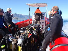
צִיוּד
ציוד סטנדרטי
רוב אתרי הצלילה באזור זה הם רדודים יחסית וניתן לבצע אותם באוויר עם ציוד צלילה רגיל לפנאי, שיכלול:
- חליפה רטובה מלאה בעובי 5 מ"מ לפחות, מכסה מנוע, מגפיים וכפפות.
- גליל עם רתמה, וסת ומד לחץ טבולה.
- מכשיר מפצה ציפה (BCD).
- מסכה ושנורקל.
- סנפירים.
- מערכת משקל הניתנת לניתוב מכוילת נכון לשאר הציוד.
- מחשב צלילה או מד עומק וטיימר עם טבלאות דקומפרסיה ותכנית צלילה.
לכך תוכלו להוסיף:
- כל ציוד נוסף שאתה או הסוכנות המאשרת שלך עשויים לשקול חובה, כגון וסת משני, מנפח BCD בלחץ נמוך, סכין וכו '.
- כל ציוד שאתה נושא או משתמש בעד העדפה אישית, כגון מצלמה, מכשיר איתות, צפיפת כף היד, חליפה יבשה, מצוף סמן סליל ומשטח, אספקת גז חלופית, מצפן וכו '.
המלצות
- אם לסנפירים יש כיסי רגליים מלאים (עקב סגור), ובמגפי החליפה הרטובה שלך סוליות רכות, ייתכן שיהיה צורך לנעול נעליים כדי להגיע לנקודת הכניסה בצלילות החוף. סנפירי עקב פתוחים ומגפיים עם סוליה קשה מומלצים לרוב צלילות החוף באזור זה מכיוון שהאדמה נוטה להיות מחוספסת ונעליים עשויות עדיין לא להיות במקום שהשארת אותן כשאתה חוזר מהצלילה.
- מצוף סמן משטח סטנדרטי אינו מומלץ במקומות בהם יש צמיחת אצות כבדה, מכיוון שהוא יתנפץ לעיתים קרובות ויספק מטרד אינסופי. סמן משטח שניתן לפרוס או "מושהה" טוב יותר באתרים כאלה והוא תמיד דבר טוב לבצע בצלילה בסירה.
- השארת אחד מהפריטים שלעיל היא על אחריותך בלבד. ישנם צוללנים שלא ילבשו ברדסים, או כפפות, או מגפיים, או ירגישו שאין צורך בשנורקל או לפני הספירה, או שהם יכולים לצלול בחליפה בגודל 3 מ"מ. נסה זאת בצלילה קלה תחילה, בה תוכל לצאת במהירות. זה אולי יעבוד בשבילך - ישנם צוללנים שמנהלים בכל אחד מהמקרים הללו, אך הוזהרת.
ציוד נוסף

For each dive site there may be additional or alternative equipment required or recommended, which may improve the dive experience or improve safety at that site. The most commonly recommended items are:
- מצפן
- Dry suit
- אוֹר
- Nitrox
- Reel with DSMB
Use of a compass is recommended wherever it may be desirable to swim back to shore below the surface to avoid wind or boat traffic, or to keep below the kelp fronds. It is required for the compass navigation routes.
A dry suit is recommended for most dives on the Atlantic seaboard, or in general if the dive is deeper than about 20 m and the water is colder than 13°C. An appropriate undergarment is required for the dry suit, at this is what provides the insulation. With a suitable combination it is possible to enjoy an hour's dive in comfort at a water temperature of 8°C, when most of the divers in 7-mm wetsuits are cold after 30 minutes. If your face and head are particularly sensitive to cold, a full-face mask will keep your face warm.
Recommendations for a light are for daytime dives, as lights are considered standard equipment on night dives. Backup lights should be carried on night dives from a boat. Underwater flashers may not be well received by the other divers as they are extremely annoying. If you feel you must use one, warn the others and stay away from those divers who do not wish to have a light continually flashing in their peripheral vision and distracting them. A strobe which may be switched on in an emergency is another matter entirely, and is accepted as a valuable safety aid.
The equipment recommendations are for divers who are competent to use those items, and if you are not, you should consider whether your competence is sufficient to dive the site without this equipment.
No recommendations are made regarding equipment for wreck penetration dives and deep dives. If you do not know exactly what equipment is required and have it with you, or are not competent in its use, you should not do the penetration. Depth, wrecks and caves are nature’s tools for culling reckless divers.
Recommendations for gas mixtures are generic. You must choose the appropriate mixture based on your qualifications, competence and the dive plan. Nitrox mixtures are generally recommended to increase dive time without obligatory decompression stops, and Trimix to reduce narcotic effects. Nitrox is available from many of the dive shops, and charter operators will usually provide cylinders filled with the blend of your choice if given sufficient notice. Trimix is more difficult to arrange, as not many filling stations keep Helium in stock, so it may require a bit of shopping around.
Decompression dives should generally only be planned by divers who are familiar with the site, and are competent and properly equipped for the planned dive. Recommendations in this regard are outside the scope of this article, and it will be necessary to discuss any planned decompression dives well in advance with the dive operator, as only a few of them are competent and willing to support planned decompression dives, and those will usually require strong evidence of your competence to do the dive, and advance notice of your dive plan.
Exotic equipment
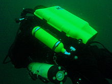

Diving equipment other than open circuit back mounted scuba with half mask and mouth-grip demand valve is considered to be exotic for this section.This would include surface supplied breathing apparatus and full face masks, used as standard equipment by commercial divers, and rebreathers, seldom used by commercial divers, but frequently used by military divers and gaining popularity with Technical recreational divers.
Also considered as exotic equipment is side-mount scuba and diver propulsion vehicles (scooters), as they are not used by many recreational divers.
Generally speaking, any use of surface supplied diving equipment will require special preparation and logistics, which are not available from the listed service providers, but are perfectly legal for use and technical support is available from the suppliers to the commercial diving industry in Cape Town.
Rebreathers are relatively uncommon, but are used by a few local aficionados, and sorb is available over the counter at a few suppliers. There is even one charter boat which regularly runs dives for mainly rebreather divers. Expect to be checked out for skills and certification before being allowed to join these dives, so it would be advisable to make prior arrangements. Technical support is available for a limited range and parts will usually only be available from overseas agencies. Most of the local dive sites do not really justify the expense and relative risk of rebreathers, and they are mostly used by divers who also use them in other places where they are more of an advantage, and by those who just enjoy the technology. They are not available for rental, except in some cases as part of a training package.
Full-face masks will not be a problem, provided you can show your ability to provide buddy support if diving with a partner (some charters will insist that you dive with a buddy). Technical support and parts are available from local agencies for most of the more popular models used for commercial and technical diving, but you may have to wait some time if parts are not in stock. The use of a full-face mask can be a particular advantage when the water is cold, and if you have one and prefer to use it, by all means bring it to Cape Town.
Side mount scuba is relatively uncommon in Cape Town, but there should be no problems if you chose to use it. Do not expect boat crews to know how to help you kit up, but they will probably respond well to explanations. There is a growing number of local side-mount aficionados, including several instructors for side-mount.
Diver propulsion vehicles (scooters) are rare but not unknown. Check with the charter boat whether will be space on board for your unit, and don't expect to find one for rental.
Decompression and bailout sets are not considered exotic, but are not easily available for rental. Bring your own, or ask around. Some of the service providers carry a small range of cylinders suitable for sling mount, but may not have the gas mixture you want in stock. Almost all the local divers that carry decompression or bailout cylinders routinely have their own equipment
אתרי צלילה


The dive sites described in these articles include some which are well known favourites and have been dived frequently and by many divers for decades, and also newly described sites, which may only have been dived a few times, and by a few divers. There are also sites which have been known for years, but seldom dived due to their relative inaccessibility, and a few which are basically not particularly interesting, but have been included in the interests of completeness, as the information is available, and occasionally people want to know what they are like. With a few exceptions, the information provided is based on personal observation at the sites by Wikivoyagers. All photos of marine life and features of interest were taken at the listed site.
Geographical information is provided in as much detail as is available. Sites are geolinked, which allows them to be identified on various internet map systems. Positional accuracy is usually good. The maps provided should be usable, to scale, and accurate, but are not guaranteed either to be correct in all details or complete. Clicking on the thumbnail will open a link to a higher resolution image.
Atlantic coast of the Cape Peninsula

Introduction and some tips on diving the Atlantic coast.
This coastline from Table Bay to Cape Point is exposed to the south westerly swells generated by the cold fronts of the Southern Ocean. The continental shelf is narrow in this part of the coast and swells are not greatly influenced by the narrow band of shallow water, so they retain most of their deep-water energy. These swells pound this coast most of the winter, and to a lesser extent in summer, so diving in this region is mostly a summer activity, and the frontal weather patterns far to the south are more important than local weather for swell prediction.
North westerly winds are a feature of the approach of a cold front, and in winter they can be very strong for a few days before swinging to southwesterly as the front passes. These north westerly winter storms were responsible for many shipwrecks in Table Bay and other parts of the west coast, and the associated wind waves can be severe. However the fetch is short and these onshore wind waves do not last long after the storm. They do mess up the visibility though, and this effect lasts for some time after the waves have dissipated.
The south easterly winds are longshore to offshore in this area and tend to knock the swell down a bit. They also cause an offshore displacement of the surface water, which results in deeper water rising to take its place. This upwelling brings colder, initially cleaner water to the inshore areas, and can produce conditions of 20 m visibility and temperatures down to 8°C, though more usually 10° to 12°C. The diving is wonderful if you are sufficiently insulated. Out of the water, however, it is commonly fine and hot, with blazing sunshine high ultraviolet levels and air temperatures in the high 20 and 30° Celsius. This means you will be overheating until you get in the water, hence the comment that summer diving in Cape Town is one easy step from hyperthermia to hypothermia.
There is no escaping the need for a well-fitting, thick (preferably 7 mm), wet suit or a dry suit with an adequate undergarment for these conditions if you intend to stay for more than a few minutes. Carrying a bottle of water with your equipment to wet the outside of your suit before or after putting it on will help keep the temperature down due to evaporative cooling, specially on a windy day. Overheating after leaving the water is seldom a problem. The alternative option of kitting up at the water’s edge requires a shore party to look after your clothes, etc., while you dive, so it has become less common. Do not leave equipment unattended if you wish to see it again.
An upwelling is frequently followed by a plankton bloom, often called a red tide. This will reduce visibility considerably, particularly near the surface. Often the water will be much clearer below the surface layer, though the light levels may be a bit dim and the colour relatively green, or even brownish. The phytoplankton will bloom while the sun shines, so it is much more developed in summer.
The south-easter is an offshore wind at some sites, and besides its influence on temperature and visibility, it also affects the swim back to shore after the dive. The south-easter can appear seemingly out of nowhere on a previously cloudless and windless day, and build up to near gale force in the time you are underwater on a dive, though it is usually predictable, so take note of weather forecasts, and in any case, allow sufficient reserve air to swim back a few metres below the surface. A compass is extremely useful if you do this as it allows you to swim shallower, which is good for air consumption, decompression and warmth. A depth of 3 to 5 m is recommended for a long swim home. The strong south-easter in these cases produces a short, steep wind chop with white-caps which does not penetrate to any significant depth, but the constant slapping of waves and the spray in the air can make snorkelling unpleasant and difficult. There may also be a shallow offshore wind drift (surface current), but this takes some time to develop and gets rapidly weaker with depth and is not usually a problem below about a metre depth inshore. Further offshore the wind induced current can take you several hundred metres during a decompression stop, at a rate of about 0.5 to 1 kph.
When boat diving a deployable surface marker buoy (DSMB) is useful to both facilitate controlled ascent and accurate decompression or safety stop depth, and as a signal to the boat that you are on your way up. In strong wind conditions it will also improve your visibility on the surface, specially if your equipment is all black, so it is worth carrying even if only as a signalling device. Bright yellow has been shown to be best for all round visibility at sea, but orange and red are fairly good too.
אי רובן

These sites are all boat dives. There is no other practical way to get to them, as they are all several kilometres from the mainland across major shipping lanes.The waters around Robben Island were proclaimed a Marine Protected Area in 2019, so a permit is required to dive there. The boat operator will have to have a permit for the restricted area. Details of how this will be done are not yet known.
Local geography:Robben Island is a low, rocky shored island in the mouth of Table Bay. The island and surrounding reefs are rock of the טייגרברג series of the late Precambrian Malmesbury group. These are folded sedimentary rocks, frequently with very steep dip, which often weather to form rather jagged outcrops.
The sites include:
- 1 MV אוֹצָר: S33°40.45' E018°19.95' (approximate)
- Wreck dive. Boat access only. Depth: 30 to 50 m
- On 23 June 2000 the damaged Panamanian registered bulk ore carrier sank off the coast of South Africa approximately 7 nautical miles north of Robben Island.
- The vessel lies upright on a fairly level bottom at about 50 m depth. The superstructure was removed shortly after the sinking by sawing it off at about 30 m depth with a cable towed by tugs as it was a hazard to shipping.
- 2 Robben Island steamer wreck: S33°49.886', E018°21.524' (approximate centre of wreckage)
- Wreck dive. Boat access only. Depth: 30 to 36 m
- Unidentified wreck of a steel steamship about 48 m long in reasonable structural condition.
- 3 MV Afrikaner: S33°50.012' E018°20.686'
- Boat access only. Deep wreck dive. Depth 43 to 50 m
- The 61 m fishing vessel struck Whale Rock in 1993 and sank while being towed away from the rock.
- 4 Whale Rock: S33°50.112' E018°22.858'
- Reef dive. Boat access only. Depth: Mostly less than 10 m
- A large shoal area of rocky reef, usually with a break over the pinnacle, which is the last resting place of a few ships.
- 5 SS היפטיה: S33°50.10’ E018°22.90’ (Turner 1988)
- Wreck and reef dive. Boat access only. Depth: Shallow, maximum probably about 15 m
- British Houston Line steamer of 5 728 tons, built in 1902. Wrecked on Whale Rock in Table Bay on 29 October 1929 in fog while on a voyage from Beira to New York with a cargo of blister copper and chrome ore.
- 6 MV Daeyang Family: S33°50.388' E18°23.133
- Wreck and reef dive. Boat access only. Maximum depth about 15 m
- A large Korean ore carrier which was wrecked on Whale Rock on 1 March 1986 when anchors dragged in heavy weather. The wreckage lies at a depth of about 15:nbsp;m
Table Bay

- 7 MV Winton: S33°52.1514' E18°29.1828 (Engine block)
- Wreck dive. Boat access, though shore access is feasible. Close to surf line. Maximum depth about 6 m.
- Wreck of a small steel freighter on a flat sand bottom.
- 8 MV Gemsbok: S33°53.0' E018°20.5'
- Boat access only. Deep wreck dive. Depth about 57 m on the sand.
- The 50 m 313 tonne buoy tender MV Gemsbok capsized and sank about 4 km from Green Point Lighthouse on 2 Seprember 1975 while transferring an anchor chain of a cargo vessel. The chain snagged and the weight of the chain caused the vessel to capsize and sink within minutes. The wreck lies on its starboard side.
- 9 Highfields: S33°53.13’ E018°25.83’ (Bow)
- Wreck dive. Boat access only. Close to major shipping lane at harbour mouth. Maximum depth 24 m.
- Wreck of a steel barque which sank after a collision in 1902.
- 10 SS Cape Matapan: S33°53.233' E018°24.533' About a kilometer north of Granger Bay harbour
- Wreck and reef dive. Boat access only. Maximum depth 25 m. The wreck is close to the shipping lane and there are no landmarks nearby.
- Wreck of a steel fishing boat which was sunk in a collision in 1960 in heavy fog.
- 11 RMS אַתוּנָה: S33°53.85’ E018°24.57’
- Wreck and reef dive. Shore or boat access. Maximum depth about 7 m
- Union Company iron steam screw barque of 739 tons, built in 1856. Wrecked between Mouille Point and Green Point on 17 May 1865 during a north-west gale while trying to steam out of Table Bay. The site can be identified by the remains of the engine-block, which is visible above the water.
- 12 SS SA Seafarer: S33°53.80’ E018°23.80’
- Wreck and reef dive. Boat access recommended. Depth: Fairly shallow. Mostly between 5 and 9 m.
- The 8000-ton Safmarine freighter SS South African Seafarer was wrecked in a north westerly gale on 1 July 1966, and lies in front of the Green Point lighthouse.
- 13 Two Oceans Aquarium: S33°54.476’ E018°25.074’
- Shore access only. Confined water. Maximum depth 6 m
- Visitors may dive in the Predator tank, which is a large oval tank, or the Kelp Forest tank, which is roughly square. There are large windows, almost full height on one side, through which you can observe the other visitors watching you if you get bored with the fish.
Sea Point

Local Geography:There is a narrow coastal plain at the base of Signal Hill and Lion’s Head. The contact zone between the intrusive granites of the חֲצִי אִי pluton and the sedimentary greywackes and shales of the טייגרברג formation of the Malmesbury series is in this area.The northern sites are on the טייגרברג rocks, which are steeply dipped and form parallel ridges and gullies, while Bantry Bay is on the granite, and has the characteristic corestone topography of rounded boulders and outcrops with sand bottom in deeper areas.
The sites include:
- 14 מפרץ שלוש העוגנים: S33°54.36’ E018°23.85’
- Reef dive. Shore access. Depth: Shallow
- A small sand bottomed bay with reef to both sides. Easy access.
- 15 פסגות רכס סי פוינט: S33°54.905' E018°21.421'
- Reef dive. Boat access. Depth: 17 to 27 m
- An isolated pair of corestone pinnacles on a low granite ridge.
- 16 מפרץ באנטרי: S33°55.56’ E018°22.65’
- Reef dive. Shore or boat access Depth: Less than 10 m
- This little bay is at the southern end of Sea Point, towards Clifton.
קליפטון

Clifton Rocks is generally considered a shore dive, but the Paws are quite a distance offshore and are only dived from boats. Parking in Clifton is often a problem, particularly in the kind of weather in which you may wish to go diving. Weekdays will be better and early morning will help. The offshore dives avoid this problem by using boats from Oceana Power Boat Club slipway, which has its own parking problems, though not quite as serious.
Local geography:The suburb of Clifton is built on the rather steep slopes of the base of Lion’s Head above Clifton Bay. There are four beaches in the bay which are famous for white sand, shelter from the south easter and cold water. North Paw is offshore of the headland to the north, and South Paw is offshore from Clifton Rocks, on the south headland. Access to the area by road is from Sea Point to the north and Camps Bay to the south.
The reefs of Clifton are granite corestones of the חֲצִי אִי פלוטון. In this area the granite base of the mountain extends to approximately the height of Signal Hill, and is capped by sandstones of the Graafwater and Table Mountain formations. Occasional rounded granite outcrops can be seen on the mountainside, which is mostly deeply weathered granitic saprolite, with some sandstone scree.
The sites include:
- North Lion’s Paw: S33°55.854’ E018°21.849’ (Exposed Rock)
- Reef dive. Boat access only. Depth: 15 to 23 m.
- A spectacular site in good conditions. A popular part of the site is the cave rock, which is slightly offshore from the exposed rocks.
- 17 הכפה הצפונית של האריות הצפוניים
- 18 צפון האריות של פאו מונטי
- 19 צפון האריות של צפון האריה
- 20 צפון האריות של כפות האריות של בארי
- 21 סלע מערת הכפות של צפון האריות
- 22 ריף ראשי של צפון האריות
- 23 כפה של דרום האריה: S33°56.308’ E018°21.890’
- Reef dive. Boat access only. Maximum depth about 20 m.
- An extensive reef of granite corestones marked by the large outcrop which extends above the water.
- 24 סלעים של קליפטון: S33 ° 56.346 'E018 ° 22.222'
- Reef dive. Shore or boat access. Maximum depth about 14 m.
- A large area of granite corestones, bounded to the north by sand bottom. The reef extends to seaward from the shoreline at the point.
- 25 המנהרה של קליב: S33°56.540' E018°21.894'
- Reef dive. Boat access. Maximum depth about 20 m.
- A large corestone pinnacle with a long low tunnel
Camps Bay
Local geography:Camps Bay is in the corner made by Lion’s Head and Table Mountain. Access is over Kloof Nek from the city bowl, and round the coast from Sea Point via Clifton to the north, and from Hout Bay via Oudekraal to the south
The reefs of this area are like those of Clifton.
The sites include:
- 26 רוק בקובן: S33°57.555’ E018°22.204’
- Reef dive. Shore or boat access. Maximum depth 17 m.
- This site is generally considered a shore dive. Parking is limited so it is most conveniently dived during the working week when there is less competition for space, otherwise get there early.
Oudekraal

This area includes some of the best and most popular shore dive sites on the Atlantic seaboard. Most can also be dived from a boat, and this is of particular importance to divers with restricted mobility on shore, as there is generally a rugged bit of coast to negotiate and in some cases a long climb. There is also a moderate to long swim at some of the sites, and at some states of the tide, heavy kelp inshore.
Local geography:The coastline at the base of the Twelve Apostles range just south of Table Mountain is steep, and south of Camps Bay, virtually undeveloped. Fortunately for divers, the coastal road is not far above sea level in the north of this area, and though there are not many off-road parking areas, the road is wide enough to park along the side.
This is an area of pale grey חֲצִי אִי Granite corestone outcrops and boulders with some Table Mountain Sandstone boulders which have rolled down the mountainside to the water’s edge. The mountainside below the sandstone cliffs is deeply weathered granite saprolite with occasional corestone outcrops. The cuttings at the roadside display the granular yellow-brown saprolite with a thin soil covering. The underwater topography is almost entirely corestones exposed by erosion, surrounded by samd, and is a continuation of the granite boulders and outcrops at the water’s edge.

North Oudekraal
The sites include:
- 27 Dreadlocks Reef: S33°58'22.05" S18°21'42.59"
- Reef dive. Boat access. Depth: 1.5 to 20 m.
- A relatively new site. First survey 30th January 2010. This granite ridge peaks about 1.5m from the surface at low tide, but the tip is small and seldom breaks. Bottom on low granite at about 20m. Colourful and diverse invertebrate cover, and notable for the relatively large colonies of Dreadlock hydroids.
- 28 Geldkis Blinder: S33°58.67’ E018°21.62’
- Reef dive. Boat or shore access. Maximum depth about 20 m.
- A relatively infrequently dived site. The highest rock on the reef is a blinder beyond Geldkis rock which occasionally breaks the surface at low tide. Huge boulders and outcrops, and a few swimthroughs.
- 29 Strawberry Rocks: S33°58.725’ E018°21.658’ (approximate)
- Reef dive. Shore or boat access. Maximum depth about 15 m.
- The two smaller rocks to the north of Geldkis rock. Several small caverns and swimthroughs.
- 30 Geldkis: S33°58.73’ E018°21.61’
- Reef dive. Shore or boat access. Maximum depth about 15 m.
- A large group of rocks with lots of overhangs, swimthroughs and chimneys. The Dutch East Indiaman Het huys te Craijestein was wrecked on the rocks in the bay at Oudekraal on 27 May 1698 in thick mist. Three chests of treasure disappeared and the name "Geldkis" (money-chest) appears on maps of the area and is now applied to the offshore rocks.
- 31 חדר ישיבות: S33°58.761’ E018°21.151’
- Reef dive. Boat access, though possible from shore. Maximum depth about 21 m near the pinnacle, but deeper water nearby. about 10 m on top.
- A very large boulder with a large swimthrough cave and a large overhang in an area of high profile boulder reef.
- 32 Het Huis te Kraaiestein: S33°58.85’ E018°21.65’
- Wreck and reef dive. Shore access. Maximum depth 10 m.
- Remnants of the Dutch East Indiaman Het Huis te Kraaiestein of 1,154 tons, which was wrecked in the bay at Oudekraal on 27 May 1698 in thick mist while trying to find the way into Table Bay. Some cannon, anchors and a few baulks of timber are all that are usually visible above the sand.
- 33 Mushroom Pinnacle: S33°58.781’ E018°21.521’
- Reef dive. Shore or boat access. Maximum depth 17 m.
- A submerged granite tor (stacked group of large corestones) between Geldkis and Justin’s Caves. The pinnacle is surrounded by lower outcrops separated by sandy gullies.
- 34 Sandy Cove: S33°58.90’ E018°21.65’
- Reef dive. Confined waters. Shore access. Maximum depth 4 m
- A shallow sheltered cove at Oudekraal, suitable for open water training exercises, refresher courses and testing equipment when you don’t need depth. Entry area for several other sites.
- 35 Justin’s Caves: S33°58.85’ E018°21.50’
- Reef dive. Shore or boat access. Maximum depth about 13 m.
- A group of big granite corestone outcrops and boulders with several swimthroughs, overhangs, caves and deep narrow gaps between the rocks. Spectacular in good visibility, colourful reef life.

Central Oudekraal
The sites include:
- 36 Antipolis: S33°59.06’ E018°21.37’ (Bow section)
- Wreck and reef dive. Shore or boat access. Maximum depth about 10 m.
- The tankers "Romelia" and "Antipolis" were under tow on 28 July 1977 during a north westerly gale when the tow cable to the "Antipolis" snagged on the sea bed. In the ensuing confusion the cables broke and the two ships were driven aground by the wind. The "Antipolis" ran aground at Oudekraal and was later cut down to water level.
- 37 Klein Pannekoek: S33°58.91’ E018°21.09’
- Reef dive. Boat or shore access. Maximum depth about 15 m.
- A group of large fairly low and flat rocks visible offshore to the west of the "Antipolis" and north of Coral Gardens.

South Oudekraal
The sites include:
- 38 Groot Pannekoek: S33°59.13’ E018°20.75’
- Reef dive. Boat or shore access. Maximum depth about 15 m
- A large flattish outcrop of granite, which extends a short way above the sea level at all tides. Some overhangs, crevices and small caves.
- גני האלמוגים (Oudekraal): S33°59.270' E018°20.782' (The pinnacles)
- Reef dive. Shore or boat access. Maximum depth 17 m
- A spectacular dive in good conditions. Huge granite boulders in groups with open patches between them. There are overhangs, small caverns, a few swimthroughs, and many deep gaps and crevices. Extensively covered in colourful reef life. Possibly the best shore dive on the Atlantic side of the Cape Peninsula on a good day.
- 39 גני האלמוגים
- 40 Coral Gardens Offshore Pinnacle
ללנדודנו

These sites can be accessed from the shore or by boat. Parking is limited, but the area is reasonably secure. Some walking is required, but no serious climbing as the parking is near the sea level.
Local geography:The small residential suburb of Llandudno is built on the moderately steep slopes of the Cape Peninsula below the peak of Klein-Leeukop, where the coast road (M6 – Victoria Drive) from Camps Bay crosses over the neck to Hout Bay. There is only one way into Llandudno by road, which is from the M6 near the top of the pass.This is an area of granite corestone reefs with sand bottom.
The sites include:
- 41 13th Apostle: S33°59.486' E18°19.922'
- Reef dive. Boat access. Depth: 10 to 24 m.
- A large granite pinnacle on an area of low granite reef with occasional sand patches.
- 42 Llandudno Reef: S34°00.037' E18°19.897'
- Reef dive. Boat access. Depth: 10 to about 30 m, on sand
- An unsurveyed granite reef, with several pinnacles, outcrops and gullies.
- 43 Logies Bay: S34°00.25’ E018°20.53’
- Reef dive. Shore access. Maximum depth probably about 10 m.
- A small rocky cove to the north of Llandudno beach.
- 44 MV Romelia: S34°00.700’ E018°19.860’ approximately
- Wreck and reef dive. Shore or boat access. עומק מרבי כ 24 מ '.
- The tankers Romelia ו Antipolis were under tow on 28 July 1977 during a north westerly gale when the tow cable to the Antipolis snagged on the sea bed. In the ensuing confusion the cables broke and the two ships were driven aground by the wind. ה Romelia ran aground at Sunset Rocks, Llandudno, where its back was broken by the heavy surf and the ship split in two. Later the bow section sank, leaving the stern mostly above sea level on the rocks. Over the years the stern section has also broken up and is no longer visible above the water.
Oude Schip headland
Local geography:Oude Schip headland lies at the foot of the Karbonkelberg between Sandy Bay to the north and Leeugat to the south, It is a low rocky headland of Peninsula granite, with several reef dives and one known wreck. It is a fairly exposed section of coast but protected from the south easterly winds by the mountain. The sites are only accessible by boat as there is no road access to this part of the shore, and most are too far offshore to safely swim.
This is an area of granite bedrock of the חֲצִי אִי pluton, The reefs are exposed corestone outcrops and boulders, with sand patches in the deeper areas
The sites include:
- 45 צעדים: S34°01.330’ E018°18.600’
- Reef dive. Boat access only. Maximum depth about 20 m.
- An area of high granite reef with deep gullies. Not actually in Leeugat, but just north of Oude Schip headland.
- 46 MV Harvest Capella: S34°01.600’ E018°18.750’
- Wreck dive. Boat access only. Maximum depth about 15 m.
- An area of mostly flattish granite reef with a few ridges and some wreckage of a steel motor fishing vessel, some of which has washed up onto the point and is visible from a distance. Not actually in Leeugat, but on the north shore of Oude Schip headland.

The Blue Flash Reefs
- 47 Rachel's Reef: S34°01.431' E018°18.151'
- Reef dive. Boat access only. Depth between about 3 and 21 m.
- Rachel's Reef is a compact granite pinnacle with surrounding high profile reef.
- 48 Humpback Ridge: S34°01.548' E018°18.142'
- Reef dive. Boat access only. Depth between about 4 and 21 m.
- A fairly massive granite pinnacle in the middle of a more extensive north-south ridge rising to about 12 m. Humpback whales have been seen near these reefs on several occasions.
- 49 Wilhelm's Wall: S34°01.502’ E018°17.931’
- Reef dive. Boat access only. Depth between about 12 and 31 m.
- A granite ridge somewhat more than 50 m long with sheer faces to the north and south, a flattish bottomed gully to the south, and another, more broken ridge south of the gully. Colourful sessile invertebrates on the sides and seaweeds on top.
The Middelmas reefs:
- Hakka Reef (Middelmas): S34°01.747’ E018°18.328’
- Reef dive. Boat access only. Maximum depth about 21 m.
- 50 Die Middelmas is a rock that projects several metres above the water at all tides, to the west of the Oude Schip peninsula.
- 51 Hakka Reef Southeast pinnacles is off this rock.
- 52 Hakka Reef Sven's Caves pinnacles is nearby at a set of pinnacles near a sand patch.
- 53 Twin Towers: S34°01.920’ E018°18.330’
- Reef dive. Boat access only. Depth about 20 m at the tops of the pinnacles to 34 m on the sand.
- A small but tall double-peaked granite pinnacle on a narrow base reef and surrounded by sand.
Leeugat (Maori Bay)

.jpg/220px-Gelderland_(1).jpg)
Although several of the sites are quite close inshore, this area is in practice only accessible by boat, as the distance to the nearest parking is too far to carry dive gear (about 3 km as the crow flies, more on foot).
Local geography:Leeugat, also known to divers as Maori Bay, lies at the foot of the Karbonkelberg, between the northern headland of Oude Schip, and Duikerpunt to the south. It is a small bay, but fairly deep close inshore, which in combination with the partial barrier afforded by the reefs at the headlands, has provided the wrecks in Leeugat bay with better protection from wave action than those on more exposed parts of the coastline. This means that not only have they lasted well for their ages, but conditions are suitable for diving more often than for many other wrecks on the Atlantic seaboard of the Cape Peninsula.
This is an area of granite bedrock of the חֲצִי אִי pluton, The reefs are exposed corestone outcrops and boulders, with sand patches in the deeper areas
The sites include:
- 54 MV Keryavor and the Jo May: S34°02.037’ E018°18.636’
- Wreck and reef dive. Boat access only. Depth: Not available, probably between 25 and 30 m.
- These two wrecks lie next to each other approximately between the מאורי וה גלדרלנד. ה Jo May sank first and not much of her wooden structure remains. ה Ker Yar Vor was a steel lobster fishing vessel and several chunks of hull structure and twisted sections of plating remain.
- 55 SS Maori: S34°02.062’ E018°18.793’ (Machinery)
- Wreck and reef dive. Boat access only. Depth: 6 to 21 m
- האס אס מאורי was a typical British steam cargo vessel of the early 1890s. The ship was wrecked in the bay between Oude Schip and Duikerpunt on 5 August 1909 in thick fog and drizzle while on a voyage from London to New Zealand.
- 56 SAS Gelderland: S34°02.070’ E018°18.180’
- Wreck and reef dive. Boat access only. Depth: 30 to 35 m
- The Ford class Seaward Defense Boat SAS גלדרלנד was scuttled on 21s ecember 1988, north west of Duiker Point, as demolition trials.
- The vessel was about 40 m long but the main part of the wreckage is now only about 20 m long as the bow and stern sections were blown right off.
- Plan B pinnacle is just to the south of the southernmost wreckage.
- 57 SS Oakburn / MV Bos 400: S34°02.216’ E018°18.573’
- Wreck and reef dive. Boat access only. Depth: Maximum 22 m
- The "Oakburn", a British cargo steamer of 3865 tons, was wrecked on the north side of Duikerpunt in fog on 21 May 1906, on a voyage from New York to Sydney. The Oakburn has pretty much fallen apart, and on 27 June 1994, the French pipe-laying crane barge Bos 400, broke its towline and stranded virtually on top of the older wreck. The Bos has started to break up, and two large sections have collapsed into the sea, though the main crane section is still firmly stuck on top of the rocks.
Outer Hout Bay


This area includes the dive sites between Duiker Point and Duiker Island and the extensive reefs to the south as far as Vulcan Rock and Tafelberg Reef. All of these are only accessible by boat. There are a number of sites being explored in this area: the reefs between Kanobi’s wall and Stonehenge, and a wreck of a lifeboat which was used to salvage materials from the Boss 400 and which lies between Stonehenge and Duiker Island are among these. There are several unexplored pinnacles in the region identified on the SAN charts as bakleiplaas, where the sea is often very lumpy due to the influence of the underwater topography on the swell.
Local geography:The suburb of Hout Bay lies in the valley between the Constantiaberg to the east and the peninsula formed by Karbonkelberg and its lesser peaks to the west. One of these peaks, the Sentinel, gives its name to a dive site at its foot. At the mouth of the valley is the business area of Hout Bay, with its small commercial fishing harbour and marina, and a public slipway used by dive charters and private dive boats for access to most of the southern peninsula dive sites on the Atlantic coast. The slipway is in good condition, wide and accessible, and has a large parking area, which on occasions can be crowded due to heavy use by commercial fishing skiboats.
The bedrock of this area is granite of the חֲצִי אִי pluton, and most of the sites are on corestone reefs of this rock.
The sites include:
Duiker Point sites:
- 58 Die Perd: S34°02.282’ E18°18.324’
- Reef dive. Boat access only. Depth: Not available, maximum probably about 20 m
- This rock off Duiker Point extends above the water and is surrounded by rugged reefs of high outcrops and deep gullies.
- 59 Kanobi’s Wall: S34°02.365’ E018°18.138’
- Reef dive. Boat access only. Maximum depth about 25 m.
- This blinder off Duiker Point is a good site with rugged topography, good biodiversity and large depth variation. Huge boulders are stacked, with tunnels, overhangs and caves of various sizes, and lots of vertical walls, some probably 10 m or more in height.
- 60 SURG Pinnacles: S34°02.375' E018°18.015'
- Reef dive. Boat access only. Depth 9 to over 30 m.
- A group of steep granite corestone pinnacles, probably mostly huge boulders, with walls, overhangs and a swimthrough. Deep narrow cracks divide the pinnacles. Spectacular topography, covered with lots of sea urchins and vast numbers of hairy brittlestars, a moderate variety of sponges, noble corals, gorgonians, and patches of cauliflower soft coral. Red bait and Laminaria on the tops of the pinnacles. Surge can be strong when a long swell is running.
- Star Wall: S34°02.466' E18°18.087' (pinnacle)
- Reef dive. Boat access only. Depth: 6 to 32 m.
- This site has the tallest and longest wall known in the Cape Town area and is a dive site well worth visiting. A massive and continuous granite wall of about 25m almost vertical height, extending for a length of 100 m on the south face and 50 m on the south-east face. Very diverse and colourful invertebrate cover on the wall face. The sites are:
- 61 Star Wall
- 62 Star Wall - M&M Cave
- 63 Star Wall - Lollipop Pinnacle
- 64 Sunfish Pinnacle: S34°02.475' E18°18.290' (pinnacle)
- Reef dive. Boat access only. Depth: 7 to 26 m.
- A fairly large pinnacle on a rocky bottom on the way to Duiker Point from Hout Bay harbour, which has been picked up quite frequently on the echo sounders of dive boats passing over it. It has now been dived, and to some extent mapped. The site is quite pretty and should make a pleasant alternative site. Topography is rugged, with high vertical walls on two sides of the pinnacle.
Stonehenge sites:
- 65 קֶנִיוֹן: S34°02.595’ E018°18.073’
- Reef dive. Boat access only. Maximum depth about 35 m.
- The area is named for a gully between rows of pinnacles. Big boulders and rock outcrops cover an extensive area.
- סטונהנג ': S34°02.838’ E018°18.316’
- Reef dive. Boat access only. Maximum depth about 22 m.
- The area is named for a group of tall rocks which break the surface. Big boulders and rock outcrops cover an extensive area. High profile in the deeper areas, with swimthroughs, holes and overhangs. Heavy kelp in some areas. Included in this area, Stonehenge Blinder, a pinnacle that approaches the surface and breaks in a large swell or at low tide.
- 66 Stonehenge Dusky Pinnacles - Coral Pinnacle
- 67 Stonehenge North
- 68 A-340 Pinnacle
- 69 Stonehenge Central
- 70 Stonehenge South
- 71 Stonehenge Blinder
- 72 Stonehenge Wreck
Seal Island sites:
- 73 אי כלבי ים (Duiker island): S34°03.458’ E018°19.562’
- Reef dive. Boat access only. עומק: רדוד, בעיקר פחות מ -6 מ '.
- האי הסלעי הקטן המסומן במפות ובתרשימים כ- Duikereiland נודע כאי החותם בשל מושבת כלבי הים של כלבי הים שהפכה לאטרקציה תיירותית. אסור לבלבל עם זה אי כלבי ים במפרץ השקר.
אתרי רוק וולקן:

- 74 הסדקים של די: S34 ° 03.855 'E018 ° 18.400' - פסגה גדולה 14 מ '- סלע על גבי שונית. כ -300 מ' צפונית מערבית (328 ° מגנטית) של סלע וולקן
- צלילת שונית. גישה לסירה בלבד. עומק: 10 עד 30 מ '.
- צלילה מרהיבה אם הראות טובה. הרבה קירות ותליונים, מחשבות שחייה וסדקים עמוקים ורחבים. כיסוי חסר חוליות עשיר. אתר טוב לצילומי נוף זוויתיים רחבים.
- 75 סלע וולקן: S34 ° 03.967 'E018 ° 18.582'
- צלילת שונית. גישה לסירה בלבד. העומק המרבי הוא מעל 25 מ 'בסמוך לסלע.
- סלע וולקן הוא הנקודה הגבוהה ביותר בשונית גרניט גדולה ושובר את פני השטח בחלק מהמצבים של הגאות. הוא נמוך ושטוח מעל. צלילה מרהיבה אם הראות טובה.
אתרי שונית טפלברג:
- 76 שונית טפלברג: S34 ° 04.22 'E018 ° 18.93'
- צלילת שונית. גישה לסירה בלבד. עומק: 8 עד 30 מ '.
- שטח נרחב של מחשופי גרניט מחוספסים עם תבליט גבוה וקרקעית חול כ 29 מ 'מערבה. חריצים עמוקים ונקעים. לא הרבה מעבר, אבל הרבה פרצופים אנכיים. טופוגרפיה מחוספסת ומרהיבה מאוד בראות טובה.
- 77 שונית קליין טפלברג (קערת סלט, תאונת יאכטה): S34 ° 04.442 'E018 ° 19.191'
- צלילת שונית. גישה לסירה בלבד. עומק: 14 עד 36 מ '.
- מחשוף גרניט ענק עם סלעים גדולים. קרקעית חול באזורים עמוקים יותר. טופוגרפיה מחוספסת ומרהיבה. הריסות של יאכטה GRP טמונה בכניסה בצד הפסגה. אפשר לעשות צלילה של 40 עד 45 מ 'החל מהחול שממזרח לשונית, ולשחות במעלה השונית בכיוון צפון מערב, אך סביר להניח שתידרש שחרור לחץ אם תגיעו עד הפסגה הרדודה.
- טפלברג עמוק:
- צלילת שונית. גישה לסירה בלבד. עומק מרבי כ- 40 מ 'על החול.
- מחשופי גרניט פרופיל נמוך עד בינוני, משופעים כלפי מעלה פסגה עמוקה של טפלברג מדרום לפסגה בשונית קליין טפלברג. אפשר לעשות צלילה של 50 מ 'ולשחות במעלה השונית, אך יהיה צורך בשיעור לחץ אחר.
- 78 טפלברג עמוק
- 79 פסגה עמוקה של טפלברג
מפרץ הוט


אזור זה כולל את האתרים שבין סנטינל לשיא צ'פמנס. רוב אלה הם צלילות בסירה. היוצא מן הכלל היחיד, Sentinel, ניתן להגיע דרך היבשה ללא קושי גדול, אך יש לו בעיה ביטחונית.
הסנטינל הוא אזור טיפוסי של קו חוף גרניט, עם מספר גדול של סלעים לאורך החוף ושוניות אבן גיר עם פרופילים מעוגלים כרגיל. הריסות של אסטר וקאטסו מארו נמצאות על קרקעית חול שטוחה, והאתר ב Die Josie נמצא גרניט לא מזג אוויר יחסית בבסיס צוקי פסגת צ'פמן התחתונה
האתרים כוללים:
- 80 זָקִיף:
- צלילת שונית. גישה לחוף או לסירה. עומק: בעיקר פחות מ -10 מ '.
- זה המקום בחוף האטלנטי בו קו המתאר העומק 30 מ 'הכי קרוב לחוף.
- הזקיף נחשב בעיני חלקם לאזור שמתחת לצוקים האנכיים, והוא אזור של שונית שטוחה עם הרבה מדוזות אצות וקופסאות, וכמה סלעים גדולים.
- The Pinnacles הם קבוצת סלעים ליד החוף ממש מחוץ לנמל Hout Bay, ליד עבודות הביוב.
- 81 MV אסטר: S34 ° 03.891 'E018 ° 20.955'
- צלילת שברים. גישה לסירה בלבד. עומק מרבי 28 מ '.
- ספינת הדייג המוטורית באורך 340 טון, "אסטר", הייתה ספינת דיג לובסטר הרשומה בדרום אפריקה, שהוכנה כשונית מלאכותית ידידותית לצולל ידי ניקוי וחתוך פתחים למבנה והובלה במפרץ הוט סמוך להריסות "MV Katzu Maru" ב- 9 באוגוסט 1997. הוא שימש כאתר אימונים לחדירת הריסות. הכלי עומד בתחתית ומתחיל להתפרק.
- 82 MV Katsu Maru: S34 ° 03.910 'E018 ° 20.942' (באמצע ההרס)
- צלילת שברים. גישה לסירה בלבד. עומק מרבי כ 30 מ '.
- הטריילר היפני "קאטסו מארו מס '25" פגע בחפץ לא מזוהה בים וננעץ בצד הנמל. כשהוא בגרירה למפרץ הוט, הציף הציף אותו ושקע במפרץ ב- 7 באוגוסט 1978. ההריסה מונחת על צידה הימני על קרקעית החול.
- 83 למות ג'וזי: S34 ° 04.497 'E018 ° 21.256'
- צלילת שונית. גישה לסירה בלבד. עומק: 7 עד 17 מ '.
- שונית רדודה מתחת לשיא צ'פמן, הנמצאת קרוב לנמל מפרץ הוט ומתאימה לצלילות לילה. אחד האזורים הבודדים בהם הגרניט אינו מעוגל על ידי בליה, כפי שניתן לראות מהצוקים מעל האתר.
חצי האי דרום האטלנטי

אזור זה כולל את כל חוף חצי האי מדרום לנורדהוק. לעתים קרובות הוא לא צולל למטרות בילוי שכן הוא נמצא במרחק רב מאתרי השקה טובים ולא ידועים הרבה אתרי צלילה טובים. באזור זה יש כמה טרופות, בייחוד בסלעי אלבטרוס / Olifantsbospunt. רק מעטים מההרוסות זוהו באופן חיובי.
האתרים כוללים
- 84 שבט האס אס מונרו: S34 ° 08.817 'E18 ° 18.949'
- צלילה שונית ושונית. גישה לסירה בלבד. עומק: 4 עד 8 מ '.
- נהרס מעט צפונית למגדלור סלנגקופ בקוממט'י. לעתים רחוקות מאוד צלל. שונית רדודה של אבן חול שטוחה, עם שרידי אצות אלמוגים.
- אס.אס תומאס טאקר:
- צלילה שונית ושונית. גישה לסירה בלבד. עומק: רדוד
- ספינה זו נהרסה גבוה על הסלעים, וחלקים מההרס נראים על החוף. רוב ההריסות הן במים רדודים למדי.
- 85 כוכב אפריקה:
- צלילה שונית ושונית. גישה לסירה בלבד. עומק: כ 27 מ 'מקסימום.
- 86 אס אס ביאה: קטע קשת: S34 ° 16.140 'E018 ° 22.812' קטע ראשי: S34 ° 16.217 'E018 ° 22.638'
- צלילה שונית ושונית. גישה לסירה בלבד. עומק: 3 עד 8 מ '.
- 87 אס.אס אומללי: S34 ° 16.435 'E18 ° 22.487'
- צלילה שונית ושונית. גישה לסירה בלבד. עומק: 5 עד 8 מ '.
- 88 רוק אלבטרוס: S34 ° 16.495 'E18 ° 22.197'
- צלילת שונית. גישה לסירה בלבד. עומק: כנראה פחות מ -15 מ 'ליד הסלע.
- שוניות דרום-מערב:
- צלילת שונית. גישה לסירה בלבד. עומק: לא בטוח.
- אזור עצום של מיטות שונית ורדודים רדודות ממערב לקצה חצי האי. זהו הרדוף של חובבי חנית ים ו סרטנים ואינו נחקר על צלילה.
חוף מפרץ השקר של חצי האי קייפ


מבוא וכמה טיפים לצלילה בחוף מפרץ השווא של חצי האי קייפ (הצד של העיירה סימון)
בניגוד לשאר האזור, הצד המערבי של מפרץ השקר מוגן מפני מערב החורף, אך בתמורה הוא לוקח את ראש דרום הפסחא הלאה. כתוצאה מכך האזור צולל בדרך כלל בחורף, כאשר פסחא הדרומי של פסחא נושף לעיתים רחוקות או בכוח רב.
סערות החזית החורפיות מעל האוקיאנוס הדרומי מייצרות מתנפחים המאטים על ידי מדף היבשת ונשברים ומפוזרים סביב חצי האי קייפ, כך שהם מתפשטים בעיקר במקביל לקו החוף, ואיבדו הרבה מאנרגיהם עד שהם מתעקלים לעבר החוף. הצורה הלא סדירה של החוף כאן מגנה גם על אזורים מסוימים יותר מאחרים. באופן כללי, חלקים אלה של החוף הפועלים בכיוון צפון מערבי יותר לדרום מזרחי מוגנים טוב יותר מהדרום מערב התנפחות מאשר החלקים הצפוניים לדרומיים, ולכן הבחירה באתר הצלילה תלויה בדפוסי מזג האוויר האחרונים.
במהלך חודשי הקיץ, כאשר דרום-חג הפסחא נושף בתדירות גבוהה יותר, לאורך זמן ובדרך כלל קשה יותר, אזור זה אינו משתנה לעיתים קרובות, והראות בדרך כלל ירודה יותר מאשר בחורף, אפילו כאשר התנאים מתאימים אחרת.
טמפרטורת המים בחודשי החורף באזור זה בדרך כלל חמה יותר מהחוף האטלנטי בקיץ, וזה פיצוי מסוים לשעות האור הקצרות יותר ולעיתים קרובות למזג אוויר קר וגשום.
טמפרטורת המים עשויה להשתנות עם העומק. בדרך כלל יש תרמוקליין בקיץ, והראות עשויה להשתנות משמעותית מתחת לתרמוקליין. המשטח יכול להיות 18 או 19 מעלות צלזיוס עם 10 או 11 מעלות צלזיוס בתחתית, אך סביר יותר שההבדל יהיה 5 מעלות צלזיוס או פחות. לא ניתן לחזות את התנאים בעומק, והם עשויים להיות טובים יותר או גרועים יותר מאשר לפני השטח. יכול להיות פריחת פלנקטון בשכבות השטח ושיפור פתאומי בראות מ -3 מ 'או פחות ליותר מ -10 מ' במים התחתונים הקרים. גם עומק התרמוקלין אינו צפוי במיוחד, אך ידוע שהוא נמצא בין 12 ל -20 מ 'בסוף הקיץ.
בחורף המים עשויים להיות באותה הטמפרטורה מלמעלה למטה, ומכיוון שיש פחות אור שמש להפעלת הפיטופלנקטון, הראות והתאורה הטבעית יכולים להיות טובים יותר למרות שיש פחות אור.
בין החזיתות הקרות לגשומות יש לעתים קרובות ימים של מעט רוח ללא שמש, ושמש קלה עד חמה, כאשר המים שטוחים וצלולים והצלילה נפלאה, ומספר האתרים הגדול מקשה על ההחלטה לאן ללכת יש כל כך הרבה ברירה. אלה חיים קשים בסוף אפריקה, אבל מישהו צריך לעשות את זה.
טמפרטורת המים בחורף היא בדרך כלל בין 13 מעלות צלזיוס ל -17 מעלות צלזיוס, אם כי ידוע כי היא יורדת עד 11 מעלות צלזיוס, כך שגם כאן יש צורך בחליפה טובה. בקיץ הטמפרטורה עשויה לעלות מעל 20 מעלות צלזיוס, אך סביר יותר שהיא תהיה סביב 17 מעלות צלזיוס עד 19 מעלות צלזיוס.
רוב צלילות החוף רדודות יחסית, בסדר גודל של 8 מ 'עד 15 מ' עומק מקסימלי, אם כי אפשר לעשות צלילה של 30 מ 'אם לא אכפת לכם לשחות 700 מ' להגיע לשם. המים הרדודים הופכים חליפה יבשה לפחות מועילה, אך יציאה מחליפה רטובה ברוח וגשם בלילה דוחפים את החליפה היבשה שוב למעלה כאופציה רצויה. זה נחמד שיש את הבחירה, וצוללנים מקומיים רבים מחליפים חליפות רטובות ויבשות בהתאם לצלילה המתוכננת.
מוזנברג למפרץ קאלק

אתרים אלה הם האתרים הצפוניים ביותר בצד המערבי של מפרץ השקר. הם רדודים וחשופים לרוחות וגלים מזרחיים דרום, ולכן נחשבים בדרך כלל לצלילות חורף.
גיאוגרפיה מקומית:יש רצועת קרקע צרה בין צלע ההר לים שנכבשת על ידי הפרברים של סנט ג'יימס ומפרץ קאלק, ובקצה הדרומי של זה יש גבעה קטנה בשם Trappieskop. בשלב זה קו החוף מתעקל אל מפרץ השקר לפני שפונה חזרה ליצירת מפרץ פיש הוק. נמל הדייג המסחרי הקטן במפרץ קאלק בנוי במפרצון זה.
זהו אזור בו קו החוף הוא אבן חול מסדרת הר השולחן, והטבילה כמעט אופקית בערך 7 ° דרומה. קו החוף שנוצר הוא בדרך כלל סלעי, עם כמה אזורים חוליים, ומפתיע לרדוד בהתחשב בתלילות צלע ההר. קרקעית החול מתחילה בערך 5 מ 'בעומק בדייל ברוק וקרוב יותר 9 מ' בנמל.
האתרים כוללים:
- 1 טרסות סירות מויצנברג
- צלילת תאונות, גישה לסירה. עומק מרבי כ 18 מ '.
- שני סוחרי פלדה שהועברו להפעלת הפצצות בשנות השבעים או בערך. הם מבוזבזים למדי, אך מבני הקליפה שלמים למדי וגדולים על ידי חסרי חוליות בכבדות.
- 2 דייל ברוק: S34 ° 07.436 'E018 ° 27.154'
- צלילת שונית. גישה לחוף. עומק מרבי כ 6 מ '.
- אתר זה ידוע בספרות המדעית בשל מגוון גדול של חיים ימיים, והוא היה אזור מקדש במשך זמן רב, אך לעתים רחוקות הוא צולל על ידי צוללני ספורט. הוא אידיאלי כאתר שנורקל בשל העומק הרדוד והמגוון הגדול של חיי השונית, והוא צלילת נעימה מאוד בתנאים רגועים. זהו האתר הקרוב ביותר לגישה לכבישים מרוב העיר בצד המזרחי של חצי האי.
- 3 חומת הנמל של מפרץ קאלק: S34: 07.787 'E018: 26.967'
- צלילת שונית. גישה לחוף. עומק מרבי כ -10 מ '.
- קיר נמל בטון עם חול ושונית סלע נמוכה בבסיסו. הקלה תחתונה לא גבוהה במיוחד. שונית נמוכה של אבן חול, כתמי חלוק נחל וחול בערך 8 עד 9 מ '.
פיש הוק וגלנקיירן
אתרים רדודים יחסית נחשפים לרוח דרום מזרחית ולהתנפח ונחשבים בדרך כלל לצלילות חורף. הכל יכול להיעשות כצלילות חוף, אם כי ריף פיש הוק וברגה מחצבה נעשים בדרך כלל כצלילות סירה שכן יש שחייה ארוכה מהחוף. כרישים לבנים גדולים נצפו משייטים באזור זה.
גיאוגרפיה מקומית:העמק הנמוך והשטוח יחסית של פיש הוק מוגבל בצד הדרומי במורדות התלולים של ברקלופראנט ופסגת אלזה, שגם הם משתפלים תלולים אל הים במזרח.
ריף הפישק נמצא במרחק מה מהחוף, ואתרי הצלילה האחרים באזור זה נמצאים לאורך קו החוף הסלעי הקצר הזה. הכביש הראשי לעיירה של סימון, ה- M4 וקו הרכבת חולקים את רצועת החוף הצרה. יש מקום לכמה בתים בסאני קוב, ורק אחרי מחצבה נהר אלזה חתך עמק קטן יותר עם חוף גלנקירן. המחצבה המכונה היא מחצבת אבן חול שלא בוצעה על צלע ההר מעל הכביש מצפון לאתר הצלילה בשם זה.
זהו אזור שבו תקלה גרמה ל הר השולחן אבני חול המשתרעות מתחת לפני הים, השביתה היא בדרך כלל מזרח-מערב והטבילה רדודה, מכ- 7 ° (דרום) במפרץ סאני לכ -10 ° (דרום) במחצבה. הצירוף לעומת זאת הוא צפון מערב / דרום מזרח.
האתרים כוללים:
- 4 שונית הוק:
- צלילת שונית. גישה לסירה או לחוף. עומק מרבי כ 15 מ '.
- 5 סאני קוב: S34 ° 08.68 'E018 ° 26.30'
- צלילת שונית. גישה לחוף. עומק מרבי כ 11 מ '.
- נקרא על שם תחנת הרכבת במקום. סלעי אבן חול תבליטיים מתונים, רכסים ושפכים המדפים עד חול בגובה של כ -10 מ '.
- 6 מַחצָבָה: S34 ° 09.390 'E018 ° 26.157' (מדף כניסה / יציאה)
- צלילת שונית. גישה לחוף. עומק מרבי כ -10 מ '.
- נקרא על שם מחצבת אבן החול הישנה בצלע הגבעה מעל הכביש מעט צפונה. רכסים דמויי רמפה משופעים של אבן חול של הר השולחן, בניצב בקו החוף בקירוב, עם כיסים חוליים מדי פעם. פרופיל לא גבוה במיוחד.
- 7 מחצבה דוברה: S34 ° 09.395 'E018 ° 26.474' (משוער)
- צלילה שונית ושונית. גישה לסירה או לחוף. עומק 12 עד 14 מ '.
- תאונה קטנה של דוברת פלדה. הקליפה שלמה למדי ושוכבת זקופה על טלאי חול בין השוניות. שתי אחיזות פתוחות לגישה מלמעלה והתקורה סביב הצדדים היא טריוויאלית.
- 8 גן מעריצים של גלנקירן: S34 ° 09.418 'E018 ° 26.412' (משוער)
- צלילת שונית. גישה לסירה. עומק 12 עד 14 מ '.
- שטח נרחב למדי של שונית אבן חול בעלת פרופיל נמוך עד בינוני עם טלאים חוליים, ומספר גדול של מאווררי ים גורגוניים, בעיקר מאוורר הים של פלמט, אך גם מספר מתון של אוהדי ים מתפתלים ומעט אוהדי שוט.
- 9 תאונת P87: S34 ° 09.570 'E018 ° 26.420'
- צלילת תאונות, גישה לסירה. עומק: כ -15 מ '.
- הריסות של סירת סיור קטנה מעץ. מיקומה מצוין ב- SAN1017 כ- ¼ ננומטר מדרום-דרום-מערב לדוברת המחצבה ב -15 מ '.
העיירה של סיימון


המפרץ הקטן בצד המזרחי של חצי האי קייפ המכונה מפרץ סימון הוא החלק המוגן ביותר של קו החוף של מפרץ השקר מהגאות המערביות הדרומיות, והוא גם מוגן טוב יותר מפני גלים דרום מזרחיים מכל מקום אחר בחלק זה של החוף. .
מכיוון שהמעגן העיקרי של הכף במפרץ השולחן חשוף קשות לסופות המערב הצפוניות של החורף, ומפרץ הוט פתוח לגאות המערביות הדרומיות, מפרץ סימון היה המעגן האלטרנטיבי היחיד והבטוח למדי במרחק סביר מקייפטאון, ו מסיבות אלה נבחר המושל ההולנדי הראשון בכף, סימון ואן דר סטל, כמעגן החורף של חברת הודו המזרחית ההולנדית בכף.
העיירה שהתפתחה במעגן זה נודעה כ"עיירת שמעון ", והמעגן התפתח למפקדה ולמספנה עבור חצי הכדור הדרומי של הצי המלכותי ומאוחר יותר עבור הצי הדרום אפריקני, שנשאר עד היום.
הגישה היבשתית לעיירה נמוכה יחסית, הכוללת את הכביש הראשי המתפתל והצר לאורך חוף מפרץ השווא, עם כונן בויס המקביל וקו הרכבת, הכביש המתפתל עוד יותר של צ'פמן על חוף האוקיינוס האטלנטי, וכביש קייפ העתיק ( Ou Kaapseweg), מעבר תלול ומפותל למדי מעל ההרים באמצע חצי האי. כולם מסלולים נופיים, אך אף אחד מהם לא ממש מתאים לתעבורה גדולה, ויכול להיות צפוף בעצבנות בשעות העומס. כולם מתכנסים בדרך החוף של מפרץ השקר רגע לפני שמגיעים לעיירה של סימון.
אתרי הצלילה מוגנים למדי מרוח דרום מזרחית ומתנפחים, יותר דרומה בלונג ביץ ', והם ניתנים לחלוקה ברוב החורף ובחלק מהזמן בקיץ.
גיאוגרפיה מקומית:העיירה נמצאת בבסיס הרי החוף, שהם תלולים למדי ובעלי מעט מאוד קרקע שטוחה למדי למרגלות המדרונות, אולם המפרץ רדוד ובעיקר קרקעית חולית, עם חוף חולי ארוך בצד המערבי. ממזרח לחוף העגינה הימי קו החוף הופך שוב לסלעי, עם אבני גרניט חשופות בסיפורת '.
באזור זה יש כנראה קו חוף של אבן חול מים גראפיים סדרה, אך לא הרבה שונית נחשפת באתרי הצלילה שנמצאים בעיקר על קרקעית חול.
האתרים כוללים:
- 10 שבט האס אס סטיוארט: S34 ° 10.303 'E018 ° 25.842'
- צלילת שברים. גישה לחוף. עומק מרבי 9 מ '.
- "שבט סטיוארט", ספינת קיטור בריטית של 3500 טון, עלה על שרטון לאחר שגרר את עוגנו בגשם דרום-מזרחי ב- 21 בנובמבר 1914. גוש המנוע של הספינה עדיין שובר את פני השטח.
- 11 ברונסוויק: S34 ° 10.880 'E018 ° 25.607'
- צלילת שברים. גישה לחוף או לסירה. עומק: 4 עד 6 מ '.
- אינדיאמן מזרח אנגלי של 1,200 טון, שנתפס על ידי האדמירל הצרפתי לינואה באוקיאנוס ההודי והובא לעיירה של סיימון. עלה על שרטון בעיירת סיימון ב -19 בספטמבר 1805 לאחר שאיבד שלושה עוגנים במהלך סוער דרום מזרח. לא נותר הרבה מהריסות.
- 12 HNMS Bato: S34 ° 10.998 'E018 ° 25.560'
- צלילת שברים. גישה לחוף. עומק: 3 עד 4 מ '
- ספינת מלחמה הולנדית של 800 טון ו -74 תותחים. הספינה שימשה כסוללה צפה במפרץ סימון במשך כמה שנים. הועלה באש ושקע מול לונג ביץ ', העיירה של סימון, ב- 8 בינואר 1806, באותו יום בו החל קרב בלאובברג. לא נותר הרבה מההרס.
- 13 חוף ארוך: S34 ° 11.239 'E18 ° 25.559'
- צלילת שברים. מסלול ניווט תת ימי. גישה לחוף. עומק מרבי כ 9 מ '.
- נקרא על שם הרצועה הארוכה של החוף החולי. במבט ראשון תפל, אך חקירה מדוקדקת תגלה חיים מעניינים ומגוונים. זה המקום ללכת אליו כאשר התנאים גרועים במקום אחר. אתר אימונים פופולרי מאוד, נהדר להשגת תצורות ציוד חדשות.
- יש כמה טרופות קטנות שניתן לבקר בהן במסלול ניווט מצפן.
- 14 מזח העיירה של סיימון
- צלילת שונית מלאכותית. גישה לחוף. עומק כ -2 מ '.
- מזח קטן על עמודי בטון. גישה קלה מאוד ומוגנת מאוד.
- 15 עגינות של מועדון היאכטות False Bay
- צלילת שונית מלאכותית. גישה לחוף. עומק מרבי כ 8 מ '.
- מרינה של מועדון יאכטות עם שונית קטנה וקצת הריסות. משתרע עד חומת הנמל של שמעון טאון, שם חלק מההרוסות עדיין צפות.
שוניות אזור הרוק הרומי

הצלילות הימיות בקרבת הרוק הרומי חשופות יחסית לתפיחות דרום מזרח, אך הן עמוקות יותר, כך שההשפעה פחות חמורה ברגע שאתה נמצא בעומק. רוח וקוצץ דרום מזרח חזק יכולות להפוך את הטיול בסירה לאי נוחות, ולכן אתרים אלה לא צוללים לעתים קרובות בקיץ, כאשר הראות לקויה לעיתים קרובות.
גיאוגרפיה מקומית:קרקעית הים היא בעיקר חול משופע בהדרגה באזור זה, עם מחשופי גרניט מסיביים, שהם אתרי הצלילה. החול נוטה להיות די עדין הרחק מהשוניות, עם חול צדפה גס יותר ליד בסיס הסלעים.
האתרים הימיים ברוק הרומי, רמבל רוק וסלע קסטור הם אבני אבן גרניט ענקיות חֲצִי אִי פלוטון.
האתרים כוללים:
- 16 שונית יעד S34 ° 10.619 'E018 ° 27.226'
- צלילת שונית. גישה לסירה בלבד. עומק 6 עד 22 מ '
- שונית גרניט והריסות קטנה עם בסיס מטרה של תותחנים ימיים מבטון.
- 17 שונית ליווינגסטון: S34 ° 10.605 'E018 ° 27.571'
- צלילת שונית. גישה לסירה בלבד. עומק 14 עד 23 מ '
- שונית אבן גיר גרניט בגודל בינוני עם הקלה טובה וחסרי חוליות מגוונים.
- שוניות סלעי קיקור: S34 ° 10.74 'E018 ° 27.61'
- צלילת שונית. גישה לסירה בלבד. עומק: 4 עד 20 מ '
- שונית נרחבת של גרניט. בעיקרון מחשוף גדול מאוד עם שטחים גבוהים מדי פעם, גלים קטנים, סלעים, סדקים קטנים ותליונים. החלק העליון של השונית הוא בהקלה מתונה, עם גלים חוליים יחסית רדודים, מתלים קטנים וסלעים, ויש לו כמה אזורים תלולים בקצוות.
- 18 רוק קיקור - פסגה צפונית נמצא על פני פער צר עם תחתית חול מצפון לשונית הראשית.
- 19 רוק קסטור - שיא מרכזי נמצא בשונית הראשית.
- 20 פלא פלאס נמצא בצד המערבי של האונה הדרומית של סלע קסטור.
- 21 המנוחה של רומן נמצא בקצה המזרחי של האונה הדרומית של שונית קסטור
- שוניות הסלע הרומי: S34 ° 10.87 'E018 ° 27.60'
- שונית צוללת. גישה לסירה בלבד. עומק מרבי 21 מ '.
- שטח זה כולל מקבץ של מחשופי גרניט המופרדים על ידי קרקעית חול, שעל הגדולה שבהם ניצב המגדלור.
- 22 הרוק הרומי צפון: שטח שונית גדול למדי אך נמוך יחסית בערך צפונית מערבית למגדלור, ללא שום עניין מיוחד ידוע. נקודה רדודה ביותר בכ- 11 מ ', וכ- 18 מ' על החול מצפון-מערב.
- 23 רוק רומי: אתר צלילה קל למצוא אותו מסומן על ידי המגדלור בעל אותו השם ליד נמל העיר שמעון. שונית גרניט גדולה שטווח העומק שלה הוא 20 מ 'בקצה המזרחי אל פני השטח סביב סלעי המגדלור.
- 24 שוניות סרטן העכבישים: שתי שוניות מקבילות קטנות ממערב לסלע הרומי, העולות מחול בערך 21 מ 'עד 16 מ' בנקודה הרדודה ביותר. הם מופרדים על ידי פער חול צר וניתן לראותם זה מזה בראות סבירה.
- 25 סלע רומי דרום: קטע קטן של שונית המקביל לשונית הראשית כ- 100 מ 'דרומית-מערבית למגדלור העולה מחול כ- 21 מ' וכנראה כ- 18 מ 'מעל.
- 26 פיגומי טיבולי. S34 ° 10.892 'E018 ° 27.765': כ -250 מ 'הנושא 301 ° מגנטי למגדלור הרוק הרומי.
- צלילת שונית. גישה לסירה בלבד. עומק 10 עד 22 מ '.
- שונית קומפקטית, גבוהה, מרחק קצר ממזרח לסלע הרומי.
- פריסקי פינס
- צלילת שונית. גישה לסירה בלבד. עומק 12 עד 22 מ '
- שתי שוניות קטנות עם פסגה גבוהה במרחק קצר ממזרח לשוניות סלע קסטור.
- 27 פסגת פריסקיס: S34 ° 10.778 'E018 ° 27.822', הגדול והרדוד יותר, מדרום, ו
- 28 שיא הצפון פריסקי הקטן והעמוק יותר, מצפון.
- שוניות סלע רמבלר
- צלילת שונית. גישה לסירה בלבד. עומק 10 עד 22 מ '.
- שונית גרניט גבוהה ממזרח למגדלור הסלע הרומי מול נמל העיירה סימון. ישנן ארבע קבוצות עיקריות של סלעים באתר זה.
- 29 פסגת רמבלר רוק צפון-מערב: S34 ° 10.924 'E018 ° 27.899'
- 30 רמבל רוק שוניות צפון-מזרחיות: S34 ° 10.916 'E018 ° 27.996'
- 31 רמבל רוק פסגות דרום: S34 ° 11.011 'E018 ° 27.918'
- 32 שיא Hotlips: S34 ° 11.145 'E018 ° 28.091' (פסגת Hotlips)
- 33 כיפת סלע: S34 ° 11.119 'E018 ° 27.776' (שיא סלע כיפה)
- צלילת שונית. גישה לסירה בלבד. עומק 16 עד 25 מ '.
- שונית גרניט קומפקטית מדרום למגדלור הסלע הרומי, וממערב לחלק הדרומי של שוניות סלע הרמבלר.
- שוניות סלעים אקראיות
- צלילת שונית. גישה לסירה בלבד. קבוצה קטנה של שוניות מדרום לסלעי רמבלר.
- 34 הסלעים האקראיים של רודי: S34 ° 11.329 'E018 ° 28.037' (פסגה בקצה הדרומי) עומק 21 עד 26 מ '. שונית גרניט קומפקטית.
- 35 שונית ללא שם (פסגות קטנות): S34 ° 11.365 'E018 ° 28.055' (Pinnacle) שונית מסוקרת חלקית במידה לא ידועה, כנראה קטנה למדי.
שפורת ים לבריכת פרוגי


אתרים אלו נמצאים ממזרח ומדרום לחצר העגינה הימית בעיירה סימון. הם רדודים למדי וחשופים לרוח הדרומית-מזרחית ולנפיחות, ולכן נחשבים בדרך כלל לצלילות חורף.
גיאוגרפיה מקומית:אתרים אלה הם כולם אזורי שונית אבן גיר, אם כי עשויים להיות סלעי אבן חול מדי פעם.
אתרי Seaforth כוללים:
- 36 דוברות תחמושת: S34 ° 11.408 'E018 ° 26.985'
- צלילת שברים. גישה לסירה או לחוף. עומק: 8 עד 10 מ '.
- שני דוברות פלדה קטנות ממערב לשפל פיניקס. הם מגודלים בכבדות ומפורקים למדי.
- 37 צורת הפניקס: S34 ° 11.388 'E018 ° 26.898'
- צלילת שונית וריסות. גישה לסירה או לחוף. עומק מרבי 10 מ '.
- "הפניקס" הייתה ספינה בריטית של 500 טון, שנבנתה בשנת 1810. היא הושחתה מעט עד הים של פניקס שואל במפרץ סימון ב -19 ביולי 1829. ניתן לראות חלק מנטל הברזל בשונית, והגבעול שוכב. קבור בחול.
- תיבת נח וארון הסלע שובר: S34 ° 11.533 'E018 ° 27.232'
- צלילת שברים וריפים. גישה לסירה או לחוף. עומק מרבי 14 מ '.
- נקרא על שם הסלע הגדול באותו השם במצעד SAN. יש שבר של דוברה ממש דרומית לסלע, שבר של כלי קטן המונע בקיטור מערבה וכלי ברזל או פלדה גדול יותר, ככל הנראה "פאראנה", שנהרס בשנת 1862, מצפון מערב. מדרום וממזרח להריסת הדוברה ניתן למצוא שרידים בצורת דוודים מבודדים של סירת קיטור לא ידועה או סירות קיטור. ישנם גם מערכים של עמודי בטון שנותרו מטווח הניתוק הצי לא מנוצל מדרום, ושברי פלדה קטנים נוספים ממזרח לסלע.
- 38 רוק תיבת נח
- 39 הרס ארק רוק בארג '
- 40 ארון רוק הדוד מס '1
- 41 ארון הסלע הרס הדוד מס '2
- ארון סלע תאונת רוק מס '3 א
- 42 ארון סלע תאונת רוק מס '3b
- 43 תאונת פרנה, קטע עיקרי
- 44 תאונת פרנה, קטע קטן
- 45 תיבת נח - שורה כפולה של עמודי בטון
- 46 תיבת נח - שורה אחת של עמודי בטון
- 47 תיבת נח - שבר מזרחי
- 48 תיבת נח - מחליף חום
- 49 תיבת נח - דוברות תאומות
- 50 נקודת פינגווין (סלעים): S34 ° 11.889 'E018 ° 27.254'
- צלילת שונית. גישה לחוף. עומק מרבי 8 מ '.
- נקרא על שם מקדש הפינגווינים. זוהי שונית הנקודה והחוף בקצה הדרומי-מזרחי של חוף בולדרס בסיפורת '.
- שוניות סלע מיידסטון: S34 ° 11.581 'E018 ° 27.466'
- צלילת שונית. גישה לסירה עומק: 8 עד 27 מ '.
- נקרא על שם השונית המוצגת במפות הצי של חיל הים. האתרים הם רוק מיידסטון, שונית העוגן ושונית התחמושת
- 51 רוק מיידסטון
- 52 שונית העוגן
- 53 שונית התחמושת
- 54 שונית הצלם (שונית JJM): S34 ° 11.839 'E18 ° 27.434'
- צלילת שונית. גישה לסירה או לחוף. עומק 3 עד 14 מ '.
- שונית זו מסומנת כשונית הצלם במפות SAN. זה ידוע גם לצוללים שצללו אותו בשנות השמונים בשם שונית JJM. השונית התחתונה מדרום היא JJM Junior. ישנם כמה שוניות מבודדות באזור, בעיקר קטנות, נמוכות למדי ואינן שם.
- 55 שונית לפיד: S34 ° 11.700 'E018 ° 27.960'
- צלילת שונית. גישה לסירה בלבד. עומק: 20 עד 30 מ '.
- זהו שונית קטנה ממזרח לשונית הצלם. באחת הצלילות שהוקלטו באתר זה צולל איבד את הלפיד, והשם דבק.
- 56 שונית הצלם החיצונית: S34 ° 11.778 'E018 ° 27.898'
- צלילת שונית. גישה לסירה בלבד טווח עומק 20 עד 30 מ '.
- מחשוף גרניט גדול ומבודד ממזרח לריף הצלם כ -140 מ 'דרומית מערבית משונית הלפיד. שטוח מעוטר ומוקף חומה.

- שוניות טחנות רוח
- שונית צוללת. גישה לסירה בלבד טווח עומק 12 עד 30 מ '.
- מספר גדול של קבוצות מפוזרות של מחשופי גרניט. נדיר צלל, מעט ידוע. לרוב עדיין לא נסקר. אלה שנבדקו בחלקם הם:
- 57 שונית דאג מסוכנת
- 58 שונית תחרה
- 59 טחנת רוח בחו"ל
- 60 טחנת רוח חיצונית
אתרי חוף טחנת הרוח ובריכת פרוגי כוללים:
- 61 חוף טחנת הרוח: S34 ° 12.06 'E018 ° 27.40'
- צלילת שונית. גישה לחוף. עומק מרבי כ 8 מ '.
- צלילת חוף עם אזורי כניסה ויציאה לחוף מוגנים מאוד. קרקעית חול עם מחשופי גרניט וסלעים גדולים, חלקם בעלי הקלה גבוהה מאוד, ומשתרעים מחול שטוח עד קרוב לפני השטח. אט אט מדפים חופים. אתר אימונים פופולרי.
- 62 בריכה פרוגי: S34 ° 12.22 'E018 ° 27.40'
- צלילת שונית. גישה לחוף עומק: נמוך מ -10 מ '.
- המפרץ הקטן הזה נקרא למעשה בריכת פרוגי במפות ובתרשימים הרשמיים של האזור. למרות שמו מדובר בצלילת ים, ולא יהיו צפרדעים. חוף חול עם סלעים ברדודים. מדף בצורה תלולה למדי בקו החוף. שוניות סלעיות לשני הצדדים.
- 63 חוף הדייגים: S34 ° 12.357 'E018 ° 27.497'
- צלילת שונית. גישה לחוף. עומק: נמוך מ -10 מ '.
- המפרץ הבא מדרום לבריכת פרוגי. יש לו חוף הרבה יותר ארוך.
נקודת שיבולת שועל

נקודת שיבולת שועל היא הנקודה הראשונה מדרום לאזור בריכת פרוגי. יש קבוצה קטנה של בתים בצד הים של הכביש הראשי, ועוד בתים במעלה ההר. ניתן לזהות אותו בקלות על ידי סלע הגרניט הגדול שטוח ממש מחוץ לחוף הים.
גיאוגרפיה מקומית:נקודת שיבולת שועל נמצאת למרגלות פסגת סווארטקופ, בגובה 678 מ ', הנקודה הגבוהה ביותר בחצי האי הדרומי. צלע ההר תלולה למדי, והבתים נמצאים ברצועה צרה למדי לאורך החוף. זהו החלק של מפרץ השווא שבו איזובאת 30 מ 'נמצאת בנקודה הקרובה ביותר לחוף ושם הגישה טובה לצלילת חוף.
אתרים אלה הם כולם אזורי שונית אבן גיר, אם כי עשויים להיות סלעי אבן חול מדי פעם. הסלעים הקטנים יותר לאורך החוף הם לעתים קרובות אבן חול אשר עברו במורד צלע ההר לאורך השנים ועוגלו בגלישה.
האתרים כוללים:
- 64 מסגרת (נקודת שיבולת שועל): S34 ° 12.484 'E018 ° 27.662'
- צלילת שונית. גישה לחוף. עומק מרבי כ -10 מ '
- נקרא על שם משואת חצובה שהוחלפה כעת בפוסט פשוט. המשואה היא אחד מסמני הגבול למקדש ימי. האתר מסומן גם על ידי מחשוף גרניט ענק המשתרע על כמה מטרים מעל המים. מצפון קרקעית חול עם שונית נמוכה וסלעים גדולים, חלקם שוברים את פני השטח, וכמה שקיפות שחייה. רכסים בגובה בינוני משתרעים מעבר לסלע הגדול עם פסגה בקצה הים. מדרום יש יותר מחשופים, ואזור נרחב של סלעים קטנים ומפוזרים עם קרקעית חול ביניהם, שהופך סלעי יותר לכיוון החוף.
- 65 מסגרת D (שונית Oatlands, Wave Rock): S34 ° 12.378 'E018 ° 27.996'
- צלילת שונית. גישה לחוף. עומק: 15 עד 30 מ '.
- זו הנקודה בצד המערבי של מפרץ השקר, שם קו המתאר של 30 מ 'הכי קרוב לחוף. צוללנים המעוניינים לעשות צלילה של 30 מטרים על החוף יכולים לעשות זאת כאן.
- השונית כוללת כמה מחשופים גדולים של גרניט וביניהם קרקעית חול. יש נקודה אחת שמתנשאת לכ -4 מ 'מפני השטח עם ירידה כמעט אנכית ל 14 מ' משני הצדדים. רוב החלקים אינם גבוהים כמעט כל כך. בשונית הדרומית יש מחשוף סלעים תלוי המכונה "סלע הגלים".
נקודת רוקלנדס

מדרום לנקודת שועל הים, החוף נעשה תלול יותר, ואין הרבה בתים. הדרך מתפתלת לאורך קו החוף, מתגברת מעט לעבר נקודת מילר. נקודת רוקלנדס מוכרת מהדרך על ידי רוק הספרדי. סלע גרניט בגודל בינוני כ- 100 מ 'מהחוף, והסלע הגלוי ביותר באזור.
החוף תלול למדי ברוקלנדס פוינט, ואין בתים בסביבה הקרובה. יש אזור נרחב של חוף שונית סלעי רדוד של בלנדר רוקלנדס וסלע ספרדי. מדרום לסלע הספרדי, ומשתרע עד לבלנדר מדרום המכונה ריף שטרן, הוא אזור של שונית גרניט מפוזרת, נמוכה ברובה, אך עם כמה מחשופים גבוהים למדי. אזור זה מורכב וטרם ממופה.
כמו האתרים בצפון ובדרום, זהו אזור של אבני גרניט על קרקעית חול, אם כי סלעי אבן חול נמצאים לעתים קרובות בקצה המים.
האתרים כוללים:
- 66 שונית אי שפיות: S34 ° 12.817 'E018 ° 28.044'
- צלילת שונית. גישה לסירה. עומק: 2 עד 14 מ '.
- מחשופי אבן גרניט גדולה וסלעים על קרקעית חול די מישורית. השונית קטנה למדי ומפורקת, אך קומפקטית, וכל הסלעים קרובים זה לזה. בקצה הצפוני יש סלע ענק התומך על מחשופים כדי ליצור שחייה קטנה עם תחתית חול עם כ -4 כניסות.
- 67 רוקלנדס בלינדר (מושבת כלבי ים): S34 ° 12.9 'E018 ° 28.0'
- צלילת שונית. גישה לחוף או לסירה. עומק: 3 עד 13 מ '.
- השונית העיקרית היא מחשופים גדולים של גרניט העולים מכ- 13 מ 'על החול מצפון מזרח, לעומק של כ- 3 עד 4 מ'. הצד החוף מורד בהדרגה יותר להרבה סלעים קטנים ומחצבים נמוכים. השונית השנייה הקטנה יותר היא גבוהה ועל קרקעית חול.
- 68 רוק ספרדי: S34 ° 13.03 'E018 ° 28.03'
- צלילת שונית. גישה לחוף או לסירה. עומק מרבי 13 מ '.
- סלע ספרדי הוא פסגה גבוהה על קרקעית חול המשתרעת כמה מטרים מעל המים. שונית נמוכה רציפה שוכנת מצפון. ממערב נמצא פסגה נוספת הכוללת קבוצה של מחשופי סלעים גדולים וסלעים, שאחד מהם שובר את השטח מדי פעם.
- 69 שונית אלפא (ספרדי חיצוני): S34 ° 12.987 'E018 ° 28.184'
- צלילת שונית. גישה לסירה. עומק 2 עד 15 מ '.
- האתר נקרא בעבר ספרדי חיצוני, אך נראה כי שונית אלפא כיום נפוצה יותר. השונית היא מחשוף של אבני גרניט בשני חלקים עיקריים המחולקים על ידי גלגלת מזרח-מערב.
- 70 שונית אומגה: S34.21426 E018.47412
- צלילת שונית, גישה לסירה. עומק 15 עד 25 מ '.
- A granite corestone reef about 220 m long from NW to SE, and about 80 m wide. Not often dived.
- 71 ריף שטרן: S34°13.164’ E018°28.032’
- Reef dive. Shore or boat access. Maximum depth about 14 m.
- An extensive area of high to low relief granite corestone outcrops on a sand bottom, marked by a rock which breaks the surface at some states of the tide.

נקודת מילר

Local geography:This part of the peninsula coastline is a steep mountainside below the Swartkopberge. The mountainside is quite steep close to the shore, but on reaching the sea, the slope flattens out dramatically. The small rocky peninsula of Miller’s Point juts out rather abruptly into the bay and provides a sheltered site for the slipway from which most of the boat launches in this area are made. There is sufficient reasonably level ground for extensive parking areas off the main road, including boat trailer parking.
This area is characterised by large areas of granite corestone reef interspersed with sandy patches, and relatively flat sand bottom further out. There are also sandstone boulders along the shoreline. Many of the reefs are fairly large areas of massive outcrops with ridges, gullies and boulders on top, some of which are very large.
The sites include:
- 1 SAS פיטרמריצבורג: S34°13.303’ E018°28.465’
- Wreck dive. Boat access only. Maximum depth 22 m.
- This 1330 tonne minesweeper was launched in 1943 as HMS Pelorus, and was sold in 1947 to the South African Navy and renamed HMSAS Pietermaritzburg. It was scuttled by explosive charges on 12 November 1994 to form an artificial reef. The wreck lies upright on the sand and is slowly collapsing.
- שונית קרוואנים including PMB Pinnacles, North Caravan, Central Caravan, South Caavan, Inner Caravan.
- Reef dive. Boat access only. Depth: 3 to 22 m
- This site is offshore of the caravan park at Miller’s Point, which may be the origin of its name. Extensive granite reefs on sand bottom. The reef may extend continuously to Miller's Point.
- 2 שונית קרוואנים - שיאי PMB
- 3 שונית קרוואנים - קרוון צפון
- שונית קרוואנים - קרוואן סנטרל
- 4 שונית קרוואנים - קרוון דרום
- 5 שונית קרוואנים - קרוון פנימי
- נקודת מילר: S34°13.822’ E018°28.411’ (Slipway)
- Reef dive. Shore access. Depth: Shallow inshore.
- Fairly shallow rocky reef of granite outcrops and boulders, some smallish swimthroughs and quite a few overhangs and holes under boulders.
- 6 החלקה של מילר פוינט
- 7 בריכת הגאות של מילר פוינט
- 8 נקודת מילר - מפרץ ראמבלי
- 9 מרפי: S34°13.958' E018°28.988'
- Reef dive. Boat access. Depth: 14 to about 20 m.
- Small pinnacle with medium profile adjacent reef of boulders and outcrops over a fairly large area.
- 10 סירה (Bakoven Rock): S34°14.05’ E18°29.05’
- Reef dive. Boat access only. Maximum depth 22 m.
- Coarse shelly sand bottom at about 14 m with big granite boulders and reef. The rock that gives the site its name extends a few metres above sea level. High relief and a lot of small holes under rocks, mostly too small to swim through.
סלעי טירה

This has been a marine sanctuary area for many years and as a result is one of the best sites for fish. There are several excellent dive sites accessible from a very limited amount of roadside parking, or by a short boat ride from Miller's Point.
Local geography:This part of the peninsula coastline is a steep mountainside below the Swartkopberge. There is very little ground along this strip which is not steep, but on reaching the sea, the slope flattens out and the small rocky peninsula of Castle Rocks juts out into the bay. There is sufficient reasonably sloped ground for a few houses above and below the main road.
This area is characterised by granite corestone reefs with sandy patches between them, and almost flat sand bottom further out. There will occasionally be the odd sandstone boulder which has made its way a short distance offshore with the assistance of wave action and gravity, and a lot of the smaller shoreline boulders are sandstone. Many of the reefs are fairly large areas of massive ridges, gullies with occasional loose boulders on top, and some of these boulders are huge.
The sites include:
- 11 שונית אוהדים: S34°14.165 E18°29.260
- Reef dive. Boat access only. Depth: 25 to 30 m.
- A low granite outcrop at about 30 m maximum depth, with a large number of sea fans.
- 12 סמטת הכריש: S34°14.21’ E018°28.60’ Estimated
- Reef dive. Shore or boat access. Maximum depth about 12 m.
- Named for the Cowsharks often seen at the site. Big granite boulders and outcrops with sand patches. Shark Alley is between the kelp forests on near-shore reef and the reef surrounding Pyramid rock.
- Pyramid reef
- Reef dive. Shore or boat access. Maximum depth about 12 m.
- Named for the pointed rock that marks the site. It projects above the water at all tides and is easily identified. Large granite boulders and outcrops with sand around them in deep areas and at the bottom of some gullies. Several small tunnels, caves and overhangs. Lots of fish.
- 13 סלע פירמידה: S34°14.225’ E018°28.698’
- 14 Castle Pinnacles: S34°14.356’ E018°28.826’ — A group of fairly tall pinnacles along the edge of the sand. One of them has a large swimthrough under it.
- Sansui Reef An area of picturesque small ridges and boulders on a rippled white sand bottom near the Castle Pinnacles.
- Castle Rocks and Parson’s Nose:
- Reef dive. Shore access. Maximum depth about 18 m.
- Castle Rocks applies to the point as a whole and the offshore rocks to the south east. The point is a small rocky peninsula that can be an island at high tide.
- The small headland just to the south of Castle Rocks is known as Parson’s Nose. Castle Pinnacles is actually part of the Pyramid Rock reef, though if dived from the shore, the Castle Rocks north entry is likely to be used,
- 15 Castle Rocks North SideS34°14.322’ E018°28.65’
- 16 Castle Rocks Point Reefs (Outside Castle) S34°14.4’ E018°28.8’
- 17 טירה פנימית (South Castle) S34°14.46’ E018°28.674’
- 18 שונית טלפון: S34°14.225’ E018°29.202’
- Reef dive. Boat access. Depth 15 to about 24 m.
- A small patch of granite reef east of Outer Castle and north of Giant's Castle. There is a compact group of tall outcrops to the east of the reef, with the top of the pinnacle at about 15 m depth, The reef is surrounded by sand bottom. There is some unsurveyed reef to the south.
- 19 טירת הענק: S34°14.362’ E018°29.225’
- Reef dive. Boat access. Depth 17 to about 30 m.
- A small patch of granite reef east of Outer Castle. The main feature is a compact group of tall outcrops with the top of the pinnacle at about 17 m depth, Below 24 m and the reef extends mainly to the east, and it is surrounded by sand bottom. There is a small low outlier to the north and Zigzag Reef reef is a short distance to the east.
- 20 Zigzag Reef: S34°14.362’ E018°29.275’
- Reef dive. Boat access. Depth 20 to about 33 m.
- A small patch of granite reef east of Giant's Castle. The main feature is a tall and massive but compact outcrop with the top of the pinnacle at about 20 m depth, Below 24 m the low reef extends mainly to the north-east, and it is surrounded by sand bottom.
- Pie Rock reefs:
- Reef dive. Boat access only. Depth: 5 to 25 m.
- Large granite corestone outcrops and boulders. There is a pinnacle to the east of the site, where it is generally deepest. Spectacular site in good visibility, and there are usually lots of fish.
- 21 טירה חיצונית (Blindevals): S34°14.320’ E018°29.002’ — Depth: about 3 to 33 m. A blinder off Castle Rocks, which breaks if there is much swell. It is marked on the SAN charts as “blindevals”. The main feature of the site is a huge granite boulder on a rock base standing on four points with a swimthrough gap underneath and a small air trap overhang. Part of the Pie Reef area.
- 22 שונית רוק נורת פאי: S34°14.375' E018°29.090' — Two adjacent groups of pointy pinnacles rising to about 9 m
- 23 South Pie Rock Pinnacles: S34°14.445' E018°28.985' — A group of pinnacles on a lobe of reef extending southwards between two sand tongues.
- 24 שונית רוק ווסט פאי: S34°14.396' E018°28.943' — A lobe of reef extending in a southwesterly direction.
נקודה של פינליי לנקודת פרטרידג '
The stretch of coastline south of Castle Rocks to Smitswinkel Bay is not really accessible from the road, partly due to the higher altitude of the road in this area and partly due to the rather steep mountainside, so these dive sites, though mostly close to the shore, are almost always dived from a boat.
The stretch of coastline south of Castle Rocks to Smitswinkel Bay is not really accessible from the road, partly due to the higher altitude of the road in this area and partly due to the rather steep mountainside, so these dive sites, though mostly close to the shore, are almost always dived from a boat.
Local geography:There are two small points along this relatively straight coastline at Finlay’s Point and Partridge Point, where some very large granite corestones form reefs which extend some distance into the bay. A few of these project quite high above the water and are easy landmarks for the dive sites.
The shoreline is consistently rocky in this section, and is made up of granite corestones with sandstone boulders which have found their way down the mountainside over the years. Above the waterline, the lower mountainside is granitic saprolith with dense vegetation cover.

The Finlay's Point area sites include:
- 25 Finlay’s Point (Jenga Reef): S34°14.959' E018°28.611'
- Reef dive. Boat access. Shore access is possible but rather athletic. Maximum depth about 15 m.
- The last big boulders north of Partridge Point. Bottom is mostly low to moderate rocky reef of outcrops and boulders of assorted sizes, some pretty big, in chaotic arrangement. Directly off the big corestones of the point is an area of big boulders and rugged reef, with small patches of sand.
- Graeme's Spot and The Jambles
- Reef dive. Boat access only. Depth 9 to 24 m.
- Large granite outcrop and huge boulders on an extensive area of granite corestone reef bordered by sandy areas to the west, north and east, and Carnaby Street Pinnacle tom the south. Good biodiversity and reef cover and spectacular topography.
- 26 The Jambles: S34°14.885' E018°28.890' —
- 27 Graeme's Spot: S34°14.9029' E018°28.9170' —
- 28 Finlay's Pinnacle: S34°14.970' E018°28.780'
- Reef dive. Boat access only. Depth 9 to 18 m.
- Large granite outcrop and boulders on an extensive area of granite corestone reef bordered by a sandy strip to the south. Contiguous reef extends to The Jambles to the north and Carnaby Street Pinnacle to the east.
- 29 Carnaby Street Pinnacle: S34°14.980' E018°28.920'
- Reef dive. Boat access only. Depth 9 to 24 m.
- Large granite outcrop and large boulders on an extensive area of granite corestone reef bordered by sandy areas to the south and east, Graeme's Spot to the north, and Finlay's Pinnacle to the west.
- 30 Finlay's Deep (Mont Blanc): S34°15.005' E018°29.194'
- Reef dive. Boat access only. Depth: 20 to 30 m.
- This is a small granite outcrop reef on a sand bottom directly offshore from Finlay's Point on the 30 m depth contour. Rich in Gorgonian sea fans.
- 31 Atlantis Reef: S34°15' E018°29'
- Reef dive. Boat access only Depth 4 to 27 m.
- A pair of huge granite pinnacles (The Pillars of Hercules), on an extensive area of high and low profile reef. Excellent diversity of reef cover, shoals of fish and some exceptionally dense groups of gorgonian sea fans.
The Partridge Point area sites include


- 32 Sherwood Forest: S34°15.190' E18°29.010' (Pinnacle) between Atlantis and Partridge Point.
- Reef dive. Boat access only. Maximum depth about 30 m.
- Reported on Underwater Cape Town as newly discovered site on 3 May 2012. Lots of sea fans.
- 33 אקווריום: S34°15.229’ E018°28.930’ (Pinnacle)
- Reef dive. Boat access only. Maximum depth about 21 m.
- Compact granite reef, Lots of sea fans.
- Partridge Point
- Reef dive. Boat access only. Maximum depth 26 m.
- The site known as Partridge Point includes the Big Rock group of rocks to the south, while Seal Rock (or Deep Partridge) is the reef offshore of the low rock to the east of the point. Peter's Pinnacle is the reef inshore and slightly south of the Big Rock. Very large granite boulders and outcrops, some extending above the surface by several metres.
- 34 Seal Rock: S34°15.3370' E018°28.8920' — A fairly large flattish rock used as a haulout rock by seals with fairly shallow reef around it.
- 35 Deep Partridge: S34°15.3500' E018°29.0000' — A lobe of high profile reef sloping down to a sandy bottom at about 27 m.
- 36 Dave's Caves: S34°15.3780' E018°28.7040' — An exposed rock with a little cave under it in a kelp forest
- 37 Partridge Point - Big Rock: S34°15.4650' E018°28.7880' — A large exposed rock marking a moderate depth area of high profile reef with a large swimthrough and a small air-trap overhang. Maximum depth about 21 m on the sand to the south and east.
- 38 Peter's Pinnacles: S34°15.5150' E018°28.6870' — A group of shallow pinnacles with a swimthrough cave. Sand depth about 15 m
מפרץ סמיצווינקל

The wrecks of Smitswinkel bay are among the best known and most popular boat dives of the Cape Town area. The water is deep enough to reduce surge significantly and shallow enough for recreational divers. The wrecks are easy to find, large and sufficiently intact to be recognisable, and have also developed a thriving ecology which includes a few relatively rare organisms.
Local geography:Smitswinkel Bay is a moderately large bay on the east side of the Cape Peninsula. The coast road gains altitude as it winds along the mountainside south of Simon’s Town and turns inland at Smitswinkel Bay.
To the north of the bay, the exposed rock at sea level is חֲצִי אִי granite, but on the south side the מים גראפיים sandstone extends below sea level. The bottom of the bay is flat sand.
The sites include:
- 39 SAS Transvaal: S34°15.956’ E018°28.778’ (Bow)
- Wreck dive. Boat access only. Depth 27 to 34 m.
- Loch class frigate "HMSAS Transvaal" F602 was launched at Belfast on 2 August 1944. The ship was sold for scrap and scuttled by explosive charges in Smitswinkel Bay to form an artificial reef on 3 August 1978. The wreck lies upright on a sand bottom and has partly collapsed.
- 40 MFV אורוטבה: S34°16.023’ E018°28.796’ (bow)
- Wreck dive. Boat access only. Depth 23 to 34 m.
- The "MFV אורוטבה" was built in 1958. The trawler was donated to the False Bay Conservation Society along with the Princess Elizabeth by Irvin and Johnson. In August 1983 the vessels were towed out to Smitswinkel Bay and scuttled. ה אורוטבה is the larger of the two trawlers and lies on the sand heeled to port about 20°.
- 41 שונית תקווה טובה: S34°16.049’ E018°28.899’
- Reef dive. Boat access only. Depth 30 to 35 m.
- A small granite reef with lots of gorgonian sea fans.
- 42 נסיכת MFV אליזבת:S34°16.060’ E018°28.816’(bow) S34°16.068’ E018°28.839’ (stern)
- Wreck dive. Boat access only. Depth 22 to 36 m. ה Princess Elizabeth was built in 1961. The trawler was badly damaged by a fire and was donated to the False Bay Conservation Society along with the אורוטבה by Irvin and Johnson. In August 1983 the vessels were towed out to Smitswinkel Bay and scuttled. ה Princess Elizabeth is the smaller of the two trawlers and lies on the sand with a slight list to starboard.
- 43 תקווה טובה של SAS: S34°16.80’ E018°28.851’ (midships)
- Wreck dive. Boat access only. Depth 27 to 36 m.
- The Loch class frigate "HMSAS תקווה טובה" was launched in 1944. The vessel saw service as a convoy escort during the closing stages of World War II and was for many years the flagship of the SA Navy. The ship was sold for scrap and scuttled by explosive charges in Smitswinkel Bay to form an artificial reef on 18 June 1978.
- 44 MV Rockeater: S34°16.135’ E018°28.855’ (Bow)
- Wreck dive. Boat access only. Maximum depth 34 m
- The 65 m "MV Rockeater" was built in New Orleans in 1945 as a coastal freighter for the United States Navy. The ship was bought by Ocean Science and Engineering (South Africa) in 1964 to be used for marine prospecting. The Rockeater was towed to Smitswinkel Bay on 15 December 1972 and scuttled.
- Smits Swim
- Wreck dive. Boat access only. Depth 22 m to maximum of 36 m
- It is possible to visit all five wrecks on a single no-decompression dive. This is occasionally organised for people who want to have been there and done that.
אזור בטסאטה

A small group of dive sites just to the south of Smitswinkel Bay. They are inaccessible by land due to the steep cliffs along the shore and lack of nearby roads.
Local geography:These sites are at the foot of Judas Peak, the mountain peak on the south headland of Smitswinkel Bay. Their position at the base of the steep cliffs gives them protection from south westerly winds and swell, but they will catch some of the north westerly wind which comes through the gap above Smitswinkel Bay. They are exposed to south easterly winds and waves.
The shoreline and shallow reef at Smits Cliff is הר השולחן Sandstone, probably מים גראפיים series, while the offshore reefs at Smits Reef and Batsata Rock are חֲצִי אִי Granite. The unconformity is near sea level in this area.
The sites include:
- שונית סמית
- Reef dive. Boat access only. Depth 6 to 27 m.
- This is a very large area of granite reef extending north from near the Batsata Rock into the mouth of Smitswinkel Bay. It is a huge outcrop rising from coarse shelly sand bottom at about 27 m at the east side to 5 m on top. The reef has gradually sloping low areas and vertical walls, narrow deep gullies and ledges along jointing lines. Kreef Reef is a fairly large, relatively low profile outlying reef to the north.
- 45 Kreef Reef: S34°16.360’ E018°28.780’ — A fairly large, relatively low profile outlying reef to the north.
- 46 Horseshoe Reef: S34°16.410’ E018°28.940’ — The pinnacle on the northeastern ridge.
- 47 שונית סמית: S34°16.4860’ E018°28.9290’ — The top of the main reef at about 5 m depth.
- 48 שונית סמית - מבוך בטטה: S34°16.5170’ E018°29.0170’ — A group of huge boulders clustered together on the bedrock forming several small caves, gullies and swimthroughs.
- 49 שונית סמיץ - פסגה מערבית: S34°16.495’ E018°28.863’ — A group of pinnacles rising to about 6 m at the south end of a large but relatively low outcrop to the west of the main reefs.
- 50 צוק סמיטס (Hell’s Gate): S34°16.48’ E018°28.41’
- Reef dive. Boat access only. Maximum depth about 16 m.
- The cliffs at the south side of Smitswinkel Bay are marked on the charts as Hell’s Gate. The site is not dived very often as there are more popular sites which are more accessible. As a result it is mostly unexplored and has not been mapped. The reef appears to be mostly sandstone.
- Batsata Rock Reefs
- Reef dives. Boat access only. A large area of mostly granite reef.
- 51 Blinds Batsata: S34°16.553' E018°28.840' — The half-tide rock north of the exposed rock.
- 52 רוק בטטה: S34°16.602’ E018°28.830’ — Sandstone reef with granite substrate at greater depth. Fairly shallow around the exposed rocks, maximum depth not known.
- 53 שונית סלעים דופקת: S34°16.775’ E018°28.830’ — Granite corestone reef, depth 6 m on top of the pinnacle, 19 m on sand patch a few metres to the east. עומק מרבי כ 24 מ '.
מפרץ באפלס
This site is inside the Cape Point National Park area. Access is controlled by the Parks Board and various fees are charged. A slipway at Buffels Bay is also controlled by Parks Board, and the facilities are usually in good condition, It would probably be more popular if access was allowed after 6 pm.
Local geography:Buffels Bay is the closest place to Cape Point where there is road access to a place sufficiently sheltered for a slipway to be viable.
The shoreline is sandstone in this area.
The sites include:
- 54 בורדג'ריף: S34°18.99’ E018°27.83’
- Reef dive. Shore access. Depth: Fairly shallow.
- Shallow sandstone reef in the Cape Point National Park area.
- 55 מפרץ באפלס: S34°19.217' E018°27.73'
- Reef dive. Shore access. Depth: Fairly shallow, less than 10 m.
- Shallow sandstone reef in the Cape Point National Park area.
מפרץ False Offshore


Introduction and some tips on diving the Central False Bay sites.
All the sites in this area are fairly far offshore, and can only be done as boat dives. They are also relatively deep and because of the long boat trip and exposed positions, generally only dived when conditions are expected to be good.
This area is exposed to the same south westerly swells as the Atlantic coast, but they must travel over a much wider continental shelf, much of which is less than 100 m deep, so there is a significant dissipation of wave energy before it reaches the shoreline.
During summer the strong south easterly winds have sufficient fetch to produce sea states which are unpleasant and though the wave action may not produce a great deal of surge at the bottom, the surface conditions may be unsuitable for diving, and in winter the north-wester can have a similar effect.
As the area is affected by the winds and wave systems of both winter and summer, there is less seasonal correlation to suitable conditions, and it is simply dived when conditions are good, which is not very often, but may be more often than previously thought, and at some reefs the visibility may be better than inshore.
It is quite common for the surface visibility offshore to be poor, with better visibility at depth, but the reverse effect can also occur. These effects are often associated with a thermocline, which is associated with midsummer to autumn.
Water temperature can differ with depth in summer from 20°C on the surface to 9°C at the bottom at 28 m, sometimes with a distinct thermocline, though usually there is less of a change, and in winter the temperature may be nearly constant at all depths. A dry suit is recommended for any of these dives, but they are also often done in wetsuits.
There is often a surface current associated with wind at the offshore sites, which generally sets to the right of the wind direction.
שוניות


These sites are not dived as frequently as the inshore reefs, as they are further from the launch sites and therefore take considerably longer to get to. They are also more exposed to the weather from all directions, so the trip is often bumpy. However, as they are relatively deep, and far offshore, the visibility can be very good, and may well be better than inshore areas at any given time, particularly with an onshore wind and swell. Unfortunately this is not reliably predictable.
Local geography:The topography of the reefs differs according to the geology of the area. As a result the character varies enormously.
Seal Island, Whittle Rock, Anvil Rock and Bellows Rock are granite outcrops, probably all part of the חצי האי קייפ פלוטון. Steenbras Reef is sedimentary rock, thought to be טייגרברג היווצרות של מלמסברי series, but looks more like sandstone than shale, and Rocky Bank is sandstone, probably of the הר השולחן קְבוּצָה.
The sites include:
- 1 Choirboys Reef: S34°08.005' E18°45.270'
- Reef dive. Boat access only. Depth 20 to about 26 m
- Hard sedimentary rock reef, in moderate to low profile ridges and gullies.
- 2 אי כלבי ים: S34°08.25’ E018°34.95’
- Cage dive. Boat access only. Depth shallow — the cages are only about 2 m deep.
- These dives are for one purpose only: to see sharks. Other fish may be attracted to the bait, but that is not what you do this dive to see. Cage dives must be done through a licensed Shark Cage Diving charter.
- 3 East Shoal: S34°08'54" E18°38'47"
- Reef dive. Boat access only. Depth probably about 2 to 25 m.
- The reef is said to be הר השולחן sandstone. A seldom dived site due to distance from launch sites, with an astonishing density of echinoderms.
- 4 איזור נפילה: S34°08.561' E18°45.829'
- Reef dive. Boat access only. Depth probably from about 12 to 25 m.
- The moderate profile but extensive reef is sedimentary rock, either מלמסברי series or הר השולחן sandstone. It was only dived by charter boats beginning in 2014. Colourful invertebrates, including large numbers of gorgonian sea fans.
- 5 Moddergat: S34°09.150' E18°49.650'
- Reef dive. Boat access only. Depth probably from about 13 to 16 m.
- The moderate to low profile but extensive reef is sedimentary rock, either מלמסברי series or הר השולחן sandstone. It was only dived by charter boats beginning in 2014. Colourful invertebrates, including quite large numbers of nudibranchs. Also known as a fishing spot, but not many fish seen of a size worth catching.
- 6 Sterretjies Reef: S34°09.364' E18°45.039'
- Reef dive. Boat access only. Depth 16 to about 30 m
- Hard sedimentary rock reef, in moderate to low profile ridges and gullies.
- 7 York Shoal: S34°09.367', E018°35.583'
- Reef dive. Boat access only. Depth is between 4 and about 28 m.
- The reef is a hard sedimentary rock. It is near Seal Island where Great White sharks are a tourist attraction.
- Steenbras Deep Reef
- Reef dive. Boat access only. Depth 17 to 30 m.
- This site is at the southern end of a long ridge towards the east side of False Bay. The southern pinnacle is irregular in shape, with a large number of cracks, grooves and indentations, mostly not very deep. Sand is coarse and shelly with lots of bryozoan detritus at the edge of the reef. There is also a northern pinnacle, though both are relatively flat.
- 8 Steenbras Deep - North Pinnacles: S34°12.15’ E018°45.57’
- 9 Steenbras Deep - South Pinnacles: S34°12.642’ E018°45.498’
- 10 Off-Whittle Ridge: S34°14.364' E18°34.847'
- Reef dive. Boat access only. Depth 19 m to more than 30 m.
- An area of granite corestone reef nearly 2 km to the west-northwest of Whittle Rock. The pinnacle is in the form of a ridge running roughly north-south with a cluster of large boulders to the northeast, and is quite small. The topography is rugged in the ridge area, with a wall down to about 25 m on the west side.
- Whittle Rock
- Reef dive. Boat access only. Depth 4 m to more than 36 m.
- This is a large area of granite corestone reefs surrounded by sand. The topography varies considerably as it is such a large area. The top of the shallowest pinnacle is at about 4 m depth, and the surrounding sand is around 30 to 40 m.
- 11 Kelly's Anchor: S34°14.668' E18°33.646'
- 12 Riaan and Sven's anchor: S34°14.735' E18°33.590'
- 13 North-west corner pinnacles: S34°14.750' E18°33.482'
- 14 JJ's anchor: S34°14.756' E18°33.720'
- 15 September anchor: S34°14.762' E18°33.575'
- 16 Whittle Rock North-west Pinnacle: S34°14.765’ E018°33.622’
- 17 פרת עוגנים: S34°14.776' E18°33.801' and S34°14.783' E18°33.795'
- 18 Little anchor: S34°14.785' E18°33.666'
- 19 Whittle Rock West Pinnacle: S34°14.844’ E018°33.682’
- 20 Whittle Rock: S34°14.846’ E018°33.714’ — (Shallowest pinnacle)
- 21 Whaleback Pinnacles: S34°14.850' E18°33.508'
- 22 Whittle Rock Western Reef Pinnacle: S34°14.856' E18°33.269' (inside the MPA)
- 23 Whittle Rock South-east Pinnacle: S34°14.887’ E018°33.775’
- 24 Whaleback Rock: S34°14.900' E18°33.635'
- 25 South-east pinnacle chain (Neptune's bath plug): S34°14.917’ E018°33.753’
- 26 Flash pinnacle: S34°14.931' E18°33.718'
- 27 Georgina's anchor: S34°14.935' E18°33.784'
- 28 M&M Tower (the Spark plug): S34°14.043’ E018°33.549’
- 29 Whittle Cave Complex: S34°14.943’ E018°33.616’
- 30 Bus Stop (the Gnarly wall): S34°14.945' E18°33.573'
- 31 Wreckless Rock and the Little Labyrinth: S34°14.949' E18°33.707'
- 32 Table Top pinnacle: S34°14.968' E18°33.668'
- 33 Grant's Spike: S34°14.991' E18°33.450' (South-western pinnacles)
- 34 מָבוֹך: S34°15.004’ E018°33.580’
- Anvil Rock
- 35 Anvil Rock 3 m pinnacle: S34°22.218' E18°31.090'
- 36 Anvil Rock caves: S36°22.244' E18°31.068' — Approx 20 m deep, area of nice caves/swim-throughs:
- Reef dive. Boat access only. Depth 3 m to more than 20 m.
- The reef is Peninsula granite corestone.
- בנק רוקי
- 37 36 m Pablo's steps drop: S34°25.160’ E018°35.571’
- 38 32 m drop: S34°24.994’ E018°35.463’
- 39 30 m drop: S34°24.957’ E018°35.473’
- 40 25 m drop: S34°24.906’ E018°35.478’
- 41 22 m drop: S34°24.820’ E018°35.473’
- Reef dive. Boat access only. Depth 22 m to more than 50 m on the south side.
- The reef is said to be הר השולחן sandstone. It is a beautiful site with bright colourful reef invertebrates, but is seldom dived due to the distance from the nearest launch site. Visibility is often better than inside the bay.
תאונות

There are a number of wrecks in central False Bay. Only the ones that are identified and dived are listed here. Exploration of previously undived wrecks occurs sporadically and the list is sure to increase over time. Most of these wrecks are relatively deep, and are all too far offshore to dive from the shore. Some of them are considered among the best dive sites of the Cape Town area, at least partly because of the difficult access and rarity value.
Local geography:The "Lusitania" is on a site where the granite reef is ruggedly spectacular and the boat trip provides a magnificent view of Cape Point. ה General Botha, Bloemfontein ו Fleur are on the flat sand bottom of the bay and in these cases, only the wreck is of much interest. ה Godetia is relatively shallow and on a mixed sand and sedimentary rock reef bottom.
The sites include:
- 42 רחוב Godetia: S34°6’ E018°44’
- Wreck dive. Boat access only. Depth: 15 to 17 m.
- האס אס Godetia was a steam trawler operated by Irvin and Johnson that was sunk for target practice by the SA Air Force. The wreck is very broken up and lies on a bottom of small patches of rocky reef and sand at a maximum depth of about 17 to 18 m. The single scotch boiler and engine block are the most prominent artifacts, and stand on top of a small section of reef, surrounded by fragments of various sizes. The propeller shaft and propeller extend slightly to the west.
- 43 SAS Fleur: S34°10.832’ E018°33.895’
- Wreck dive. Deep dive. Boat access only. Depth: 35 to 41 m.
- The SAS Fleur was a 'Bar' class boom defence vessel, formerly HMS Barbrake. The wreck lies almost level embedded in the bottom as if floating in sand with the weather deck at about 35 m. Hull structure is collapsing.
- 44 SATS General Botha: S34°13.679’ E018°38.290’
- Wreck dive. Deep dive. Boat access only. Depth: 47 to 54 m.
- The River-Class cruiser HMS תמזה was built in 1886 and later purchased from the Royal Navy and donated to the South African Government as a training ship for seafarers. The vessel was renamed the "South African Training Ship (SATS)General Botha".
- ה General Botha was scuttled by gunfire from the Scala Battery in Simon’s Town on 13th May 1947. The hull is substantially intact from the ram bow to some metres abaft amidships, approximately level with the aft gun sponsons.
- 45 SAS Bloemfontein: near S34°14.655’ E018°39.952’
- Wreck dive. Deep dive. Boat access only. Depth: 47 to 55 m.
- The SAS Bloemfontein M439 was a sister ship to the SAS פיטרמריצבורג and has similar dimensions and layout. This Algerine class Minesweeper was built as HMS Rosamund, and was scuttled on 5 June 1967.
- The ship lies upright on a flat sand bottom and is substantially intact.
- 46 SS לוסיטניה: S34°23.40’ E018°29.65’
- Wreck dive. Deep dive. Boat access only. Depth: 35 to 40 m.
- Portuguese twin-screw liner of 5557 tons, built in 1906. Wrecked on Bellows Rock off Cape Point on 18 April 1911 in fog while on a voyage from Lourenco Marques (Maputo). The granite reef slopes down from Bellows Rock to the east, and drops off almost vertically from about 15 m to about 33 m, where the broken wreckage lies between the wall and some boulders further east. The wreck is very easy to find, and spread over a fairly large area down to 40 m.
- 47 רוק מפוח
חוף מפרץ השקר המזרחי


Introduction and some tips on diving the Eastern False Bay coast from Gordon’s Bay to Hangklip.
This coast is exposed to the same south westerly swells as the Atlantic coast, but they must travel over a much wider continental shelf, much of which is less than 100 m deep, so there is a significant dissipation of wave energy before it reaches the shoreline. There are other influences, as some of the swells must pass over the shoal area known as Rocky Bank in the mouth of False Bay, and this tends to refract and focus the wave fronts on certain parts of the shore, depending on the exact direction of the wave fronts. As a result there is a tendency for some parts of the coast to be subjected to a type of “freak wave” which appears to be a combination of focused wave front, superposition sets and the effects of the local coastal topography. There are a number of memorial crosses along the coast to attest to the danger of these waves, though the victims are generally anglers, as divers would not attempt to dive in the conditions that produce these waves.
This area, like the Atlantic coast, is a summer diving area, though there will occasionally be conditions suitable for a winter dive.Even in milder conditions there tend to be more noticeable sets than on the Atlantic coast, and it is prudent to study the conditions for several minutes when deciding on an entry or exit point, as the cycle can change significantly over that time. Timing is important at most of these sites, and often when returning to the shore it may seem that the conditions have deteriorated dangerously during the dive. If this happens, do not be in a rush to exit, hang back for at least one cycle of sets, and time your exit to coincide with the low energy part of the cycle, when the waves are lowest and the surge least. When you exit in these conditions, do not linger in the surge zone, get out fast, even if it requires crawling up the rocks on hands and knees, and generally avoid narrow tapering gullies, as they concentrate the wave energy.
The local geology has produced a coastline with much fewer sheltered exit points on this side of the bay, adding to the difficulty, but there are a few deep gullies sufficiently angled to the wave fronts to provide good entry and exit points in moderate conditions. The most notable of these is at Percy’s Hole, where an unusual combination of very sudden decrease in depth from about 14 m to about 4 m, a long, narrow gully with a rocky beach at the end, and a side gully near to the mouth which is shallow, wide, parallel to the shoreline, and full of kelp, results in one of the best protected exits on the local coastline. As a contrast, Coral Garden at Rooi-els, which is about 1.7 km away, has a gully that shelves moderately, with a wide mouth and very small side gullies, which are very tricky unless the swell is quite low.
There is no significant current in False Bay, and this results in relatively warmer water than the Atlantic coast, but also there is less removal of dirty water, so the visibility tends to be poorer. The South-Easter is an offshore wind here too, and will cause upwelling in the same way as on the Atlantic coast, but the bottom water is usually not as clean or as cold, and the upwelled water may carry the fine light silt which tends to deposit in this area when conditions are quiet, so the effects are usually less noticeable. These upwellings are more prevalent in the Rooi-els area, which is deeper than Gordon’s Bay.
As in the Atlantic, a plankton bloom frequently follows an upwelling. This will reduce the visibility, particularly near the surface. It is quite common for the surface visibility offshore to be poor, with better visibility at depth, but the reverse effect can also occur, particularly inshore. These effects are often associated with a thermocline.
Surface water temperature on this side of the bay can range from as high as 22°C to as low as 10°C, and the temperature can differ with depth, sometimes with a distinct thermocline.
מפרץ גורדון

This area includes some of the best and most popular shore dive sites in the east side of False Bay. All can also be dived from a boat, and this is of particular importance to divers with restricted mobility on shore, as there is generally a rugged bit of coast to negotiate and in some cases a long climb. There are also sites which are only dived from boats as the shore access is too difficult or dangerous. The dive sites are all close inshore, as sand bottom is quite close to the shore in most cases, There is little or no kelp at these sites.
Local geography:The coastline from Gordon’s Bay to just north of Steenbras River mouth lies approximately north east to south west along the foot of the Hottentot’s Holland mountain range. This is a steeply sloping area with low cliffs along the shoreline and no level ground. The southern part of the Gordon’s Bay urban area is perched along the northern end of this strip above the Faure Marine Drive (R44), which is the access road for all shore dives in this area except Bikini Beach.
The dive sites from Bikini Beach to Lorry Bay are along this part of the coast, and are more sheltered from south westerly swell than sites further to the south as a result of the orientation of the coastline approximately parallel to the swell direction.
Further south the coastline curves to the south east, so the sites are more exposed to the swell. By Rocky Bay the swell approaches the coastline almost perpendicularly, which makes it relatively rough in any south westerly swell.
The shoreline topography of this area is generally low rocky cliffs with occasional wave-cut caves, gullies and overhangs. The underwater profile is usually quite steep with the flat sand bottom quite close to the shoreline. Maximum depth increases from north to south, reaching just over 20 m at Rocky Bay, where the rocky bottom extends much further out than at the more northerly sites.
The coastal formation in this area is mostly light grey to yellow brown quartzitic sandstones of the מים גראפיים היווצרות. This directly overlays the greywackes of the Malmesbury group which form the coastline further north from Gordon’s Bay to the Strand. Higher up the mountainside are the rocks of the חֲצִי אִי formation, which are light grey quartzitic sandstone, with thin siltstone, shale and conglomerate beds. The strike is roughly parallel to the coastline, approximately ENE, and the dip is steep SSW, nearly vertical in places.
The sites include:
- 1 חוף ביקיני: S34°09.923 E18°51.492
- Reef dive. Shore access. Maximum depth about 3 m.
- חוף שחייה פופולרי במפרץ גורדון, בדרך כלל לא נחשב לאתר צלילה, אך מתאים לאימונים אם הגלים לא גדולים מדי. החוף משתפל בצורה תלולה למדי באזור הגלישה, ואז קרקעית חול שטוחה עם שונית של סלעים מעוגלים קטנים מפוזרים.
- 2 מדפים: S34 ° 10.193 'E018 ° 50.726'
- צלילת שונית. גישה לסירה. עומק מרבי כ 9 מ '.
- נקרא על שם המדף על החוף ממש מעל מים גבוהים, שהוא נקודת ציון מהצד הימי. ישנה גם מחשוף סלעים גבוה בקצה הצפוני-מזרחי של המדף בו חובבים קופצים למים ממספר מטרים למעלה. תחתית די שטוחה עם סלעים קטנטנים ומדי פעם חול ביניהם.
- 3 פוגלשטיין: S34 ° 10.302 'E018 ° 50.355'
- צלילת שונית. גישה לחוף או לסירה. עומק מרבי כ 12 מ '.
- נקרא על שם הסלע הגדול המועדף על עופות ים ומצופה קלות בגואנו. הקלה מתונה בקרבת החוף, אך די שטוחה עם סלעים ומחצבים קטנים בלבד. ראוי לציון למיטות של חלוקי נחל, סחף וקונכיות בין אזור החוף הסלעי לבין קרקעית החול השטוחה יותר מהחוף, שם ניתן למצוא מספר גדול של כלנית נוברת במפרץ השקר (Cerianthid).
- 4 פרה ועגל: S34 ° 10.310 'E018 ° 50.263'
- צלילת שונית. גישה לחוף או לסירה. עומק מרבי כ 13 מ '.
- נקרא על שם שוניות התאומות שנמצאות מחוץ לחוף הים המתקרבות ולעתים שוברות את פני השטח, ומזכירות פרה ועגל לווייתנים. שוניות מחוספסות של אבן חול עם ורידים קוורציט. הרכסים מקבילים בערך לקו החוף. התחתית היא סלעים וסלעים בינוניים עד קטנים עם חלוקי נחל, חול וקליפה בסדקים. גַם:
- 5 סטון דוג
- 6 שִׂיא: S34 ° 10.468 'E018 ° 49.981'
- צלילת שונית. גישה לחוף או לסירה. עומק מרבי כ 14 מ '.
- נקרא על שם שיא הסלע ששובר את פני השטח ממש בחוף הים ברוב מדינות הגאות.
- אזור של שונית אבן חול הכוללת פסגה גבוהה, מערה קטנה, גרביים רבים ורכסים והרבה סלעים. מגוון גדול של חסרי חוליות לאזור קטן.
- 7 השונית של טוני: S34 ° 10.565 'E018 ° 49.745'
- צלילת שונית. גישה לסירה. עומק מרבי כ 14 מ '.
- שונית מחוספסת למדי עם רכסים בינוניים עד גדולים ומחשופים המשתפלים למטה בתלילות די לאזור חלוקי נחל מרהיבים ולבסוף קרקעית חול.
- 8 המפרץ של טרגלודיטה (מערת מערה): S34 ° 10.828 'E018 ° 49.509'
- צלילת שונית. גישה לחוף או לסירה. עומק מרבי כ 14 מ '.
- האתר נקרא על שם המערה שבראש הכניסה המציגה סימנים למגורים אחרונים בצורת אשפה וכלים מושלכים. רכסי שונית אבן חול מקבילים בערך לתצורות החוף, ומגיעים ל -9 מ 'קרוב מאוד לקצה החוף החיצוני, ואז מדפים אותם בהדרגה ל -14 מ', ואז זה חול דק. ישנם כמה מחשופים וסלעים גדולים למדי עד לגובה של כ -3 מ ', וקצת מתלים ליד קו החוף, במיוחד בכניסה.
- 9 מפרץ משאית: S34 ° 10.955 'E018 ° 49.312'
- צלילת שונית. גישה לסירה. עומק מרבי כ -10 מ '.
- נקרא על שם פיסות הרכב המנועי שעדיין נמצא במפרצון. כמה כלי רכב ירדו מהכביש מעל המפרץ במהלך השנים והסתיימו במים. תחתית שטוחה, חול בערך 10 מ '. תחתית סלעים מעוגלים במפרץ. צדדים קרובים ומחוספסים יותר.
- 10 מפרץ פיל: S34 ° 11.199 'E018 ° 49.133'
- צלילת שונית. גישה לסירה. עומק מרבי כ 14 מ '.
- קרקעית חול בערך 14 מ ', ואז שונית הקלה מתונה של סלעי אבן חול ורכסים עם פערים חוליים המקבילים פחות או יותר לקו החוף. מתקרב יותר לחוף, והוא עמוק למדי בחוף הים.
- מפרץ רוקי ושונית אצילים: S34 ° 11.585 'E018 ° 49.035'
- צלילת שונית. גישה לחוף או לסירה. עומק מרבי יותר מ -20 מ '.
- זה בכלל לא מפרץ. לאורך קו החוף יש עקומה קמורה לאורך אתר הצלילה הזה. אתר הנופש על החוף נקרא Rocky Bay, ושם האתר נובע מכך. שונית אצילים הוא רכס מצפון מערב אזור רוקי ביי.
- קו החוף תלול מאוד ומשקף ולא שובר גלים, כך שהמעגן מאוד מהמורות בתנפוח. בהמשך החלק התחתון משופע בהדרגה, עם רכסים וגודל בינוני. בהמשך החוף הוא בדרך כלל שטוח יותר עם שונית סלעית נמוכה וחלוקי נחל וסלעים קטנים ורכס גבוה מדי פעם.
- 11 מפרץ רוקי: S34 ° 11.585 'E018 ° 49.035'
- 12 שונית אצילי רוקי ביי: S34 ° 11.332 'E018 ° 49.123'

רואי-אלס
אזור זה כולל אתרי הצלילה החוף הטובים והפופולאריים ביותר בצד המזרחי של מפרץ השקר. ניתן לצלול את כולם גם מסירה, אם כי יש גישה מוגבלת לשיגור באזור, והיא נסיעה ארוכה ממפרץ גורדון. ברבים מהאתרים הללו יש חוף קשוח למשא ומתן ובמקרים מסוימים טיפוס ארוך. אתרי הצלילה לרוב קרובים לחוף הים, אך בחלק מהמקרים משתרעים מרחק ניכר. בדרך כלל יש אצות באזורים הרדודים יותר באתרים אלה. בבונים יכולים להוות מטרד אצל רואי-אלס, אם כי כאן הם לא כל כך בעייתיים כמו מדרום לעיירה של סיימון. אל תשאיר אוכל ללא השגחה פתוח, ואל תאכיל את הבבונים מכיוון שהדבר מעודד להיות מטרד עוד יותר.
גיאוגרפיה מקומית:האתרים מצפון למפרץ רואי אלס נמצאים למרגלות רואילסברג (636 מ '), המשתפלת בצורה תלולה למדי בצד הצפוני-מערבי, אך יש שיפוע הדרגתי יותר רק מצפון לפה הנהר רואי אלס, שם יש הוא חוף חולי המוגן היטב מתנפחי דרום מערב. עם זאת, הטופוגרפיה התת-מימית עומדת בסתירה לכאורה לכך, מכיוון שהאתר בבלוקראנס רדוד יותר ומדף בהדרגה יותר מאשר בחור פרסי, שם העומק צונח לכ- 12 מ 'במרחק קצר מאוד מקו החוף.
מחשופי סלע כהה של טייגרברג תצורה ב Bloukrans, עם אבני חול של הר השולחן סדרות דרומה יותר. השביתה היא צפון מזרחית ברואי אלס, עם טבילה סביב 25 ° דרום מזרח.
האתרים כוללים:
- 13 בלוקליפ (Bloukrans): S34 ° 16.439 'E018 ° 50.163'
- צלילת שונית. גישה לחוף או לסירה. עומק מרבי 17 מ '.
- נקרא על שם רכס הסלע הכהה של טייגרברג היווצרות בנקודת הכניסה. רכס ההרים שמאחורי האתר ידוע בשם Blousteenberge, והשיא היישר מעליו הוא Rooielsberg.
- שונית יבשתית היא סלעים ומחצבים בגודל בינוני. בהמשך הם יורדים עד ש -10 מ 'יש מיטות חצץ שטוחות למדי. בהמשך יש עוד מחשופים, כמה שוניות פצלים שטוחות, עוד מיטות חצץ ועוד יותר מחשופים. יש גם כמה כתמי חול קטנים בין הסלעים והחצץ.
- 14 רכס Blousteen: S34 ° 16.497 'E018 ° 49.924'
- צלילת שונית. גישה לסירה בלבד. עומק מרבי לא נרשם, כנראה כ- 18 מ '.
- אתר זה נמצא כמה מאות מטרים דרומית מערבית לבלוקליפ. הוא משתרע עד קו החוף, אך הגישה מהכביש תלולה וקשה ואין חניה בקרבת מקום.
- 15 מערבולת קוב: S34 ° 16.97 'E018 ° 49.55' (משוער)
- צלילת שונית. גישה לחוף או לסירה. עומק מרבי כ 24 מ '.
- נקרא על שם הפער הסוער בין קבוצת הסלעים לקצה הדרומי של המפרץ המייצר כמה מערבולות מדהימות בתנופה חזקה. המגמות התחתונות יורדות בהדרגה בסדרה של רכסי אבן חול ומקורות, בגודל משתנה אך טבולים ושבילים עקביים.
- 16 החור של פרסי: S34 ° 17.350 'E018 ° 49.377'E.
- צלילת שונית. גישה לחוף או לסירה. עומק מרבי כ 23 מ '.
- זהו אחד האתרים המוכרים והמעניינים ביותר באזור רואי-אלס. מפרץ הכניסה צונח עד 14 מ 'בין הראשים, יש חומה מדורגת מדרום, ושוניות סלעיות נרחבות בצפון צפונה עם חוף שחייה של פסגת הסלע החשופה (Seal Rocks). לכיוון הים של השוניות הגבוהות הללו המדרון התחתון יורד עד 23 מ 'עם קרקעית חול, ומצפון מערה קטנה. זהו אתר בעל מאפיינים טופוגרפיים מגוונים ומגוון אקולוגי עשיר.
- 17 קרויס (צלבים): S34 ° 17.431 ’E018 ° 49.304
- צלילת שונית. גישה לחוף או לסירה. עומק מרבי כ 22 מ '.
- נקרא על שם הצלב שהוקם לזכרו של ג'יי.פי מארה, רקטור הגימנסיה של סטלנבוש, שטבע בסביבה. הכניסה יורדת בהדרגה לצפון מערב על פני שטח נרחב של שונית עמוקה יותר עם כמה טלאי חול עד שהוא מגיע לקרקעית החול. אל שפת הכניסה יש שונית גדולה למדי, רדודה למדי, היורדת בתלילות לשונית העמוקה הנמוכה.
- 18 נקודת רואי-אלס: S34 ° 17.8 'E018 ° 48.8'
- צלילת שונית. גישה לחוף או לסירה. עומק מרבי כ -20 מ '.
- הנקודה ברואי-אלס נראית מקום ברור עבור אתר צלילה. יש הפסקה המשתרעת מצפון לנקודה המצביעה על שונית מורחבת. שוניות אלה מהוות המשך לשוניות בגני האלמוגים מצפון ודומות מאוד מבחינות רבות. רכסי אבן חול קשוחים, בעיקר שבורים למדי, וגובהם משתנה בעומק תחתית עקבי למדי.
- 19 גני האלמוגים (Rooi-els): S34 ° 18.144 'E018 ° 48.795'
- צלילת שונית. גישה לחוף או לסירה. עומק מרבי יותר מ 25 מ '.
- נקרא על שם גורגוניאנים בשפע, מאווררי ים ואלמוגים רכים שנמצאים באזור. רכסים סלעיים עוברים כצפון מזרח לדרום מערב. מחשופים גדולים וסלעים מקלים על הקלה ומספקים בית גידול למגוון גדול של חסרי חוליות. ישנם שלושה פסגות גדולות לאורך החוף הרחוק ביותר של הרכסים הגבוהים. בדרום הרכסים הללו יש מאפיין קשת ממש מדרום לנקודת השיא. ברכס הצפוני יש מערה / שחייה מתחת לסלע גדול.
- 20 אנדרה סי גת: S34 ° 18.25 'E018 ° 48.76' (משוער)
- צלילת שונית. גישה לחוף או לסירה. עומק מרבי המדווח כ 25 מ '.
- אתר זה שימש לאימונים וכאתר צלילה פנאי כללי לפני כמה שנים.
- 21 מִרפֶּסֶת: S34 ° 18.454 'E018 ° 48.911'
- צלילת שונית. גישה לחוף. עומק מרבי כ -10 מ '.
- אתר זה משמש בעיקר כאתר הדרכה או כאשר התנאים הם שוליים. הוא לא עמוק במיוחד והשונית לא מרהיבה במיוחד, אך היא מוגנת טוב יותר מפני המתנפחים מאשר ברוב האתרים באזור. שונית אבן חול נמוכה עד בינונית המשתפלת תלולה למדי עד לקרקעית החול.
- 22 אנקרים: S34 ° 17.350 'E018 ° 49.377'
- צלילת שונית. גישה לחוף. עומק מרבי כ -20 מ '.
- נקרא על שם הבית המקורי שעמד במעלה מעל המפרצון, שנהרס ונבנה מחדש בשנת 2003. זהו אתר עם אזור כניסה ויציאה מוגן יחסית.
- 23 נקודת מייק: S34 ° 18.75 'E018 ° 48.72' (משוער)
- צלילת שונית. גישה לחוף או לסירה. עומק מרבי כ -20 מ '.
- זהו המשך השוניות אשר עוברות דרומה מאנקרס, על היבשה הצפונית של מפרץ המכולות. לעתים רחוקות צולל האתר ולא ממופה.
- 24 מפרץ מיכלים (מפרץ מייק): S34 ° 18.75 'E018 ° 49.05' (משוער)
- צלילת שונית. גישה לחוף או לסירה. עומק מרבי כ 14 מ '.
- אתר זה נקרא על שם מיכל שנשטף לחוף לפני מספר שנים, והחליד כמעט לחלוטין. זה לא צולל לעתים קרובות על צלילה. הגישה טובה יחסית.
מפרץ פרינגל והנגקליפ
אזורים אלה צוללים בעיקר על ידי דייגי הרגליים, אך ידוע כי צללו בצלילה. לרוע המזל אין מידע זמין בשלב זה.
האתרים כוללים:
- צלילת שונית. גישה לחוף.
- צלילת שונית. גישה לחוף או לסירה.
- רכס האנגקליפ:
- צלילת שונית. גישה לסירה.
אתרי צלילה במים מתוקים


יש רק אתר מים מתוקים אחד שיש לציין באזור שפתוח לקהל. זו המחצבה הכחולה של הרוק בתחתית המעבר של סר לורי, ליד מפרץ גורדון,
האתרים כוללים:
- מחצבה כחולה רוק: S34 ° 07.536 'E18 ° 54.066'
- צלילת מחצבה. גישה לחוף בלבד. עומק מרבי לפחות 47 מ ', אולי יותר. בעיקר רדוד יותר מ -30 מ '.
- נקרא על שם אגרגט הבניין שנחצב כאן בעבר, שהיה בצבע כחול-אפור כהה. המחצבה נסגרה וכעת היא מוצפת ומשמשת לספורט ימי כולל צלילה וסקי מים באמצעות מערכת כבלים עילית.
- 1 מחצבה כחולה רוק עמוק סוף
- 2 מזח צף מחצבה כחולה רוק
- 3 מחצבת בלו רוק ווסט אנד
- 4 פינת צלילה והרפתקאות של מחצבה כחולה רוק
הערכה
צולל על שוניות סלעיות
ככלל הימנע ממגע עם אורגניזמים חיים. זה ללא ספק בלתי אפשרי ביערות אצות, ולכן מזל שבמבוק הים ואצות המפוצלים צמחים במהירות וקשים. לאמיתו של דבר מומלץ שאם תצטרכו להתייצב בזינוק, תשתמשו בחלק התחתון של צנרת האצות כמחזיקי ידיים בהעדפה לאורגניזמים אחרים אם אין מצע ברור לאחיזה. בדרך כלל הם מחוברים חזק למצע מכיוון שהם חייבים לעמוד בחבטות קשות בסופות, כך שצולל מדי פעם שנאחז נראה כנטל קל. בחלק מהמקרים צמחי אצות קטנות עלולים להיקרע במגף חזק. תלמד להכיר מתי זה צפוי לקרות ואז עליך להכין תוכנית אחרת.
נראה כי הנזק שנגרם על ידי צוללנים באקולוגיה הימית המקומית שלנו נובע בעיקר מאורגניזמים שברירי יחסית מתחת לאזור הגלישה. נראה שאלמוגי השווא (Bryozoa) נמנים עם השבריריים יותר, ויש להימנע מכל מגע עם אלמוגי השקר המגולגלים, הנקבוביים והסטגורניים. יש להתייחס גם לאלמוגים קשים, אלמוגים רכים, כלניות ומאווררי ים כרגישים מאוד. ספוגים הם כנראה פחות רגישים למגע, אך בדרך כלל אינם חזקים במיוחד ויכולים להיקרע די בקלות, ואינם מתאימים להחזקה.
פיתיון אדום (השפריץ הגדול הגדול הנפוץ והפורה ביותר פיורה סטולוניפרהנראה כי הוא קשוח וחוסן, ויכול לשמש כמחזיקי ידיים, מכיוון שנראה כי אין בו שום נזק מורגש. הדבר אינו חל על כל האסידיאנים, רובם עדינים בהרבה. פיתיון אדום הוא לעתים קרובות גם מצע לאורגניזמים אחרים ועדינים יותר, ובמקרה זה, יש להתייחס בזהירות המתאימה למינים העדינים יותר.
בעיטה בשונית ומערבבת את קרקעית החול עם הסנפירים שלך נחשבת כצורה גרועה וסימן של צוללן לא מיומן. הימנע מכך על ידי שמירה על ציפה ניטרלית והיות מודע למצבך ביחס לסביבתיך, שמור על תנועות רגליים וזרועות, גזז את עצמך כדי לאפשר אוריינטציה מתאימה לגוף, והימנע מציוד משתלשל, העלול לדפוק בשונית או להתחבר לדברים לגרום נזק ישיר או עקיף. ככלל, כיוון אופקי עם סנפירים מורמים מעל פלג הגוף העליון מתאים ומאפשר תמרון באמצעות סנפירים מבלי לבעוט בשונית או לעורר ענן חול.
נראה כי חלק מהצלמים פיתחו הרגל מגעיל להעביר דברים על מנת להתאים להרכב הרצוי של התמונה. זה מאוד לא אחראי ואין לעשות זאת, מכיוון שהטיפול עלול להיות קטלני עבור אורגניזמים מסוימים. זה גם לא חוקי באזורים מוגנים ימיים, אם כי בפועל, כמעט בלתי אפשרי לאכיפה.
איסוף של אורגניזמים ימיים אינו חוקי ללא האישור המתאים. אם אתה זקוק לאורגניזמים למטרה לגיטימית כלשהי, קבל את האישור. אחרת השאר אותם ללא הפרעה ואל תפריע לאורגניזמים שכנים אחרים שלא לצורך אם אתה אוסף.
ישנם חששות בנוגע להשפעת צלילה בספורט על אקולוגיית השונית. חלקם עשויים להיות לגיטימיים, ויש צורך במחקר נוסף כדי לבדוק האם מדובר בבעיה אמיתית. מספר הצלילות באזור גדל משמעותית עם השנים, אך אין נתונים מספריים זמינים. גם מספר האתרים גדל, ולכן תדירות הצלילות ברוב האתרים לא תעלה באופן יחסי. למרבה הצער משרד הממשלה שכונה בעבר ניהול ימי וחופי, כיום חלק ממשרד החקלאות, היערות והדיג, ראה הזדמנות להפריע לפעילות ספורטיבית ועשה שימוש בסקרים על שוניות האלמוגים הטרופיות כדי לתמוך במאמץ להשתלט על השליטה. של צלילת ספורט על השוניות הממוזגות סביב חצי האי קייפ. לא ניתן לייצר סקרים של שוניות ממוזגות כדי להצדיק את טענותיהם ונראה שלא סביר שההפרעה שלהן תועיל לאקולוגיה או לתעשיית הצלילה.
אזורים מוגנים ימיים


מרבית אתרי הצלילה של קייפטאון נמצאים בפארק הלאומי של הר השולחן וההגנה הימית של האי רובן.
נדרש היתר לצלילה בכל MPA. האישורים תקפים למשך שנה וקיימים בחלק מסניפי סניף הדואר. היתרים זמניים, תקפים למשך חודש, עשויים להיות זמינים בחנויות צלילה או ממפעילי סירות צלילה. האישורים תקפים לכל ה- MPA בדרום אפריקה.
גבולות השולחן המוגן הימי של הפארק הלאומי הר השולחן מוצגים בתמונה, המציגה גם את האזורים המוגבלים, כאשר בתיאוריה, אסור לבצע פעילויות דיג או קציר. זה לא עוצר את הציידים, ואם יש לך משיכה פוליטית נראה שאתה יכול לקבל אישורי דיג מסחריים עבור חלק מאזורי ההגבלה.
באזור המוגן הימי של רובן איילנד יש גם כמה צלילות הרס פופולריות למדי, והאזור המוגן הימי הלדרברג נמצא במפרץ השקר, אך לא ידוע על אתרי צלילה פנאי מאותו אזור.
צלילה הרוסית סביב חצי האי קייפ ומפרץ השווא
צולל על הריסות בדרום אפריקה היא פעילות פופולרית, והריסות ההיסטוריות מוגנות מבחינה חוקית מפני ונדליזם והצלה בלתי מורשית וארכיאולוגיה מחלצת. תוצאה מעניינת, אם כי לא הגיונית במיוחד של החקיקה, היא שכל תאונה הופכת אוטומטית להריסות היסטוריות 60 שנה לאחר תאריך ההריסות, עם השפעה שערימת אשפה חלודה, שכל אחד יכול להסיר כרצונו, יכולה להפוך בין לילה ל חפץ היסטורי בעל ערך וחסר תחליף וחלק מהמורשת הלאומית. נראה שיש השפעה דומה על צוללנים, אשר יחרטשו באדיקות בהריסות, בתקווה למצוא חפץ שלא יתכופפו להרים אם הוא מונח ברחוב.
אף על פי כן, לצלילה ההרוסית האטרקציות שלה, ובמימי חצי הכף ומפרץ השווא יש מספר רב של תאונות. הסיבות לכך הן ראשית שאחד ממסלולי הספנות הגדולים בעולם עובר סביב קייפ פוינט, ושנית שמזג האוויר ותנאי הים באזור זה יכולים להיות קשים מאוד. המעגן במפרץ השולחן מספק מעט מחסה אם הרוח מצפון מערב, דבר הנפוץ בחורף, וספינות רבות הונעו לחוף במפרץ השולחן ובסמוך לו בסופות חורף כאשר עוגנים נגררו או כבלים נכשלו, והספינה הייתה לא מסוגל לנצח את חוף לי. זה קורה בתדירות נמוכה יותר מכיוון שאוניות מונעו, אך אחת לכמה שנים מפליגות ספינה אחרת לחוף במפרץ השולחן בגלל תקלות או חוסר יכולת.
רשימת ההריסות ארוכה, אך רשימת ההריסות באזורים הנוחים לצלילה קצרה בהרבה, ומספר לא מבוטל של ההריסות שנמצאות ככל הנראה באזורים נוחים, לא נמצא. - הקלטת מיקום מדויק עם ירידת הספינה לא הייתה לעתים קרובות בעדיפות גבוהה של הצוותים, גם כאשר זה היה אפשרי. כתוצאה מכך, יש המשך חיפושים וחיפושים שנעשו על ידי חובבי צלילת ההריסות אחר הריסות שידוע על עמדות משוערות, ויש כמה מפעילים ששומרים בקנאות על ידיעתם על מיקומי הרס כדי שתהיה להם גישה בלעדית.
ספינות רבות שקעו מרחק משמעותי מעבר לנקודה בה הן ניזוקו, ורבות במים עמוקות מדי מכדי לצלול או ממש על החוף, שם הוכה אחר כך לחתיכות על ידי פעולת גל. אחרים התדרדרו עד כדי כך שצולל הפנאי הממוצע כמעט ולא יכיר בהם כשרידי ספינה. כתוצאה מגורמים אלה, מספר ההריסות שהן אתרי צלילה פופולריים הוא תת-קבוצה קטנה מהמספר הכולל הידוע, ורבות מהן הוטלו במקור, הן כנוהג יעד ימי, והן כשוניות מלאכותיות. תאונות אלה צוללות בתדירות גבוהה למדי, ככל שהתנאים מאפשרים זאת.
תקבל עזרה
במקרה חירום
| הערה: היפרבריקה הלאומית נסגרה ללא הגבלת זמן החל מינואר 2011. אין תא דקומפרסיה זמין לתאונות צלילה פנאי באזור קייפטאון. עד להודעה חדשה, צרו קשר עם DAN או Metro Rescue. |
במקרים בהם יש צורך בתמיכת חיים במהלך הפינוי, פנה לאחד משירותי החובש כגון Netcare 911. אם הצוללן הוא חבר ב- DAN, לפחות נסה ליצור קשר עם DAN (רשת התראות צוללנים) במהלך הפינוי, כפי שהם יעשו זאת לעשות סידורים נוספים. לחברים שאינם DAN פנו לשירות החובשים או ישירות למטרו הצלה.
אם אתה צריך להסיע את הנפגע בעצמך, עבור אל היחידה הרפואית לשעת חירום בבית החולים קלרמונט ראשית, שם הצוות יודע על תאונות צלילה ויכול לספק תמיכה בחיים וטיפול מתאים.
מומלץ מאוד שמישהו מקבוצת הצלילה ילווה את הנפגע באמבולנס, רצוי בטלפון סלולרי כדי שיענה על שאלות אודות האירוע. יש להעביר את מחשב הצלילה של הנפגע עם הנפגע, וזה מועיל אם האדם המלווה את הנפגע יודע לחלץ את היסטוריית הצלילה מהמחשב.
- DAN דרום אפריקה מוקד הפועל 24 שעות ביממה, ☏ 27 82 810-6010, 27 10 209-8112, ללא תשלום: 0800 020 111.
- Netcare 911, ☏082 911 (מקומי). חילוץ ים, מסוק, אמבולנס, תא היפרברי, רעלים וקו ייעוץ חירום רפואי.
- הצלת מטרו, ☏10177 (מקומי).
- 1 יחידת החירום של בית החולים קלרמונט (גישה מהכביש הראשי), ☏ 27 21 670-4333.
- המכון הלאומי להצלת ים, ☏ 27 21 449-3500.
- הצלת הרים, ☏ 27 21 937-1211.
- אֵשׁ, ☏107 (מקומי).
- ש. א 'משטרה, ☏10111 (מקומי).
- במקרה של קשיים בשיחת חירום, ☏1022 (מקומי).
תגלה
- קבוצת מחקר תת-ימי דרומית (SURG), ✉[email protected]. לזיהוי ספרי הדרכה בחיים ימיים. שלחו תמונה ל- SURG והם ינסו לזהות את האורגניזם.
- דרום אפריקה iNaturalist. לזיהוי צמחים ובעלי חיים. העלה תמונת תצפית ומיקום ל- iNaturalist ואחד התורמים עשוי לזהות את האורגניזם. אתה יכול גם לשתף את הידע שלך על ידי זיהוי נושא התמונות שלך ושל אחרים.
- אפריקה מתחת למים. "החייאה לצלילה": שימור, קידום וייצוג. אפריקה התת ימי מנסה לשרת את חבריה על ידי זיהוי נושאים מרכזיים המשפיעים על הצמיחה וההצלחה של צלילת פנאי. זה הקול המאוחד שמדבר בשם הספורט ותפקידו המבצעי הוא ליצור תוכניות ממוקדות המשפיעות באופן חיובי על צלילה פנאי ועל הסביבה התת-מימית. באופן ספציפי, אם אתם מתקשים לקבל אישור צלילה מסניף דואר בדרכון זר, או עבור אנשים מתחת לגיל 16, אפריקה התת ימי תנסה לסדר את הבעיה שלכם, מכיוון שחלק מעובדי הדואר אינם מודעים מספיק לכללים .
- הארכיאולוג הימי בסאהרה, P O Box 4637, קייפטאון, ☏ 27 21 462-4502, פַקס: 27 21 462-4509, ✉[email protected].
קבל שירות
לִלמוֹד
לִרְאוֹת מדריך שירותים לפרטים ליצירת קשר.
בתי ספר לצלילה:
- מרכז צלילה אלפא
- מרכז הצלילה של קייפטאון
- פעולה צלילה
- צלילה והרפתקאות
- Dive Inn קייפטאון
- שבט הצלילה
- מרכז צלילה אינדיגו
- לתוך הכחול
- רק אפריקה סקובה
- למד לצלול היום
- מועדון תת-ימי של מאטיס
- חוויות אוקיינוס
- Oceanus Scuba
- תעשיות אורקה
- צוללי דגים
- בית הספר לצלילה
- חוקרים מתחת למים (טק בלבד)
לִקְנוֹת
לִרְאוֹת מדריך שירותים לפרטים ליצירת קשר.
חנויות צלילה:
סוחרי השיווק המתמחים בציוד צלילה מפורטים. חנויות מוצרי ספורט אחרות עשויות גם לספק מגוון מוגבל של ציוד צלילה.
- מרכז הצלילה של קייפטאון
- פעולה צלילה
- מרכז צלילה אינדיגו
- לתוך הכחול
- תעשיות אורקה
- צוללי דגים
גליל צלילה מתמלא:
העוסקים הרשומים ימלאו צילינדרים לקהל הרחב. כמה נותני שירותים אחרים ימלאו עבור חברים בלבד או עבור סטודנטים משלהם או לקוחות שכר. לפרטים נוספים, עיין בספרייה.
- מרכז צלילה אלפא: אוויר.
- מרכז הצלילה בקייפטאון: אייר, ניטרוקס
- פעולת צלילה: אוויר, חמצן
- ציוד בטיחות מנהלים (ESS): אוויר.
- תעשיות אורקה: אוויר, אוויר תואם חמצן, ניטרוקס (לחץ רציף וחלקי בכל האחוזים), חמצן.
- מרכז צלילה אינדיגו: אוויר.
- אל הכחול: אוויר.
- צוללי דגים: אוויר, אוויר תואם חמצן, ניטרוקס (לחץ חלקי בכל האחוזים), חמצן
- יחידת צלילה למחקר: אוויר, אוויר תואם חמצן, ניטרוקס (לחץ רציף וחלקי).
- בית הספר לצלילה: אוויר עד 300 בר, Nitrox
השכרה
לִרְאוֹת מדריך שירותים לפרטים ליצירת קשר.
יש מפעילי צלילה שישכירו לכם ציוד כשתצללו איתם. בדקו בעת ביצוע הזמנה. המפעילים הרשומים שוכרים ציוד צלילה מלא. רוב סירות השכר יספקו צילינדרים מלאים על פי בקשה.
- מרכז הצלילה של קייפטאון
- פעולה צלילה
- צלילה והרפתקאות
- Dive Inn קייפטאון
- לתוך הכחול
- צלילת מזל דגים
- בית הספר לצלילה
לַעֲשׂוֹת
לִרְאוֹת מדריך שירותים לפרטים ליצירת קשר.
שכר צלילה בסירה:
צלילה בסירה מסירת צלילה מומחית. בדרך כלל צלילה אחת לנסיעה, לפעמים שתיים. הזמנה חיונית. יש מפעילים שמספקים בונה, חלקם ישכירו ציוד, אחרים רק מספקים הובלה. הצלילה עשויה להתבטל עד הרגע האחרון אם התנאים הופכים לרעים. אם הטיול יבוטל, תוכלו לצפות להחזר כספי. יש מפעילים שיבטלו אם הם חושבים שהצלילה לא תהיה טובה, אחרים ישיקו אלא אם כן זה נראה מסוכן מדי. בדוק תנאים לפני ההזמנה.
רישום זה הוא של מפעילים שבבעלותם ומנהלים סירה. מרבית חנויות הצלילה ובתי הספר שאינם מפעילים סירה משלהם יזמינו צלילות בסירות ללקוחות בסירות אלה. זו בדרך כלל הדרך אם אתה צריך לשכור ציוד או להזדקק להובלה. הזמנה ישירה מתאימה אם יש לכם ציוד משלכם. רוב צ'רטרי הצלילה ישכרו צילינדרים.
- אוקיינוס בעלי חיים
- פלאש כחול (ידידותי לטכנולוגיה)
- פעולת צלילה (ידידותית לטכנולוגיה ולרישום מחדש)
- צלילה והרפתקאות
- מרכז צלילה אינדיגו
- למד לצלול היום
- חוויות אוקיינוס
- צוללי דגים
- חוקרים מתחת למים (ידידותיים לטכנולוגיה)
צלילות חוף מודרכות:
צלילות חוף בהובלת Divemaster. בדרך כלל צלילה אחת לנסיעה. הזמנה בדרך כלל נדרשת. רוב המפעילים שוכרים ציוד, חלקם מספקים הובלה לאתר מאזור הרכבה ספציפי, בדרך כלל חנות צלילה. בדוק תנאים לפני ההזמנה
- מרכז צלילה אלפא
- קייפ RADD
- מרכז הצלילה של קייפטאון
- פעולה צלילה
- Dive Inn קייפטאון
- מרכז צלילה אינדיגו
- לתוך הכחול
- רק אפריקה סקובה
- למד לצלול היום
- חוויות אוקיינוס
- צוללי דגים
- בית הספר לצלילה
מועדוני צלילה:
מקומות בהם צוללנים מתאספים כדי למלא גלילים, לשתות משהו ולדון בצלילה. מועדונים מציעים בדרך כלל אימונים והשכרת ציוד לחברים, וממלאים מדי פעם ניטרוקס וטרימיקס. רק מועדוני צלילה שאינם קשורים באופן בלעדי לבית ספר לצלילה או לחנות צלילה מופיעים כאן. ישנם מועדונים שמקבלים את פני המבקרים בטיולי צלילה במועדונים, אך בדרך כלל אנשים שאינם חברים יצטרכו לספק ציוד משלהם.
- מועדון אקווהוליקס
- מועדון תת ימי של בלוויל
- מועדון סקובה קייפ
- מועדון תת מימי False Bay
- מועדון מתחת למים מאטיס (מועדון סטלנבוש תת ימי)
- Old Mutual Sub Aqua Club
- מועדון התת ימי של אוניברסיטת קייפטאון
צלילה בכלוב (כרישים)
מספר קטן של מפעילים מורשים מציעים צלילה בכלובי מים פתוחים כדי להתקרב אל הלבנים הגדולים בסביבתם שלהם. אפריל עד ספטמבר הוא זמן השיא לראות את הלבנים הגדולים בדרום אפריקה. ישנם טיולי בוקר ואחר הצהריים לאי כלבי הים, שם תוכלו לראות את הכרישים הלבנים הגדולים המפורסמים של מפרץ השקר, כמו גם צלילה בכלובים, לפעמים הכל בטיול אחד. לא כל צלילה בכלובים מתבצעת בצלילה - למעשה רובם נעשים על נשימה. בדקו בעת ההזמנה.
- כרטיסי אקולוגיה של כריש אפריקאי
- מסעות כריש איפקס
- הרפתקאות כריש
- חוקרי כרישים
לתקן
לִרְאוֹת מדריך שירותים לפרטים ליצירת קשר.
שירות ותיקון ציוד צלילה:
- מרכז צלילה אלפא
- מרכז הצלילה של קייפטאון
- פעולה צלילה
- מרכז צלילה אינדיגו
- תעשיות אורקה.
- צוללי דגים.
בדיקת ובדיקת צילינדרים:מרבית חנויות הצלילה ייקחו צילינדרים לצורך מתקן בדיקות, אלו הרשומים כאן מבצעים את הבדיקות בפועל.
- מערכות בטיחות מנהלות. בדיקות הידרוסטטיות ובדיקות חזותיות
- תעשיות אורקה. בדיקת זרם אדי "חזותית פלוס" של גלילי אלומיניום וניקוי שירות חמצן על פי בקשה.
שירות ותיקון חליפות יבשות:
- פלאש כחול.
- טריגון.
תיקוני חליפות רטובות והתאמה אישית:
- חליפות צלילה אלמוגים.
- חליפות צלילה של שונית.
מדריך שירותים

- 2 כרטיסי אקולוגיה של כריש אפריקאי, חנות WC13, מרכז הטיילת של שמעון טאון, רחוב סנט ג'ורג ', העיר סיימון, ☏ 27 21 785-1941, 27 82 674 9454 (נייד), ✉[email protected]. משרד: 9: 00-18: 00. כלוב כריש לבן צולל. כלוב כריש לבן נהדר צולל R1450-1750.
- הרפתקאות ימיות באוקיינוס בעלי חיים, הפעלה ניידת - ללא משרדים, ☏ 27 79 488-5053, ✉[email protected]. זמין בכל עת במייל או בטלפון הסלולרי. שנורקלינג כלבי ים, ספארי באוקיאנוסים, שייט בסירות, הפעלת סרדינים ומסעות צילום מומחים. צלילת סירה מקומית R200 ללא ציוד, מינימום 2 פקסים.
- 3 מרכז צלילה אלפא, 96 Main Rd, סטרנד (מול תחנת הרכבת), ☏ 27 21 854-3150, פַקס: 27 86 551 0702, ✉[email protected]. M-F 07:30 - 18:00, Sa Su 07:30 - 14:00. הכשרה של NAUI, PADI ו- DAN; מכירות והשכרת ציוד; מילוי אוויר; שירות רגולטור ו- BC; צלילה בסירה ובחוף (מפרץ גורדון).
- 4 מסעות כריש איפקס, בניין Quayside, חנות מס '3, Main Rd, Simon's Town, ☏ 27 21 786-5717, 27 79 051-8558 (נייד), ✉[email protected]. צלילה בכלובי כרישים לבנים.
- 5 מועדון תת ימי של בלוויל, פארק ג'ק מולר, פרנס קונרדי דרייב, מול בית הספר התיכון DF Malan, ✉[email protected]. ליל המועד רביעי, 19:00 עד 23:00. CMAS-ISA והדרכת IANTD; צלילה במועדון ברוב ימי ראשון; מילוי אוויר וניטרוקס לחברים; מועדון חברתי לצוללי פנאי וטכני.
- 6 פלאש כחול, 5 Glenbrae Ave, Tokai, ☏ 27 73 167-6677, ✉[email protected]. שירות חליפות יבשות, תיקונים והתאמות; חדש (קייפ גיר) ומכירות חליפות יבשות משומשות; אמנויות צלילה פנאי וטכניות; טיולי שייט מהירים וסיור ימי; חקר הריסות ושוניות חדשות (חצי האי קייפ). ניתן להירשם לניוזלטר השבועי בדואר אלקטרוני באתר. צלילה בסירה מקומית R400 למעט ציוד.
- 7 מרכז הצלילה של קייפטאון, כביש ראשי 122, גלנקאייר סאיון טאון, 7975 הכף המערבי, ☏ 27 84 290 1157, ✉[email protected]. 9: 00-16: 30 (מתישהו זמן רב יותר). אימון PADI וגילה חוויות צלילה. למי שכבר הוסמך, שיגור סירות וצלילות חוף. מכירה והשכרת ציוד צלילה, כמו גם שירות ותיקון ציוד.
- מועדון סקובה קייפ, ✉[email protected]. מפגשים חברתיים שבועיים. מועדון הצלילה קייפ הוא מועדון צלילה מהנה ומשפחתי. חברים מקבלים: מילוי אוויר מוזל, שכר בסירות מוזל, תמיכה מצוללנים מנוסים, צלילה בסוף השבוע בקייפטאון בהובלת צוללנים מנוסים, כולל צלילות לילה, צלילות הרס, צלילות סירות וכניסות לחוף וטיולי צלילה בסוף השבוע.
- 8 חליפות צלילה אלמוגים, רחוב הופקינס 60, סולט ריבר, ☏ 27 21 447-1985, פַקס: 27 21 448-8249, ✉[email protected]. מלאי וחליפות צלילה בהתאמה אישית. חייטים ותיקוני חליפת צלילה.
- 9 פעולה צלילה, רח 'קרלייל 22, פארדן אילנד., ☏ 27 21 511-0800, ✉[email protected]. M-F 8: 30-17: 30, Sa 8: 30-13: 00. הכשרה של PADI ו- IANTD (NAUI על פי בקשה); צ'רטרי צלילה פנאי וטכניים (חצי האי קייפ); מכירות והשכרת ציוד; מילוי אוויר, ניטרוקס, חמצן וטרימיקס; רגולטור ושרות BC; לנשום מחדש מילוי ולספוג. טיולי שיט מהירים וסיורים. צלילה בסירה מקומית R350 למעט ציוד.
- צלילה והרפתקאות, מפרץ גורדון, ☏ 27 83 962-8276, ✉[email protected]. הכשרת CMAS-ISA; השכרת ציוד; שכר צלילה בסירות (מפרץ גורדון); מילוי אוויר; הכשרת סקיפרים בסירה קטנה.
- 10 DiveInn קייפטאון (קרל ואן דר קולף), ☏ 27 84 448-1601, ✉[email protected]. הכשרה פרטית של PADI & RAID, צלילה, מומחה לציידים ב Nudibranch, משרד העבודה אישר קורס עזרה ראשונה באמצעות DAN, השכרת ציוד, סיורים פרטיים בקייפ וויינלאנד, קייפטאון, קייפ חצי האי, צלילות בסירה, צלילה פרטית דרך החוף צלילת חוף כולל משקולות ואוויר R380.
- 11 שירותי בטיחות מנהלים (E.S.S.), רחוב דורשייר 4, פארדן אילנד, ☏ 27 21 510-4726, פַקס: 27 21 510-8758, ✉[email protected]. M-Th 8: 00-16: 00, F 8: 00-15: 00. בדיקה חזותית של צילינדר צלילה ובדיקה הידרוסטטית; שירות של שסתומי עמוד; אוויר מתמלא עד 300 בר.
- 12 מועדון תת מימי False Bay, מתחת לגשר הכביש ווטון, וויינברג (הכניסה היא בדרך בלפר, מחוץ לכביש Kildare), ✉[email protected]. ליל המועד רביעי, 19:00 עד 23:00. הדרכת CMAS-ISA, SSI ו- IANTD; צלילה במועדון ברוב ימי ראשון; מילוי אוויר, ניטרוקס וטרימיקס לחברים; מועדון חברתי לצוללי פנאי, טכני ומדעי, ספירוס והוקי תת ימי.
- 13 מרכז צלילה אינדיגו, שדרת Bluegum 16, מפרץ גורדון, ☏ 27 83 268-1851 (נייד), ✉[email protected]. M-F 9: 00-17: 00, יום ראשון ראשון 8: 30-14: 00. הכשרת SSI; מכירות והשכרת ציוד; מילוי אוויר, שירות ציוד. צלילה בסירה ובחוף. צ'רטרי צלילה וספארי ים
- 14 לתוך הכחול, כביש ראשי 88ב, סי פוינט (ממש מול ה- Pick 'n Pay בכביש הראשי של סי פוינט), ☏ 27 21 434-3358, 27 71 875-9284 (נייד), ✉[email protected]. M-Sa 9: 00-18: 00. אימון PADI. השכרת ציוד. חוף צולל 7 ימים בשבוע בתנאים המתירים. סירות צוללות W, Sa ו- Su. הזמנת צלילה וכרישים. תחבורה הניתנת ממרכז העיר. צלילה בסירה R280, השכרת ציוד מלא R360 ליום.
- 15 רק אפריקה סקובה, יחידה 17, קניון קייפ העתיק, חוף 33, מפרץ גורדון (פינת דרך סר לורי. חנות נמצאת בחלק האחורי של הקניון.), ☏ 27 82 598 1884, ✉[email protected]. M-F 8: 00-18: 00, Sa-Su 8: 00-13: 00. אימון PADI, צלילות חוף וסירות, טיולי שיט באי ים חוף צולל מ- R300 כולל צילינדר, צלילה בסירה מ- R450 למעט צילינדר.
- 16 למד לצלול היום, דרך קורסייר 5, עמק השמש, קייפטאון, ☏ 27 76 817-1099, ✉[email protected]. אימון צלילה SDI ו- PADI, שכר סירות וצלילות סירות מודרכות וחוף. השכרת ציוד לסטודנטים. חבר ב- DAN.
- 17 מועדון תת-ימי של מאטיס (מועדון תת מימי סטלנבוש), מגרשי הספורט של אוניברסיטת סטלנבוש, קוצנבורג, סטלנבוש. מועדון צלילה לפנאי לחברות פתוחה. צלילה, דייג, הוקי תת ימי; השכרת ציוד ומילוי אוויר לחברים.
- 18 חוויות אוקיינוס (OceanX), V&A Waterfront, חנות 8, רציף 5, קייפטאון, ☏ 27 21-418-2870, ✉[email protected]. מדי יום 9:30 עד 18:00. PADI 5 * מרכז צלילה וצלילה חופשית: קורסי צלילה החל מצלילות ניסיון וקורסי מתחילים ועד לרמות מקצועיות, קורסים לצלילה חופשית מרמות מתחילים למתקדמים. Boat and shore entry dives. Boat dive charter trips out of the Cape Town V&A Waterfront on 8.5-m RIB or 40-ft catamaran. Snorkeling and scuba diving with Cape fur seals, scuba diving on shipwrecks, reefs and kelp forests. Adventure boat rides, Adventure combo packages with partner Cape Town Helicopters. Stand up paddle boarding lessons and trips in the V&A Waterfront Canals, Granger Bay & Windmill Beach. Surfing and Kitesurfing lessons.
- Oceanus Scuba, Mobile Operation (based in Tokai), ☏ 27795225903, ✉[email protected]. PADI training, guided dives (shore and boat), equipment rental & sales.
- Old Mutual Sub Aqua Club (OMSAC), Old Mutual head office in Pinelands. Thursday nights from 7PM. Air fills and equipment hire for members. Open membership recreational diving club.
- 19 Ollava, 122 Main Road, Glencairn, Simon's Town, 7975, ☏ 27 217861261, ✉[email protected]. PADI recreational and technical diver training, PADI emergency first response training, equipment sales and rental, Air and nitrox fills, equipment service See website.
- 20 Orca Industries, 3 Bowwood Road, Claremont, ☏ 27 21 671-9673, ✉[email protected]. M-F 8:30AM-5:30PM, Sa 8:30AM-1PM. Naui & CMAS-ISA training; equipment sales; air, nitrox and oxygen fills; regulator and BC servicing; scuba cylinder inspection and testing (Visual Plus); oxygen cleaning.
- 21 Pisces Divers, Goods Shed, Main Road Simon's Town, Cape Town, ☏ 27 21 7863799, 27 83 231-0240 (Mobile), פַקס: 27 21 7862765, ✉[email protected]. Tu-F 8AM-4:30PM, Sa Su 8AM-4PM, M closed. PADI training; dive charters (Cape Peninsula); equipment sales and rental; air and nitrox fills, regulator and BC servicing. Local boat dive R400 excluding equipment.
- 22 Reef Wetsuits, Royal Park, Percy Road, Ottery, ☏ 27 21 703-6662, פַקס: 27 21 703-6678, ✉[email protected]. M-Th 8AM-4:30PM, F 8AM-2:30PM. Stock and custom wetsuits, Wetsuit tailoring and repairs
- Shark Adventures, 11 Faure Street, Gordons Bay, 7150, ☏ 27 21 856-4055, 27 83 225-7227 (נייד), פַקס: 27 86 627-0374, ✉[email protected]. White shark cage dives.
- Shark Explorers, ☏ 27 82 564-1904, ✉[email protected]. Shark, seal and kelp forest diving packages. Cage dives with Great Whites R1300 per person.
- The Scuba School, Western Cape, Independant, פַקס: 27 86 662-3989, ✉[email protected]. PADI recreational & technical diver training, EFR & DAN First Aid training, Sharklife training, air and nitrox fills, equipment rental, boat and shore dives.
- Underwater Explorers, PO Box 60604, Flamingo Square, 7439, Cape Town, ☏ 27 82 648-7261, ✉[email protected]. Rebreather diving and rebreather courses; Technical diver training; recreational and technical dive charters. DAN Diving Safety Partner. Local boat dive from R330 excluding equipment.
- 23 University of Cape Town Underwater Club (UCTUC), Lower Campus Sports Complex, off Woolsack Road, Rondebosch. Training, equipment rental and air fills to members.
לָנוּעַ

Transportation to shore dive sites or boat launching sites is best done by road. In most cases there is no other option. The public transport in the region is not diver-friendly. Trains do not stop near most of the sites, Buses are infrequent, and also usually do not pass near the sites, and Mini-bus taxis are geared to maximising the number of passengers. If you are visiting for a short period and do not wish to rent a vehicle, it may be possible to arrange transport through a local divemaster or charter organisation. Ask if they have facilities for fetching you from your accommodation when you arrange a dive. Not all will offer this service, but it can be a great convenience if available. Some will even fetch you from the airport.
If travelling in your own or a rented vehicle, bear in mind that many dive sites, particularly on the Cape Peninsula, are notorious for theft from parked vehicles. Do not leave any items that may attract unwanted interest in the front of the vehicle, and ensure that the luggage compartment is secure. Dive clubs will sometimes arrange for an attendant to watch over parked vehicles during club dives.
ה Street Guide to Cape Town, published by MapStudio and available at most book shops in Cape Town, is recommended for finding your way around to any of the sites north of Miller’s Point on the peninsula, and north of Steenbras river mouth on the east side of False Bay. This is adequate for most divers.
The map shows the most useful main road routes for getting around the dive sites. Road signs for these routes are as good as any in the region. The National roads are indicated with white numbers on blue signs and the prefix נ. Regional routes are white on green signs prefixed with ר. Main routes in the greater metropolitan area are prefixed with an M and are usually black on white signs.
Map links to Geocoded sites — Most of the dive sites, harbours and slipways featured in this guide are Geocoded . Look in the left hand sidebar 'toolbox' for a "Map" link. If you click on this a choice of on-line zoomable street maps will become available. The Google maps have the advantage that a photo-overlay is available as an option.
צלילה בסירה
טיולי יום

Most of the dive charter boats of Cape Town are large rigid hulled inflatable boats powered by twin outboard engines. These boats are usually launched from a slipway for the day’s dives and are transported to the slipway on trailers. The boats are usually from 6 to 7.5 m in length and are licenced to carry from 8 to 12 divers.
Bookings are made by phone, e-mail or in the shop. If you are not known to the operator you will be asked to present certification, and usually to sign a disclaimer.
Many of the dive charter boats in this area are purely transport facilities, leaving the responsibility for safety during the dive to the divers. If you want a guided tour, or need a buddy, check whether this is provided before booking.
Equipment is usually loaded onto the boats before launching or at a jetty near the slip. Diving suits are generally put on before boarding and worn during the ride, though occasionally jackets may be carried and put on at the site if the weather and sea conditions are suitable. Ask your skipper.
If you dive with unusual or specialised equipment such as large twin cylinders, side mounts, rebreather or bulky video equipment it is recommended that you clear this with the operator before booking. Similarly if you wish to dive solo or do scheduled decompression this should be cleared before booking, as some charter boats do not cater for these procedures.
Liveaboards
There are no liveaboard dive boats based in Cape Town. However there are a number of large motor and sailing yachts that may be chartered, and there is no fundamental reason why they could not be chartered for a dive trip. Enquire about diving equipment and compressor rental when booking, as these will generally not be included.
נמלים ומסלולים


Atlantic seaboard:
There is a beach launching area behind the point reefs at Melkbosstrand which is sometimes used for dives to the אוֹצָר. Adequate parking, Restaurants nearby, Security dubious but probably better than on the southern Peninsula.
- 1 Melkbosstrand launch site: S33°43.705' E018°26.330'
Most launches for the Table Bay and north Peninsula sites are from the מסלול מועדון סירת הכוח של אוקיאנה at Granger Bay, just west of the V&A Waterfront.
- 2 מסלול מועדון סירת הכוח של אוקיאנה: S33° 54.074' E018° 24.926'
The V&A Marina slipway near the Cape Grace hotel in the V&A Waterfront has also been used, but access is limited and parking can be a problem.
- 3 V&A Marina slipway: S33°54.570' E18°25.244'
The southern part of the Atlantic seaboard is served by the Hout Bay harbour and slipway
- 4 מפלט הנמל של מפרץ הוט: S34°03'01.76" E018°20'42.97"
The launching area at Kommetjie is only for vessels less than 5.8 m long. This is a beach launch into a protected gully. Parking is usually adequate except in Rock lobster season. Security unknown. There is a public toilet about 200 m back along the road you come in on.
- 5 Kommetjie launch gully: S34°8.406' E018°19.314'
- 6 Kommetjie parking: S34°8.496' E018°19.455'
The Peninsula south of Noordhoek is also served by the Witsand slipway at the Crayfish factory near Scarborough.
- 7 Witsand slipway: S34°10.692' E018°20.684'
False Bay coast of the Cape Peninsula:
Western False Bay launches are from the slipway at נקודת מילר או ה slipway at the False Bay Yacht Club in Simon's Town.
- 8 False Bay Yacht Club slipway: S34°11'32.54" E018°26'0.22"
- 9 החלקה של מילר פוינט: S34°13'49.63" E018°28'25.12"
The municipal jetty of Simon's Town is also used for diver pickups, but it has no launching facilities and parking is limited. Long Beach is also sometimes used for diver pickup and drop-off, as it has fairly extensive parking, but no slipway. Boats can be launched at the False Bay Yacht Club by members or prior arrangement, or at Miller's Point slipway.
- 10 Municipal jetty parking: S34°11'33.56" E018°25'56.49"
- 11 Municipal jetty: S34°11'31.49" E018°25'58.06"
There is a slipway at מפרץ באפלס, but that is seldom used by divers.
- 12 Buffels Bay slipway S34°19'15.24" E018°27'40.29"
Gordon's Bay:
On the east side of False Bay, there are two good slipways in Gordon's Bay: at the נמל ישן וב- האי הארבור.
- 13 Old Harbour slipway: S34°09'53.48" E018°51'33.90"
- 14 Harbour Island slipway: S34°09.132' E018°51.470'
Rooi-els:
There is a small and very shallow slipway at Rooi-els which can only be used by local residents who have permits, and is too small for the charter boats.
- 15 Rooi-els slipway: S34°17'56.27" E18°49'2.67"
Hangklip:
Lastly there is a slipway at Masbaai just east of Hangklip, which is open to the public, but is very shallow at low tide.
- 16 Masbaai slipway: S34°22'49.62" E18°49'51.70"
להישאר בטוח
The regional and local hazards are of the following main types:
מאפיינים טופוגרפיים
Many of the local dive sites require some level of fitness and agility to access as shore dives. Research the site, ask the locals, but the final responsibility is with the diver to assess each site personally. Beware of loose rocks and slippery slopes.
Sea and weather conditions
These are variable, and even the experts get them wrong occasionally from forecasts and reports. You just have to estimate which area looks most promising, and go there to take a look. Be aware that a strong offshore wind can develop in a relatively short time, and plan accordingly. This is particularly prevalent in summer, when a strong South-easter can spring up from a quiet morning, and make a long surface return swim hard work.
Many of the shore dive sites have limited access areas, which may vary in suitability with changes in tide or weather conditions.
The air and water temperatures can also be considered as hazards, particularly in summer on the Atlantic coast, where on an extreme day it is possible for the air temperature to be over 30°C and the water below 10°C. Both hyperthermia and hypothermia are possible on the same dive outing.
Boats and shipping
Some areas are more heavily used by seaborne traffic than others. In this respect, shore dives are not generally a problem, except for a few of the deeper shore dives on the west side of False Bay, in the vicinity of Miller’s Point. It is recommended to tow a brightly coloured SMB with an Alpha flag if you dive Boat Rock, Outer Castle, Oatlands outer reefs, or Photographer’s Reef as a shore dive.
Bakoven is a launching site for the National Sea Rescue Institute, and divers are required to tow a SMB when diving there.
The Law requires all powerboats to be in the charge of a licensed skipper who is theoretically aware of the international regulations regarding divers in the water and keeping clear, but in reality there are a number of skippers who are either ignorant or don’t care. Look out for yourself and do not fasten the SMB to your equipment in an area of boat traffic, in case it gets hooked up on a boat and you get dragged up. Report incidences of dangerous boat-handling to Table Mountain National Park offices if in their jurisdiction, or to the nearest harbour master.
Incidences of dangerous or illegal boat handling can be reported to the SA Police Services Water Wing in Simon's Town, but it appears that they only work alternating weekends, so there is a 50% chance there will be no-one there, and the regular police charge office does not know how to deal with this class of offense. More action is likely if you report the problem to SAMSA, (South African Marine Safety Authority). Try to provide as much information as possible to identify the offenders. Ideally the registration number of the vessel should be included, and a photograph can be helpful.
Marine life forms


ה Great White Shark is found in False Bay and is considered by some to be a danger to divers. This may be true, and it would be prudent to avoid them when possible. There are areas and seasons when they are more common. The west side of False Bay from Muizenberg to Simon’s Town seems to be the most popular inshore cruising ground, particularly in spring and summer, and Whittle Rock has also been reported to be a popular site for the sharks. Seal island is known as their main feeding area, and there are known cases of attacks on divers and close encounters of the terrifying kind from that area. If you want to see the sharks, do a cage dive with a licensed operator. If you do encounter one during a dive, try to avoid looking like a seal. Some divers suggest keeping close to the bottom, most recommend getting out quickly. Hanging around in mid-water or on the surface is not recommended by anyone. If there are Great Whites around, a safety stop may not be safe. On the other hand, if you do a cage dive, some cage operators will tell you that the noise of open circuit scuba keeps the sharks away, but this may be to save them money by not providing air and space on the boat for scuba equipment. Cow sharks are not kept away by scuba noise.
An analysis of sightings by shark spotter personnel has shown that some conditions are correlated to shark sightings:
- More sharks are seen in summer than in winter. This trend has been known for a long time, and is confirmed by the data.
- Sea surface temperatures of 16-20 °C increase the probability of a sighting — the probability of a shark sighting at Muizenberg is significantly higher when the water is warmer. This is thought to relate to the preferred temperature range of many of the shark’s prey species.
- There is a greater probability of shark sightings from 3 quarter (waning) to new moon than at full moon.
Bluebottles אוֹ Portuguese Man o’ War are often seen in the bay, and can give an unpleasant sting, which may be dangerous to sensitive people. A wet suit is good protection. Avoid contact with your face; hands can be used to cover the exposed parts, or dive below the trailing tentacles, which can be quite long. Box jellyfish are also reputed to sting. The stinging cells of bluebottles and jellyfish may become attached to your gloves or other equipment by contact during a dive, and may later sting you if they come into contact with unprotected skin. The triangular shaped leafed succulent beach groundcover creeper the 'Sour Fig' provides excellent treatment. Rub some of the leaf`s juice on the sting. Ammonia also works well as does Meat Tenderiser.
Cape Fur Seals are not considered a hazard, though they make some people nervous. If they are relaxed, there are probably no Great Whites hunting nearby. If you ignore them they will typically get bored eventually and go away. They are big, strong, fast and have large teeth with strong jaws, so don't molest them.
סטינגרים are theoretically a hazard. If you walk on one it may swipe you with its tail barb. This does not happen here, as we don’t walk on them. If you don’t try to grab hold or harass them they will not sting you.
חשמלי or Torpedo rays may shock you if you touch them. This is unlikely to happen as they are shy and usually avoid divers, but it could happen that you might touch one inadvertently when it is buried under the sand. This is highly unlikely, and will probably not do any lasting harm. Don’t worry about it, and don’t touch any yellowish brown disc-shaped ray that your buddy suggests you handle.
Sea urchin spines are a real but minor hazard. Surge or inattention may result in you getting spiked by these. If they bother you, get medical attention, but usually they will dissolve or if large may work their way out in time. A few spines is not usually considered a reason to abort a dive. There are so many sea urchins that it is only a matter of time before you get spiked by one. It is no big deal, the local urchins have fairly short and non-venomous spines, but they will go right through most suits and gloves.
There are various polychaete worms with bristles that may be an irritant. Avoid touching them. Gloves which are recommended as thermal protection will also protect against these bristles.
גאות ושפל have occasionally produced irritant aerosols which can affect the respiratory passages. More often they do not and merely cause poor visibility, but bear this in mind. If by some chance you find yourself diving in waters where the air on the surface seems to be an irritant, breathe off your scuba gear until clear of the water. Associated toxins in the water may also produce a skin rash in these conditions, so get out as soon as possible.
Terrestrial life forms
Most of the terrestrial life forms in the Western Cape are not ordinarily considered a hazard to divers, though theft from parked vehicles at dive sites puts people at the top of the list.
Baboons in the southern peninsula and Rooi-els areas have become an occasional nuisance as they have learned to steal food from tourists, and as they are quick and strong and are armed with large teeth, they should be taken seriously. Some have learned how to open car doors and break into houses. Do not feed them, do not let them see that you are carrying food, and do not leave food where they can get to it. If you do you may be prosecuted, and will certainly be contributing to a problem that may result in serious injury to people and the necessity to kill the offending baboons.
There are a few species of venomous snake in the area, but mostly they are shy and keep away from people.
At some sites it is necessary to walk through bush with overgrown paths. Some of the bushes may have thorns. They will not usually penetrate a wet-suit, but be careful.
Microbiological hazards
These are not generally considered a problem in the region. There are no endemic parasite-transmitted diseases. The area is free of Malaria, Bilharzia, Sleeping sickness and other tropical diseases. Aids can be avoided by the usual precautions, and municipal water supplies are safe to drink. Sewage is treated before discharge to the sea, and the greatest hazard is probably storm water runoff from the Cape Flats after heavy rains. Most of the dive sites are in areas well clear of major storm drainage, and if the water looks clear it should be fine.
Marine filter feeders should not be eaten after Red tides, but anything served in a restaurant should be safe.
Artificial hazards
Unfortunately some of our citizens and visitors are complete slobs and dispose of their garbage illegally, and broken bottles and similar hazards may be encountered. This can happen almost anywhere, but is most common at the roadside within throwing distance and along the paths where you need to walk. Some places are worse than others, and you will just have to be careful. Wet-suit boots are not always sufficient protection. Areas controlled by SAN Parks Board are usually better than those theoretically maintained by the City Council. Areas outside the municipal and Table Mountain National Park area appear not to be maintained at all.
להתמודד
Most divers will drive to the meeting point by car. Public transport is very limited and does not usually get you where you need to go. Uber and other taxi services will get you there, but at a price. It may be cheaper to rent a car. Minibus taxis are cheaper, but crowded, and are restricted to a route. Some dive operators will collect visitors from their accommodation by arrangement, but this should be negotiated as early as possible during the booking process. Make sure you know exactly where the meeting point is when making a booking. For shore dives, it is sometimes possible to just drive along the coast until you find a suitable parking place and find yourself a path to the shore and a suitable entry and exit point, but a lot of effort can be avoided by consulting local knowledge through a dive shop, a local diver, or a website. There are several websites provided by local dive shops, but they tend to tell you almost nothing about doing your own thing, as they would prefer you to pay them to take you diving, which is fair enough - that is their business. The sites that are more likely to provide practical information are those of dive clubs and Wikivoyage, which is particularly detailed for the sites around Cape Town.
Hazards of the parking lot

Security at parking areas in South Africa is unfortunately a big problem, and some of the worst places are harbours nominally under the control of the Department of Agriculture, Forestry and Fisheries, who pay no apparent attention to security, since the local fishermen and poachers are too much for them to handle. If they do show themselves, it is usually to be officious and harass someone unlikely to fight back, like tourists and divers. Sad, but that’s how it goes.
Parking attendants may improve security. They are a mild equivalent to a protection racket, but not organised. They are usually unemployed and what they get in way of tips is their income. However if a couple of Rand can reduce the risk of having your car broken into and the contents stolen it is a bargain. Car guards who have some form of a uniform are usually semi-official at least, and are less likely to turn a blind eye on vandals and thieves as their income depends on satisfied customers, and they could lose their spot. Don’t leave your car unlocked unless you are watching it. Some dive charters employ a person specifically to guard the customers' cars.
Parks Board controlled parking areas are usually acceptably secure, and most areas where you pay to get through the gate are not too bad (Hout Bay harbour excepted).Some south peninsula parking areas have an added hazard: Baboons are intelligent and have learned how to open unlocked car doors, and will do so on the chance there may be food inside. They will not intentionally steal anything else, but may damage and befoul anything that happens to be in the wrong place at the time. They are very strong, and have large teeth. Do not attempt to get between them and the only escape route. They will go right over you.
חוף צולל
Getting to the water for shore dives

Most Cape Town shore dives are from rocky shores, or from beaches with some surf. These entries can be more physically challenging than the actual dive. In some places the parking area is about 50 m above sea level, with a scramble over boulders to get to the water, and occasionally a further scramble over boulders in the water. In other places there may be a surf line to cross.
Entry and exit
When you plan a shore dive there are a few complications that must be considered.
One is that you need to find your way back to a suitable exit point. Often this is the same place as the entry point, but not always. There are places where it is easy and convenient to get in, but not to get out. Be sure you can recognise the exit point from the sea, and find your way to it after the dive.Ideally you should be able to find the exit point while underwater, but at an unfamiliar site this is seldom possible, so make sure you know the landmarks which will be visible from where you are likely to surface. They will look different from the sea. Check them out before you descend, and take a bearing. Keep track of your movements underwater if you swim a long way, and try to keep a picture in your mind of where you are in relation to where you will need to be later.Another complication is that the conditions may change at the exit point while you are underwater, and it may not be so suitable when you get there. Have an alternative planned where this can happen.
הוֹדָעָה
When you do a shore dive it is a good idea to let someone on shore know your dive plan, so that they can start things happening if you are not back on schedule. This can be a hassle, but if you end up drifting out to sea in the wind at the end of a dive, you will have some idea of when the search party is likely to be notified.The other side of this is that if you don’t report in at the expected time, you may be sitting in the pub looking out to sea and wondering what all the fuss is about. This will not be appreciated by the rescue teams.
צלילה בסירה
The joys of rubber ducks (not the bath-time version)


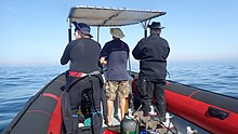
In South Africa, the standard dive boat is a large (6 to nearly 9 m) Rigid Inflatable Boat These are known as rubber ducks. Power is generally twin outboard motors, which may be two-stroke and smoky, but are increasingly often either four stroke, or the improved two-strokes which are cleaner and quieter.
These boats are generally powerful and fast, but speed is usually limited by sea state. They have a wet ride in a bumpy sea or if there is a crosswind. You travel in your dive suit, quite often with your hood on, and sometimes with your mask on to keep the spray out of your eyes. It has been known for the occasional diver to also use a snorkel to keep out heavy spray in rough conditions. If you wear a hat to protect your head from UV, make sure the hat is a tight fit, and preferably with a lanyard. The combination of cool sea air, wind, spray and high levels of UV can grill you in quite a short time, even in winter. Wear a good blockout or other method of keeping the sun from your skin. Unfortunately some blockouts wash off easily, and others sting your eyes if water gets into your mask and sloshes around a bit. A ski-mask is considered slightly eccentric, but it does the job.
Preparing for the dive.

If using all your own equipment, pack it as you find convenient, and check that everything is in good working order before leaving home. It will be wet on the way home, a waterproof bag or bin will keep the water off the upholstery. If using rental gear, get to the shop early to make sure it fits and works properly. If you are an unusual shape or size you may have difficulty finding a suit which fits well.At some places you will kit up at the side of the road or in a parking lot, and at others there will be changing rooms provided by the dive operator. If this is an issue, find out before the dive, You might want to take along a small mat or towel to stand on while putting on your suit, particularly if the ground is sandy or muddy.Some operators provide facilities at the dive shop for the customers to change into their dive suits and assemble equipment and load the boat before leaving for the launch site. In these cases the heavy equipment is usually loaded by staff, and the divers carry their light equipment to the boat. Where the boat collects divers from a jetty, the divers are expected to get their own kit to the boat. Actual loading will usually be done or supervised by the skipper.You will almost always be expected to wear your dive suit on the boat trip. There is no space to put it on during the ride, which may be wet.
What to take
- A small bag is useful to carry items like sunglasses, sunblock, hat, etc. Cell phones and car keys are usually kept in a waterproof bag or box by the skipper, and stored in the console. Large boxes for underwater cameras or video equipment should be negotiated before the dive, as there may or may not be space for them on board. In summer sunblock is advised for most skin types. UV factor is generally high and reflection from the water grills you from below. A peaked or brimmed hat may help if securely strapped on against the wind generated by boat speed.
- Kit bags for dive gear are not usually carried, but a medium sized soft bag to hold fins and mask, and other dive accessories like DSMB, reel, computer, dive light etc. is OK.
- On a long boat trip a small bottle of water or other suitable rehydration drink is nice to have, specially for after a deep or long dive. Similarly a small amount of high energy food may be welcome after a cold dive. In Cape Town, many dive boats supply a small chocolate bar or other sweet (candy) to each diver after the dive.
- A light waterproof windbreaker jacket is useful if the wind is strong, the weather or water is cold, or the trip is long. This can reduce wind-chill, particularly after the dive if you wear a wetsuit.
- A small emergency supplies (dive saver) kit of spare O-rings, fin strap, etc is acceptable.
What not to take
- Don’t take anything that you do not intend to use on the trip. (emergency equipment excepted).
- Don’t bring anything that must not get wet unless you have a watertight bag or box for it. A towel is usually a waste of time, as it will probably get wet. The same goes for dry clothing.
- Space is limited and must be shared by all. Do not annoy everyone by bringing a huge bin for your kit and fighting with the skipper at boarding time. No-one will have sympathy when you are evicted.
Loading kit and getting into the boat


The boat may loaded before launching, except where the water at the slipway is too shallow, when the boat is not taken out between dives, or when the slipway is not at the same place where the divers will be boarding.Loading of the boat is usually done by the skipper and divemaster. You are usually expected to transport your own equipment to the boat and hand it over to the person who will stow it for the trip. The standard arrangement is to stack scuba sets along a centreline rack, and tie them in place. You will usually sit at your scuba set, so if you want to do pre-dive buddy checks, ask for your gear and your buddy’s to be stowed together.Weight belts and pockets may be stacked on deck or in a box at the front or back of the rack. They are handed out when the boat gets to the site, so be sure you can identify your weights.
Fins and masks are usually stowed by the diver. There are often no special places reserved for this purpose, and fins are generally stowed either behind a handrope along the inner side of the pontoons, or between scuba sets along the rack. Be careful how you do this, as simply stacking them on top of the scuba sets can sometimes result in a fin or two being blown overboard by wind. This can ruin your dive, and is usually expensive. Masks are commonly stored in the foot pocket of a fin. The deck is not a good place for fragile items.Large cameras with strobe arms should be carried in the smallest plastic bin or crate that will hold them. There will often be several divers with camera boxes contending for the same limited storage space. Do not expect special treatment unless you have specifically organised it with the charterer.Some crews will carry your scuba set to the boat, but don’t count on it. If you need help, say so. If you are renting gear from the same organisation that runs the boat, they will usually load it for you. Make sure you can identify your rented gear and that it has all been loaded.
Slipway launches


Slipway launches are standard in the Western Cape
Where launching is from a slipway the procedure is fairly relaxed, and much depends on how far the slipway is from the parking area, and whether there is a convenient jetty.In some cases, usually at low tide, the water may be too shallow to launch the boat loaded with kit, but more often the boat is loaded with most of the dive gear, but not the divers, before launching. The boat is then launched with usually just the skipper on board, and the divers either get in from shallow water or from a jetty, as described above.Sometimes there may be commercial ski-boat fishermen launching at the same slipway. There are exceptions, but the lasting impression is of a mob of hooligans with no respect for anyone. They are generally a law unto themselves, and you will not gain brownie points by pointing out the error of their ways, and are likely to be given a brief introductory course in local invective at no charge.
Getting into the boat will depend on the launch site. In most cases the boat will be launched with only a skipper on board. Divers will board from the jetty or from the water.
Boarding from a jetty
Boarding from a jetty is usually easy, unless the step down to the boat is high. The crew will help where necessary and direct boarding. Follow their instructions. Do not leap down onto the deck, as it may not be designed to take this kind of shock load, and the sound of cracking glass fibre will not bring a smile to the skipper’s face. Also don’t leap down onto the pontoon, as this is likely to be followed by an inelegant face-plant onto the rack of scuba gear. The owners may be more concerned with damage to their equipment than your injuries.
The roll bar at the stern is a good place to hold if you can reach it. The radio antenna, plastic windscreen and engine control levers are not.Try to avoid getting parts of yourself between the boat and the jetty. The pontoons are fairly soft, but the jetty usually isn't, and may be decorated by barnacles and other abrasive material.
Boarding from shallow water
If boarding from standing in the water, try to get in where the water is not too deep, as most divers do not have the agility and upper body strength to boost themselves in without fins or a jump. Ask for help if you need it, but your fellow divers are more likely to be enthusiastic than skillful at pulling you in, Say goodbye to dignity, and hope for a reasonably comfortable landing.
The stern of the boat (blunt end) is usually lower and therefore easier to get into. This is often combined with it being in the shallowest water, so get in and out of the way of the people who have to hold the boat while the rest are getting in.
If you are a gymnast or acrobat you may safely ignore this advice.
הוֹשָׁבָה


Seating is almost exclusively on the pontoons, with your back to the water. This puts you in a position where losing your balance backwards will result in falling into the water, a manoeuvre most divers prefer to restrict to times when the boat is stationary at the dive site. To prevent unscheduled backward rolls, use the foot-straps and hand-ropes provided. As a general rule, sit opposite your scuba set, so you don’t have to move around when kitting up on site.
Occasionally there may be a seat across the stern in front of the motors. This will be the most comfortable place on the boat but may catch more spray in your face. The boat will bounce up and down as it hits waves. Bigger boats less so than small ones, and the part that bounces the least is the stern, so the most comfortable seating is as far back as you can get. This puts you close to the motors, and if they are two-stroke, closest to the exhaust smoke when the boat is not moving. You may not have much choice where you get to sit, but if you have a bad back or other disability which makes a rough ride a problem, mention this to your dive-master or the skipper as soon as possible. You will not be popular if the boat has to stop to re-arrange passengers. With practice it is possible to sit with one foot in a foot-strap (preferably the foot nearer the bow (pointy end)) and ride the bumps with very little effort. It is much like riding a horse, don’t fight the motion, absorb the bumps by relaxing a bit, and you will bounce less. A death-grip on the hand ropes will be exhausting if the ride is long.
Some boats have no footstraps. You will have to find something else to hold onto, or lean into the boat to keep more weight on your feet. Some divers may be seen comfortably sitting on the tubes, riding the waves with no obvious concern as the boat bounces along. They may not even need to hold on. They have done this before.
Moving around in the boat
If possible, don’t move around while the boat is moving, unless asked to trim the boat. You will be expected to sit where directed by the skipper, and unless there is a good reason not to, do as requested. Standing up when the boat is moving and there is nothing to hold onto can result in a fall and possible injury if the boat hits a wave or moves in an unexpected direction. If equipment comes loose under way, shout to the skipper, who will stop if it is safe, so that the equipment can be re-stowed.There may be cables and pipes in places on the deck. These are usually routed through areas where they are reasonably protected, but as a rule don’t stand on them or use them to hold on to. Batteries are often stored in plastic boxes near the transom, to keep the wires short. The lids are not usually load bearing structures, do not use them as steps.
Getting out of the boat

Getting into the water is usually done by a synchronised backward roll – falling into the water alongside your neighbour, neither on top nor underneath. Generally all the divers or a nominated group will roll off together, on a countdown from the skipper or divemaster. It is important to all roll together, as if you do not, the later divers may fall on top of the earlier ones, possibly casing injury or equipment damage. If you are not ready, or are not happy with this procedure, wait until the others are in and the boat is clear of them. The skipper will then let you roll in clear of the others, but you may have to fin a bit to get to them. This can be a problem if diving in a current. Some divers may not wish to backward roll with a large camera setup. הם יכולים לבקש מהסקיפר להעביר להם את המצלמה כשהם במים. במקרה זה עליהם להישאר קרוב לסירה ורצוי להחזיק בה עד שהמצלמה שלהם עוברת.
מצוף הקו והסמן

רוב הצלילה בקייפטאון היא בשונית או בהריסות. נהוג לסמן את המיקום בקו יריות לפני הצלילה כדי שהצוללנים יוכלו לרדת למקום הנכון. אם יש זרם קל על פני השטח, קו הזרם ייסחף לרוח כדי לתפוס את הרפיון. במקרה זה נהוג להיכנס למים במרחק קצר של הזרם של המצוף ולהתחיל את הירידה ברגע שהקו נראה דרך המים, כדי למזער את עבודת השחייה חזרה נגד הזרם. נסחף עד המצוף פירושו שתצטרך לשחות בחזרה נגד הזרם. קו הקו אינו עוגן. אם תמשוך את עצמך לאורך קו המצוף, הוא עלול לגרור את הזריקה, ובסופו של דבר אתה תהיה זרם מטה של האתר, כמו כל האחרים מאחוריך. אם קו הקו קצר מדי, יתכן שהזריקה תונף על ידי המצוף ותיסחף מהאתר, כך שהיא זקוקה לרפיון. הזרם לא יכול לרדת ישירות ברוח. גם כאשר מדובר בזרם המושרה על ידי הרוח, כוחות הקוריאוליס יקזזו אותו נגד כיוון הרוח בכדור הרוח בחצי הכדור הדרומי, בהשפעה המכונה הובלת אקמן. ההשפעה היא כ 45 ° על פני השטח, יותר ככל שאתה הולך עמוק יותר, אבל עם פחות מהירות.
אתה יכול לבחור לשטח על קו הגבול או להתרחק ממנו. אם אינך מכיר את האתר יתכן שיהיה קשה למצוא את הדרך חזרה. בדרך כלל זו לא בעיה, ורוב הצוללנים מקייפטאון יעלו לכל מקום בו הם נמצאים בסוף הצלילה, אך במקרה זה מומלץ בחום לפרוס DSMB ולשטח על המצוף שלך, או על המצוף של החבר שלך. ה- DSMB יציין את נוכחותו של צולל כך שהסירות באזור יוכלו להישאר ברורות וכדי שסקיפר הסירת הצלילה שלכם יוכל לעקוב אחר המקום בו לקוחותיו צפויים לעלות על פני השטח.

אם קיים סיכוי משמעותי לצפייה הרחק מקו היריות באזור עם תנועת סירות רבה, צוללנים מוזמנים, או עשויים להידרש, לשאת DSMB ולפרוס אותו לפני הצפה. אתרים אחרים בהם צוללנים עשויים להידרש לשאת DSMB הם אתרים רחוקים מהחוף, או בכל עת שהסקיפר חושב שזה עשוי להיות קשה למצוא צוללן בגלל תנאי הים. לצלילה לפנאי, בחירת הצבע והגודל עבור DSMB אישי תלויה בצולל. צהוב, כתום ואדום הם הנפוצים ביותר, אך מדי פעם רואים גם ורוד עז, אלא אם כן תודיעו במפורש לסקיפר על משמעות מיוחדת לצבע, יש להניח כי אין משמעות מיוחדת מלבד סימון עמדתכם. לאף אחד לא יהיה אכפת עד כמה הוא גדול כל עוד ניתן לראות אותו ממרחק סביר. רצועות רעיוני, אורות מהבהבים ושמך הם גם אופציונליים.
Divemasters
יכול להיות שיש אחד על הסירה, או שלא. הסירות המספקות תושבים מקומיים נוטות פחות לספק מחלקה בהשוואה לסירות המחוברות לבתי ספר או שבדרך כלל נותנות מענה למסחר החולף והמבקרים. אם אינכם בטוחים בצלילה בלי שמישהו יראה לכם מסביב, ציינו זאת כשאתם מזמינים ושאלו על האפשרויות.
צלילת אצות
באזורים בהם יש אצות כבדות, צוללנים בדרך כלל לא גוררים SMB במהלך הצלילה. למרבה המזל אלה בדרך כלל גם מקומות שבהם אין זרמים משמעותיים, אם כי הזינוק יכול להיות חזק. לרבים מאתרי החוף של קייפטאון וחוף הים יש אצות כבדות, במיוחד על שפת הים האטלנטי. באזורים אלה מעודדים את הצוללנים לשאת DSMBs ולהשתמש בהם כאשר הם צפים הרחק מקו היריות, כך שהסקיפר יכול לעקוב אחר המקום בו כולם צפים, וכדי שלסירות חולפות תהיה אפשרות להימנע מלהרוס אותך אם מישהו טורח. לשמור על תצפית. DSMBs יעילים מאוד לאיתות לסירה כשאתה על פני השטח - הרבה יותר מזרוע בחליפת צלילה שחורה. זה יכול להיות יקר במיוחד אם הרוח מצטברת במהלך הצלילה והמשטח סוער עם מים לבנים.
חוזרים לסירה אחרי צלילה


כלל 1: אין להוריד את הסנפירים במים אלא אם כן יש סולם. אתה צריך אותם כדי להגביר אותך. מרבית ברווזי הגומי אינם מספקים סולם עלייה למטוס. זה חשוב עוד יותר אם אתה עולה על הצד הרוח של הסירה, מכיוון שהסירה תיסחף כמעט תמיד מהר יותר מאשר צוללן. התקרב לסירה וקבל אחיזה בחבל היד החיצוני. נסה לשמור על האחיזה בסירה בכל עת, והרפה רק כל עוד יש צורך בהחלט להסיר את הערכה, מכיוון שהסירה עלולה להיסחף בזמן שאתה לא מחזיק מעמד.
כמה סירות עשויות לספק קו תפיסה קצר עם לולאה שתוכל להחליק זרוע דרכה, אך משום מה זה נדיר ביותר. נפוץ עוד יותר הוא קו עם קליפ שניתן לחבר לציוד לפני הורדתו. יש להניח כי אין דרישת לקוח לפריטים אלה ... הציוד שלך יונף על ידי הצוות או צוללנים אחרים.
ההליך המומלץ הוא להעביר תחילה כל מצלמה או ציוד רופף אחר, ואז להמריא ולהגיש את המשקולות שלך. זה מבטיח לך לצוף לאחר הסרת BC שלך. אל תשחרר עד שתהיה בטוח שלאדם השני יש אחיזה טובה, חגורות משקל שוקעות מהר מאוד. הסר את ערכת הצלילה והעביר אותה לצוות. אתה יכול לעזור על ידי דחיפה כלפי מעלה מתחת לסט כאשר הם מרימים, ובדיקה ש- DVs ומדידים אינם מתחברים לחבלי היד. ניתן למסור מסיכה ושנורקל בכל עת אם זה נוח.קח אחיזה טובה בידיות הניתנות, או חבל יד גבוה ככל האפשר בצד הפונטונים. טבלו את עצמכם עד כמה שניתן בכדי להגיע להרמה ציפה, ואז סנפיר חזק כלפי מעלה והשתמשו בזרועותיך כדי למשוך את עצמך גבוה ככל האפשר, ואז דחף מטה על החבל או הידיות תוך גלגול פלג גופך העליון אל הפונטון. החלף אחיזה לידית פנימית או קו יד, והניף רגל לסירה. זה יכול להיות נוח לעצור כאן בזמן שמישהו מסיר את הסנפירים שלך, ואז לשבת ולהניף את הרגל השנייה לסירה. עם סנפירים טובים, טכניקה טובה וכוח סביר ניתן לעלות כך בנוחות ובכבוד. שיטה זו קשה הרבה יותר אם בצד הרוח ברוח חזקה.

אם אין לך כוח, ההליך דומה, אך בעזרת צוות או צוללנים שכבר נמצאים בסירה, שיגררו אותך בכוח הראשי ובכל מה שהם יכולים להשיג אחיזה בו. לפני שתאשים מישהו בתקיפה מגונה, שקול אם יש מקום חלופי סביר לתפוס שהיה עובד. אלגנטיות היא ביחס הפוך לגודל ולמסה שלך. אם יש לך כיסי ירך מול החליפה שלך, אל תעלה עם שום ציוד שביר או מגושם בכיסים. כיסי צד בדרך כלל אינם מהווים בעיה.

יש מגמה חדשה עם כמה סירות לספק סולם לעלייה למטוס. סגנון "עץ חג המולד" פופולרי יחסית מכיוון שקל לטפס עם סנפירים על הרגליים. על ברווזי גומי הוא בדרך כלל תלוי מעל הצד, ועל קטמרנים עם נוקשות גוף עדיף הטרקטור.
לצאת מהסירה לאחר צלילה

היציאה למזח היא בדרך כלל פשוטה, אך עלולה להיות מסובכת על ידי מזח גבוה ושפל. אם מדובר בבעיה, הצוות יעזור וייתן הוראות. אם אתה עושה בעצמך, אותן אזהרות חלות על כניסה ממזח. במיוחד על כך שלא תגיעו בין הסירה למזח.
היציאה לחוף היא יוצאת דופן בקייפטאון, אך פשוטה יחסית. בדרך כלל זה בטוח ונוח יותר לרדת בצד הנמוך אם הסירה נוטה בעת ריצה על החוף. אם אתה נמצא בצד הגבוה, המתן עד שיהיה מקום ותעבור לצד התחתון, או שבמקרים מסוימים הצד הגבוה יהפוך לצד הנמוך ככל שהסירה צונחת לאחור עם הסרת העומס. אל תנסו לפרוק ערכה על הצד הגבוה, למקרה שאתם במקום הלא נכון והסירה מתגלגלת עליכם. זה סביר במיוחד אם הסירה לא נקייה לחלוטין מהגלים.
לִרְאוֹת

מימי חצי האי קייפ ומפרץ השקר תומכים באקולוגיה משגשגת של אורגניזמים ימיים קרירים, רבים מהם אנדמיים בדרום אפריקה, או אפילו באזורים קטנים יותר, ולמרות שהדגים אינם צבעוניים בצורה מרהיבה כמו אלה שנראים במים טרופיים, רבים מהם צבעוניים למדי בכדי להסוות את עצמם בין חסרי החוליות החי ביותר המכסים את השוניות.
בעלי חיים ימיים
יש מגוון רחב של בעלי חיים ימיים שאפשר לראות בזמן צלילה באזור זה, והם כוללים כמה מהמפגשים המדהימים והמרהיבים ביותר שיש לצולל.
לווייתנים ודולפינים
מפרץ השקר הוא יעד שצוין לצפייה בלווייתנים. מספר גדול של לווייתנים ימניים דרומיים מבקרים במפרץ מדי שנה, אך זה יוצא דופן לראות אחד במהלך צלילה. מיני לווייתנים אחרים שנראים לעיתים במפרץ השווא הם לווייתני גיבנת, הלווייתנים של ברידה ואורקה, ואלה עוד פחות יראו בזמן צלילה. אם אכן יש לך מזל להיתקל בלווייתן במהלך צלילה, היזהר מכיוון שגודלם העצום מקל על צולל להיפצע שלא בכוונה.
דולפינים נראים גם במפרץ השקר ובחוף הים האטלנטי. דולפינים נפוצים מבקרים מדי פעם בבתי ספר המונים מאות עד אלפים, אך לעתים קרובות אינם נראים על ידי צוללנים. דולפינים חשוכים נוטים לנסוע בקבוצות קטנות יותר, אך הם נוטים יותר לחקור צוללן בתחנת הבטיחות. מינים אחרים מבקרים מדי פעם, אך הם מצויינים יותר בזכות אירועים תקועים שנראים צוללנים מתחת למים.
כרישים

מפרץ השקר הוא אחד המקומות האמינים ביותר לצפייה בכרישים לבנים גדולים, אם כי לעיתים נדירות כצולל, וכמה מיני כרישים אחרים נראים לעיתים קרובות. לעתים קרובות ניתן לראות את סוונגיל או את הפרה בכמה אתרים, בעוד שכרישי הגומי והכרישים נפוצים יותר. ישנם ארבעה מיני כריש שכיחים באופן מקומי, החל מהשיש כריש הצבעוני ועד לכריש הפיג'מה הגדול בהרבה. כרישי אגן אחרים נראים בדרך כלל רק בצלילות "מים כחולות" מהחוף מעל חצי האי הדרומי, וניתן לראות כמה מינים גדולים של דגי אגן בנסיעות דומות.
פלאגיים

צורות גדולות של זנב צהוב נראות מדי פעם באתרי צלילה מסוימים, ובהזדמנויות בלתי צפויות צוללנים עשויים להיות בר מזל מספיק כדי לראות דגי שמש שמש באוקיאנוס, לווייתנים ימניים דרומיים, לווייתני גיבנת, שכיחים, דולפינים מבושל או דושקי.
סנוק המצוי, המהווה אבן הפינה של תעשיית דיג קו מקומי, הוא ביישן מאוד וכמעט ולא נראה על ידי צוללנים, למרות הרגלו לחטוף בכמויות גדולות.
פינגווינים וחותמות

יש מושבות של פינגווינים אפריקאים במפרץ השקר, אבל זה יוצא דופן מאוד לראות אותם במהלך צלילה. מצד שני, כלבי הים של פרוות הכף הם גם סקרנים וגם לא מפחדים מצוללים, ונראים לעיתים קרובות מאוד, גם במפרץ השקר וגם על שפת הים האטלנטי. ישנם מספר מקומות בהם כמעט ניתן להבטיח שהם נראים.
דג שונית


דגי שונית באזור זה הם המגוונים ביותר במפרץ השקר, ונפוצים ביותר באזורים המוגבלים של האזורים המוגנים הימיים, שם הם מוגנים על ידי החוק במשך כמה עשורים, אם כי ציד ציד עדיין קיים, והאכיפה אינה מהימנה למדי. רוב דגי השונית מוסווים במידה מסוימת. רבים הם אפורים כסופים ומוצללים, כמו קרם הים של הוטנטוט בכל מקום, פרנסמדאם הכסוף והסטנטג'י. לאחרים יש מוטות אנכיים או טלאים כהים שעשויים לסייע בפירוק הפרופיל שלהם באצות ים, כגון גבעול לבן, זברה, וזקנים לבנות, בעוד שרבים מהמינים הקטנים יותר הם צבעוניים בצורה משתלבת ומשתלבים היטב בסביבתם. בדרך כלל מדובר בדגים אשר מבלים את רוב זמנם על השונית או בקרבתה מאוד, וצבעונם מהווה בדרך כלל אינדיקציה לצבעים האופייניים לבית הגידול שלהם. אלה כוללים קליפפיש אנדמי שונים, וכמויות אדומות אחדות, סנפירי האצבעות, טריפלפין קייפ, סקורפיונפיש חלקלק, שני מינים של דג סוס, צנרת והרוקסוקר. יש גם כמה דגים אדומים, שנראים לעין למדי, כמו הרומית הנפוצה מאוד, והדאמפנוז האדום והסטנבראיות האדומות פחות נפוצות. מרבית הדגים שהוזכרו הם בודדים או נמצאים בצורות קטנות, אך ישנם גם Strepies ו- Maasbanker הנוטים להצטמצם בכמות גדולה למדי, וצורות גדולות בינוניות של Hottentot נראות לעתים קרובות למדי. גלג'ואן נדיר למדי ונראה בדרך כלל בקבוצות קטנות על גבי השונית בהן יש הרבה תנועת גלים, והסכמוטה הכפית דומה למראה מעדיפה שונית עמוקה וגבוהה יותר בין הסלעים. ים הים הם ביישנים ונוטים לבלות את היום בסדקים ובחור.
אזורים חוליים

באזורים החוליים יש גם את הדגים האופייניים שלהם, הכוללים כמה מינים של קרניים, סוליות, גרדנים, דג עלים ודג החול המקורי, שהוא נדיר וביישן ביום, אך ניתן לראות אותו בכמויות גדולות בלילה בחלק מהאתרים, כאשר הוא יוצא מהחול שהוא מתחבא בו ושוחה סביב בחופשיות. כמה מינים של קליפפיש שוכנים גם הם בחול, כאשר המינים השונים מעדיפים צפיפויות חול שונה, כאשר אלה שמעדיפים חול דק עם גוף דמוי נחש יותר, ואילו אלה שבחול גס הם חזקים יותר. תבנית גופם נוטה להתאים גם לסוג החול.
חסרי חוליות שונית
חסרי חוליות בנטיים מספקים את רוב הצבעים הבהירים בשוניות של אזור זה, והתפלגות המינים אופיינית לאזורי המשנה השונים כמו העומק וטמפרטורת המים. המגוון הוא גדול, ויש מגוון גדול בכיסוי השונית השולט עם עומק ומיקום גיאוגרפי כאחד. חיי השונית האופייניים משתנים במידה ניכרת בין הצדדים המזרחיים והמערביים של חצי האי קייפ, וזה מוכר כגבול בין הכף הדרומי-מערבי לאזורי הביולוגיה היבשתיים של אגולהאס. האיזור האנכי אופייני גם לאזורים הביולוגיים השונים, ולכן יכולים להיות הבדלים בולטים מאוד במה שניתן לראות באתרים השונים.
יש נטייה כללית לאזור נתון של שונית להיות נשלט על ידי מין מסוים של אורגניזם, למשל, כוכבי נוצות נפוצים, מלפפוני ים אדומים, מלפפוני ים אדומים, פיתיון אדום או קיפודי ים, עד כדי כך חלק משטח הפנים מכוסה על ידי האורגניזם הדומיננטי. זה לא אומר שאין מגוון, שכן יש מגוון גדול של בתי גידול ברוב השוניות בהתאם לכיוון ולסמיכות, ובמידה רבה, אורגניזמים שבים חיים במקום שהם יכולים, וזה תלוי במידה רבה היכן הזחלים הפלנקטוניים למצוא דריסת רגל.
מי התיכון
חסרי חוליות פלגיים אינם צפויים באופיים הפלנקטוני בעיקר מתי ואיפה הם נראים. הם כוללים כמה מינים של מדוזות, כמה מינים של ג'לי מסרק, כמה סיפונופורים ספוראדיים, סלפים ופטרופודים, והרבה דברים קטנים מכדי להבחין בהם בקלות. יש גם דיונונים, אך הם ביישנים מאוד ולעתים נדירות נראים ביום.
הספוגים, הקנידרים, ג'לי המסרק, תולעים שטוחות, תולעים מפולחות, פרוקי רגליים, רכיכות, בריוזואנים, דגימתיים, תריסים, דגים, עופות ים ויונקים ימיים שתועדו מאזור זה מופיעים באזור. ויקיפדיה: רשימת בעלי חיים ימיים של חצי האי קייפ ומפרץ השווא. רבים מאלה עשויים להיות נראים על ידי צוללן פנאי.
אצות ים
יערות אצות ים
יערות אצות ים הם אצות הים הברורות ביותר של קייפטאון. ישנם שלושה סוגים שנמצאים במקום, לפעמים בסמיכות. המובהק ביותר הוא במבוק הים, המגיע לפני השטח כשהוא גדל לגמרי, ובעל החלק הקדמי העבה עם חלל מלא גז בחלקו העליון, ושומר על החזית קרוב לפני השטח לחשיפה מקסימאלית לאור. אצה זו נפוצה מאוד על שפת הים האטלנטי, והיא מצויה גם משני צידי מפרץ השקר, אך באופן שכיח יותר לכיוון החלק הדרומי של המפרץ.
אצות ספליט-מניפה קטנות יותר גדלות על שוניות עמוקות יותר ואינן מגיעות לפני השטח. הצינורות קצרים יותר ואין חלל מלא גז, כך שהפרונות נשארים שקועים במים החשוכים יותר. אצה זו נמצאת במים עמוקים יותר מבמבוק הים, עם טווח גיאוגרפי דומה.
השלישי הוא אצות השלפוחית, שיש בה אשכולות של צינורות דקים ארוכים, עם כריכות ארוכות ומספרים גדולים של שלפוחיות שתן מלאות בגז השומרות על אצות הזקוף ועל הכפות על פני השטח. אצה זו לא נמצאת במפרץ השקר, והיא נראית בעיקר בסמוך לאי רובן.
דשא אלגי וחללי יער אצות.
מתחת לכרי האצות, השונית באזורים רדודים יותר בהם יש מספיק אור, עשויה להיות מכוסה בשכבת אצות מגוונת, והמין המסוים יהיה תלוי במגוון גורמים, כולל כמות האור הזמינה וכמות המים תְנוּעָה. ככלל, אצות ירוקות וחומות ימצאו באזורים רדודים יותר, ואדומים יהיו עמוקים יותר, מכיוון שהם יכולים לשרוד בפחות אור. העמוקים ביותר הם לעתים קרובות אצות האלמוגים האדומות, אשר יכולות ליצור דשא צפוף על משטחי הסלעים העליונים.
דגימת אלמוגים.
במקום בו הגלישה חזקה מדי או שהאור עמום מדי עבור אצות אחרות, אצות האלמוגים הדוממות עדיין עשויות למצוא דריסת רגל ולשגשג. אצות אדומות אלו יוצרות קרום קשה למדי ודבק בחוזקה על השונית, והן ידועות גם בשם "צבע ורוד", שהוא תיאור הוגן של המראה שלהן - הן לא נראות כמו אצות ים. הטווח שלהם נמצא כמעט בכל מקום באזור בו מספיק אור חודר ואין דייר אחר שכבר נמצא בשונית.
באזור זה נרשמו כ -57 אצות ירוקות, 49 אצות חומות ו -240 אצות אדומות ויקיפדיה: רשימת אצות חצי האי קייפ ומפרץ השווא.
ספינות טרופות

ה כף הסופות וה כף התקווה הטובה הן ערעורים מסורתיים לאזור זה, ומסיבה טובה. מזג האוויר יכול להיות רע מאוד לפעמים, והחוף חשוף מאוד, עם מעט נמלים מוגנים, אך הוא מהווה גם נקודת דרך חשובה באחד ממסלולי הסחר הימיים הגדולים בעולם. כתוצאה מכך, יש מספר מרתיע של טרופות ספינות שנרשמו לאורך קו החוף המקומי.
רבים מההרוסות הללו מעולם לא נמצאו, ורבים אחרים נפרצו ללא הכר, או כוסו בחול, או במקרה של מפרץ השולחן, נקברו במסגרת פרויקטים של החזרת אדמה, אך כמה מהם נמצאים במקומות מתחלקים וייתכן שביקרו בהם צוללנים אם התנאים מתאימים.
עומק ההריסות המתחלקות נע בין 3 או 4 מטר, ליותר מ -65 מטר, והמצב משתנה בין חצי שברי עץ או פלדה קבורים, לספינות ששומרות על מרבית מבנהן ומראהן המקורי, ונחות מתוך המעמקים כאילו מפליג בקרקעית החול.
רובם מצופים בכבדות עם אורגניזמי שונית, החל מאצות ים במים הרדודים למגוון גדול של חסרי חוליות צבעוניים במים עמוקים יותר. הם גם מקלטים מגוון דגי שונית, ודגי פלאגנים עשויים לבקר בהם באירועים בלתי צפויים. למעשה, הם משמשים כשוניות מלאכותיות, וכתוצאה מכך הם בדרך כלל מעניינים גם צוללנים שאינם מעוניינים בהם במיוחד כממצאים.
מאפיינים טופוגרפיים
רבים מהאתרים מאופיינים בתכונות טופוגרפיות מעניינות, כולל פסגות, גיאיות, מערות, שקיפות ושטיחים. מאפיינים אלה בולטים לא רק בתרומתם לנוף הים, אלא גם מספקים שינויים גדולים בבתי הגידול הזמינים באתר, והתוצאה היא מתאם חזק בין מגוון ביולוגי גבוה לטופוגרפיה מעניינת. האופי הטופוגרפי הכללי של אתר תלוי בגיאולוגיה, ואתרי הגרניט ניתנים להבחנה מיידית מאתרי חול ומשקעים. סלעי הגרניט מעוגלים בדרך כלל ונערמים כסלעי אבן גיר על מחשופים של אותו סלע, לרוב עם חול קוורץ לבן ביניהם, או כבסיס משופע בהדרגה. ערימות אלה של סלעים בגדלים שונים יוצרות לעיתים קרובות פסגות, וגליונים בכיוונים אקראיים למדי, והמתלים והחורים ביניהם גדולים במקרים מסוימים בכדי לצוללנים לשחות דרכם, ומספקים מבנה שונית מרהיב.
שכבות אבן החול נוטות לייצר תצורות הנשלטות על ידי הטבילה והשביתה המקומית, וזה צפוי יותר. עם זאת, הפרט בקנה מידה קטן יותר נוטה לייצר יותר חורים קטנים, סדקים, מדפים ורכסים מאשר אזורי הגרניט, ואלה פחות מרהיבים ככלל. ישנם יוצאים מן הכלל, שבהם שוניות אבן החול קטנות מאוד, בדרך כלל כאשר הטבילה די תלולה, אך לא אנכית, וקו החוף תלול למדי, אך במישור שונה מהטבילה.
למרבה המזל התכתיב הישן "כנ"ל, כך למטה" חל די טוב, ואפשר לחזות את האופי של השוניות בצורה מהימנה למדי על ידי התבוננות בנוף קו החוף הסמוך. היוצא מן הכלל העיקרי לכלל זה הוא דרומית למפרץ סמיצווינקל, שם יש מתחת לאבני חול גרניט.
המבנה הגאולוגי וההיסטוריה של אזור זה מתוארים בקצרה ב ויקיפדיה: גאולוגיה ימית של חצי האי קייפ ומפרץ השווא
לקרוא
ספרי עיון על האקולוגיה של מימי קייפטאון:
מ SURG, במיוחד עבור צוללנים באזור זה: ניתן להשיג בחנויות צלילה נבחרות ובחנויות ספרים בקייפטאון, וישירות מ- SURG.
- ג'ונס, ג'ורג'ינה. 2008. מדריך שדה לבעלי החיים הימיים של חצי האי קייפ, SURG, קייפטאון. ISBN 9780620416399
- זסילאבץ, גואידו. 2005. דגי חוף של חצי האי קייפ ומפרץ השווא, SURG, קייפטאון. ISBN 0620342307
- זסילאבץ, גואידו. 2007. ענפי עירום של חצי האי קייפ ומפרץ השווא, SURG, קייפטאון. ISBN 0620380543
ממפרסמים אחרים, ועם יישום כללי יותר:
- סניף, ג 'וענף, מ' 1981, החופים החיים של דרום אפריקה, סטרייק, קייפטאון. ISBN 0869771159
- סניף, G.M. גריפיתס, C.L. Branch, M.L and Beckley, L.E. 2010, שני אוקיאנוסים - מדריך לחיים הימיים של דרום אפריקה, דייוויד פיליפ, קייפטאון. ISBN 9781770077720
- גוסלינר, ט '1987. ענפי עירום של דרום אריקה, אתגרי הים וג'ף המן, מונטריי. ISBN 0930118138
- Heemstra, P. ו- Heemstra E. 2004, דגי חוף של דרום אפריקה, NISC / SAIAB, גרהמסטאון.
- אד. סמית, מ.מ. והימסטרה, עמ '2003 דגי הים של סמית '. סטריוק, קייפטאון
- Stegenga, H. Bolton, J.J. ואנדרסון, ר 'ג'יי. 1997, אצות הים של החוף המערבי של דרום אפריקה. בולוס הרבריום, קייפטאון. ISBN 079921793X (טכני למדי)
ספרי עיון בנושא הגיאולוגיה של חצי האי קייפ:
- קומפטון, ג'ון ס '2004, הסלעים וההרים של קייפטאון. קומה כפולה, קייפטאון. ISBN 1919930701

![]()