
| מדינות נורדיות: דנמרק, פינלנד, אִיסלַנד, נורווגיה, שבדיה ויקינגים והנורדים הזקנים • הִיסטוֹרִיָה • תרבות סמי • חוֹרֶף • זכות גישה • סִירָאוּת • טיול רגלי • מִטְבָּח • מוּסִיקָה • נואר נורדי |
בתוך ה מדינות נורדיות שֶׁל פינלנד, אִיסלַנד, נורווגיה ו שבדיה ישנם אזורים גדולים המאוכלסים בדלילות המתאימים להם תרמילאות במדבר וטיולי לודג 'עד אכסניה מרובים, ואזורים לטיולי יום אפילו ליד רוב העיירות והכפרים - בנורבגיה כולל טיולים לפסגות גבוהות. יש מגוון עשיר של נופים בארצות הנורדיות, מאיסלנד הוולקנית ועד היערות המזרחיים בפינלנד, מההרים האלפיים של נורבגיה ועד השפלה העדינה של דנמרק ודרום שבדיה. ה חופש לשוטט, המכונה גם זכות גישה או בשוודית / נורבגית allemansrätten / allemannsretten ("זכויותיו של כל אדם"), נותן גישה לכל אחד לרוב הטבע.
בחורף, שמשמעותו היא מינואר עד פברואר או מאוקטובר עד מאי, תלוי ביעד, קרוס קאנטרי סקי זו הדרך ללכת, לפחות למרחקים ארוכים יותר באזורים רבים - תרמילאות במדבר וסקי חזרה כפחות נחשבות לאותה פעילות. ביעדים עם שבילי הליכה, לעיתים קרובות יש מסלולי סקי בחורף.
חלק מהעצות שלהלן רלוונטיות גם לדרכים אחרות לחקור את הנוף הטבעי.
ל איי פארו, גרינלנד ו סוולבארד, עיין במאמרים העיקריים שלהם.
בעוד שטחי השממה בדנמרק קטנים מאוד בהשוואה למדינות נורדיות אחרות, למדינה יש עדיין כמה הזדמנויות לחיי חוץ. לִרְאוֹת קמפינג פרימיטיבי בדנמרק.
| COVID-19 מֵידָע: כבר אסור להגיע לבקתת השממה הנורבגית ללא סייג. בפינלנד המתקנים נסגרו באביב 2020, אך נפתחו מחדש והמבקרים פשוט מתבקשים להימנע ממקומות מנוחה צפופים ולעקוב בקפידה אחר ההמלצות בנושא היגיינה, מרחקים וכו '. סבון וחיטוי אינם מסופקים, ולכן יש לבצע אותם בעצמכם. | |
| (מידע עודכן לאחרונה ב -2 בפברואר 2021) |
מבינה

| “ | הוא זקוק לאש, מי שהגיע עכשיו, קהה עם קור עד הברך; אוכל ובגדים שהנווד משתוקק לו שהסתדר עם נפילת השפה. | ” |
—הוומאלי | ||
נורבגיה, שבדיה ופינלנד משתרעות יחד על שטח של יותר ממיליון קמ"ר, רחב פי עשרה מאשר אוסטריה ושוויץ ביחד. אזור הטיולים כולל את הפיורדים האטלנטיים הלחים והמתונים וחופי נורווגיה, דרך הפסגות הגבוהות האלפיניות הפראיות של ההרים הסקנדינבים, אל הרמות הרחבות והיערות העמוקים של הפנים.
רק לפני כמה דורות התגוררו רוב האנשים במדינות הנורדיות באזור הכפרי. עם אוכלוסייה דלילה ושדות דלים, ייעור, דיג וקטיף פירות יער העניקו הכנסה משלימה חשובה לרבים. כיום, טיולים רגליים, דיג וקטיף פירות יער הם חלק חיוני מהחופשות עבור רבים מאנשי המקום, בעיקר כבילוי בקוטג 'הקיץ. לא כולם מטיילים רציניים בחזרה לארץ - אבל יש לא מעט.
היבט אחד של המסורת החיצונית הנורדית, ציד, מוזר עבור רבים ממדינות שבהן זה היה משהו ששמור לבעלי הקרקעות, המעמד הגבוה. במדינות הנורדיות היערות היו תמיד בחלקם הגדול של החקלאים ואלה היו ציד כמקור מזון משלים לעיתים חשוב. באזורים הכפריים להיות נורמלי במועדון הציד המקומי. המילה הפינית לשממה, erämaa, פירושו גם שטחי ציד ודיג. בתקופות ישנות אנשים היו הולכים לטרק בדיוק כדי להשיג אוכל ופרוות, וטיולים רגליים כוללים עקבות של מסורת זו, לפחות עבור כמה מטיילים.
אפילו האזורים המרוחקים לעיתים נדירות אינם נגועים באמת. בצפון רוב האזורים משמשים לגידול איילים. היער הלא מוגן ביותר משמש לייעור. בפועל, רוב האנשים ישימו לב לכך רק מדי פעם.
בגלל האוכלוסייה הדלילה, במיוחד בצפון, השבילים יהיו שקטים למדי, למעט ליד אתרי התיירות העיקריים. מחוץ לשבילים תוכלו לראות מעט אנשים אפילו ליד ערים. ליד כבישים ראשיים אולי תשמעו את התנועה, אך באזורים המאוכלסים יותר בדלילות תשמעו בקרוב רק שקט.
אקלים ושטח

סוג השטח ותנאי מזג האוויר משתנים מאוד, מההרים התלולים של נורבגיה ועד המישורים הכמעט שטוחים של אוסטרובוטניה הפינית, מהאקלים המתון והגשום של חוף האוקיינוס האטלנטי ועד האקלים הכמעט יבשתי של פינלנד הפנימית ומאקלים ממוזג וחם בדרום. לקרחונים בהרים וטונדרה בצפון מאוד.
פחות מ -5% משטחה של נורבגיה מפותח (אדמות חקלאיות, כבישים, ערים), והשיעור דומה במדינות האחרות. בנורבגיה, כ -50% מהשטח הוא שטח פתוח כלשהו ללא יער, כולל קרקע חסרת עצים וסלעים חשופים, יותר מ -30% הם יער וכ -5% הם שטחי ביצה וביצות (במיוחד במזרח נורבגיה, טרונדלג ופינמרק) , 5% הם מים מתוקים (נהרות ואגמים) ו- 1% הם קרח או שלג קבוע. בפינלנד 70% הם יער, בעוד שהשטח הפתוח מורכב ברובו מאגמים וביצות, בצפון מאוד גם אזורי נדן גדולים. כמו כן בשוודיה שטחי לחות שכיחים (כ -20% מהשטח). כ -63% מאיסלנד הם נוף צחיח, ל 23% יש צמחייה כלשהי, 12% מכוסים על ידי קרחונים ו -3% הם אגמים.
שירותי תחזית מזג האוויר הם בדרך כלל באיכות טובה, אך ייתכן שיהיה צורך בניסיון מקומי בכדי לפרש אותם: תנאי הרוח משתנים בהתאם לטופולוגיה המקומית ולטמפרטורה נאמר רק על מקסימום ממוצע היום בתחזיות רבות, יש להסיק טמפרטורות לילה. הרוח בדרך כלל חזקה יותר בהרים הגבוהים והצחיחים ולאורך החוף החיצוני. ההבדל בין טמפרטורה מקסימלית למינימום ביום נתון הוא בדרך כלל בטווח של 3-15 מעלות צלזיוס, אלא אם כן יש שינויי מזג אוויר משמעותיים. שמים בהירים בדרך כלל פירושם לילה קר. הטמפרטורות הממוצעות המרבי ביום בחודש יולי נע בין 15 ° C (60 ° F) לכ 23 ° C (75 ° F) בהתאם למיקום, בחודש ינואר בערך קפוא עד -10 ° C (15 ° F), הרים גבוהים לא נספר. קיצוניות הטמפרטורה עשויה להשתנות בין 35 ° C (95 ° F) בקיץ ל -50 ° C (-55 ° F) בחורף הצפוני בפנים הארץ.
שירותי תחזית מזג אוויר ומידע על האקלים זמינים עבור פינלנד מהארץ מכון מטאורולוגי (סמארטפונים) או פורקה, לנורבגיה מהארץ משרד מטאורולוגי וחדשות מזג האוויר ולאיסלנד מ משרד מטאורולוגי איסלנדי.
האזור נמצא באזור הגבול בין המערביים לסובארקטיקה; מזג האוויר יכול להיות נשלט על ידי מערכת מזג אוויר מסוימת או שקשה לחזות מזג אוויר מתחלף. סמוך לחוף האטלנטי (כלומר באיסלנד ובנורבגיה ובקרבתה) ובגבהים גבוהים שכיחים במהירות מזג האוויר.

הרים גבוהים וקרחונים קשה לבקר בתקופות מסוימות בשנה. כשאתה שופט את הגובה, זכור שקו העץ יכול להיות נמוך מ -400 מטר בחלקים הצפוניים ביותר של פינלנד ונורבגיה. בהרים הגבוהים של נורבגיה ואיסלנד שלג יכול להישאר אחרי החורף עד יוני, וטלאים גדולים יכולים להישאר לאורך כל הקיץ. ברגל, בדרך כלל ניתן לבקר בהרים הגבוהים של נורבגיה רק במחצית השנייה של הקיץ ובתחילת הסתיו (בדרך כלל ביולי עד ספטמבר, על המבקרים לקבל מידע ספציפי לכל אזור).
המשטח בהרים הגבוהים הוא בעיקר מחוספס מאוד, לרוב סלעים רופפים, סלעים, שלג וקרחונים - טיולים בדרך כלל מאומצים ויש צורך במגפיים טובים. משטח מחוספס ועקר זה מופיע בגובה נמוך בהרבה בנורבגיה מאשר ביבשת אירופה או ברוקי ארה"ב; אפילו בגובה של 1000 עד 1500 מטר מעל פני הים ישנם תנאים אלפיניים גבוהים כמעט ללא צמחייה ושדות שלג שנותרו במהלך הקיץ.

בגבהים נמוכים יותר, אך מעל לקו העץ, יש לעתים קרובות נחת להליכה. זהו השטח האופייני ב"פילות הנמוכות "(lågfjäll), כמו בצפון פינלנד ממש ובין ההרים הגבוהים והיערות בשבדיה. שטח רטוב ליד קו העץ מכוסה לעיתים קרובות בערבה (סליקס) שיחים, די מכבידים לעבור. העמקים מיוערים לרוב, בעיקר עם ליבנה נפל, אך גם כמה כתמים עם אורן ויערות אורן ואשוח מעט נמוכים יותר.
יערות האורן והאשוח הם החלק המערבי ביותר בחגורת הטאיגה הצפון אירואסית הגדולה. חגורת הטייגה מכסה את מרבית פינלנד ושבדיה וחלקים מנורווגיה (במיוחד מזרח נורבגיה ואזורי גבול מסוימים). בשפלה, במיוחד בחלקים מסוימים של פינלנד ושוודיה, יש גם מירות וביצות עצומות. עידן הקרח השאיר אסקים, המעניקים לנוף אופי מתגלגל מוזר באזורים מסוימים. הרבה מדרום פינלנד ושוודיה היו מתחת לפני הים כשהקרח עזב, והסלע נראה לעיתים קרובות אפילו על גבעות נמוכות, עם עצים שגדלו במקום שהצטבר מספיק אדמה, מה שמביא יער דליל על צלעות הגבעות. פרט לאזורים מסוימים, רק חלק קטן מהאדמה הוא אדמה חקלאית. היער שולט, אם כי חלק גדול ממנו משמש לייעור, עם קרחות רבות. יער ישן נמצא פה ושם, נשמר על ידי שטח קשה, ושטחים גדולים יותר רחוקים מספיק מכבישים ונהרות.
גבהים וצורות אדמה


הגבהים הגבוהים ביותר נמצאים בחלקים המערביים של חצי האי הסקנדינבי מדרום נורבגיה, דרך מרכז נורבגיה ואזורי הגבול עם שוודיה ועד טרומס ו פינמרק מחוזות בצפון מאוד. גבהים אלה מכונים לעתים קרובות הרי סקנדינביה. הפסגות הגבוהות ביותר הן בנורבגיה יוטונהיימן, שם הפסגה הגבוהה ביותר היא 2469 מטר. כ 200 פסגות בנורבגיה הן מעל 2000 מ '- בעיקר ביוטונהיים אבל גם ב רונדאן ו דברג'ל. הפסגות הגבוהות ביותר בשבדיה נמצאות לפלנד ליד הגבול עם נורבגיה, עם קומץ פסגות מעל 2000 מטר. הפסגות הגבוהות ביותר באיסלנד נמצאות ב פנים איסלנד ו דרום איסלנד, עם פסגה אחת מעל 2000 מטר. השפלה בנורווגיה מוגבלת במידה רבה לעמקים ולחופים. באופן כללי, הגובה הגבוה יותר פירושו גם השטח הפרוע ביותר, במיוחד לאורך החוף האטלנטי של נורבגיה עם פיורדים עצומים (כגון סוניפיורד) ופסגות מתנשאות העולות ישירות מהאוקיאנוס כמו בתוך לופוטן. עם זאת ישנן גבהים גבוהים עם צורות קרקע עדינות יותר (מישורים גבוהים), כגון הרדנגרבידה מִישׁוֹר, דברג'ל, רצועות ארוכות של גבהים בין העמקים הגדולים של מזרח נורבגיה, ו Finnmarksvidda (פנים פינמרק מִישׁוֹר). בגלל האקלים הקר בצפון מאוד, פינמרקסווידה וגבהים אחרים בפינמרק עקרים למדי אפילו בגובה של 300 עד 500 מטרים בלבד מעל פני הים.
שלא כמו החלק המערבי, פינלנד מאופיין יותר בצורות קרקע עדינות עם יערות או שטחים פתוחים. הגבהים הגבוהים ביותר בפינלנד הם כ- 1300 מטר בלבד, והרים הגבוהים מ- 1000 מטר מעל פני הים ניתן למצוא רק ב"זרוע "פינלנד בצפון-מערב הקיצוני. למעט כמה יוצאים מן הכלל במזרח, לעתים רחוקות תיתקל בהרים הגבוהים מ -300 מטר דרומית ל לפלנד. מצד שני, חלק גדול מפינלנד מכוסה אגמים ונחלים.
בהשוואה לפינלנד, שבדיה הוא גבעוני וחלק גדול ממה שמצפון לקו שטוקהולם – אוסלו הוא שממה מיוערת ללא ערים גדולות. סוף כל סוף סקאניההחלק הדרומי ביותר של שוודיה, מזכיר יותר את דנמרק, הולנד או צפון גרמניה - היא בעצם שטוחה כפנקייק, וחלק גדול ממנה אדמות חקלאיות.
איסלנד עקרה כמו נורבגיה. הגובה הגבוה ביותר של איסלנד נמצא בפנים האיסלנדי וברכס ההרים טרולאסקאגי בצפון איסלנד. במקומות אחרים באיסלנד הגבהים נמוכים מ- 600 מטר.
הרים

בנורווגית, "הר" ("fjell") מתייחס בעיקר לגבהים המגיעים מעל לקו העץ. מישורים חסרי עצים פחות תלולים, מישוריים יחסית, ללא פסגות בולטות נקראים לעתים קרובות "vidde" (הרשימה שלהלן כוללת חלקית מישורים כאלה כמו למשל Finnmarksvidda הרחב של הצפון).
ניתן לחלק בערך את ההרים הסקנדינבים כמו במפה.
- A & B: הרי ארקטי
- כולל קבנקייס, פארק הלאומי שארק, לינגן הרי האלפים, לופוטן, קרחון Svartisen, נרוויק, אזור השממה קסיווארסי
- ג: הרי הגבול המרכזי (נורבגיה ושוודיה)
- D: טווח פיורדים
- כולל Sunnmøre & רומסדל הרי האלפים, יוסטדלסבריין קרחון, רובו של סוניפיורדן
- ה: הרי המרכז
- לְרַבּוֹת רונדאן-דברג'ל, יוטונהיימן (הגבוה ביותר בצפון אירופה)
- ו: הרמות הדרומיות
- לְרַבּוֹת הרדנגרבידה מישור ו רוגאלנד/סטסדל אדמת אדים
עונות
עונת הטיולים בקיץ היא בדרך כלל אמצע מאי עד תחילת ספטמבר, למעט בצפון ובהרים גבוהים, שם היא מתחילה ביוני, אפילו ביולי באזורים מסוימים. טיולים קלים בעיקר בתקופות אלה ויש פחות צורך בהכנות, מיומנויות וציוד מאשר בחלקים אחרים של השנה - אך יעדים מסוימים עדיין תובעניים. רוב יתוש הקיץ והאמצע מהווים מטרד באזורים רבים, במיוחד מתחת לקו העץ בצפון מסוף יוני עד אוגוסט. בחודש אוגוסט הלילות מחשיכים, ילדים חוזרים לבית הספר וכמה מתקני תיירות נסגרים לחורף.
תחילת הסתיו (בעיקר ספטמבר) הוא הזמן של רוסקה, כאשר העלים הופכים לאדומים וצהובים, מראה יפה במיוחד ב לפלנד ו פינמרק (אך התקופה לעיתים קצרה שם - החורף יכול לבוא מוקדם). מקומיים רבים יוצאים לקטוף פטריות ולונגבוני. זו לעיתים קרובות עונת טיולים נחמדה; הימים בדרך כלל קלים, אם כי כפור עשוי להופיע בלילה והשלגים הראשונים עשויים להופיע בסוף החודש. חרקים נעלמו במידה רבה והאוויר בדרך כלל פריך. לעומת זאת, בסוף הסתיו (אוקטובר - נובמבר) היא לא העונה הטובה ביותר עבור רוב המבקרים: היא חשוכה ורטובה, עם שלג מוזר אך ללא כיסוי שלג אמין (אתרי סקי אמנם נפתחים, אך לרוב תלויים בשלג מלאכותי). . בחודש נובמבר הטמפרטורה לפעמים יורדת ל -15 מעלות צלזיוס (5 ° F) או פחות אפילו בדרום פינלנד.
באמצע החורף אין זריחה כלל בצפון - ויכול להיות קור עז. הימים קצרים גם בדרום. אולי תרצה לחוות את הלילה הארקטי או את חג המולד במולדת האבא חג המולד (הפינים מאמינים שהוא גר בלפלנד והמוני בריטים באים לבקר אותו). אחרת אולי תעדיף את פברואר בדרום או את תחילת האביב בצפון לכל טיולי חורף. אם אתם מתכוונים להשתמש במתקני אתר סקי, שימו לב לפסגות בחופשות החורף; יתכן שתקבל מציאות לפי תזמון כלשהו. ראה גם חורף במדינות הנורדיות.
האביב הוא עונה אהובה מאוד על ידי מקומיים רבים. ימים הם אור, השמש חזקה והטבע מתעורר. טיולים במדבר יכולים להיות תובעניים, עם שלג עמוק כאן ואדמה חשופה שם, והרבה מים, אך יעדים רבים אינם בעייתיים. בצפון ובהרים הגבוהים יוני הוא עדיין זמן של נמס שלג ומים גבוהים בנחלים ובהרים הגבוהים שלג עשוי להימשך עד יולי או מאוחר יותר. שלג רקוב ומים גבוהים מקשים על הטיולים באזורים הפגועים בתחילת הקיץ במקום אחר. מאוחר יותר השלג שנותר הוא לעתים קרובות קומפקטי, קשה מספיק כדי ללכת עליו.
האביב מאוחר במיוחד בהרים הגבוהים של נורבגיה, אפילו ביוני באזורים מסוימים נגישים רק במגלשיים. זה נכון בהרים כמו נורווגית יוטונהיימן ו הרדנגרבידה, שם השלג עשוי להימשך עד יוני וכתמי שלג גדולים עשויים להישאר עד סוף הקיץ. אפילו בפינלנד מתקיימת תחרות סקי אמצע קיץ (ב קילפישארווי). נורווגים מטיילים ברגל ונושאים את המגלשיים לאזורים בהם הם יכולים להמשיך בסקי.
חופש לשוטט

הזכויות הבסיסיות של כולם (זכות גישה, חופש לשוטט) הן הזכות לשוטט בחופשיות ברגל, בסקי או בסירה, הזכות להישאר ללון באוהל והזכות לקטוף פירות יער ופטריות. באילו אזורים שאינם בשממה הזכויות חלות משתנה במקצת בין המדינות - למשל. באיסלנד הכניסה לכל אזור סגור מחוץ לכבישים מחייבת את רשות בעל הקרקע - וכך גם פרטים מסוימים. הזכויות (נכון יותר: היעדר זכות איסור של אדמות) מלוות בציפייה להתחשב ואינן מאפשרות להפר חוקים ספציפיים, לגרום נזק (כמו הליכה בשדות עם יבול גדל או השארת פסולת או שערים נפתחים מאחור) או מטריד תושבים או חיות בר. חלק מהפרטים מקודדים בחוק, אך הרבה הם פרשנויות; תיקים בבית משפט נדירים.
בעת ביקור בפארקים לאומיים וביעדים "רשמיים" אחרים, קרא את ההוראות לאזור הספציפי. בעיקר השירותים הניתנים (כגון מדורה ייעודית ואתרי קמפינג) מפצים על מגבלות מקומיות. אתם מוזמנים (לעיתים מחויבים) לעקוב אחר השבילים, שם ניתנים כאלה.
לִרְאוֹת זכות גישה לדיון מעמיק יותר ואולי קישורים למדריכים עבור המדינות הספציפיות.
אֵשׁ
- ראה גם: מדורה
אתה תמיד צריך להיות זהיר בעת ביצוע אש - וודא שאתה יודע מה זה אומר. תמיד צריך לצפות בו ולכבות אותו בזהירות. בפרט האשוח, הנפוץ בארצות הנורדיות, יוצר חומר דליק רב. השתמש באתרי מדורה ייעודיים במידת האפשר. אל תעשה שריפות על סלע (שייבקע) או על כבול (שקשה לכבות אותו בצורה אמינה). בשבדיה אתה לא צריך אישור, כל עוד אתה נזהר. באיסלנד מותרת שריפה מחוץ לאזורים מוגנים בהם אין סיכון לאש בשדה קוצים או לנזק אחר (אך עצים להסקה נדירים). בנורווגיה בדרך כלל אסור לבצע שריפה בין התאריכים 15 באפריל ל -15 בספטמבר, למעט במרחק בטוח בנדיבות מיער, מבנים ומחומרים דליקים אחרים או באתרים המיועדים רשמית. בפינלנד אש פתוחה תמיד מחייבת את רשות בעל הקרקעות, אך בצפון יש הרשאה כללית לחלק ניכר מהאדמות שבבעלות המדינה (בדוק את השטחים המכוסים והתנאים). אישור להבעיר אש אינו בהכרח מרמז על זכות לקחת עצי הסקה; אין לפגוע בעצים או ביומני ערך אסתטיים או אקולוגיים. באיסלנד העץ הוא משאב דל במיוחד ומה שיעבור באופן רשמי שלא מותר אך לא עושה שום נזק (וכך מקובל) במדינות האחרות יכול בהחלט להיות רע שם. במקרי חירום אתה משתמש בשיקול דעתך.
בנסיבות יבשות במיוחד, יכול להיות איסור מוחלט על כל אש פתוחה בחוץ (כולל גרילים חד פעמיים וכדומה). בפינלנד איסורים כאלה נפוצים בקיץ, ומפורסמים לפי אזור (בלפלנד: לפי עירייה) ברוב תחזיות מזג האוויר כ"אזהרה מפני שריפת יער "(metsäpalovaroitus/varning för skogsbrand). באביב עשויה להיות אזהרה לשריפת דשא, שאינה קשה כל כך, אך עדיין כדאי לשים לב אליה. תנורי קמפינג אינם נחשבים לאש פתוחה, אך לעיתים קרובות הם מסוגלים לפתוח במאש, לכן היזהרו איתם (ועם הגפרורים המשומשים שלכם). בשוודיה האיסורים אינם מפורסמים במרכז; האיסורים נקבעים על ידי שירותי החירום, בדרך כלל ברמה אזורית או עירונית.
בפארקים לאומיים וכדומה ישנם אתרי מדורה עם עצי הסקה המסופקים בחינם. בחלק מהפארקים הלאומיים הגדולים ואזורי השממה עשויים להתיר אש במקום בו אין אתרי מדורה בקרבת מקום (בדוק את הכללים באזור). אל תדליק שריפות גדולות מדי, אלא השתמש במשורה בעצי הסקה. אם חלק מעצי הסקה מוכנים וחלקם לא, או חלקם בחוץ, צריך להכין עצי הסקה חדשים ולקחת אותם במקום במקום מה שמשתמשים בו. בדרך כלל לא כדאי לחדש את הטבע. לעיתים קרובות יש גרזן ואולי מסור לצורך העניין, במיוחד במקומות מרוחקים יותר, אך אולי תרצה לשאת בעצמך. סכין טובה היא ציוד הישרדות בסיסי ויש לבצע אותה בכל טיול ארוך יותר, כמו גפרורים, עם חלפים ארוזים למים.

כדי להבעיר אש בתנאים קשים, בדרך כלל ניתן למצוא ביער כמה משלושה סוגים של פחח: זרדים יבשים מתים נמוכים על עצים אשוחיים (רק קח את אלה קלים לניתוק - האשוח נדבק בקלות), קליפת ליבנה (לא קליפת עץ דומה) זה של עצים אחרים) או עץ אורן שרפי. השלושה דורשים טכניקות שונות, לכן התאמן במקום כלשהו בו לקיחת החומר אינה מזיקה לפני שתצטרך להשתמש בהן. באמצעות זרדי האשוח אתה צריך מספיק מהם, עם מספיק חומר משובח, והפשרה הנכונה בין מספיק אוויר לחום מספיק (יתכן שתצטרך להשתמש בידיים שלך, עליך לכבד את האש אך לא להיבהל). השימוש בקליפת ליבנה הוא קל, אך בדוק כיצד הוא מתנהג. סכין שימושית כדי להוציא אותה מהעץ בחלקים גדולים יותר. עבור אורן המפתח הוא שיהיו פרוסות משובחות מספיק. אורן שמיש כקיסם מזוהה על ידי הריח בחיתוך טרי ועל ידי היותו מת מזמן אך לא רקוב, לרוב כחלקים קשים של גדם מכוסה טחב אחר (הכשר את עינך!). ביערות ליבנה שנפלו, שבהם אין עץ יבש, יש לפצל את עץ ליבנה לחתיכות דקות מספיק, ולהפוך אותו לרזה במיוחד בכדי להעלות את האש לדרך (ניתן להשתמש בעצי הסקה עבים יותר בכדי להרחיק יתושים, ולאחר שהתייבש. מספיק). מעל קו העץ ניתן להשתמש בזרדים יבשים, אך קבלת עצי הסקה יבשים יכולה להיות קשה.
אוֹר
בגלל קו הרוחב הצפוני, השמש מסתובבת די קרוב לאופק ביום ובלילה במשך כל השנה. בין הערביים דמדומים נמשך זמן רב הרבה יותר מאשר קרוב יותר לקו המשווה, יותר מחצי שעה בדרום ואולי מספר שעות בלילה הארקטי (ללא אור יום).
אור היום מוגבל בסוף הסתיו ובתחילת החורף, והשעות הזמינות לטיולים מוגבלות מאוד לפחות ביער צפוף, בשטח מחוספס ובמקומות בהם התמצאות קשה, במיוחד מכיוון ששמים לרוב מעוננים בסוף הסתיו. בחורף השלג יעזור אפילו לכוכבים לתת מעט אור בלילה, מה שעשוי להספיק בשטח פתוח וקל לאחר שתתרגלו אליו - אור הירח עשוי להרגיש הרבה.
ממאי עד יולי הלילות קלים למדי בכל האזור. יש שמש חצות במשך חודש וחצי בצפון הרחוק ורק שעות חושך (יחסית) אפילו בדרום סביב אמצע הקיץ. עד אוגוסט הלילות מחשיכים ובסוף הסתיו, לפני שהשלג מגיע, יש ערבים חשוכים ארוכים מאוד.
שים לב שקרני השמש יכולות להיות חזקות במיוחד בקיץ בגובה רב בגלל אוויר נקי, השתקפות מאגמים ושדות שלג ומעט צמחייה.
אֲנָשִׁים
.jpg/220px-Amanda_Delara_(29519019388).jpg)
הצוות בכל מרכז מידע, בתי מלון וכו 'בדרך כלל שוטף אנגלית ומידע המיועד לתיירים זמין בעיקר גם באנגלית. באטרקציות תיירותיות גדולות, מלונות וכדומה יש בדרך כלל כוח אדם השולט בכמה שפות, אך בעסקים משפחתיים קשישים אינם בהכרח שוטפים אלא בשפת האם שלהם. אתה בעיקר תוכל לשרוד באנגלית, עם זאת - ואתה עלול לפגוש סמי שנולד בגוהטי אך מדבר בכמה שפות זרות באופן שוטף.
צפון ארצות סקנדינביה היא מולדתו של אנשים סמים; הם הרוב בכמה עיריות ומיעוטים גדולים באחרים. בגלל פוליטיקת השפה לפני חצי מאה, סמים רבים אינם מדברים סמי, אך רבים כן, במיוחד בלפלנד הפינית והשוודית הצפונית ביותר וברוב נורווגית פינמרק. הם מדברים גם בשפת הרוב של המדינה ובגבולות, אולי בשפת המדינה השכנה (גם שוודית ונורבגית מובנות הדדית). ישנן קבוצות גדולות המדברות בשפות פיניות (Meänkieli, Kven; בנוסף לשפת הרוב) בשוודית טורנדלן ובחלקים מפינמרק.
בארכיפלג Uusimaa, הדרומי ים הארכיפלג, יבשה והחוף של אוסטרובוטניה שוודית היא השפה המסורתית. אתה תשרוד בפינית או באנגלית, אך ייתכן שהעם דובר השוודית לא מתרשם מאוד מהניסיון שלך לברך אותם בפינית.
בחלק מהאזורים המאוכלסים בדלילות, כמו לפלנד והארכיפלג הפיני, תיירות מהווה הכנסה משלימה חשובה עבור רבים. עסקים משפחתיים קטנים אינם בהכרח מפרסמים באינטרנט או בחוברות תיירות. עליכם לפקוח עיניים ולשאול במקום.
יעדים
- ראה גם: יעדי טיול בנורבגיה, פארקים לאומיים פיניים

- העולה החדשה זקוקה לאש
- ברכיהם חסרות תחושה;
- פשתן בשר ונקי שגבר צריך
- מי עבר על פני המפל ... – החוומאל
החופש לשוטט מאפשר לך ללכת פחות או יותר לכל מקום. ישנם יערות או סוגים אחרים של טבע הפתוחים לציבור בכל חלקי הארצות. מי שאוהב תרמילאות במדבר או רוצה להיות מחוץ לכביש במשך מספר ימים עשוי לחפש את האזורים הפחות מיושבים, כגון בצפון הארץ הפינלנד, נורבגיה ושוודיה, במזרח הרי נורבגיה או רק ממזרח לה (יוטונהיים, הרדנגרווידה, דוברה) ), במזרח פינלנד ובפנים האיסלנדיות. במקומות מסוימים ניתן ללכת מאה קילומטרים פחות או יותר בכיוון אחד מבלי לראות כביש.
בנורבגיה ישנם שבילים לטיולי יום או לטיולים ארוכים בכל רחבי הארץ. במדינות האחרות ישנם גם אזורים לא מפותחים בכל מקום, המתאימים לטיול ביער או לקטיף פירות יער, אך בשבילים או מסלולים אחרים המתאימים לטיול ארוך יותר בדרך כלל צריך ללמוד את המפה קצת יותר, או לנסוע מרחק מה שביל מתאים.
שים לב כי תרמילאות במדבר במדינות הנורדיות יכולות להיות טיולים ללא תשתית כלשהי, ואולי לא לפגוש איש במשך ימים ולהיות לבד גם כאשר משהו משתבש. זה משהו שאנשים רבים מגיעים אליו, אך אם אתה מטיל ספק בכישוריך, בחר מסלולים מתאימים. ישנן כל רמות הפשרות הזמינות.
הטיולים או הנופים הטובים ביותר אינם בהכרח בפארקים לאומיים או בשמורות טבע. עם זאת, כדאי לשקול תחילה יעדים "רשמיים" או ידועים אחרים, המכסים חלק מהטבע היקר ביותר וחלק מהנופים המשובחים ביותר. קל יותר למצוא מידע ושירותים עבור אלה.
אזורים מוגנים מסוגים שונים מעורבים זה בזה לעיתים. יתכן, למשל, אזורים עם מגבלות קשות בתוך גן לאומי או אזור גבול פחות מוגבל מחוץ לפארק. ישנם גם אזורים מוגנים אשר משפיעים מעט על המטייל, המגבילים בעיקר את פעולותיהם של בעל הקרקע ושל רשויות התכנון.
בפינלנד, הפארקים הלאומיים, אזורי השממה וכמה מהיעדים האחרים מתוחזקים על ידי מטהחליטוס, ממשלת היערות הפינית, שיש לה מידע על היעדים והטיולים בכלל nationalparks.fi. המידע ניתן גם בנקודות שירות הלקוחות שלהם ובמרכזי המבקרים בגן הלאומי, שם ייתכן שתוכל להזמין מיטה בבקתה או לקנות היתרי דיג (או אפילו ציד). גַם פארקים לאומיים פיניים יש מידע על רוב היעדים "הרשמיים".
בנורבגיה, עמותת טרקים מקיים שבילים בין בקתותיהם הרבות (בקתות הרים) בכל חלקי הארץ.
פארקים לאומיים

בנורבגיה, "הפארק הלאומי" מציין בעיקר מעמד מוגן לאזור לא מפותח. טיולים ונופים לעיתים קרובות נחמדים באותה מידה מחוץ לפארקים. פארקים לאומיים מוקפים לרוב באזור של "נוף מוגן", שמבחינת המטייל הוא לרוב השממה המעניינת ביותר ובדרך כלל הנגישה ביותר.
אחרת הפארקים הלאומיים הם היעדים הברורים ביותר. הם מכסים אופי ראוי במיוחד, שירותים זמינים בדרך כלל בקלות ורובם נגישים ללא הרבה מהומה. בדרך כלל ישנם שבילים קצרים יותר בקרבת מרכזי המבקרים, המתאימים לראות במהירות חלק מהטבע האופייני, לטיולי יום ולמטיילים פחות מנוסים. בגדולים יותר יש גם אזורים מרוחקים למי שרוצה ללכת בדרכם שלהם. בניגוד לתרגול במדינות אחרות, בפארקים הלאומיים אין כבישים, גדרות או שומרים - בנורבגיה רק שבילים ובקתות.
ישנם פארקים לאומיים ברחבי המדינות, המכסים את רוב סוגי הנופים הפראיים (וחלקם מעובדים): פארקים לאומיים פיניים, פארקים לאומיים שוודים, פארקים לאומיים נורווגיים, פארקים לאומיים איסלנדיים.
מרכזי המבקרים ("naturum", "nasjonalparksentre"), לפעמים די רחוק מהפארק עצמו, נותנים לעתים קרובות מבוא שימושי לטבע ולתרבות האזור. יתכנו סרטים, סיורים מודרכים או דומים, שכדאי לבדוק מראש. חלק מהמרכזים סגורים מחוץ לעונה או שאינם מאוישים כלל.
אזורי בילוי
לרוב ניתן להגיע בקלות לאזורי בילוי מפארקים לאומיים ועשויים להיות בעלי פחות מגבלות. רבים מהם מתאימים לטיולים, אם כי הם קטנים יותר מרוב הפארקים הלאומיים ולעתים נדירות מציעים את הנוף המלכותי ביותר.
בפינלנד אזורי טיול לאומיים מתוחזקים על ידי מטהחליטוס.
ברוב העיירות יש לפחות אזורי בילוי, בדרך כלל ניתן להגיע אליהם באמצעות אוטובוס מקומי או באמצעות הליכה ממרכז העיר. ישנן אפשרויות טיול נרחבות מחוץ לעיירות מסוימות. למשל בסביבה אוסלו יש יערות רחבים עם שבילים או שבילים מטופחים (חלקם עם אורות) בהישג יד של אוטובוסים מטרו ועיריים, ובתוכם ברגן ישנם מספר הרים ליד מרכז העיר.
ישנם מסלולי טיול וסקי סביב רוב אתרי הסקי ודומים להם. לפעמים הם מתחברים לרשתות שבילי הפארק הלאומי.
שמורות טבע

בשמורות טבע יש בדרך כלל צורת הגנה קפדנית ביותר ויש לבדוק מראש את הכללים לשמורה הספציפית. הם נוצרו כדי להגן על הטבע, למען עצמו ולמחקר. בדרך כלל ישנם מסלולי הליכה דרך הגדולים יותר וייתכן שיש מתקני לינה או מחנאות מחוץ לאזור המוגן. הם עשויים להקיף טבע מיוחד מאוד או שמור היטב. לרוב הם קטנים יותר מפארקים לאומיים ואלו עם שבילים מתאימים בדרך כלל לטיול יום או לטיול של יום אחד. לעתים קרובות מותר לסטות משבילים בחורף או מחוץ לעונת הקינון.
אזורי שממה
אזורי שממה בפינלנד הם אזורים מרוחקים המוגדרים בחוק, עם מגבלות קשות על בניית תשתיות או כל ניצול שאינו למלאכות מסורתיות (כגון גידול איילים, ציד או לקיחת עצים לצורכי משק בית). למעמד אין השפעה ישירה מעט על המטייל, אך הם יעדים מעניינים למי שלא רוצה שבילים מוכנים. האזורים חשובים לגידול איילים, יתכן שיש דייגים, אך בעיקר תהיו לבד, אולי במשך ימים. יש כמה שבילים ובקתות במדבר באזורים ובדרך כלל ישנם כמה שירותי תיירות בקרבת מקום. בדרך כלל קיימים רישיונות לציד משחק קטן (בעונה). לדוגמאות ראו קסיווארסי, Pöyrisjärvi ו Muotkatunturit.
יעדים לא רשמיים
אתה יכול לטייל פחות או יותר לכל מקום שתרצה. הסיבה הרגילה לא להשתמש ביעד "רשמי" היא שאתה רוצה לטייל או לשוטט בסמוך למקום בו אתה שוהה אחרת או במקרה עובר במקום. אפילו ליד העיירות הגדולות יש בדרך כלל שפע של טבע לא מפונק. המקומיים לעיתים קרובות אינם מבחינים בין יעדים "רשמיים" כגון פארקים לאומיים ואזורי טיול אחרים. החופש לשוטט מאפשר לך ליהנות ממנו כל עוד אתה מתרחק מחצרות, אדמה מעובדת וכדומה. היו שקולים ומנומסים כשאתם פוגשים אנשים ומנסים לא להפריע לאחרים.
מרבית המדינות (כ -95% מנורווגיה) הן סוג של שממה בה הציבור רשאי לטייל. Even in such wilderness there may be occasional roads reserved for logging, hydro power construction or power line maintenance. In Finland such roads are common in unprotected areas and provide easy access for berry pickers and hikers alike, while ruining the feel of wild nature – choose routes where the forestry roads (and clearings) are not too common. In Norway there are in addition many roads to summer farms (seter) in the forests or mountains or to abandoned farms. Such roads may not be open to public traffic and are usually dead-end roads with minimal traffic. Seters are usually hubs for hiking trails in the area.
מסלולי הליכה

Trails are often meant for use either in summer or in winter. When using them outside the intended season it is important to check the viability of the route. Winter routes are usually meant for cross-country skiing and may utilise the frozen lakes, rivers and bogs, while summer routes may have all too steep sections, go through areas dangerous in wintertime or simply be difficult to follow when marks are covered with snow. When evaluating the route, make sure you understand whether any descriptions are valid for the present conditions. Local advice is valuable.
Usually deviating from trails is allowed, except in nature reserves and restricted parts of national parks, although not encouraged in sensitive areas or areas with many visitors. Many experienced hikers prefer terrain without trails, at least for some hikes.
In addition to hiking trails at separate destinations there are some long distance hiking trails and hiking trail networks connecting nearby protected areas and recreational areas. They usually follow minor roads some or most of the distance, going through interesting natural surroundings wherever possible and sometimes passing by villages and tourist attractions, where you might be able to replenish. Lengths vary from suitable for a one day hike to the extreme European long distance paths. The longest routes are usually created by combining trails of different trail networks, which increases the risk of some parts not being well signed or maintained. There may even be parts missing. As hiking on other persons' land is perfectly allowed, you can make your own adjustments to the routes, but this may sometimes mean walking by a road or through unnecessarily difficult terrain.
On combined trails or trails that pass borders (between countries, municipalities or areas with different protection status), it is quite common that the markings or the maintenance standard change. Check that the same agent is responsible for the trail all the way or be prepared for it to change character. This is no problem if you have the equipment and skill to continue regardless, but can be problematic if you made your decision based on what the first part looked like. The character of the trail can change also for other reasons, such as leaving for the backwoods, reaching higher mountains or crossing mires.

In contrast to many trails in continental Europe, the hiking trails seldom go from village to village, but tend to mostly keep to non-inhabited areas. There is usually no transport (for instance for luggage) available. Where the trails follow traditional routes (from the time before the cars), they usually do so in the wilderness, where few villages are to be found. Newer trails have usually been made for exploring the natural landscape, not to connect settlements. Many trails lead from permanent settlements to shielings (summer farms, seter in Norwegian, fäbod in Swedish, karjamaja in Finnish) in the forest or in the high valleys, then onwards to pastures further into the uplands, high plateaus or high valleys. In Norway, such shielings are often starting points for hiking trails at higher altitudes, DNT lodges are often found at old shielings.
There are trails usable with wheelchair or prams, but this is not typical. Many trails follow quite narrow and rough paths. Even trails that start wide and smooth may have sections that are muddy (possibly with duckboards) or narrow, steep and rocky. This is true also for some very popular trails, such as the one to Trolltunga. Check, if this is important for you.
DNT maintains some 20,000 kilometres of summer trails in Norway. In the fells these are usually marked with cairns, some of which are marked with a red "T". In woods, markings are often red or blue stripes painted on trees. Winter routes and routes where the cairns would be destroyed in winter often have poles instead, also these usually with a red mark. Note that new or little used trails may be less worn than other paths leading astray. Winter routes are often marked with twigs instead of permanent marking, before the main season in spring. Markings in Finland and Sweden follow somewhat different standards.
The DNT trails are also classified: green trails do not require special skills and are often short (those suitable with wheelchair or pram are specially marked as such), blue trails require some fitness and basic skills, red trails require experience, fitness, good footwear and adequate equipment, while black trails can also be hard to navigate. Metsähallitus in Finland has some years ago started with a similar classification (with red and black combined and less emphasis on fitness, as the terrain is less demanding there).
In addition to the classification, DNT gives height profile and estimated time for the trails. The times are calculated for a fit and experienced hiker, excluding breaks – add considerable time to get a realistic estimate of total time needed.
There are three hiking routes in the Nordic countries that belong to the European long distance paths network (long sections are missing or unmarked at least in the Finnish parts):
- E1 hiking trail runs from Italy through Denmark and southern and middle Sweden to נורדקאפ in Norway
- E6 hiking trail runs from Turkey through Denmark, southern Sweden and Finland to קילפישארווי (the north-west tip of Finland by the Swedish and Norwegian border). You can continue by the Nordkalottleden.
- E10 hiking trail runs from Spain through Germany and Finland to Nuorgam (the northern tip of Finland, by the Norwegian border). מ Koli National Park ל Urho Kekkonen National Park in Finland the route is known as the UKK route.
ה נורדקאלוטלדן/Nordkalottruta trail (800 km) goes through Sweden, Norway and Finland offering versatile northern fell landscape, with easy to travel fell highlands, lush birch forests, glaciers and steep-sided gorges.
ה Padjelantaleden trail (140 km) and קונגסלדן trail (440 km) meander through the national parks of Swedish Lappland, one of Europe's largest remaining wilderness areas.
Some Finnish trails are described by Metsähallitus. For trails at specific destinations, see that destination. There are also trail networks maintained or marketed by municipalities and other entities, such as the Walks in North Karelia רֶשֶׁת.
Gear

For a basic idea about what to pack, have a look at packing for a week of hiking, תרמילאות במדבר ו מזג אוויר קר.
Good quality hiking equipment is available in many specialist shops, the largest probably being Partiovaruste / Scandinavian Outdoor Store, owned by a non-profit Finnish Girl and Boy Scout foundation. Such specialist shops should also be able to give good advice. Some equipment is available for rent at some destinations, especially if you are using a guide.
Every hiker must be familiar with the proper equipment for various seasons and areas as well as their style of hiking. In the Nordic area, choosing the right equipment may be particularly challenging outside the warmest summer and for the higher mountains.
Pack so that your spare clothes and outs won't get wet in rain and moist. Most backpacks are water repellent, but few if any are water resistant. Many have an integrated "raincoat", for others one is available as an add-on. Using plastic bags or similar inside the backpack is wise.
כל השנה
- Map – 1:50,000 standard topographical maps with trekking info are generally recommended; 1:25,000 are available for some areas and give greater detail, necessary for hikes in forests, where sight is limited; 1:75,000 and 1:100,000 are usable for good trails but may not give enough details in rough or steep terrain
- Compass – you want robust, low-tech navigation
- First aid kit
- Bottle(s) for water – e.g. used mineral water bottles
- Sunglasses – in summer, on snow and at high altitude
- Sunscreen – particularly at high altitude and where there is sun and snow
- Sleeping bag, hiking mattress and tent – on overnight hikes, unless you know you will get by without
- Food, snacks
- Camping stove – on any longer hike
- Cutlery etc.
- התאמות
- סַכִּין – carrying a knife in a public place is illegal, unless you have a good reason, carrying it together with camping equipment is acceptable.
- Repair kit covering any essential gear (by your definition of essential on the hike in question – knife, rope and tape will get you a long way)
- Fabric in bright colour, such as a reflexive vest, to aid finding you if need be. Can be your tent, backpack or similar.
- אופציונאלי
- satellite navigator (GPS) – not a substitute for map & compass
- Mobile phone (pack watertight and keep off most of the time)
- Binoculars
- Torch, candles: seldom needed in the white nights, but at least in autumn and winter a light source may be needed in the night; many wilderness huts lack electricity
- Towel (light)
- Nordic walking poles, walking staff or similar, to aid in keeping the balance in rough terrain and while fording
קַיִץ

On short hikes or in easy terrain you may get by without some of these. The right foot wear is the most important for a successful hike.
- Foot wear:
- Jogging shoes are acceptable on tractor roads and other smooth trails in the lowland
- Rubber boots are good in wet terrain, unless the terrain is too rough for them
- Hiking boots with ankle support and a sturdy sole on rougher trails and in some terrain off trails; some people prefer lighter footwear also on rough ground, do as you wish if you are sure-footed and have strong ankles
- Gaiters or tall (military style) boots useful in muddy areas, after snow fall or in areas with dense low bushes
- For steep hills, on very rocky surface, with crampons or heavy backpacks, stiff, durable mountain boots often needed
- Trousers:
- Flexible, light hiking/sport trousers in synthetic material is useful for most conditions, preferably water repellent, if you have two pairs one pair should probably be suitable for hot weather
- Shirt on body:
- Cotton or synthetic on warm days
- Wool or similar on cool days/high altitudes
- Walking staff can be useful in rough terrain and for fording, Nordic walking sticks also serve some of these needs
- In the backpack
- Mosquito repellent (for the warm season, particularly in the interior), in some areas a mosquito hat is very much recommended
- Wool underwear
- Shirt/jumper (wool or microfleece)
- Wind proof, water repellent jacket
- Raingear (on short hikes the jacket may be enough, on some hikes the raingear should be heavy duty)
- Head cover (for rain, warmth, sun and mosquitoes)
- Neck cover (in high altitude for all but the shortest hikes, otherwise probably not necessary)
- Light gloves/mittens (high altitude, also otherwise if weather can become cold)
- Light footwear for the camp (to let the foots rest and the heavy duty boots dry), possibly also for fording
חוֹרֶף


Already 15 cm (half a foot) of snow makes walking arduous, and much more is common also in the south, in some areas more than two metres (6 feet) is possible. Walking is thus a serious option only around your base or camp, at much used trails (do not spoil skiing tracks!) or if you know there will be little snow. In addition, in early Winter (November-December) there is little or no daylight. On Norway's Atlantic side heavy snowfalls are common, particularly a bit inland and uphill. Several metres of snow has been recorded along the Bergen railway (near Hardangervidda). In the city of טרומסו the record is more than two meters, in the month of April, more than a metre heavy snow is common. The deep snow typical in Western Norway and Troms county is often heavy and sticky, making hiking really difficult.
Snowshoes probably work as well here as in Canada, and there are snowshoe trails at some destinations, but they are much slower than skis in most Nordic conditions.
This means מגלשי שטח are necessary for most Nordic winter hiking. Depending on conditions you may get away with skis meant for track skiing, but if you are going to ski off tracks, "real" cross-country skis are much better. There are many options though, mostly depending on whether you are going to mountainous terrain and whether deep loose snow is to be expected. Also check what possibly breaking parts there are, and whether the skiing boots are suitable for all conditions (warm enough etc.).
For clothing, advice for מזג אוויר קר להגיש מועמדות. You should have light enough clothing not to get too sweaty going uphill (especially important when it is cold, as you will not get dry easily), but also warm enough when having sought shelter for a snow storm.
כמה portable stoves fare badly in really cold conditions. Check that for yours.
Some mobile phones fare worse in cold weather than others. Having the phone off in a sealed bag close to your body protects it and its battery, but it might still not work when needed.
When the sun comes out in earnest, i.e. after midwinter, be careful about snow blindness and sunburn. Mountain goggles are good also in some windy conditions (the snow carried by strong wind sometimes feels like needles).
Most people hiking in winter in the north or in the mountains stay overnight indoors, at wilderness huts. In severe weather it may however be hard to get to the hut, and in some areas there simply are no huts where you would need them. If you might have to sleep outdoors, make sure your equipment is good enough. Some tools for digging snow can come handy. In the south, where temperatures are comparably manageable, even quite cheap winter sleeping bags are enough, at least in mild weather or when sleeping by a fire at a shelter.
Remember that the unmanned huts are usually heated by wood, and it may be as cold indoors as outside (even colder, if temperatures have risen) when you arrive. It will take some time and labour before it gets warm – and if your matches got wet you won't be able to light the fire (unless you find some hidden away in the hut). A good knife, matches, torch and candles are important equipment.
For areas where avalanches are possible, and on glaciers, special equipment is needed.
להכנס

From most towns there is some hiking terrain in reach by local bus and by foot. Here is some advice for more remote destinations, such as most national parks.
על ידי המאמן
There are usually coach connections with stops near your destination. Watch out for express coaches that may not stop at your stop. Connections that start as express may stop at all stops in the far north.
Some destinations do not have direct coach connections. There might be a school bus, a regular taxi connection or other special arrangements to use for the last ten or twenty kilometres.
במכונית
- ראה גם: נהיגה בשבדיה, נהיגה בנורבגיה, נהיגה באיסלנד

There are usually parking areas near the starting points of hiking routes in national parks and at similar destinations. You might, however, want to consider leaving your car farther away and use local transports, to be freer to choose the endpoint of your hike. On the other hand you can drive your car on minor roads without coach connections and stop at your whim – and for planned hikes you often can have a local business drive your car to a suitable location near the endpoint.
You are allowed to drive on some private roads, but not all. In Finland and Sweden roads that get public funding are open for all to use. Generally, unless there is a sign or barrier you are OK (watch out for temporarily opened barriers, which may be locked when you return). Parking may be disallowed in Norway except in designated places, in any case you should take care not to block the road or any exits. Some private roads are built for use with tractors, all-terrain vehicles or similar (or maintained only before expected use) and may be in terrible condition. In Iceland also many public roads (with numbers prefixed with "F") require four wheel drive cars and many mountain roads are closed in winter and spring.
נהיגה בחורף requires skills and experience, and should be avoided unless you are sure you can handle it. Nordic roads are regularly covered in ice, slush or hard snow during winter. Not all minor roads are ploughed in winter. In Norway even some regional roads are always closed in winter and there is a telephone service (ph 175 in Norway) to ask about temporarily closed roads and road conditions.
בסירה
Some destinations are best reached by boat. There may be a regular service, a taxi boat service or the possibility to charter a boat (crewed or uncrewed).
במונית
Taxi rides are expensive, but they may prove worthwhile to avoid hiring a car or bringing your own, and to allow you to choose starting and ending points of the hike more freely.
Sometimes there are special arrangements that can be used, such as a reduced rate or shared regular taxi service, or a possibility to use a taxi transporting children to or from school (minivan taxis are common for these services).
Although taxis in the towns are usually ordered via a calling centre, in the countryside you might want to call the taxi directly. Numbers may be available from the yellow pages of the phone catalogue, from tourist information centres, visitor centres or tourist businesses.
ברכבת

In Norway and Sweden there are train connections to some hiking destinations. Also in Finland train can be a good option for part of the voyage. Iceland has no railways. Long-distance trains often run בין לילה. There may be combined tickets, where you get a reduction on ferries or coaches by booking the voyage in a special way.
In Finland trains are especially useful for getting from the south (Helsinki, Turku, Tampere) to Lapland (רובניימי, Kemijärvi, קולארי). The overnight trains on this route also take cars (loaded quite some time before departure, and not to all stations, check details). Nearly all trains take bikes. There is usually a smooth transfer to coaches or minibuses to get farther.
בשוודיה אביסקו על לולאו–נרוויק מסילת רכבת (מלמבנאן, "Iron Ore Railway") and Porjus on Inlandsbanan provide railway access into the לפוניה national park complex or nearby destinations, such as Abisko National Park, Kebnekaise וה קונגסלדן ו נורדקאלוטלדן שבילים. Bikes are not allowed on mainline SJ trains, except foldable ones.
In Norway Hardangervidda can be reached directly from the spectacular Bergensbanen railway between אוסלו ו ברגן, and some stations are available by train only. The Nordlandsbanen (Trondheim–Bodø) railway runs across the Saltfjellet plateau, while the Dovrebanen (Lillehammer–Trondheim) runs across the Dovrefjell plateau. The Malmbanan runs through the Narvik mountains and passes the wild areas at the border between Norway and Sweden.
במטוס

Some destinations are remote. There may be an airport near enough to be worth considering. The airport probably has good connections to the area.
If you want to spend money you might be able to charter a seaplane or helicopter to get to the middle of the wilderness – but part of the joy is coming there after a tough hike and few areas are remote enough to warrant such a short-cut other than in special circumstances. There are flights for tourists to some destinations especially in Sweden, where also heliskiing is practised near some resorts, while such flights are available but scarce in Finland, and air transport into the wilderness generally is not permitted in Norway.
By bike
Most destinations are reachable by bike. If the destination is remote you might want to take the bike on a coach or train or rent a bike nearby. In Sweden only some trains take bikes. Foldable bikes can be taken also on the others.
By snowmobile
There are networks of snowmobile routes in parts of the countries, e.g. covering all of northern Finland. Rules for driving differ between the countries. Driving around by snowmobile is forbidden at many destinations, but routes by or through the areas are quite common. Ask about allowed routes and local regulations (and how they are interpreted) when you rent a snowmobile. הערה avalanche ו ice safety implications and do not disturb wildlife. Maximum speed is about 60 km/h on land, with trailer with people 40 km/h, but lower speed is often necessary.
ב פינלנד driving snowmobile (moottorikelkka, snöskoter) on land requires landowner's permission. Driving on lakes or rivers is free, unless there are local restrictions. There are designated snowmobile routes and tracks especially in the north, leading by national parks and wilderness areas. The snowmobile routes maintained by Metsähallitus ("moottorikelkkareitti", "snöskoterled") are regarded roads and thus cost nothing to use, while snowmobile tracks ("moottorikelkkaura", "snöskoterspår") require buying a permit, giving "landowner permission". Beside Metsähallitus, also e.g. some local tourist businesses make snowmobile tracks. Snowmobile "safaris" (i.e. tours) are arranged by many tourist businesses. Minimum age for the driver is 15 years and a driving licence is required (one for cars or motorcycles will do). Helmets and headlights must be used. Check what tracks you are allowed to use; driving on roads is not permitted, except shorter stretches where necessary, as in crossing the road or using a bridge. לִרְאוֹת Finnish Lapland#By snowmobile for some more discussion on snowmobiles in Finland.
Snowmobiles are extensively used by the local population in the north, especially by reindeer herders (permits are not needed for using snowmobiles in reindeer husbandry or commercial fishing).
ב שבדיה snowmobiles may in theory be driven without permission, where driving does not cause harm (there has e.g. to be enough snow), but local regulations to the contrary are common, especially in the north. In the fell area driving is generally restricted to designated routes. Minimum age is 16. A driving licence is needed, a separate snowmobile licence unless the licence is from before 2000 (foreigners might be treated differently, ask). Headlights must be used.
ב נורווגיה all use of motor vehicles in the wilderness is generally forbidden unless specific permission is obtained. A driver's licence covering snowmobile (snøskuter) is needed. Helmets and headlights must be used.
ב אִיסלַנד driving a registered and insured snowmobile is allowed when the ground is frozen enough and there is enough snow not to cause harm. Driving in national parks and cultivated lands however is forbidden. A driving licence for cars is needed.
אגרות והיתרים
There are no entrance fees to national parks, wilderness areas or other hiking destinations, and entry is usually allowed from anywhere. There may however be service available for a fee, such as lodging in cabins (which is highly recommended at some destinations) – and of course fees for transportation, fishing permits and the like. Many services of visitor centres are free.
In most nature reserves only marked trails may be used; entry is entirely forbidden for the public to a few nature reserves and to a few restricted areas of national parks. The rules often vary by season: more severe restrictions when birds and mammals have offspring, often April–July, or when there is no snow cover. Otherwise you are mostly allowed to find your own paths.
Picking אָכִיל berries and mushrooms is allowed even in most nature reserves, with limitations in non-protected areas varying by country. Non-edible species are usually protected in nature reserves. Collecting anything else, including invertebrates, stones or soil is usually forbidden in the reserves, often also in national parks.
Camping in nature reserves is usually forbidden, but there may be a suitable site (with toilet etc.) by the trail just outside the reserve.
דיג

There are several systems for fishing permits. Normally you pay for a permit for fishing in general and separately to the owners of the waters or an agency representing them. Some fishing is free. Salmon waters (many inland waters in the north) are often not covered by the ordinary fees, but use day cards instead. Make sure you know the rules for the area you will be fishing in; there are minimum and maximum sizes for some species, some are protected, and there may be detailed local regulations. Note that there are parasites and diseases that must not be brought to "clean" salmon or crayfish waters by using equipment used in other areas without proper treatment (be careful also with carried water, entrails, which can be carried by birds etc.). Tourist businesses and park visitor centres should be happy to help you get the permits and tell about needed treatments.
In Finland, fishing with a rod and a line (with no reel nor artificial lure other than a jig) is free in most waters. For other fishing, people aged 18–64 are required to pay a national fishing management fee (2016: €39 for a year, €12 for a week, €5 for a day). This is enough for lure fishing with reel in most waters, but streams with salmon and related species, as well as some specially regulated waters (not uncommon at the "official" hiking destinations), are exempted. For these you need a local permit. Fishing with other tools (nets, traps etc.) or with several rods always requires permission from the owner of the waters, in practice often a local friend, who has a share. There are minimum sizes for some species, possibly also maximum sizes and protection times. The restrictions are published online at kalastusrajoitus.fi (national restrictions by species and local exceptions by water area), but in practice you probably have to check from a visitor centre, suitable business, local fisherman or the like.
In Norway fishing with a rod and a line is free in salt water (living bait and fish as bait are prohibited). Norway's rivers and lakes are generally private and landowner permission is required. In water with salmon and related species a state fishing licence is also needed.
In Sweden fishing from the shore with hand-held tools (rod-and-line, lure and similar fishing) is generally permitted in the biggest lakes (Vänern, Vättern, Mälaren and Hjälmaren in southern Sweden, Storsjön in Jämtland) and in the sea. For fishing with nets etc. or from a boat, check the regulations. Other waters are mostly private property and a permit is required. The permits can often be bought from e.g. a local petrol station or fishing shop, for some waters also on Internet or by SMS.
In Iceland fishing does require buying an permit from the land owner. This also applies to fishing within national parks.
ציד
The additional meat got by hunting has always been welcome in the countryside, and hunting has remained a common pastime. Especially the hunt on elk get societies together, as the hunt is usually by driving. Among city dwellers hunting can be much more controversial.
For hunting yourself, you need general hunting and arms licences, and a permit for the specific area, time and intended game. Check the regulations well in advance. Some tourist businesses arrange hunting trips. If you are going to use such a service, they can probably help also with preparation and may enable hunting without licences, under their supervision.
The licences are usually easily obtained if you have such in your home country, but regulations are strict and some bureaucracy needed. You should of course acquaint yourself with local arms and hunting law, the game you are going to hunt and any similar protected species.
The permit is usually got either as a guest of a hunting club (which has obtained rights to hunting grounds), through a governmental agency (for state owned land; Finland: Metsähallitus, mostly for the wilderness areas) or through an association administering renting of private land (common in Norway).
Big game hunting in Norway (moose and red deer) is generally reserved for landowners and most forests are private. Reindeer hunting is possible in some areas of Southern Norway, largely on government land in the barren mountains. In Finland big game (including also wolves and bears in small numbers) requires special permits, usually acquired by the hunting club in an area. You may get a chance to join, but probably not to hunt independently.
לָנוּעַ

Freedom to roam is mostly about getting around by foot or ski, but you may also want to use other equipment. There are often trails but seldom roads inside the protected areas.
You are allowed to use nearly any road, also private ones, unless you use a motorized vehicle. With a motorized vehicle you may drive on most private roads, but not on all (see במכונית above), and use of motorized vehicles off road is restricted: usually you at least need landowner's permission. In Norway and Iceland there are also restrictions on the use of bicycles outside trails or tractor roads.
As all Nordic countries are members of the Schengen Agreement (and have far-reaching cooperation), border controls are minimal. Unless you have something to declare at customs, you can pass the border wherever – and if you have, visiting any customs office before you go on your hike may be enough. This is especially nice on the border between Sweden and Norway, on Nordkalottleden near קילפישארווי, where Norway, Sweden and Finland have common land borders, in Pasvik–Inari Trilateral Park סמוך ל קירקנס and (for the hardcore backcountry hiker) if combining visits to Lemmenjoki National Park ו Øvre Anárjohka National Park. The border to רוּסִיָה is quite another matter, paperwork is needed to visit that border area.
אם יש לך כֶּלֶב, be sure to check the procedures: there are some animal diseases that need documented checking or treatment before passing the border.
Dogs should be on leash at all times, except where you know you are allowed to let them free. They can easily wreck havoc among nesting birds and among reindeer. They are disallowed altogether in some areas. In any case you must be capable of calling your dog back if it e.g. finds a wild animal, livestock or another dog.
Orienteering
.jpg/220px-In_the_forest_(Tromsø,_Norway).jpg)
At least on longer hikes you will need a compass, a suitable map and the skill to use them. Official trails are usually quite easy to follow, but there might be signs missing, confusing crossings and special circumstances (for instance fog, snow, emergencies) where you can get lost or must deviate from the route. Finding your way is your own responsibility. א ג'י.פי. אס navigation tool is useful, but insufficient and prone to failure.
Magnetic declination is roughly in the range −15° (western Iceland) to 15° (eastern Finnmark), usually – but not always – negligible on land and in the inner archipelago. Finnish compasses often use the 60 hectomil for a circle scale; declination may be given as mils ("piiru"), i.e. 6/100 of degrees. One mil means about one metre sideways per kilometre forward, 10° about 175m/km.
As anywhere, compasses are affected by magnetic fields, and magnets have become common in clothing and gear, e.g. in cases for mobile phones. A strong magnet, or carrying the compass close to a weaker one, can even cause the compass to reverse polarity permanently, so that it points to the south instead of to the north. Check your gear.
ל פינלנד, Maanmittaushallitus makes topographic maps suitable for finding your way, in the scale 1:50,000 (Finnish: maastokartta, שוודית: terrängkarta) for all the country, recommended in the north, and 1:25,000, earlier 1:20,000 (peruskartta, grundkarta) for the south. You can see the map sheet division and codes at Kansalaisen karttapaikka by choosing "order" and following directions. The former map sheets cost €15, the latter €12. For national parks and similar destinations there are also outdoor maps based on these, with huts and other service clearly marked and some information on the area (€15–20). Some of these maps are printed on a water resistant fabric instead of paper. For some areas there are detailed big scale orienteering maps, available at least from local orienteering clubs. Road maps are usually quite worthless for hikers once near one's destination.
Newer maps use coordinates that closely match WGS84 (EUREF-FIN, based on ETRS89), older ones (data from before 2005) a national coordinate system (KKJ/KKS/ISNET93; difference to WGS84 some hundred metres). In addition to coordinates in degrees and minutes (blue), metric coordinates are given in kilometres according to some of the old KKJ/YKJ grid, the local ETRS-TM grid and the national ETRS-TM35FIN grid. Old maps primarily show the metric (KKJ/YKJ) coordinates.
The data is free (since spring 2012) and available in digital form, packaged commercially and by hobbyists (but maps included in or sold for navigators are sometimes of lesser quality). The data is used by OSM and thus by OSM based apps. The map sheets are also available for הורדה חינמית as png files (registration mandatory) at the National Land Survey; topographic raster maps 1:50,000 are about 10 MB for 50×25 km.
Online maps for all the country with Metsähallitus trails and services marked (most municipal and private ones missing) are available for general use ו מכשירים ניידים.
Explanatory texts are usually in Finnish, Swedish and English. Maps can be ordered e.g. מ Karttakeskus.
ל אִיסלַנד יש sérkort in 1:100,000 scale with walking path information. Online map from the national land survey.
ל נורווגיה יש Turkart (including trail and hut information etcetera; 1:25,000, 1:50,000 and 1:100,000) and general topographic maps by Kartverket (1:50,000, 1:100,000 and 1:250,000). Maps at 1:50,000 give enough detail for navigation in difficult Norwegian terrain (standard maps in Norway), maps 1:100,000 tend to be too course for hiking. Maps at 1:250,000 can be used for general planning, but not for navigation in the wilderness. Maps can be ordered e.g. מ Kartbutikken אוֹ Statens Kartverk[קישור מת]. Electronic maps are available from Norgesglasset. Online map for general planning is provided by the Trekking Association (DNT). The DNT maps also have information on huts and routes. Although the info is in Norwegian, it is in a standard format, quite easy to grasp. Note that walking times are given as hours of steady walk, you have to add time for breaks, and you might not be able to keep the nominal speed.
Lantmäteriet, the Swedish mapping, cadastral and land registration authority, used to publish printed maps of Sweden. Since 1 July 2018 they only publish maps on their website, where it is possible to download maps in the scales of 1:10 000 and 1:50 000.
For fell areas in שבדיה there were two map series by Lantmäteriet, Fjällkartan 1:100 000 covering all the fell area, and Fjällkartan 1:50 000 covering the southern fells. The maps included information on trails, huts, weather etcetera, were adapted to the trails and overlapped as needed. They were renewed every three to five years.
For most of the country there is Terrängkartan (1:50 000, 75 cm x 80 cm). The road map, Vägkartan (1:100 000), covers the area not covered by Fjällkartan and includes topographic information. It may be an acceptable choice for some areas.
Lantmäteriet has an online map.
Maps are often for sale in well equipped book stores, outdoor equipment shops and park visitor centres. Maps for popular destinations may be available in all the country and even abroad, maps for less visited areas only in some shops. Ordering from the above mentioned web shops is possibly restricted to domestic addresses.
Note that maps, especially when based on older data, can have coordinate systems other than WGS84.
ב border areas you often need separate maps for the countries. Some electronic maps handle the situation badly (the device showing blank areas of one map instead of information of the other map).
Polaris (North Star) is high in the sky, often seen also in sparse forest, but low enough that the direction is easily seen. אַחֵר natural orienteering aids include ant nests (built to get as much warmth from the sun as possible, thus pointing to the south), moss preferring the shadow and the boundary between grey and red of pine tree trunks, being lower on one side.
Fording

On marked routes there are usually bridges or other arrangements at any river, but at least in the backcountry in the north, in the mountains and in Iceland there are often minor (or "minor") streams too wide to jump over. In times of high water fording may be difficult or even impossible. Asking about the conditions beforehand, being prepared and – if need be – using some time to search for the best place to ford is worthwhile. Asking people one meets about river crossings ahead is quite common.
In Norway and Sweden it is common to have "summer bridges", which are removed when huts close in autumn. Off season you have to ford or take another route unless there is strong enough ice or snow cover. It is not always obvious from the maps what bridges are permanent (and permanent bridges can be damaged by spring floods). Not all bridges are marked at all on the maps, so you can have nice surprises also.
At some crossings there may be special arrangements, such as safety ropes. At lakes or gentle rivers there may be rowing boats, make sure you leave one at the shore from where you came.
Often the streams are shallow enough that you can get to the other side by stepping from stone to stone without getting wet (at some: if you have rubber boots or similar). The stones may be slippery or may wiggle; do not take chances.
In a little deeper water you will have to take off boots and trousers. Easy drying light footwear, or at least socks, are recommended to protect your feet against potential sharp edges. If you have wading trousers, like some fishermen, you can use those to avoid getting wet. A substitute can be improvised from raingear trousers by tying the legs tightly to watertight boots (e.g. with duct tape). Usually you get by very well without – avoiding drenching boots and raingear would your construction fail.
When your knees get wet the current is usually strong enough that additional support, such as a walking staff or rope, is needed. Keep the staff upstream so that the current forces it towards the riverbed, make sure you have good balance and move only one foot or the staff at a time, before again securing your position. Do not hurry, even if the water is cold. Usually you should ford one at a time: you avoid waiting in cold water or making mistakes not to have the others wait. People on the shore may also be in a better position to help than persons in the line behind.
Unless the ford is easy, the most experienced one in the company should first go without backpack to find a good route. If you have a long enough rope he or she can then fasten it on the other side. A backpack helps you float should you loose your balance, but it floating on top of you, keeping you under water, is not what you want. Open its belt and make sure you can get rid of it if needed.
The established place to cross a river is often obvious. Sometimes an established ford is marked on the map (Finnish: kahlaamo, Swedish, Norwegian: vad, vadested), sometimes it can be deduced (path going down to the river on both sides), sometimes you have to make your own decisions. Always make a judgement call: also established fords can be dangerous in adverse conditions, especially when you lack experience. לעולם אל תסמוך על היכולת לנסוע לנהר שעלול להיות מסוכן, במקום זאת שמור מספיק זמן כדי להימנע מהצורך אם הטיסינג נראה קשה מדי.
כשאתה מחפש היכן לחצות את הנהר, אל תחפש את הנקודה הצרה ביותר: שם הזרם הכי חזק. קטע רחב יותר עם זרם בינוני ועומק בינוני עדיף. חול קשה על אפיק הנהר טוב, אם כי לא נפוץ מדי. לפעמים אתה יכול לקפוץ מעל הנהר בערוץ או על האבנים במפלים, אך אל תמהמר עם חייך (חשוב להתנדנד או סלעים חלקלקים, טחבים רופפים וכו ').
תזמון יכול להיות המפתח בחלק מהפורדות. עם גשמים עזים כנראה שתעלו בהקדם האפשרי או תוותרו. נהרות עם שלג או קרחונים במעלה הזרם יהיו קלים יותר בבוקר שאחרי לילה קר.
עבור נהרות מסוימים אתה רק צריך לעלות במעלה הזרם עד שהם קטנים מספיק. זה קורה כשגשר חסר או שאתה מטייל בזמן מים גבוהים. אם הנהר מגיע מאגם עם כמה יובלים, מציאת מסלול מעל האגם היא לרוב פיתרון. אתה יכול גם לעקוב אחר מסלול על רכסים במקום בעמקי הנהר, כדי למנוע עלייה וירידה בנחלים בודדים.
במקרים נדירים הדרך הטובה ביותר לחצות נהר עשויה להיות באמצעות רפסודה מאולתרת, שניתן לבנות למשל. מהתרמילים שלך, ברזנט, חבל וזוג עצים צעירים. ודא שהציוד שלך ארוז היטב בשקיות ניילון ושאין זרם שמכניס אותך לסכנה.
בחורף לעיתים קרובות ניתן לחצות נהרות על השלג והקרח, אך זו חרב פיפיות: עובי הקרח בנהרות זורמים במהירות משתנה בצורה דרסטית ויכולים להיות מים פתוחים, או מים המכוסים רק בגשר שלג, גם בחורפים קיצוניים. גשרי שלג שחוצה חברה קודמת עשויים לקרוס עבורך. אל תסמוך יותר מדי על שיקול הדעת שלך אם חסר לך ניסיון.
ברגל

לטיולים קצרים ייתכן שלא תזדקק לציוד מיוחד.
ברוב האזורים ניתן לצפות בשטח רטוב. במסלולי טיול מתוחזקים אכן יש לוחות ברווז במקומות הגרועים ביותר, אך הם לא תמיד מספיקים.
באזורים הרריים מסוימים השטח סלעי והנעלה יציבה נחוצה.
באזורים נופלים מרוחקים ישנם מעט גשרים וגשרים המסומנים במפה שלך עלולים להיות חסרים (נהרסים על ידי שיטפונות בנהרות או הוסרו לחורף). היו מוכנים להשתמש במוטות ואולי ברפסודות מאולתרות. מפלסי המים עשויים להיות גבוהים מאוד באביב (במורד הזרם מקרחונים: בקיץ) או לאחר גשמים עזים ממושכים, מה שגורם לשכשוך להיות מסוכן גם בנחלים שאינם מינוריים. בדרך כלל ניתן לקבל מידע לפחות על שבילים מסומנים ועל המצב הכללי באזור ממרכזי מבקרים בפארק ומעסקי תיירות המספקים מטיילים. במסלולים מסומנים מעברי הנהרות לא צריכים להיות מסוכנים או לדרוש מיומנויות מיוחדות בתנאים רגילים, אלא השתמש תמיד בשיקול דעתך.
יש ביצות עצומות באזורים מסוימים. לפני שאתה יוצא לאחד, ודא שאתה יכול לרדת ממנו. הבעיה העיקרית היא לאבד את הדרך כך שכאשר אתה מוותר וחוזר, תמצא שם גם כתמים קשים מדי. הימנעות מאלה תוריד יותר ויותר מהמסלול המקורי שלך. לזכור את המסלול המשומש מספיק בצורה מדויקת קשה להפליא.
בסקי

טיולי חורף נעשים בדרך כלל על ידי סקי קרוס קאנטרי. למטיילים המנוסים יותר יש מגלשיים המיועדים לשימוש גם מחוץ למסלולים, המאפשרים סיורים במדבר, בנופים שנראים לא נגועים בידי האדם. גם עם מגלשי שטח רגילים תוכלו לחוות נופים מדהימים, לאורך מסלולים מוכנים או בסמוך לבסיס שלכם, בתנאים מסוימים גם בסיורים ארוכים יותר ללא מסלולים.
במקומות בהם ישנם מסלולי טיול, ישנם לעיתים מסלולי סקי קרוס-קאנטרי מסומנים בחורף, עם מסלולי סקי מתוחזקים. המסלול לרוב שונה ממסלולי הקיץ, למשל. כדי למנוע קטעים תלולים מדי או לנצל אגמים וביצות קפואות. הסטנדרטים שונים. בסמוך לערים ואתרי סקי במסלולים עשויים להיות מסלולים כפולים, מסלול חופשי ואורות, בעוד שחלק מ"מסלולי הסקי "באזור האחורי נשמרים רק על ידי נסיעה לאורכו עם אופנוע שלג מדי פעם. כמה מסלולי סקי אפילו לא מתוחזקים, כלומר אתה צריך לעשות מסלולים משלך גם כאשר אתה עוקב אחריהם, אלא אם כן מישהו כבר עשה זאת. לרוב המסדרים מטופחים באופן קבוע, אך לא בהכרח זמן קצר לאחר שלג. בסיורים שאירגנו על ידי עסקים תיירותיים, לפעמים יתכן שמסלולים יוצרו במיוחד בשבילך.
כשיש מסלולי אופנועי שלג קל יותר לעקוב אחריהם מאשר לגלוש בשלג הרופף. היזהר עם זאת, מכיוון שאופנועי שלג עוקבים אחר מסלוליהם במהירות די גבוהה והמסלולים שנעשו על ידי נהגים עצמאיים יכולים להוליך אותך שולל.
באזורים הצפוניים בפנים הארץ הטמפרטורות עשויות להיות נמוכות בחלק גדול מהחורף, מה שאומר שהשלג יבש ורפוי (למעט מסלולים מטופחים ושם התקשה ברוח). יש ימים (ולילות) שיכולים להיות קרים להפליא. זה המחיר לסקי בלילה הארקטי.
עונת הסקי הטובה ביותר בצפון היא כאשר טמפרטורות היום עולות מעל הקפיאה, ומעניקות משטח קשה טוב בבוקר, אחרי הלילה המקפיא. היזהר מפני עיוורון שלג ו כֶּלֶף. קום מוקדם: אור השמש החזק והימים החמים לעתים קרובות מרככים את השלג והסקי ממסלולים מטופחים יכול להיות מפרך אחר הצהריים.
בזמן שאתה נהנה ממזג אוויר נאה בצפון או בהרים, אל תשכח שמזג האוויר יכול להשתנות במהירות. להיתפס בסופת שלג באזורים חסרי עצים זה מסוכן, במיוחד אם אינך מאומן ומוכן. כמו כן, אם תקבל איחור ותצטרך לבלות (חלק מהלילה) בחוץ, יהיה הרבה יותר קר מאשר ביום.
בסוף האביב בצפון, כאשר הלילות אינם קרים מספיק, השלג רך גם בבוקר - אם נותר שלג לא אומר בהכרח שהסקי קל. במקביל שלג נמס מציף כל נחל זעיר. מתכננים טיול בשלג האחרון, עליכם לוודא שאתם מבינים את התנאים.
לפי החלקה

לעיתים קרובות תנאי קרח באגמים, בנהרות ובים מאפשרים החלקה על הקרח למרחקים ארוכים וטיולים רגליים על ידי גלגיליות. ללכת לבד זה רעיון רע, מכיוון שקשה לחזות את תנאי הקרח, אך מועדונים וכמה עסקים תיירותיים מארגנים סיורים. ככל שאגמים רדודים קופאים מוקדם יותר, הארכיפלג הפנימי במקצת והים הרבה יותר מאוחר (עם הרבה שונות בהתאם לרוחות, זרמים, שלג מקומי וכו ') יש בדרך כלל כמה מקומות שלא היה או רק שלג קל מאז שקיעת הקרח. . החובבים המקומיים יודעים איפה לנסות את מזלכם או את מי לשאול. דאג להביא ציוד בטיחות ספציפי להחלקה מסוג זה (אלא אם כן המדריך שלך מספק זאת).
באופניים

רכיבה על אופניים כלולה בדרך כלל בחופש לשוטט בפינלנד, שבדיה והרי נורווגיה, אך אופניים משאירים עקבות ועלולים לגרום לשחיקה - ואינך רשאי לגרום נזק. כדאי להימנע מאופי רגיש או לא מקולקל. בשפלה של נורבגיה, שנמצאת מתחת לקו העץ, ניתן לרכוב על אופניים רק בשבילים ובכבישים. רכיבה על אופניים אסורה גם בשבילים נבחרים בשפלה. באיסלנד מותר לרכב על אופניים רק על שבילים, כבישים ושבילים.
בחלק מהפארקים הלאומיים ואזורי השממה רכיבה על אופניים לאורך חלק מהשבילים מותרת ועודדת, ואילו רכיבה על אופניים באזורים מוגנים עשויה להיות אסורה במפורש או במפורש אחרת.
כדאי גם לרכוב על אופניים בכפר רגיל, להשתמש בכבישים קלים בכפרים ולבלות את הלילות באוהלים ולנצל את הזכות לגישה. קצת מחקר למצוא צימר: s ודומים עשויים להתברר כדאיים, למשל לקבל תה ולחמניות בסביבה נחמדה ושיחה עם המקומיים. הצימרים מוכרים לעתים קרובות כמה מוצרים משלהם, כמו עבודת יד או גבינת עזים. ייתכן שיהיה צורך בשיחה מראש.
ה ראלרווגן (כביש Navvy) הוא מסלול אופניים פופולרי, במקור דרך בנייה לאורך רכבת אוסלו – ברגן.
על ידי סוס
רכיבה על סוסים נכללת בדרך כלל בחופש השיטוט, לפחות בפינלנד ובשבדיה, אך כאשר הרכיבה היא יותר מזדמנים, יש לכך השפעה על כבישים פחותים בשטח. אם אתם שוכרים סוסים, כנראה שבאורווה יש הסדרים עם בעלי אדמות מקומיים ותחזוקת דרכים. האם לשאול באילו מסלולים אתה אמור להשתמש.
בסירה

ישנם יעדים רבים אותם חווים הכי טוב בסירה, או בהם קאנו מציע חוויה אחרת כדאית. בחלקם תוכלו לבצע הסעות עסקיות מקומיות אליכם חלק מהמרחק עם סירת נהר ולהמשיך ברגל.
בנורבגיה אסורה על תחבורה מוטורית בכל המים היבשתיים, במדינות האחרות במים מסוימים מסוימים. אסור להשתמש במזחים פרטיים ללא אישור. אחרת, לעתים רחוקות יש מגבלות על התניידות בסירה, כל עוד אתה מתחשב.
לעתים קרובות ניתן לשכור סירות סירות קטנות בסמוך ליעד. לעיתים קרובות ניתן לשכור יאכטות בערים גדולות יותר. אם אתה רוצה להשתמש במשהו גדול או מהיר, עליך להכיר את התקנות הרגילות. ראה גם שייט בים הבלטי.
אם אתה יורד אֶשֶׁד כדאי שיהיה לך מספיק ניסיון כדי לדעת מה לשאול או לוודא שהמדריך שלך יודע שאתה מתחיל. יש הרבה עסקים תיירים ששמחים לעזור. יש גם שפע של אפשרויות לעוד שייט בקאנו שקט, במיוחד בפינלנד.
אין להעביר סירות קאנו, סירות אחרות בין מערכות מים ללא חיטוי הולם על מנת למנוע זיהום (כגון טפילי סלמון ומגפת סרטנים; ייתכן שהסירה תתייבש ביסודיות), ואין צורך לבדוק זאת במקרה הספציפי.
ליד החופים, באגמים הגדולים ובארכיפלג יש הזדמנויות טובות קייקי ים. היעדים כוללים את ים הארכיפלג, מערכות אגם של לייקלנד פינית וארכיפלג מלרן ב סוואלנד.
לִרְאוֹת

רפרוף בתיאורים של פארקים לאומיים עשוי לתת לך מושג על דברים שאתה כן רוצה לראות.
בלילות החורף של הצפון הרחוק, מדי פעם בדרום, אתה עשוי לראות את אורות הצפון (זוהר צפוני). ברוב איסלנד, בטרומס, בפינמרק, בצפון נורלנד ובצפון לפלנד הפינית הם מתרחשים 50-75% מהלילות עם שמים בהירים, ובחוץ במדבר אין לך שום זיהום אור, מלבד הלפיד שלך - הימנע מקלקול ראיית הלילה שלך . ההסתברות היא הגבוהה ביותר משעות הערב המאוחרות, כאשר היום שלך בדרך כלל הסתיים (אם שמים בהירים ייתכן שתרצה לצאת זמן מה בערב), אך עם שעות אור קצרות ומעט מזל, ייתכן שתאיר את דרכך , מה שגורם לקסם חזק עוד יותר.
תופעות אחרות שאתה עשוי לראות הן תופעות הילה, כמו כלבי שמש ועמודי אור, שכולם מופיעים כאשר אור השמש או הירח משתקפים דרך גבישי קרח באטמוספרה.
יש גם את שמש חצות מצפון לחוג הארקטי, כשהשמש בכלל לא שוקעת, במשך מספר שבועות בצפון לפלנד ופינמרק. גם במקום בו השמש שוקעת באופן רשמי, היא בכלל לא מחשיכה, למעט דרום שבדיה. מצד שני, באמצע החורף יהיה חשוך במשך רוב שעות היום (שוב, מעל חוג הארקטי, יש לילה קוטבי עד מספר שבועות סביב חג המולד). זה מספק הזדמנויות טובות לראות את האורורה אלא אם כן היא מעוננת. עדיין תהיה סוג של "שחר" לכמה שעות באמצע היום והשלג יגביר את האור הקטן שקיים. לילות בהירים במיוחד ללא ירח באזורים חסרי עצים מכוסים שלג, מציעים תחושה קסומה, שבה האור הקטן שמספקים הכוכבים (ואורות הצפון הפוטנציאליים) עשוי להיות מספיק למציאת דרכו. הימנע משימוש בלפידים שלך (פנסים) מכיוון שלוקח כשעה עד שהעיניים מסתגלות לחלוטין לחושך.
שֶׁלֶג מתרחש באופן קבוע במשך כמה חודשים בחורף - שוב, העונה מתחילה מוקדם יותר ומסתיימת מאוחר יותר ככל שתצפון. אגמים ובמידה מסוימת הים (רוב מפרץ בוטניאן ומפרץ פינלנד, לפעמים כמעט כל הבלטי) קופאים ואפשר לגלוש, להחליק, לדג קרח או אפילו לנסוע על קרח בחורף (אבל רק אם הקרח סמיך מספיק, שאלו וצפו בתושבים המקומיים!). סקי שטח יכול להיות הדרך הטובה ביותר להתנייד. ה חורף במדינות הנורדיות יכול להיות חוויה חדשה לגמרי עבור מבקרים ממדינות חמות יותר. בחוף האטלנטי ובשליש הדרומי, מזג האוויר חם יותר וייתכן שלא ירד הרבה שלג אלא הרבה יותר גשם במקום הראשון.
נופים חורפיים שונים בהרבה בהתאם לתנאי מזג האוויר. בתנאים מסוימים הכפור מכסה צמחייה עם מבנים עדינים, באחרים שלג כבד מכסה את העצים, בחלקם העצים חשופים בגלל רוח או הפשרה. במיוחד בצפון נוצרים עומסי שלג כתר קיצוניים על ידי לחות ויוצרים שפה קשה על גבי השלג. אשוחית בצפון צומחת אחרת מאלה שמדרום יותר כדי להתמודד עם העומסים.

יש הרבה יַעַר באזור זה, למעט באיסלנד, על ההרים הגבוהים שבהם כמעט שום דבר לא צומח, ברמות בצפון ובטונדרה. הטייגה - עם בעיקר אורן ואשוחית, מעט ליבנה וטלאים מינוריים של למשל. אספן, אלמון ורואן - שולט בחלק גדול מהאזור. בדרום יש גם למשל יערות אשור ועץ אלון, בעוד שרחוק בצפון ובקרבת קו העץ נפל ליבנה.
בסתיו עלים צהובים, כתומים ואדומים לפני שהם נופלים. ככל שאורך היום והטמפרטורות יורדות במהירות רבה יותר בחלק הצפוני ביותר של האזור זה גורם לצבעים חזקים יותר. בפינלנד חלק מהאנשים אפילו נוסעים ללפלנד כדי לראות את צבעי הסתיו המכונים רוסקה (עונת טיולים נחמדה גם אם העיתוי משתבש).

חלק מהגדולים ארכיפלג באירופה ניתן למצוא בסקנדינביה. אם אתה לנסוע בסירה משטוקהולם לטורקו או להלסינקי, תוכלו לראות כמה איים במשך רוב הזמן. ה ים הארכיפלג מחוץ לטורקו יש כ 40,000 מהם (אם סופרים גם איים). ארכיפלג ארוך מאוד והררי יותר משתרע לאורך חוף נורבגיה - כדי לחוות את הארכיפלג הזה במלואו, שייט על Hurtigruten. יש כמובן גם מעבורות קטנות יותר שלוקחות אותך מאי לאי. לאורך החוף הנורבגי ישנם כ -300,000 איים, יותר מאשר בכל מדינה אחרת באירופה. ארכיפלג קטן יותר של הודעה ניתן למצוא משני צידי קווארקן חוף גבוה סמוך ל אומאו וארכיפלג קווארקן ליד ואזה, שיוצרים יחד אתר מורשת עולמית של אונסק"ו. ניתן למצוא ארכיפלג נוסף ב בוהוסלאן רק צפונית ל גטבורג. אם אתה רוצה לראות ארכיפלג האגם, ה לייקלנד פינית, במיוחד סיימה, הוא בהחלט המקום ללכת אליו.
יש עקבות של עידן הקרח; כל האזור היה מכוסה ביותר מקילומטר קרח בעידן הקרח האחרון, עד לפני כ -10,000 שנה. אסקרים נוצרו במקום בו מטריה הובלה על ידי הקרחון ההולך וגדל וכי מים מהקרחונים הממיסים הביאו חול, חצץ ואבן. סלעי ענק הובלו על ידי הקרח והושארו הרחק ממקורם (מיוחסים לעיתים קרובות למעשי ענקים בפולקלור המקומי). אבנים רופפות בנחלים סוערים מגולפות קומקומי ענק. אבנים וחצץ שנדחפו על ידי הקרחונים טיפחו את הסלע, כשרואים מהסלע החלק בחלקים רבים. אותן תופעות בקנה מידה קטן יותר נמשכות בקרחונים קיימים. בשמורת הטבע קולוואננורו ב קונטיולהטי יש עקבות של עידן קרח לפני 2500 מיליון שנה (sic!); הסלע הפיני הוא מהעתיקים בעולם (ולכן חסרים הרים: הם נשחקו, ההרים הסקנדינבים צעירים בהרבה).

על הצד התרבותי, בחלק הצפוני ביותר של פינלנד, נורווגיה ושוודיה תוכלו לחוות תרבות סמי. יש גם אבנים ותחריטים מעניינים לראות פה ושם - פטרוגליפים, אבני רונה, סימני גבול ואנדרטאות. בורות מלכודות עתיקים, המשמשים לציד ציד גדול (איילים ואיילים), ניכרים בערבות העקרות - יש לזכור כי חפצים עתיקים מוגנים כברירת מחדל בחוק. המעלות הנורבגיות ועמקי ההרים עדיין משמשים לרעיית חיות בית ועל מטיילים להיות מוכנים לפגוש פרות, עזים וכבשים, ובמקומות מסוימים גם סוסים. פעם היו אלפי "חוות קיץ" ("סתר", שילינגים) שהיו משרתות חלב שהפיקו גבינה וחמאה מעיזים ופרות במהלך הקיץ. באזורים מסוימים שיחות כאלה היו חלק מאורח חיים נוודי למחצה שבו כל המשפחה עברה להתגורר במהלך הקיץ. צבאות אלה קיימות כהריסות או מתוחזקות כבקתות חג, קומץ עדיין מנוהל כמחלבות.
חַיוֹת בַּר
- ראה גם: חיות בר אירואסיות
באזור הנפילה ובצפון ישנם מינים ארקטיים רבים. בטייגה, במיוחד במזרח ובצפון, ישנם מינים מזרחיים רבים שלא נמצאים במערב אירופה או במרכז אירופה. כשנותרו יערות גדולים ואזורים לא מפותחים אחרת, נמצאים מינים רבים שנדירים או נכחדים באזורים הצפופים יותר של אירופה, אפילו שכיחים.
עבור רוב היונקים, אתה צריך להיות קצת מזל כדי לזהות אותם, אפילו הנפוצים ביותר. לא שיהיה לך יותר מדי רעש במחנה שלך והליכה בשקט, אולי נגד הרוח, תעזור להגדיל את הסיכויים שלך - כמו גם את הסיכון להתקרב יותר מדי לפני שתבחין בהם. חיות מסוכנות. בעלי חיים רבים פעילים עם רדת החשיכה, לכן פקחו עיניים באותם זמנים. יש לך גם סיכוי גדול יותר למצוא צואה וטביעות כפות רגליים - במיוחד בשלג טרי מתאים - ועקבות אחרים, מאשר לראות את בעלי החיים המתאימים.
אם אתה רציני ברצונך לראות חיות בר ספציפיות, כדאי לשכור מדריך. הם יודעים איפה ומתי הסיכויים הטובים ביותר, יכולים להראות את עקבותיהם וכנראה שגם להבחין בהם לפני שאתה עושה זאת. יש קיצורי דרך, כמו להישאר לילה במחבוא עם פיתיון. בדוק שהמדריך נמצא באותו אורך גל ויודע את רצונך.
טורפים גדולים

ארבעת הגדולים (דוב, זאב, וולברין ולינקס) הם ביישנים ולעתים נדירות נראים גם אם מטיילים יכולים להיתקל בעקבות. נורבגיה, שבדיה ופינלנד הן המדינות היחידות באירופה (למעט רוסיה) עם וולברין. הזאב והלינקס מסתובבים באזורים רחבים תוך כמה ימים. אף אחד מהקרניבורים הגדולים אינו מהווה איום על בני האדם, למעט אמהות דוב שיגנו על גוריה.
יש דוב (דוב חום אירואסיאני, אורסוס ארקטוס ארקטוס) בצפון שבדיה, פינלנד כולה וחלקים מנורווגיה. הוא חי בעיקר ביערות מחטניים, והריכוזים הגדולים ביותר נמצאים בו צפון קרליה. בחורף זה ישן. לעתים קרובות קל לזהות את הזבל, בעונה הנשלטת על ידי אוכמניות. בניגוד לדובים הצפון אמריקאים, הם לא למדו לבוא אחרי אוכל המטיילים.
ה זְאֵב נכחד בסקנדינביה, אך זאבים מהגרים מפינלנד ורוסיה הקימו כעת אוכלוסייה בת קיימא פחות או יותר ליד הגבול בין מזרח נורבגיה ושוודיה התיכונה מסביב ורמלנד. ישנם זאבים בכל רחבי פינלנד מדרום לאזור גידול האיילים, די בדלילות. יש הרבה יותר סיכוי שתשמע זאבים, או תראה את עקבותיהם בשלג, מאשר שתראה את הזאבים עצמם. טביעות הכפות דומות לזו של כלב גדול ומזוהות בעיקר על ידי לימוד ההתנהגות: זאבים נעים לעיתים קרובות למרחקים ארוכים עם מעט עקיפות, והם מחליפים באופן קבוע את כף הרגל הקדמית משמאל לימין ואחורה במרחקים ארוכים אלה. בחפיסה, זאבים משתמשים לעתים קרובות בשביל משותף, ונראים כמו של זאב אחד בלבד.
רוב זאבים נמצאים באזור הנפילה הסקנדינבי ובאזור פרשת המים סומנסלקה בין אגם פינלנד וצפון פינלנד. ישנן אוכלוסיות דלילות גם בצפון לפלנד והמזרחית, וברוביה בודדים נצפו אפילו בחוף הדרומי. הם נהנו מאוד מחזרתו של הזאב. ה לִינקס משוטט ברוב חצי האי הסקנדינבי ובפינלנד, אך כמו הזאב במספרים צנועים, הוא ביישן ונראה לעיתים נדירות. הלינקס גדול בערך פי שניים מהבובקט הצפון אמריקאי.
שועל אדום נפוץ במספרים גדולים יחסית בכל האזור. ה שועל ארקטי נמצא בסכנת הכחדה קשה, אך המאמצים הנורבגיים השיגו תוצאות טובות והוא ניתן למצוא בכמה אזורים בהרים הגבוהים הסקנדינבים ובדלילות רבה בצפון פינלנד.
נרתיקים
חצי פראי אַיָל הוא מראה שכיח באזור גידול איילים, כלומר בחלקים הצפוניים של פינלנד, נורווגיה ושבדיה. יש אוכלוסיות של אייל נפל פראי מעל קו היער בדרום נורבגיה באזורים כמו הרדנגרבידה, ריינהיימן, סטסדל-ריפלקה, ו דברג'ל-רונדאן. יש פרועים איילי יער ב קאינו ובסומנסלקה (התפשטה כעת גם מחוץ לאזור זה). איילים היו פעם משחק חשוב מאוד, ובורות לכידה פרהיסטוריות הם עדיין מראה שכיח למדי בצפון. המילה הפינית לאייל יער (peura) הוא חלק משמות מקומות רבים, המראים את משמעותו. מטיילים לא צריכים להפריע לאיילים.

אלקים (אמריקאית: איילים; נורווגית: אלג, פינית: hirvi), "מלך היער", נמצאים בכל האזורים המיוערים, שנראים בקלות בשדות ובקרחות. האייל הוא משחק גדול הנפוץ ביותר על ידי מטיילים מכיוון שהוא פחות ביישן מאשר הצבי האדום. צבי אדום לחיות בכמויות גדולות במערב נורבגיה ובדרום שבדיה, אייל כרמל בבתי גידול מתאימים בכל האזור למעט הצפון. הצבי האדום חי בעיקר ביערות, והוא בקיץ ובסתיו נפוץ גם סביב קו היער. צבי צבי נראה לעיתים קרובות סביב חוות והתנחלויות בשפלה. אֲמֶרִיקָאִי צבי לבן זנב נפוצים בפינלנד (הוצגו בשנות השלושים). עם קצת מזל תראו כמה כאלה, לפחות תראו צואה.
שוורים של מיסק הוצגו מחדש בדוברפל בשנות הארבעים, לאחר שנעדרו מאירופה במשך 9000 שנה, וכעת יש עדרי גם בכמה אזורים אחרים.
חזירים (בשוודית: ווילדווין) נפוצים למדי ב גוטלנד ו סוואלנד בשוודיה ובדרום פינלנד. חזירים העולים משם ניתן לראות מדי פעם באזורים אחרים (כגון לאורך אזורי הגבול של נורבגיה באוסטפולד ובהדמרק), אך הם מתקשים לשרוד חורפים קשים יותר צפונה.
יונקים יבשתיים אחרים

גיריות אירופאיות הם די שכיחים, אבל ליליים. באזורים קרים הם ישנים כל החורף. הם נעדרים באזורים הצפוניים ביותר.
ה לוּטרָה שוב נפוץ למדי בפינלנד, בעוד שהוא עדיין נדיר בנורבגיה ובשבדיה. ה בונה נכחד בפינלנד ובשבדיה, אך הוצג מחדש, בפינלנד תוך שימוש גם בביברים אמריקאים (שנחשבו אז כאותו המין).

למינגס מתרחשים בכמויות עצומות באזורים שנפלו ובסמוך להם כמה שנים, ולעתים נדירות הם נראים אחרת. פסגות אוכלוסיית הלמינג מכונות "שנת הלם" (lemenår) ויכול להוביל מדי פעם לצפיפות בהרים ובגבהים. תנודה זו משפיעה מאוד גם על ינשופים ועופות תפילה, חלקם נודדים או לא מקננים כאשר מכרסמים דלילים. הלם בערך בגודל של אוגר קטן והוא מפורסם בגישה תוקפנית אם הוא מאוים.
ה סנאי נפוץ בטייגה ובדרום, לעתים רחוקות יותר נראה ביערות ליבנה שנפלו. סנאי מעופף סיבירי חי בעיקר ביער מעורב ישן, שהוא ביוטופ מאוים, ולעתים רחוקות הוא נראה לילי, אך בכל זאת יכול להיות נפוץ למדי בפינלנד (הם נמצאים על ידי חיפוש גללים בבתי הגידול הנכונים).
ישנם שני מינים של אַרנֶבֶת: ארנבת ההרים נפוצה ברוב האזור, ואילו הארנבת האירופית נפוצה בדרום פינלנד ויש בה אוכלוסיה קטנה יותר שהונהגה בשוודיה. הראשון הוא קטן יותר (אך כפותיו גדולות, התאמה לשלג עמוק), לבנות בחורף למעט צמרות האוזניים, ואדון לעשות שבילים מבלבלים (לרוץ קדימה ואחורה, לקפוץ לצד וכו ').
טורפים אחרים כוללים כלב דביבון (בפינלנד, מדרום למעגל הארקטי), מרטן אורן, מינק (במקור נמלט מחוות פרווה, כיום נפוץ), פולקטה אירופית (בפינלנד למעט לפלנד, בדרום שבדיה ובדרום מזרח נורבגיה), ערמין ו הכי פחות סמור. המינק האירופי, שאינו קשור מאוד לאמריקאי, מסווג כנכחד כאן, בין השאר כמתחרה על ידי האחרון.
ציפורים

תוכלו גם להיתקל בהרבה שונים ציפורים, ובאביב ובתחילת הקיץ לעתים קרובות תשמע את הקוקיה. לעתים קרובות יש צורך במשקפת טובה לצפייה בציפורים.
באיסלנד ובנורווגיה מצוקים תלולים לאורך החוף, שם מקננים אלפי עופות מים. בחוף נורבגיה יש את מספר העופות הגדול ביותר, ואילו בחלקות הפנים יש מספר קטן יותר של ציפורים - לעתים קרובות ציפורים נדירות כמו הינשוף המושלג או הזמזום המחוספס רגליים (האחרון שנמצא בכל האזורים שנפלו בצפון).
בקו החוף של נורבגיה יש את המספר הגדול ביותר של נשר הים האירופי הגדול (המכונה גם נשר לבן זנב). הציפור הגדולה מוגנת על פי חוק וניתן לצפות בה רק מרחוק. מספר הנשרים הגדול, במיוחד סביב בודו, אומר שהם נראים לעיתים קרובות. הנשר הפך לנפוץ גם על ידי חופי פינלנד, הודות לתוכניות שימור מסיביות לאחר שכימיקלים כמו DDT וכספית כמעט נכחדו בשנות השבעים. ליד הפיורדים, בהרים הסקנדינבים ובצפון הארץ הפיני (לרוב מסומנסלקה צפונה), יש גם את עיט הזהב (שנקרא "נשר המלך" בפינית ובשוודית).
הבאזור המחוספס רגליים נמצא בכל מקום באזורי הנפילה. ינשוף מושלג מקנן בדלילות על הכף שנפל. כמו כן ניתן לראות כאן בזים כמו גירפלקן, בז פרגרין (שניהם בסכנת הכחדה במדינות הנורדיות) והמרלין. הינשוף הגדול האפור מקנן ביערות הצפוניים, ינשוף הנץ הצפוני ביער ליבנה שנפל או יער צפוני דליל אחר, ינשוף אוראל בטייגה, ואילו ינשוף הנשר האירואסי מקנן בבתי גידול בשממה מתאימים ברוב האזורים למעט הצפון הקיצוני. . ינשוף שזוף נפוץ ביערות הדרומיים. גושוק ודרור אירופי נפוצים ביערות ברוב האזור. זמזום מצוי נפוץ באזורים חקלאיים.
ציפורים רבות מקננות או ניזונות בשטחי ביצות. במקלטים רבים של ציפורים יש לוחות ברווז ומגדלי תצפית המשקיפים על נוף טוב, בעוד ששטחי מים בשטח האחורי דורשים לעיתים קרובות מסירות מסוימות, מכיוון שהם פחות או יותר כהגדרה מפרכים לעבור וביתם של מיליוני יתושים (וכדאי להיזהר כיצד הרבה כדי להפריע לציפורים המקננות). אתה יכול לראות תצפית הגונה על כמה ביצות מחוף או אחרת מחוץ לביצה עצמה.
הברבור האילם נפוץ בדרום. הברבור הזעיר הוא הציפור הלאומית של פינלנד, הציפור של נורלנד, סמל לשיתוף פעולה נורדי וסמל למוצרים ידידותיים לסביבה. הוא מקנן בעיקר באגמים קטנים בשממה הצפונית, אם כי הוא מתפשט חזרה למרכז פינלנד ודרום סקנדינביה. ספר מאת Yrjö Kokko על היעלמותו היה פותח עיניים חשוב בשנות החמישים, ותרם לשמירת הטבע.
עופות שממה אחרים המקננים באגמי השממה או בסמוך אליהם כוללים לולאות גרון אדומות ושחורות, פלרופה אדומה צווארון, זנב צפון, צהבהב אירואסיאני ואווזים בעלי חזית לבנה.
מים
בגופי מים יש גם בעלי חיים לאתר, במיוחד באוקיאנוס האטלנטי בו ניתן לראות לווייתנים, כלבי ים, דגים ומגוון יצורים קטנים יותר החיים בים. אתה יכול לראות גם עופות ים, החל משחפים ועד נשרים לבנים. מפגש נדיר אחד הוא חותם הטבעת של סיימאא בסכנת הכחדה (saimaannorppa), חותם שחי רק באגם סיימה.
לַעֲשׂוֹת

שחייה מותר ואפשרי כמעט בכל מקום במאות אלפי אגמים ברחבי האזור - או בים ובנהרות. עליכם לשמור על מרחק סביר לבתים, קוטג'ים ועמיתים פרטיים (בנורבגיה לפחות 50 מטר מבנייני מגורים). באזורים רבים חופים חוליים הם נדירים, אך צוקים חלקים בחוף נפוצים בחופי פינלנד ושוודיה (rundhäll) ובחלקים מסוימים בנורבגיה (svaberg), ולעיתים מועדף על ידי המקומיים. היזהר מזרמים, בולי עץ שקועים למחצה וסלעים חלקלקים. לקראת המחצית האחרונה של הקיץ, האגמים והים (במיוחד הים הבלטי) עלולים להיפגע מציאנובקטריה ("פריחת אצות"), המייצרים נוירוטוקסינים. במקרה זה לא כדאי לשחות שם. אחרת המים בדרך כלל נקיים (צבע חום נפוץ באזורים רבים ואין מה לדאוג).
ככל שתגיעו צפונה יותר, כך המים יהפכו קרים יותר ושחייה בים הארקטי או באגם או בנחל בצפון הרחוק תהיה ככל הנראה חוויה קרה במקצת גם בקיץ. ובכל זאת, חלק מהתושבים אוהבים לשחות במים קרים, אפילו בחורף שבו קפוא. נקבע חור בקרח (בשוודית: vak, פינית אוונטו) שלאחריה אפשר לשחות במים הקרובים לקפוא. ישנם אירועים רבים בנושא החורף שחיית חורף.
בפינלנד זה מלווה לעתים קרובות עם סָאוּנָה אמבטיה כדי לחמם אותך לפני ואחרי, אם כי ללכת לסאונה נפוץ בכל ימות השנה. יש סאונות במרבית בתי המלון והקוטג'ים הפינים ובכמה בקתות (גם בשוודיה), בתשלום או בחינם. במתקנים פרימיטיביים יותר, לעתים קרובות אתם אמורים לחמם את הסאונה בעצמכם, לשאת מים ולהכין עצים להסקה.
זה אפשרי ש לאסוף אוכל משלך במדבר. החל מאמצע הקיץ ועד הסתיו תוכלו לקטוף פירות יער ופטריות (ראו לאכול סָעִיף). שימו לב שפטריות יכולות להיות למעשה הדבר המסוכן ביותר שתראו ביערות; ודא שאתה מכיר את הפטרייה שאתה קוטף ואת הדופלגנגרים המקומיים האפשריים. ציד ו דיג הן פעילויות פופולריות למדי באזורים הכפריים, אך למעט דיג בנסיבות מסוימות לרוב תזדקק לאישור מבעל הקרקע, מהרשויות או משניהם (ראה עמלות סָעִיף). בחורף דיג קרח נפוץ.
אמנם טיולים הם משהו שנעשה ברגל, אך ישנן דרכים אחרות להסתובב, חלקן חוויות בפני עצמן. אם אתה רוצה להסתובב ביער (או במקום אחר) כשיש שלג, קרוס קאנטרי סקי יכולה להיות אלטרנטיבה טובה. נהרות, אגמים וים הם מקומות עבור שייט בקאנו, קיאקים ו שייט (ראה את לָנוּעַ סָעִיף). אם אתה רוצה הַעפָּלָה, ההזדמנויות הטובות ביותר שלך הן בנורבגיה או בסמוך לגבול נורבגיה בשוודיה. לצורך פעילות זו אתה זקוק ליותר ציוד מאשר לטיולים רגילים, ובמקרים מסוימים - למשל. ל קַרחוֹן סיורים - גם מדריך. במקום אחר ההרים בדרך כלל נמוכים יותר ולא כל כך תלולים, ולכן אפשר להגיע לפסגות רק בהליכה. טיפוס הרים אפשרי פה ושם ברוב האזור.
ישנן גם פעילויות ספציפיות ליעדים אחרות, כגון פנורמי זהב לממנג'וקי ו טנקווארה בלפלנד הפינית.
לאכול

אתה מורשה ל קוטפים פירות יער ופטריות (למעט בכמה שמורות טבע) ותוכלו לרכוש אישורים לדיג (חלק מהדיג הוא בחינם, אך זה משתנה לפי אזור) ולפעמים אפילו לציד (הקפידו להשלים את הניירת הנדרשת מראש). מה שאתה מקבל יכול לשמש כדי להפוך את הארוחות שלך למגוונות יותר ולעיתים יכול לאפשר לך יום נוסף, אך אל תסמוך על זה. קטיף פירות יער או פטריות ליד אחרים, או בתיהם וקוטג'ים, יכול להיחשב גס רוח.
כמו בכל מקום, אוכל במשך כמה ימים יכול להישא די בקלות, אבל לנסיעות ארוכות יותר אתה צריך לתכנן בקפידה. גם כשרוב המסע הוא דרך השממה אתה עלול לעבור במקומות שבהם תוכל לחדש. אוכל נמכר בבקתות רבות: selvbetjent hytte (עם אוכל מיובש ומשומר) ו betjent hytte בנורבגיה ורבים fjällstuga בשוודיה. In Finland, Iceland and northernmost Norway such "huts" are rare, you will have better luck trying to pass by a camping ground with a well equipped kiosk or a village with a shop, the smallest ones sometimes serving you on request outside normal hours as well, some even delivering purchases to or nearby the trail on agreement.
You can also get meals at some destinations: food is served in the fjällstation in the Swedish fells and betjent hytte in the Norwegian outdoors. In Finland some tourist businesses serve meals also in the wilderness on request (if not too far from usable roads or off-road routes; you could ask them to bring replenishment as well), otherwise you could at least have a good meal before or after your hike – or have a guide catering for the meals. The normal way is to cook one's own food, though, at least most of the time.
You should keep your food (and edible waste) away from rodents, especially at wilderness huts, campfire sites and similar, where they might get accustomed to finding food of hikers, and when staying a longer time at some location.
בישול food over an open fire is nice and you may have plenty of opportunities, but open fires are not allowed when there is a risk of forest fire, and not everywhere. Wilderness huts have stoves, where you can cook your meals, but you are advised to also carry your own camping stove. Check in advance that fuel is available for your stove, in the right package if you use gas; locals typically use denatured alcohol (Sweden: "T-sprit", Finland: "marinoli" or "sinoli", note that also other products sold under the last name) or propane (or propane/butane/whatever), in Iceland mainly the latter [check!].


If you plan picking mushrooms, do make sure you pick only edible ones and treat them correctly, and if you have any doubt in your ability to avoid eating poisonous mushrooms, don't pick any. Beware that some deadly mushrooms may resemble edible ones growing where you come from. Be especially cautious about anything that can be mixed with אמניטה species such as Death cap and European destroying angel or with Deadly webcap. The false morel גירומיטרה אסקולנטה is regarded a delicacy, but is potentially deadly unless carefully prepared the right way. "Safe" mushrooms that are often picked include chanterelles (Cantharellus cibarius) and many species of ceps (בולטוס), e.g. porcini (בוליטוס אדוליס). Most mushrooms are extremely perishable, so handle them with care. Mushroom picking trips with an expert guide are arranged at many locations, or you might have a knowledgeable friend who could give you advice.
Commonly picked berries include bilberry (Vaccinium myrtillus), bog bilberry (V. uliginosum), strawberry, raspberry, lingonberry (cowberry), cranberry, cloudberry and crowberry. There are also poisonous berries, but they should be easy to distinguish from these. The berries can be eaten untreated, although some of them are at their best as juice or jam. Picking cloudberry may be restricted in northern Norway and northern Finland, so check before picking large quantities (eating as much as you want on the spot is always allowed). In Iceland berries may be picked only for immediate consumption.
Choice of food varies very much depending on the length of the journey and possibilities of replenishment – and personal preferences. Also, the season affects choices: in cool weather you might not need a fridge, but many fruits and vegetables dislike freezing temperatures (heard at a winter camp: "may I have a slice of milk, please").
In Finland, a common choice for hiking breakfasts is oat porridge with soup made from berry powder (kissel, fruit soup; Finnish: kiisseli, שוודית: kräm). Lunch should be easy to prepare, an extreme variety being to heat water at breakfast and put soup powder in it at lunch. Sandwiches are common on shorter hikes. If weather and terrain permits, a somewhat more time-consuming lunch can be made. The heaviest meal is usually eaten in the evening (contrary to local practice at home) — often freeze-dried stews or meals with dehydrated mashed potato or pasta combined with e.g. suitable tins. On longer hikes crispbread (näkkileipä/knäckebröd) is often used as snack and accompaniment. Fresh fish made by open fire is a luxury, as is self-made bread or wild herbs as complement. Some prefer to avoid the industrialised food altogether, using home-dried ingredients.
Wash up dishes some distance from the water source and pour used water on land, not in the stream (there is no bear problem here). Washing-up liquids are often unnecessary if you can use hot water. Have somewhere to put used tins and other packages.
לִשְׁתוֹת
.jpg/220px-Øye_waterfall_(cropped).jpg)

In the wilderness you can usually drink good-looking מים from springs and streams without treatment, and most hikers do. In the Norwegian mountains above the forest line one can often see where water is coming from which makes it easy to assess quality. There is no guarantee, however. A dead elk or reindeer upstream can make you severely ill with no warnings. In general, streams from high ground have the best water, particularly from areas too high for animals to graze. In the high mountains, free-flowing streams offer superb water quality, and lakes in the high mountains also have good water. However, water directly from glaciers including glacial melt water rivers has lots of particles and should be avoided. In periods of warm weather, water in minor slow-running streams can easily become unhealthy. Heavy rains, although they increase the flow, also increase the amounts of unhealthy elements from the ground. Massive reindeer movements, such as at the round-ups in June, can make water in the affected area unhealthy for a few weeks – check your map and take your water upstream.
You might be advised to boil your water for a few minutes unless tested (and it is wise to do so if you have any doubts about the quality; boiling seems to be more effective than filtering) – but drinking the water fresh from a stream is one of the pleasures. Water with visible amounts of cyanobacteria is unusable also as boiled, but you would probably not drink that anyway.
Where natural water (or snow) can be used, you do not want to carry excess water. Half a litre to one litre per person is usually enough for breaks between water sources. On the Norwegian mountains there is generally plenty water throughout summer, except on ridges and high plateaus. In wintertime you might prefer a thermos bottle.
When planning where to eat or stay overnight, remember that the smaller streams running off fells without glaciers may be dry in hot summers. Have a backup plan with more reliable sources if in doubt.
In populated areas the water is more likely to be unhealthy, e.g. because of roads, settlements or grazing cattle upstream. Also in some boggy areas, and in certain types of terrain in Iceland, good water is hard to find. Tap water is nearly always potable (except in trains, boats and similar); you can expect there to be a warning if it is not.
At lodgings and cooking sites there are usually wells, unless a nearby stream can be used. The water may or may not be usable untreated. If the water is supposed to be good, there should be official test results confirming the quality. The snow is usually clean if it looks so, and can be melted on the stove (if there is both a gas stove and a wood heated one, the wood stove should mostly be used for this, to save gas).
Private wells may not be used without permission, but if you are polite, people at any house will probably be happy to give you water.
לִישׁוֹן

You are probably going to carry a tent, at least as a safeguard. Using it is free in the wilderness, but when camping at a site with facilities, you may have to pay for the service.
There are also lodging facilities of varying standards, especially at "official" destinations and maintained trails. In northern Finland there are open wilderness huts (in the south lean-to shelters are more common), where small parties can stay overnight for free. In Sweden and Norway you usually have to pay for the lodging, but the huts have a more hostel like standard, sometimes B&B or hotel like. The "huts" are usually cottages, but some resemble the traditional goahti (kota, kammi, gamme, kåta). Some facilities are meant only for those moving by foot or ski (check separately, if you e.g. are using a snowmobile).
In many wilderness huts there is a wood fired stove for heat and a gas stove for cooking. Do not use gas for warming or for melting snow for water. It takes some time to get the cabin warm in the cold season, but you have warm clothes, don't you.
If you have a dog, check where it is allowed. Usually it is allowed in Finnish wilderness huts if the other users agree, but not in the reservation huts. In Norway there usually is a separate apartment for those with dogs, or a special place for the dogs.
In Finland most wilderness huts are maintained by Metsähallitus, the governmental forestry administration. Many huts in Norway are maintained by "dugnad" (common work) by local clubs of the non profit DNT, Den Norske Turistforening, or administered by DNT. Within the Norwegian DNT-system there are more than 500 lodges available. Svenska Turistföreningen (STF) administers many of the huts in Sweden. There are often discounts for members of the tourist associations involved, and possibly of their sister organisations in other countries. You will also need the key of DNT to access its unmanned huts (deposit of 100 kr for members of DNT, STF, Suomen Latu ו Ferðafélag Íslands).
Nowadays most Metsähallitus wilderness huts have a page at the nationalparks.fi site, most huts in or near Norway have one at the DNT site ut.no (in Norwegian, but the summary information is in a consistent format), often with links to the official page if any, and many huts in Sweden have a page at the operators site, sometimes also elsewhere. These pages provide basic information, but are sometimes generic. "Overnatting: lite egnet" ("hardly suited for overnight stay") on ut.no may just mean that the hut is not up to DNT standards – the reason may e.g. be lack of mattresses and blankets as in the Finnish open huts. A somewhat more comprehensive description is provided (e.g. "... med sovepose ... er det greitt å overnatte": with sleeping bag ... fine), but may require proper knowledge of Norwegian. STF appends a general description of their huts, which may or may not apply.
In Iceland wilderness huts are maintained by Icelandic travel clubs, with most of them being maintained by The Icelandic touring association וה icelandic travel club útivist.
You might want to stay at a hotel or some other non-wilderness facility before or after your hike. There is also the possibility to rent a cottage as a בסיס for your hikes, either by the roads, with service in reach, or in the backwoods.
Sleeping bags
There are accommodations with sheets and pillows in some areas, but unless you know you are going to get to use such service every night, you will need to have sleeping bags and hiking mattresses. Mostly the "three season" version, with "comfort" temperature around freezing and "extreme" temperature about -15°C to -25°C ( 5 to -15°F), is the right choice. Freezing night temperatures are possible all the year in the north and in the mountains, most of the year elsewhere, although also night temperatures of 10–15°C (50–60°F) are possible. Sleeping bags for "summer" use are adequate in summer with some luck (sometimes even slumber party bags suffice), but use your judgement before trusting one for a certain hike. A sheet and the right pyjamas will go a long way in making a borderline sleeping bag warmer. In cold weather it is common to use also a cap and possibly other additional garment, but try to reserve dry clothes for that. The clothes used in the day are usually damp, and will give you a colder night than necessary (but it is a judgement call, sometimes you want to dry them in the bag). And note the difference between a borderline sleeping bag and one totally inadequate: your ability to withstand cold is seriously diminished while laying down; a cold winter's night is really incredibly cold. You do not want night temperatures anywhere near the "extreme" figures of the sleeping bag (where most fit men survive a short night, not necessarily unharmed).
If hiking in cold weather, the hiking mattress is not just a luxury, but as essential as the rest of the gear. It need not be expensive, but should be good enough. Double cheap ones are often as good as one expensive, if you sleep between others (the expensive ones are usually wider and less slippery). Air-filled hiking mattresses are not warmer or more comfortable than the ordinary ones, they just save a little space and weight, at the cost of being less reliable.
Unless having some experience or going for extreme adventures, you probably do not intend to sleep outdoors in winter. A good sleeping bag allows sleeping in a tent (sometimes even without) also in cold winter nights, but not in all conditions without quite some skill; fire can make the night warmer, but building and maintaining it is not necessarily easy. For mountain hikes and for winter hikes in the north, unless you have an experienced guide in the company (friend or professional), you should make sure you have some understanding of the worst case scenarios and appropriate survival techniques.
Sleeping bags for the winter are unnecessarily warm indoors. A version with double bags (use only one when in a hut) is probably a good choice. Some use a pair of sleeping bags the other way round: two lighter sleeping bags can be used as one for the winter, given the outer one is big enough. The latter solution allows saving money, at the cost of more weight.
אוהלים

Even when you plan to use huts, a tent may be a necessary safeguard. Local hikers mostly use tents with waterproof roof and bottom and a mosquito proof but breathing inner layer. The typical size is "2–3 persons". Larger tents are often clumsy and heavy. Good ventilation is key to avoid excessive moisture, but you also want to keep the wind and snow out. In winter moisture is hard to avoid, and often the tent should be dried in a cottage after use. In the fells the tent should be usable also in hard winds (learn how to cope). In warm weather, the sun shining at the tent from three o'clock in the morning can turn it into a sauna. Choose a place with shade in the morning if you want to avoid that.
There are tents warmed by fire, either with a stove (typically the same types as the military uses) or constructed for an open fire (the Sámi lávvu, the Finnish laavu or loue or similar). They are quite commonly used, but weight or need of firewood make them impractical on many wilderness hikes. In some of these, three season sleeping bags are adequate also in cold winter nights.
In spring and autumn, when the nights are not too cold and the mosquitoes are absent, a laavu, loue or tarp tent can be a real alternative also where you cannot keep an overnight fire: lighter than tents, giving shelter in the evening and getting you closer to the nightly nature. With some tents it is possible to use just the inner layer (for mosquitoes) or the outer layer (for wind and moisture), to likewise get closer to the environment.
You might get away without a tent in areas where extreme conditions are unlikely. In Norway, where light packings are the norm, bivvy bags or similar are commonly carried instead, but you should know how to survive in any foreseeable conditions with the equipment you choose.
There are no fees for using the tent in national parks and similar in Finland. There may be a fee in Norway and Sweden, if you want to use facilities of non-free huts (toilets etcetera – which you are supposed to intend to use if you camp nearby).
You are often allowed to camp freely in the backcountry. In minor protected areas, where there is no true backcountry, camping is often restricted to designated campsites, possibly outside the area proper. Camping by infrastructure such as campfire sites and lean-to and cooking shelters is usually allowed (put the tent up at a small distance, so that also others can use the facilities).
Outside protected areas the זכות גישה allows camping, as long as you keep the distance to people and do not disturb. If you are staying in the same place for more than one night (or a few, if far enough from people), you should make sure the landowner does not mind. Probably you should ask for permission and give something to show appreciation.
Camping sites do have fees. If you are planning to stay near a camping site you should probably use it and pay the fee – but you are free to find a suitable place for your tent somewhere farther from people, if you prefer.
Lean-to shelters

Lean-to shelters (Finnish: laavu, kiintolaavu; נורווגית: gapahuk; שוודית: vindskydd, skärmskydd) are structures with a leaning roof and three walls, often of timber, with a campfire place near the missing front wall. They are common in Finnish national parks and usually primarily intended for breaks, but can be used for spending the evening or even the night. There is often a pit toilet, a woodshed and some water source nearby.
Although the lean-to shelters are constructed also for overnight stay, you might sleep more comfortably in your tent nearby. The shelters are usually designed so that the fire will be of little use to persons sleeping, to avoid massive consumption of firewood. In Sweden some, but not all, shelters are meant for overnight stays.
There are similar shelters made from tent fabric (Finnish: laavu), which can be carried instead of a tent. Where keeping a big enough fire through the night is possible, they offer a lighter and warmer solution than normal tents – but the firewood is hardly available in non-emergencies unless you know the landowner. Traditionally these, or similar shelters made from spruce branches, were used with a log fire, which would burn steadily through the night (rakovalkea, nying; the dimensions of the logs: an inch an hour, the length of an axe handle per person). Lone Finnish wanderers would use an even lighter loue אוֹ erätoveri (a kind of tarp tent) in the same fashion.
Day huts

Day huts (in Sweden: rastskydd, in Finland päivätupa, raststuga) are wilderness huts not meant for staying overnight. They can be nice locations for a lunch break and similar and in emergencies they may be used also for overnight stay.
In many Finnish national parks there are so called "Lap pole tents", primarily used as day huts, but at least some suitable also for overnight stay. They are much more primitive than the normal wilderness huts, their construction inspired by the Sámi timber or peat goahtis.
The Norwegian emergency huts (nødbue) are also commonly used as day huts.
The Icelandic day huts are generally emergency huts (neyðarskýli), run by the local search and rescue teams. Road signs with an red house and a blue border will lead you to the emergency huts.
Open wilderness huts

Open wilderness huts are unmanned and unlocked cottages open for use without any fee. They are typical for the Finnish national parks and wilderness areas, but open wilderness huts exist also in other countries.
Most wilderness huts in פינלנד מתוחזקים על ידי מטהחליטוס. Wilderness huts maintained by others (typically by reindeer herders, fishers, hunters or the border guard) work much in the same way, but are usually not marked as such on official maps. Nowadays many of these other huts are locked, especially at popular destinations.
The wilderness huts may be very primitive, but typically provide at least beds (without mattresses or blankets; traditionally one wide bunk bed for all to share), a table and benches, a stove for heat and cooking (often separate, the latter with gas), firewood, a well or other water source and a guest book. There may be a folder with instructions. There should be a pit toilet nearby (use your own toilet paper). You usually get light by your own candles and torch (flashlight). As heating is by the wood fired stove, it will take some time to get the hut warm in the winter. The capacity varies, with beds for six to twelve persons being typical; sleeping on the floor is not unusual.
Wilderness huts may not be used for commercial overnight stays, but may otherwise be used for one or two nights by anybody moving by foot. In some huts you are explicitly allowed to stay somewhat longer. The ones arriving last have an absolute right to the facilities: if there is no room left, earlier guest have to leave, be it in the middle of the night (such latecomers are probably in dire need of the shelter). Usually there is room for everybody, with proper consideration, but larger parties coming early should go to sleep in their tents instead (or use a reservation hut), to avoid hassle.
If you stay for more than one night, you should put up your tent and keep the hut tidy, so that you easily can leave it for another party turning up (still having some equipment drying and making food indoors is usually no problem). Otherwise the newcomers will probably themselves put their tent up. If the area is busy, you should leave the hut after one night, unless there are special reasons for you to stay (drenched equipment, snowstorm, what have you).
Much of the responsibility for maintaining wilderness huts is by their guests (regular maintenance being done only biennially at many remote huts). Check the stove before using it and report any faults that you cannot repair yourself. Make sure there is dry firewood ready for use (the next party may arrive late, wet and cold).
ב שבדיה similar wilderness huts can have a fee, paid after the visit by giro forms available at the hut. Unlocked compartments of manned huts (or a small unlocked hut nearby), available for emergencies when the hut is closed outside season, work in a similar way.
ב אִיסלַנד too you are supposed to pay for using unlocked wilderness huts. Some of the huts are intended for use in summer only and may lack a stove. There are also emergency huts (usually painted red or orange), where you are not supposed to stay in normal circumstances. If you do use the hut, sign the guest book and tell if you used any of the supplies.
גם ב נורווגיה there are open huts for overnight stay in emergencies (nødbue), often used as day huts otherwise. The standard resembles that of Finnish open wilderness huts. In some areas of Norway (particularly those not covered by the trekking association) there are also very basic huts maintained by regional mountain councils.
Locked wilderness huts

Some wilderness huts are locked, with the key available from a park visitor centre or similar location. In Norway the key of DNT is used for most of these, but not all. A few of the Norwegian huts are closed in midwinter, in the hunt season in autumn or in the reindeer calving season in May–June. In Finland booking is compulsory, in Norway typically not possible.
Ubetjent hytte in Norway resembles the open wilderness huts in Finland, but has mattresses, blankets and pillows (use your own sheet bag/sheets). Extra mattresses are available, so that everybody gets a place to sleep even when the hut is crowded. The price is typically 300–500 kr per person for a night, less if you have bought a membership in DNT. Nowadays many of the huts have solar panels for light (the 12V symbol on ut.no pages usually signifies this, not that phones can be charged).
Selvbetjent hytte is also unmanned (except possibly in season), but with possibilities to buy food, which is paid together with the accommodation. The food item selection is intended to be sufficient (but no perishables).
Reservation huts in Finland are often available at popular destinations, meant for larger or commercial parties and those wanting a guaranteed bed. They are often located by an open wilderness hut (and may consist of a separate locked department of this). They are like the open wilderness huts, but often have mattresses, blankets, pillows and cooking utensils. The fee is about €10 per person for a night.
Wilderness huts in Iceland have sleeping bag accommodations (use your own sleeping bags), a WC and either a kitchen or a stove. The huts are open during the summer, closed during the winter. To ensure a place in the hut you should reserve in advance. The price is typically 4500–7000 ISK for a night. Some of the wilderness huts are manned during the summer.
Manned wilderness cottages

In Sweden and Norway it is common to have bigger staffed wilderness cottages in popular areas. You may or may not be able to reserve a bed beforehand and there may be service available, such as food to buy or meals served. The standard is sometimes like that of a hostel or even a hotel.
Fjällstuga in Sweden are often located by trails at 10–20 km distances, equipped with mattresses, blankets, pillows and kitchen utensils. There may be a sauna and a kiosk for buying food (quite limited assortment). The guests are supposed to fetch water, make firewood, clean up etcetera themselves. Booking beds may or may not be possible. Larger parties or persons with dogs should announce their arrival beforehand. Prices vary, typically 150–400 SEK/night/person.
If the cottage is closed outside seasons, there may be an unlocked room available for emergencies (see open wilderness huts above).
The Swedish fjällstation are larger establishments, with both hostel and hotel like lodging, restaurant, self-service kitchen, sauna and other facilities. In season booking beds is recommended. Outside season the fjällstation may be closed, with an unlocked space available for emergencies (see open wilderness huts).
Covid-19 information: Advance reservation is mandatory at staffed Norwegian wilderness huts. For information about how to make a reservation, refer to the hut's page on ut.no.
Betjent hytte in Norway often offer electricity (by the grid or a local source), dinner and breakfast, bedrooms for a few persons each and dormitories, showers and drying rooms. Their web pages usually show weather forecasts for the area. The price for room and meals might be around 800 - 1000 NOK/night/person for members (dormitory prices are often in the range of unmanned huts, i.e. 200–300 NOK).
Off season they may function as unmanned self-service (selvbetjent) or serviceless (obetjent) hytte. Some close entirely.
Rental huts and cottages
If you want a base for exploration of an area you might want to rent a hut or cottage. Some may be available for a single night also. The cottages may be maintained by governmental agencies, tourist businesses, associations or private people. The standards and prices vary wildly.
Statskog in Norway has some 80 cottages for rent across the country for NOK400 per night.
Many former border guard huts, little used open wilderness huts and similar in Finland have been transformed to rental huts. These are usually maintained by Metsähallitus.
Motorhomes, caravans
It is not legal to park a motor-home on most parking places. Usually it is legal to spend the night on a rest area along the roads, but especially in southern Sweden, there have been thefts there. It is recommended to stay at camping sites if having a motorhome. In Finland, using rest areas for caravans is possible at least while visiting some wilderness areas.
בתי מלון
Hotels and other high standard accommodation is used by many hikers before or after a long journey, to get a good rest and as a way to become ready for the civilisation (or for the hike). There are often hotels and other high level accommodation available near "official" hiking destinations. Often most guests are staying at the hotel, enjoying just local facilities, possibly making day trips or the odd overnight trip.
לִקְנוֹת

You might want to buy an all-round hiking and handicraft knife, either a Finnish "puukko" or a Sami "leuku" or "niibi", and a Sami wooden cup "guksi" (Finnish: kuksa, שוודית: kåsa). Quality varies from cheap import to masterpieces by local craftsmen – and the price accordingly.
The literature for sale at park visitor centres may be interesting – and a postcard is never wrong. There are some souvenirs to buy, but you probably want to look in real shops also.
Some shops in the country side have an impressing collection of things, worth investigating if something breaks or you lack something essential. They may also be willing to order things for you. Buying food here instead of in supermarkets will help these shops survive, but hiker's specialities, such as freeze-dried foods, may not be available. Opening hours are often short (but sometimes very flexible) and some shops are closed off-season.
You might want to check beforehand where to get products of local artists, craftsmen and craftswomen. Tourist shops may have quite a limited assortment of the real thing, with lots of (possibly imported) kitsch instead.
להישאר בטוח

As the Norwegian mountains have been "discovered" by the world, even people without mountaineering experience have come to think "I have to go there". Countless rescue operations frustrate local authorities and volunteer rescue services, and fatal accidents have not been avoided. The other Nordic countries have similar risks, although the numbers of careless adventurers are smaller.
Nordic hikers usually grow into the hiking tradition from childhood, and often have a great deal of experience and understanding of the dangers before going on their own. When you know what you are doing, most risks can be avoided or given due attention without even thinking twice about it. This is not necessarily the case for tourists. Do heed warnings even when not emphasized, and make sure you are up to your planned adventure.
If you are at all unsure about your skills and fitness or the difficulties on the intended route, talk with somebody who can make an assessment. There are many easy routes, but some routes are easy only for those with enough experience, and that may not always be apparent from the descriptions.
- You are on your own.
- Check the route on a good map and evaluate it. Do not expect stairs, rails or foolproof markings – or any guarantee about the weather. If you head for wilderness views, expect to have to handle the wilderness, whatever that means, sometimes even on busy trails.
- Be aware that in general there are no guards on duty and mostly no fences. Also warning signs are used sparingly in the Nordic countries – do not expect any in the wilderness. People are supposed to have enough experience and to use their own judgement; if something looks dangerous, it probably is. The rare cases of warnings are really serious.
- You do not have immediate help available on your hike, you have to be able to help yourself for quite a while. While cell (mobile) phones add to safety, hikers can not rely on them; in some areas there is no phone coverage in the lowlands and valleys. The obvious minimal precaution is to never go alone and never without experienced enough company.
- Somebody knowing your plans and calling for help if you do not return on time is a good life insurance (if you are delayed, do tell the person or, if that fails, the emergency service).
- Stay warm and dry
- The main hazard in the Nordic countries is מזג אוויר קר, which can turn minor mishaps into emergencies. Hypothermia can happen even in summer at above freezing temperature. Water and wind increases cooling tenfold and can turn an easy hike into an unpleasant and even dangerous situation. At high altitudes (such as in Jotunheimen) strong wind and snowfall can occur even if there is nice weather in the valleys beneath. Bring basic winter clothing (beanie, gloves, scarf, warm jumper, wind proof jacket) even in summer for higher altitudes and longer hikes.
- Frostbite is a risk at temperatures considerably below freezing, particularly when wind adds to the cooling effect. Frostbite occurs first or primarily in extremities (fingers, toes) and exposed areas of the face. Hypothermia and frostbite are related because hypothermia causes the body to withdraw heat and blood from the limbs to protect the body core. Alcohol, smoking, medical conditions, fatigue and insufficient food and water increase the risk.
- When crossing rivers or lakes in the winter, mind ice safety.
- Wind warnings are given for quite moderate winds – for a reason. In open terrain in the mountains hard winds will make everything more difficult. In the lowland already gale force winds can take down trees and branches.
- ב mountainous areas there are all the usual risks, including fog, high waters, avalanches (lavin(e)/snøras/snöskred/lumivyöry), and snowstorms even in the summer at sufficient altitudes. Heed the advice and you will be reasonably safe. ראה גם Snow safety ו הַעפָּלָה. Avalanche warnings are given for the slopes of ski resorts and for the general mountain areas. Check them and make sure you understand the implications, especially if you are going off season or off marked trails.
- Know where you are
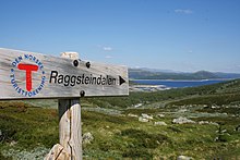 Signs are helpful and convenient, but no substitute for a map and compass. Raggsteindalen in Buskerud.
- It is easy to get lost at ridiculously short distances in unfamiliar terrain. Take a careful look even if you are going only for a minute. Dense forest, fog and open plateaus with no clear landmarks are the most difficult.
- Always take a map and compass with you when leaving the immediate vicinity of your camp (electronics is no substitute, only a supplement – instead of checking battery status you should create a good mental map). Learn to use a compass for navigation and learn to match your map with the terrain.
- If you do get lost, admit it and stop immediately. A few minutes of good rest is surprisingly effective at making you think clearly again. Lines in the terrain can be used to find way back, for instance rivers (rivers can lead you to settlements or to lakes and other points that can be identified on the map), power lines and slopes. But beware of slopes making you change direction and leading you only to a local depression, rivers leading you to hard-to-walk wet terrain, etc. Check the map for what lines are usable.
- Bugs ו בעלי חיים
- Mosquitoes and black flies are a nuisance in June and July, especially in Lapland and Finnmark. They do not carry diseases, but repellents, long sleeves, long pants and perhaps a mosquito hat in the worst areas are recommended. Avoid keeping doors and windows open in the evening.
- קרציות can carry Lyme disease and TBE in some areas (especially south Norway to south-west Finland). The risk is small for a casual visitor, but you may want to take precautions.
- There are big predators like bears, wolves, lynxes and wolverines in the Nordic countries, but they are generally no threat to people, as they will flee in most circumstances once they smell or hear humans. Back out if you encounter bear cubs, as their mother will protect them. Also musk oxen, elks and boars can be dangerous if you go too close.
- If you are hiking in the hunting season (the autumn), in areas where hunting is allowed, you should wear some orange or red clothing. Ask for local advice about whether any areas should be avoided. Hunting season varies by species. Moose hunting is common in the forest areas of Sweden, Finland, East Norway and Trøndelag. Red deer hunting is common in West Norway. Reindeer hunting occurs mostly in the barren mountains.
- Be careful in sun
- Clear Nordic air, high altitude and snow patches can multiply the effect of the sun, which hardly sets during the Nordic summer. Snow blindness is a serious risk, so bring UV-resistant sunglasses, and preferably mountain goggles. Bring sun cream or sun block (sun protection factor). Light can be strong in the highlands even if the sun is not visible.
- Glaciers
 Do not go on your own. יוסטדלסבריין glacier.
- Glaciers are one of the most dangerous places for visitors to the Norwegian outdoors. Never underestimate the power of the glacier. Observe warning signs. Never approach the front of the glacier. A glacier is not a stable piece of ice, it is constantly moving and huge chunks regularly fall off. Snowbridges can obscure crevasses.
- The sun's rays get reflected from the white snow, so it necessary to use sunscreen and sunglasses to protect your skin and eyes. Bring warm clothes for tours on the glacier.
- לַעֲשׂוֹת לֹא enter a glacier without proper equipment and a skilled local guide.


Rules of mountain conduct
Norway's trekking association has compiled a set of rules or guidelines for sensible hiking, "fjellvettreglene":
- Don't go for a long hike without training.
- Tell where you are going.
- Respect weather and forecast
- Be prepared for storm and cold weather even on shorter hikes. Bring a rucksack with the kind of gear needed.
- Listen to experienced hikers.
- Dont hike alone.
- Use map and compass
- Turn back in time, it is nothing to be ashamed of.
- Don't waste your energy. Dig into snow if necessary.
Volcanic eruption

Out of the Nordic countries, Iceland is the only one with active volcanoes.
As a precautionary mesure carry a cell phone and a battery powered radio, and heed to warnings from the Icelandic civil protection about hazardous areas. Listen to either the radio station Rás 1 or Bylgjan. Rás 1 is on the LW frequencies 189 kHz and 207 kHz. For the FM frequencies see the frequency map of Ras ו frequencies of Bylgjan. Pay attention to any SMS messages you get, as the Icelandic civil protection does send out SMS messages in Icelandic and English to phones in hazardous areas.
Should an eruption occur the ash can spread throughout the whole country depending on the wind direction. Eruptions increase the chance of lightnings and a glacial eruption will generate n flood in rivers with sources at the melting glacier.
Regardless of where you are in the country during an eruption, consider the wind direction and consider whether the wind can spread the ash to you. As an alternative you can use the mobile website of the Icelandic met office. If so, walk high up in the landscape to avoid poisonous gases, cover your nostrils and mouth with a cloth. Should the ash get thick or if you have an asthma, go into the next day or wilderness hut, close windows on the side that the wind blows at, close the chimney and stay there until the wind direction changes.
Should you be in close proximity of an eruption walk opposite to the wind direction to get out of the area. If you have concerns that you cannot abandon a hazardous area in time, do not hesitate to call the emergency number 112.
הערכה

Many people you meet on remote trails are there to be with nature only. They might not be interested in socializing and will probably frown upon noisy behaviour. It is common, though, to stop and exchange a few words, e.g. about the terrain ahead, and at least some kind of greeting is usually expected when you meet people on (or off) the trail. Some might of course be interested in where you come from. People are often less reserved with strangers when they are in the wilderness.
Smoking is disliked by many and can be a serious hazard. In hot and dry periods a cigarette butt can cause a forest fire (even if "extinguished"), so just like with other litter, avoid leaving them in nature. Smoking indoors is mostly prohibited. Where locals smoke you might follow their example, but otherwise try to be a good example yourself.
Even if there is right of access, wilderness is often privately owned. In Norway only barren high mountains are public (government) property. Trails and bridges are usually maintained by volunteers (the trekking association for instance) or by landowners for the visitors' benefit. זכור שאתה אורח בקרקע הפרטית של מישהו. יכולים להיות בעלי חיים רועים וציד גדול שלא צריך להפריע. אל תשאיר אשפה מאחור. זה פופולרי יותר ויותר בקרב מבקרים לבנות מערות אבן במדבר, לאורך חופים סלעיים ועל מעברי הרים. מערות אבן משמשות לסימון שבילים ולמעשה יכולות להטעות את המטיילים. מבקרים הבונים מערות קוטפים לעתים קרובות אבנים מגדרות אבן, שחלקן למעשה מורשת תרבותית או בשימוש. זה לא חוקי לשנות את הטבע כזה, גם אם רק עם סלע פשוט.
שיקולים דומים חלים על אדמות ציבוריות. מרבית לפלנד היא בבעלות ממשלתית מכיוון שהסאמים לא היו בעלי רעיון בעלות זהה. התושבים תלויים במדבר כאילו היו בבעלותם את האדמה. ובמקום בו מתקנים מתוחזקים מכספי משלם המסים, הם תוצאה של צוואה משותפת, שצריכה להיערך בלא פחות התחשבות בתרומות פרטיות.
שמות מקומות ומילים שימושיות
מכיוון ששמות במפות ובשלטים בדרך כלל מצביעים על טופוגרפיה, הבנת כמה מילות נוף יכולה להיות שימושית. אם יש לך אפשרות ללמוד מפות בקנה מידה גדול מראש, כדאי לך לבדוק את המשמעות של הקידומות והסיומות הנפוצות ביותר, אך חלקן מפורטות כאן. לעתים קרובות הם מספרים דברים שאינם ברורים מהמפה על תכונת השטח או נותנים רמזים לגבי ההיסטוריה של האזור.
באזור הסמי שמות המקומות הם בדרך כלל ממוצא סמי, גם כאשר הדבר אינו מובן מאליו. לְמָשָׁל. לממנג'וקי הוא במקור "נהר חם" (מסאמית: leammi; פינית: lämmin), לא "נהר אהבה" (פינית: lempi, lemmen). תכונות השטח של האזור נקראות לעתים קרובות על ידי המילה הסאמית (למשל "jåkk", ג'וקה, במקום המילים השוודיות לזרמים).
השפות המעורבות משתמשות בשמות עצמיים מורכבים. שמות נוצרים בדרך כלל על ידי מילים מורכבות, כאשר החלק האחרון מציין איזו תכונת נוף היא. לדוגמה יוסטדלסבריין הוא שם שנוצר מ יוסטדאל (עמק יוסטה) ו bre (קרחון), במילים אחרות, הקרחון ביוסטדל. לעתים קרובות המילים הן ברבים ו / או באיברי המין, מה שמשנה מעט את המילים, בפינית ובסאמית לא תמיד מעט מדי.
בנוסף, בנורווגית ובשוודית, המאמר המובהק ("ה") מופיע כסיומת, המשולבת במילה, כך ברין אומר הקרחון.
יש כמה שפות סאמיות שונות והכתיב שלהן עבר סטנדרטיזציה רק לפני כמה עשורים, מה שאומר שיש הבדלי כתיב גם ללא תלות באיזה מהשפות מעורב.
האותיות השוודי ä ו- ö נכתבות æ ו- ö באיסלנדית, æ ו- ø בנורווגית; å כתוב o בשפות הפיניות וברוב השפות הסאמיות. השוודית ä מבוטאת לעתים קרובות קרוב ל- e, ונכתבת e בנורווגית ברבים מאותם מקרים. זיהוי הבדלים אלה ואחרים פחות או יותר שיטתיים באיות או בהגייה מסייע בהבנת מילה שאתה מכיר משפה אחרת, כגון joki / jåkk / jåkkå / johka באזורים הסאמיים (איות פינית, שוודית וסאמית).
שוודית ונורבגית

- קארט / קארטה
- מַפָּה
- fjell, fjäll
- הר, פסגה, פסגה (מתייחס לנוף הנמתח מעל קו העץ, עשוי להתייחס לפסגה ספציפית או להרים בכלל)
- vidde
- רמה גבוהה ופתוחה (מעל קו העץ)
- innsjø, vann, vatn, sjö
- אגם, בריכה
- tjern, tjärn
- בריכה, אגם קטן, זפת
- יער
- יער, יער
- מיר, קרר
- mire, bog
.jpg/220px-Besseggen_Hike,_Norway_(14673663307).jpg)
- ur, taluskon
- הפקדות, טלקוס פיקדונות
- bre / glaciär, fonn, skavl
- קרחון, סחף שלג
- דאל
- עֶמֶק
- juv, kløft / klyfta, ravin
- ערוץ, נקיק, קניון
- elv, bekk / älv, å, bäck
- נהר, נחל, נחל
- bro / bru, sommarbro, helårsbru
- גשר, גשר נסגר בחורף, גשר כל השנה
- vad
- לַחֲצוֹת
- stuga / stue, hytte
- בקתה, בקתה
- förfallen
- רָקוּב
- snaufjell / kalfjäll
- הרים צחיחים
- tregrense / trädgränsen
- קו עץ
- skyddsområde
- אזור מוגן
- סטי / סטיג
- שביל, שביל
- ruskmärkning
- סימונים בצורת ענפים בשלג
- øy / ö, holme, skär
- אי, איון
- foss / fors, מיםfall
- מפל, מפלים
איסלנדית

- kort
- מַפָּה
- נפל, fjall
- הַר
- heiði
- מישור פתוח גבוה
- vatn, tjörn
- אגם, בריכה
- מירי
- mire, bog
- פיורד
- פיורד, מפרץ
- jökull
- קַרחוֹן
- דאלור
- עֶמֶק
- gjá, gljúfur
- ערוץ, נקיק, קניון
- א
- נהר
- פוס
- מפל מים
- eyja, sker
- אי, איון
פינית וסאמית
- קארטה
- מַפָּה
- vuori, tunturi / tuodtar, vaara / várri (várre, várrie, vaerie, vare)
- הַר; vuori היא המילה הכללית בפינית, tunturi ו- vaara בהתאמה אינן משתרעות מעבר לקו העץ - אך várri בסאמית היא המילה הכללית עבור גבעה או הר (לעתים קרובות בערך תלולים גדולים), לעתים קרובות "מתורגמים" כווארה; tunturi / duottarmailbmi משמש גם בכל האזור שמעל קו העץ
- קייסה / גאיסה; קרו / טסארו; oaivi; kielas / gielas, kaita / skäidi; rova / roavvi
- הרים בצורות שונות: פסגה מכוסה שלג גבוהה; הר בצורת ערימה מעל קו העץ; הר עגול מעל קו העץ ("ראש"); רֶכֶס; גבעה אבנית עם יער דליל
- čohkka (tjåhkkå, tjåhkka, tjahkke, tjåkkå)
- שיא, פסגה
- mäki, kallio, harju / puoldsa
- גבעה, (גבעה של) סלע מוצק, אסקר
- skäidi, selkä / cielgi
- רכס, אזור קו פרשת מים (selkä גם מרחב ים או אגם גדול) / רכס עם ליבנה, ליד הר
- פתח / פאה
- צלע גבעה גבוהה ותלולה
- järvi / jávri (jávrre, avrre, havrre, jávrrie, jaevrie, jävri, jäu'rr, jauri, jaure, jaur)
- אגם, בריכה
- vesi
- מים, שפירושם לעתים קרובות "אגם" בשמות
- lähde, kaltio / galdu
- אביב
- lampi
- בריכה, אגם קטן, זפת
- lahti / luokta (luoktta, loekte)
- מִפרָץ
- niemi / njárga (njárgga, njarka)
- כַּף

- suo, rahka, räme, aapa / aaphe, jänkä / jeäggi, vuoma / vuobme
- בוץ, ביצה; סו היא המילה הכללית, האחרים סוגים שונים; וואלה / וואבמי גם עמק
- פלזה
- תלולית כפור (בטחב או בביצה)
- jäätikkö
- קרחון, סחף שלג
- לאקסו
- עֶמֶק
- rotko, kuru / autsi, ävdzi, gorsa
- ערוץ, נקיק, קניון
- joki / johka (jåhkå, juhka, johke, jåkkå, jåkk), eno / eädnu, puro, oja / ája,
- נהר, נחל, נחל; joki / johka היא המילה הכללית, eno הוא די גדול, puro הוא קטן, oja זעיר
- קהלמו
- לַחֲצוֹת
- metsä; kuusikko, männikkö, koivikko וכו '.
- יער, יער; היערות האחרונים ממיני עצים שונים (kuusi = אשוחית, mänty = אורן, koivu = ליבנה)
- רג'ה
- גבול, גבול
- puuraja
- קו עץ
- rajavyöhyke
- אזור גבול
- kuusimetsän raja
- גבול (צפוני) ליערות אשוחית ("kuusi")
- פולקו, ריטי
- שביל, שביל
- mökki, pirtti, tupa; kammi / gamme
- קוטג ', צריף; צריף דשא
- סיידה
- כפר או קהילה סאמית

- seita / sieidi
- רוח, חפץ קדוש
- סארי, לוטו
- אי, איון
- koski, niva, kurkkio, kortsi / gorzze
- המפלים, האחרונים תלולים ואבניים
- suvanto, savu
- מים דוממים (מתחת למפלים)
- קנגאס
- מפלים תלולים, מפל קל
- (vesi) משוגע
- מפל מים
- latu (pl. ladut) / láhtu
- מסלול סקי
לְחַבֵּר

דואר רגיל
יתכן שיש תיבות דואר וחותמות בחנויות ובעסקי תיירות. במקום poste restante כדאי להשתמש במתאים מתאים כתובת c / o. שאל על שיטות עבודה מקומיות.
טלפונים
בדרך כלל יש כיסוי טוב לטלפונים ניידים בארצות הנורדיות, אך לא בהכרח במקום בו אתה זקוק לו. בחלק מבקתות השממה יש טלפונים לשיחות חירום (לא יותר בפינלנד; בשבדיה הם נפוצים, ויש להשתמש בהם גם כדי לספר על העיכוב שלך ולקבל ייעוץ במידת הצורך, לא רק במקרי חירום).
בשטח הררי לעיתים אין שום סימן בעמקים. באזורים מרוחקים לא יכול להיות שום אות אלא על גבי צמרות נפילות. ייתכן שתרצה לבדוק שירותי אינטרנט חשובים עם חיבור במהירות נמוכה (אפילו 9600 ביט / שניות) מראש. ישנם שירותי מזג אוויר ב- SMS. 3G היה אמור להיות זמין רק ליד עיירות גדולות ואתרי תיירות חשובים ולאורך כמה כבישים ראשיים, אך הוא זמין כיום בפינלנד אפילו בחלק גדול מהשממה.
הכיסוי משתנה מספק לספק. אם יש לך יותר מטלפון אחד (כרטיס SIM) בחברה, כדאי שיהיה לך ספקים שונים. שים לב שהאות הטוב ביותר עשוי להיות ממדינה שכנה ולכן ייתכן שתצטרך לשלם עבור שיחות בינלאומיות גם עם כרטיס SIM מקומי, אם תתן לטלפון לבחור ספק.
כאשר האות גרוע, אל תנסה לבצע שיחות, אלא השתמש ב- SMS: ההודעות זקוקות לאות רק למשך כמה שניות, וכך הן יהיו אמינות יותר והן ישתמשו פחות חשמל.
שמור על הטלפון שלך יבש. זכור כי משתמשים בסוללות הרבה יותר מהר במקום שיש אות רע. הרחק את הטלפון שלך רוב הזמן. חשמל בדרך כלל אינו זמין בארץ האחורית, לאו דווקא אפילו בקוטג'ים ובבתים.
שיחות חירום
ה מספר חירום 112 עובד בכל המדינות הנורדיות. יתכן שיש מספרים מיוחדים למקרי חירום מסוימים, אך ☏112 יכול להתמודד עם כולם. שיחות למספר 112 הן ללא תשלום ועובדות ללא כל קשר למנעולים ברוב הטלפונים. פשוט הקלד את המספר או השתמש בלחצן חירום (בחלק מהטלפונים החכמים). למעשה, ייתכן שבמקרים מסוימים תרצה להסיר את כרטיס ה- SIM כדי לוודא שהטלפון משתמש בחיבור הטוב ביותר שיש. למרבה הצער, 112 השבדית מעמידה שיחות ללא SIM בהמתנה עד שתלחץ על "5". בפינלנד שיחות כאלה יוקפאו למשך כחצי דקה לפני שייענו.
ל טלפונים לוויניים מספר שירות החירום הוא ☏ 46 63-107-112 (שבדיה), 358 9 2355-0545 (פינלנד), 354 809-0112 (צ'ק איסלנד!). לווייני Inmarsat-14 נמצאים רק כ- 15 מעלות מעל האופק הדרומי וכך נחסמים בקלות על ידי שטח גבוה יותר או מכשולים אחרים. לאירידיום אין את הבעיה הזו.
אל תהססו לספר לשירות החירום על כל בעיה העלולה להוביל לחירום. ודא שאתה מתקשר אליהם גם כדי לומר להם שאתה בטוח, וכמו כן כשאתה מאחר ומישהו עשוי להתקשר כדי להתחיל במבצע חילוץ. ההוצאות הן בחמישה ספרות ספרות - ביורו לשעה (בדרך כלל משולמות מכספי משלם המסים, אך אינך מעוניין להתעלל במערכת).
אפשר לומר את המיקום בצורה הטובה ביותר כקואורדינטות ETRS89 / WGS84 (בדוק מראש אם זה מה שמשתמש במפה שלך). ניתן להשתמש בכיוון ובמרחק ממיקום ידוע או מכל מערכת קואורדינטות במפה שלך. ספר גם לכמה שמות בסמוך למיקום, כדי להימנע מטעויות. שים לב שמשתמשים במערכות 360 ° ובמספר מילים (60, 63 או 64 הקטומיל למעגל) על מצפנים וששמות מסוימים, כגון אייליגאס ("נפל קדוש"), הם דו משמעיים. בפינלנד שירות החירום עשוי לבקש עירייה וכתובת (הם משרתים אזורים ענקיים), אך הם יהיו סבירים כשתגיד להם שאתה לא יודע.
נווטי לוויין (GPS וכו '; לעתים קרובות כלולים בסמארטפונים, לפעמים במצלמות) משתמשים בכוח רב למדי, ולכן כדאי להרחיק אותם רוב הזמן, אך לעתים קרובות יכולים לתת קואורדינטות מדויקות במקרה חירום. לוקח להם זמן למצוא את הלוויינים והם עשויים לתת קואורדינטות שגויות עד אז. ודא שאתה מבין את ההגדרות וההתנהגות שלהם.
להתמודד
בזבוז
לעתים קרובות יש פחי פסולת בבקתות, במקלטים ובאתרי מדורה. במיוחד במקום בו אין דרך כדאי להימנע משימוש בכאלה, ולארוז במקום. ריקון פחי אשפה בארצות הבתים פירושו תנועה מיותרת ויקרה. אין להכניס שאריות מזון ודומיהם לפח אשפה אלא אם כן ידוע לך שהוא יתרוקן בקרוב. ניתן להניח כמויות קטנות של פסולת אורגנית, כמו שאריות מזון, בשירותי בור (ובשירותי קומפוסט מתקדמים יותר). ישנם קומפוסטרים נפרדים בחלק מהמקומות. בנקודות המיחזור ניתן לטפל בנייר, מתכת וזכוכית בנפרד. מחוץ לשבילים ניתן גם לקבור פסולת אורגנית, אם יהיה צורך, אך במיוחד בכבול ומעל קו העץ, פירוק עשוי להימשך שנים רבות. ניתן לשרוף נייר טהור במדורות ובכיריים, אך יש לארוז נייר מכוסה מתכת או פלסטיק. אל תשאיר פסולת לאחרים לשרוף.
שֵׁרוּתִים
לאורך שבילים ישנם שירותים בבקתות ולעתים קרובות במקלטים ובאתרי מדורה, בדרך כלל מספיק לצרכים הגדולים שלך אם אתה משתמש בשירותים אלה. בדרך כלל הם שירותים יבשים: בית חוץ עם חור בספסל ודלי עם כבול, נסורת או דומה לכיסוי הצואה שלכם. יתכן שתצטרך להשתמש בנייר טואלט משלך. שטיפת ידיים היא בדרך כלל בעיה משלך (אל תעשה זאת במעלה הזרם ממנו אנשים לוקחים את מי השתייה שלהם, וגם לא קרוב לדלי מי השתייה). מחוץ לשבילים ובין בקתות, עצה של השאירו קמפינג ללא עקבות ניתן לעקוב אחריו.
כְּבָסִים
יש הרבה נחלים ואגמים, או חוף ים, ברוב אזורי הארצות, ולכן לעיתים רחוקות למצוא מים לשטיפה עצמך היא בעיה - אך במיוחד בצפון, למעט יולי-אוגוסט זה בעיקר קריר למדי. פשוט תאמצו את עצמכם לכך או השתמשו בסאונות. לשטיפת הידיים ניתן לחמם כמויות קלות של מים על הכיריים, אך לעתים קרובות מים קרים מספיקים. במקומות רבים כדאי להימנע מלכלוך או סבון באגם או בנהר, ולבצע שטיפה מרבית ביבשה. מי הים אינם מלוחים מדי בים הבלטי ולעתים נדירות בפיורדים.
מקלחות בדרך כלל אינן זמינות בבקתות במדבר, אך ניתן לקבל אותן בבקתות מסוימות ובחניונים אמיתיים אם אתה נתקל בהן. במקום זאת השתמשו בסאונות, הנמצאות בהרבה מאוד בקתות ובקתות. בשביל ה סָאוּנָה בהליך, עיין במאמר זה (כאשר לא בפינלנד, בדוק אם ההתנהגות הצפויה שונה), אך כביסה מתאימה היא בדרך כלל על ידי ערבוב מים חמים וקרים בכביסה ושימוש בזה. מערבבים סט חדש או שניים לשטיפה.